Book Talk at Veteran’s Memorial Library

Mark your calendars if you’re based in northern Maine. I’ll be giving a talk at the Veteran’s Memorial Library in Patten at 6 p.m. on February 28. While I’ll discuss some of the main storylines in my book, The Bears of Brooks Falls: Wildlife and Survival on Alaska’s Brooks River, I also talk about how those stories might provide lessons for our relationship with the Maine landscape.

This will be a new talk, so now it is time for me to stop procrastinating and get to work polishing the presentation. I hope to see you there.

Flyer for a book talk. Background image is a bear swimming through water with two cubs clinging to her back. Above the bears is a book cover with the title "The Bears of Brooks Falls." The descriptive text reads, "What can brown bears and Pacific salmon teach us in Maine? Join Mike Fitz as he discusses his book, The Bears of Brooks Falls: Wildlife and Survival on Alaska’s Brooks River, and how that landscape offers lessons for our relationship with Maine’s wild spaces. Date: Tuesday, February 28, 2023. Time: 6 p.m. Location: Veteran’s Memorial Library at the Patten Lumbermen’s Museum."

E.P.A. Vetoes Pebble Mine!

On January 31, the U.S. Environmental Protection Agency banned the disposal of mine waste associated with the Pebble deposit in southwest Alaska. The mine could have become one of the largest open pit mines in the world and would have imperiled Earth’s last great salmon run. The EPA’s decision is a great victory for the Bristol Bay region and its salmon.

Seventy-nine million salmon returned collectively to Bristol Bay in 2022, setting a new record high for the region. Bristol Bay’s wholly intact watersheds make this possible. Water flows freely from snowmelt-fed rivulets and springs high in the mountains through the chains of lakes that occupy glacially-carved basins and into the lower stems of rivers that empty into the Bering Sea. Adult salmon swim upstream without encountering human-made obstructions or water diversions. And, instead of being displaced by shore-line hardening structures to protect buildings or roads, such as it is throughout much of the U.S. west coast, billions of salmon fry in Bristol Bay find ample refuge in the slack-waters along stream margins, grassy marshes, and lakes. Vast numbers of salmon don’t even see a bridge during their entire lives. The diversity and health of the watersheds make Bristol Bay whole. 

Turbulent water filled with salmon. A red-colored salmon's tail fin breaks the surface at upper left. At center, a more silver-colored salmon's face breaks the surface.
salmon jumping at waterfall. salmon are jumping from bottom center to lip of falls on upper left.
GIF of underwater footage of salmon fry. Water is clear. Salmon swim in current facing right over pebbly bottom.

I was late to the Pebble fight, only learning about the proposed mine in 2007 during my first summer as a park ranger in Katmai National Park. But many people in the Bristol Bay region have been advocating against Pebble Mine for 20 years. I hope the fishing boat captains and their deck hands; Alaska Native Tribes, village councils, and coalitions; lodge owners, employees, and fishing guides; chefs; scientists; those who work for non-profit and conservation organizations; and many others have the opportunity to rest well for at least a few days now that the threat of the mine is no longer looming. I thank them for their work.

Landscape scene from mountaintop. Scree slope in foreground transitions to lowland area with, forests, some mountains, and large lakes. No human development can be seen.
GIF of underwater footage of sockeye salmon. Salmon are facing left over stream bottom covered in cobbled

Before I had the fortune of living in the Bristol Bay area, I did not understand—or even fathom—the importance of salmon to place and people. The calendar in Bristol Bay is centered on salmon. The region’s economy is centered on salmon. Its ecology is centered on salmon. And it works, beautifully.

I’ve said many times before that our world is wounded. Too much of humanity seems to have a unique desire and capability to consume land, habitats, material without considering the rights of other creatures or the value that future generations of people might place on those things. I wish I could take everyone to Bristol Bay at the height of the summertime salmon run to see the fishing fleet and processors, to stand on the edge of a river while tens of thousands of salmon swim upstream, to watch brown bears gorge on their most important and sought-after food, to see an ecosystem functioning at its fully realized potential. It just might change your perspective on what should be and what is possible for our world.

Ten Years of Bear Cam and Counting

Last summer, explore.org celebrated the 10th anniversary of the bear cams at Brooks River in Katmai National Park. These webcams offer an in-depth look at the behavior and ecology of a population of brown bears, allow us to observe the same individual bears over many years–giving us the chance to learn about their personalities and habits–and provide a platform for rangers and other experts to host live programs and commentary about the bears and their stories. It’s a wildlife watching experience like no other.

As part of the celebration, I chose to highlight some the moments that I thought were most memorable from the last ten years of bear cam. Some explore point-in-time events. Others celebrate the behavior of individual bears who have left their mark on Brooks River in ways we can’t forget or ignore. Each was unforgettable from my perspective. I hope you enjoy them.

Most Defensive Mother: 128 Grazer 

Grazer is an archetypal mother bear. Don’t get in her way and don’t approach her cubs.

Lefty Learns to Fish at Brooks Falls

Old bears can definitely learn new tricks. In July 2015, we watched a fully mature adult male brown bear figure out how to fish where he’d never fished before.

Otis Eats 42 Salmon in a Sitting

Be awed by the capacity of his stomach.

Death of 451’s Spring Cub

When a bear cub falls ill the world will watch.

503’s Saga

A lone yearling finds a new family.

Reign of 856

Few bears will ever experience the prolonged dominance and advantage earned by 856.

2020 Salmon Smorgasbord

What happens when bears have access to unlimited salmon? The 2020 salmon run gave us the answer.

History of Fat Bear Week

A goofy idea becomes a world famous internet sensation.

We are Family: 909, 910, and Cubs

Sister bears reunite while raising cubs to create an extended family.

If that’s not enough, the bear cam community complied links to all of our bear cam live events from 2022. Two stand out in my mind: 1. The impromptu Q&A about a fight between and mother bear and a dominant male, and 2. The bear cam 10th anniversary live chat.

We’ve seen a lot of special moments on the cams during the last ten summers–perhaps too many to recall–so these are only a small snippet of the larger story. What are your most memorable moments from the bear cams?

Inspiration at Katmai Pass

August 6, 2015. I stand at the crest of Katmai Pass, remarkably alone in an exceptionally quiet place, not having seen or spoken to a person in five days. Surrounded by wildness, I couldn’t help but think of the transformational moments that occurred here about 100 years before.

While wildlife such as brown bears take center stage in Katmai National Park today, volcanoes originally placed Katmai on the world map. Each national park is unique, but Katmai stands apart from all others for a landscape that did not exist before June 6, 1912.  

ovoid crusts of clay (lower right) lay on top of gray, orange, and brown pumice fields. snow covered mountains

An extinct fumarole in the Valley of Ten Thousand Smokes.

On June 6, 1912, around 1 p.m. in the afternoon, Novarupta volcano exploded at the head of the isolated Ukak River valley. The eruption continued for 60 hours, plunging the region into darkness. It was the largest eruption of the 20th century and the fifth largest in recorded human history. Novarupta unleashed roughly 4 cubic miles of ash and 2.6 cubic miles of pyroclastic flows. In total, this represents 3 cubic miles of underground magma, an output greater than the eruption of Krakatoa in 1883 and 30 times more than the eruption of Mount Saint Helens in 1980. The eruption drained a magma chamber underneath the 7,600-foot Mount Katmai, creating a 2,000 foot deep caldera, and flooded the area near Novarupta in hundreds of feet ash and pumice.

In the aftermath, the Katmai area, particularly the mainland Pacific coastline and interior regions near Mount Katmai became uninhabited. What seemed to be a wasteland, however, would soon inspire the movement to establish Katmai National Park.


Robert Griggs was a professor of botany at Ohio State University when, in 1915, he led a National Geographic Society expedition to explore vegetative recovery on Kodiak Island. About of foot of ash fell on Kodiak in 1912 and Griggs found the town “bleak and desolate” with only tall shrubs, trees, and hardy perennials surviving above the ash when he visited in 1913.

Upon his return to Kodiak in 1915, however, Griggs found a wholly different place. The island was verdant. As he recalled, “[I] could not . . . believe my eyes. It was not the same Kodiak I had left two years before. . . . I had come to study the revegetation, but I found my problem vanished in an accomplished fact.” Griggs concluded the foot-deep ash, rather than killing the hardy perennials underneath, served as a mulch that retained soil moisture and suppressed competition for space and nutrients.

Instead of remaining on Kodiak watching the grass grow, Griggs decided to explore the area closer to the eruption center with his remaining time. Landing in Katmai Bay with two expedition companions, Griggs discovered a strikingly different scene than the greenery of Kodiak, one that he described as an “entrance to another world.” It seemed the entire world was covered in ash. Traveling conditions were so difficult—they routinely encountered thigh-deep quicksand and dangerous river crossings—that the team could not ascend far up the valley. The little he saw, though, convinced Griggs that the area was worthy of further exploration.

The next year, 1916, Griggs returned determined to reach Mount Katmai, then thought to be the sole source of the 1912 eruption. His larger and better-equipped expedition slogged up valley that July and eventually climbed Mount Katmai, becoming the first people to gaze into its 2,000-foot deep caldera.

While on the caldera rim, Griggs thought he saw wisps steam wafting from the far side of the volcano. He would soon discover what lay on the other side but was wholly unprepared for what he saw. I’ll let this excerpt from my book, The Bears of Brooks Falls, describe what happened next.

July 31, 1916 was a tiresome day for Griggs and his two partners, Donovan Church and Lucius Folsom. Their legs remained fatigued from their second Mount Katmai climb and the ash beds offered little firm ground to stand on.

Not far from the highest point in Katmai Pass, Church gave out, “incapacitated by too many flapjacks at breakfast” and waited while Griggs and Folsom continued onward. Griggs’ first glimpse through the pass didn’t hint of much worth investigating except more ash and pumice, but just as he considered turning back a tiny puff of steam caught his attention. This fumarole, or volcanic gas vent, wasn’t particularly large, but the day was damp and chilly so Griggs used it practically, warming his hands in the condensing steam. Shortly afterward he spotted another plume rising from a larger fumarole in the distance. Curiosity hastened Griggs forward and he climbed a small hillock for a better vantage.

“The sight that flashed into view . . . was one of the most amazing visions ever beheld by mortal eye. The whole valley as far as the eye could reach was full of hundreds, no thousands—literally tens of thousands—of smokes curling up from its fissured floor.

“After a careful estimate, we judged there must be a thousand whose columns exceeded 500 feet. I tried to ‘keep my head’ and observe carefully, yet I exposed two films from my one precious roll in trying for pictures that I should’ve known were impossible. For a few moments we stood gaping at the awe inspiring vision before us…It was as though all the steam engines in the world, assembled together, had popped their safety valves at once and were letting off steam in concert.”

With the day waning and Church still waiting on the other side of Katmai Pass, Griggs and Folsom had little time to explore further, but this was truly virgin territory. No one had set foot in this valley since the eruption irreparably altered it. No one had felt the hot earth under their shoe leather or warmed their hands next to the fumaroles. No one had seen the eruption’s epicenter, the steaming dark gray lava dome Griggs would later name Novarupta. After roughly estimating the number and extent of visible fumaroles, he christened the landscape the Valley of Ten Thousand Smokes.

Griggs didn’t return to his base camp until very late in the day. Despite his fatigue he found sleep impossible, his mind whirling with thoughts about the valley he had just found. The landscape was “unseen and unsuspected…until this hour…I had yet only a very inadequate conception of the place we had discovered, but I had seen enough to know that we had accidentally discovered one of the great wonders of the world. I recognized at once that the Katmai district must be made a great national park, accessible to all the people, like Yellowstone.”

black and white photo. man squats at center next to small steam vent. a snow capped mountain is o the horizon. text reads "190. The Valley of Ten Thousand Smokes. Photograph by L. G. Folsom. Warming my hands at the first little fumarole in the pass. These little sentinels of the Pass continued unchanged through 1918, but had gone out in 1919. It was the sight of these which led to the discovery of the Valley."

From the 1922 book The Valley of Ten Thousand Smokes by Robert Griggs.

Griggs returned home later that summer and began immediately to lobby for a national park in the Katmai region. With the support of the National Geographic Society and their contacts in the federal government, President Woodrow Wilson proclaimed Katmai National Monument in 1918.

Standing in Katmai Pass about 100 years later, I thought of the moments that Griggs and Folsom experienced as they wandered into the Valley of Ten Thousand Smokes for the first time. With the heat trapped in the ash and pumice having almost completely dissipated, there are no fumaroles in the pass today. Large lava flows from the southwest flank of Mount Trident, even fresher than the 1912 deposits, constrict the valley leading to the pass from the south. A wrinkled cryptogamic soil covers much of the pumice, anchoring the airy gravel in place. The veneer of glaciers on the nearby volcanoes has thinned as the climate continues to warm.

Still, the scene remains remarkably similar to that in which Griggs experienced. No roads or maintained trails snake their way into the Valley or the pass. The views are unimpaired. No light pollution reaches its night skies. In calm weather, your footsteps and heartbeat are often the only sounds—a quiet so immense that the rip of a jacket’s zipper feels like an intrusion. The Valley of Ten Thousand Smokes is contradictory, both wholly different and very much the same as it was when it inspired Griggs to pursue permanent protection for a unique landscape on the face of the Earth.

In 1912, the Alaska Peninsula was forever changed. Rarely has a single event—one that humans witnessed—catalyzed the creation of a national park. If you’ve been fortunate enough to experience the sublimity of wild landscape then perhaps you’ve also experienced something akin to what Griggs felt at Katmai Pass in 1916.  The legacy of the discovery of the Valley of Ten Thousand Smokes continues to shape the history of Katmai.

ash and pumice covered plain with hills

Looking north in Katmai Pass near the spot where Griggs and Folsom found their first fumarole. The Valley of Ten Thousand Smokes is found just beyond Mount Cerberus at center.

three men stand in front of fumarole at lower left. A valley filled with many steaming fumaroles fills the rest of the middle ground. clouds and mountains fill the upper third

Taken in 1919, “Waiting for Supper to Cook” is perhaps the most iconic historic image of the Valley of Ten Thousand Smokes. From the 1922 book The Valley of Ten Thousand Smokes by Robert Griggs.

canyons carved through pumice and ash on lower half of photo. mountains line horizon. low angled sunlight highlights depth of canyons

The Valley of Ten Thousand Smokes near the confluence of Knife Creek and River Lethe.

Mount Katmai Caldera

We found ourselves hanging over the brink of an abyss of such immensity that, as the event proved, we were powerless even to guess its size. Down, down, down, we looked until the cliff shelved off and we could follow it no further.

–Robert Griggs in The Valley of Ten Thousand Smokes describing the moment he first peered into Mount Katmai’s caldera

Standing on the rim of the Mount Katmai caldera, staring at the gaping hole where a mountain once stood, elicits a profound awe. At the caldera and across the Valley of Ten Thousand Smokes, the Earth’s power and ability to foment change is laid bare.

About a year ago, I disappeared into one of the most unique landscapes on Earth, the Valley of Ten Thousand Smokes in Katmai National Park, a trip I partly chronicled in a blog post for explore.org. I hadn’t specifically planned on ascending to the caldera rim on that trip, knowing that the weather along the crest of the Aleutian Range is fickle at best and an inviting window of opportunity may never materialize. When I woke at daybreak on June 10, 2019 to see a cloudless sky though, I left my base camp eager to reach one of Katmai National Park’s most spectacular features.

I slept the previous night at Novarupta, the lava dome that marks the eruptive center of the 1912 Novarupta-Katmai eruption, the largest eruption of the twentieth century and one of the five largest volcanic eruptions in recorded history. The lava dome represents the eruption’s last gasp, forming anywhere from days to months after the 60 hour eruption waned on June 9, 1912.

view of pumice-covered flats and snow fields dark-colored lava dome at center

Novarupta lava dome

I began walking not long after the first light of dawn cast a pink alpenglow on the surrounding volcanoes. The rivulets of snowmelt where I gathered drinking water the prior evening had run dry as overnight temperatures dropped below freezing. Thankful for the firm footing, however, I traveled quickly across frozen snowfields to the base of the Knife Creek Glaciers, a badlands of pumice-covered ice attached to the north faces on Trident and Katmai volcanoes.

view of snowfields and mountain peaks

Early morning light on Trident Volcano

Not one, but many meltwater streams pour from the snout of these glaciers, and the permanent channels have eroded deeply into the pyroclastic deposits that form the Valley of Ten Thousand Smokes proper. Finding places to hop over or ford these streams is straightforward, although tedious work as you climb in and out of their past and present floodplains. They can be crossed most safely within a few hundred yards or less of the base of the ice. Farther downstream, they create impassible gorges, akin to southern Utah’s famed slot canyons only filled with a torrent of glacially cold water.

view of pumice flat and small stream with ash and pumice covered glaciers in background

Lower sections of the Knife Creek Glaciers are a badlands of ice covered with as much as six feet of ash and pumice.

Compared to the scale of geologic time, Katmai’s volcanoes forced their way to the surface relatively recently. Over the last several hundred thousand years, upwelling magma buckled and fractured its way through thousands of feet of Jurassic-aged rocks, although these sedimentary layers have deformed little since they were deposited. The rock of “Whiskey Cleaver” a wedge of 150 million year-old marine sediments buttressing the north flank of Mount Katmai, are nearly as level as when they accumulated on the bottom of the seafloor.

The first time I reached the caldera in 2011, I stuck to the base of the cleaver, following the margin of the glacier to the west while hugging the exposed rock and glacial till until I needed to step onto the glacier leading to the caldera rim. This time while looking to avoid glacial travel as much as possible—dying alone, trapped in a crevasse seems like a horrible way to go—I chose a slightly more direct route up a steep ash and snow-covered slope slightly east of the main glacier. The sun had yet to soften the frozen snow as I ascended. I couldn’t kick sufficient steps into the crust, which forced me to avoid the steepest snowfields where I felt the risk of falling was too great. This turned into the diciest part of the route and was the one place that I wished I carried an ice axe.

View of hummocky landscape created by ash and pumice covered glaciers at the foot of mountains hidden in clouds. Blue line near center represents route.

I explored the termini of the Knife Creek Glaciers the day before my ascent to the caldera, partly to scout a way through the badlands. My approximate route through a corner of the Knife Creek Glaciers is shown in blue. The view looks east toward the caldera.

At the top of this slope, I reached a bench where the gradient lessened in steepness, kept me temporarily off the glacier, and away from areas prone to rock fall. From here, it was a simple task of avoiding the steep sidewalls prone to sodden late spring avalanches and the center of the glacier where crevasses are more likely to open in June. Not a single cloud hung in the sky, the air was dead calm, and the caldera was only two miles away.

view of mountains with vast snowfields with some small pumice-covered areas in fore and middle ground

The final two miles leading to the caldera

When the 1912 eruption began, Mount Katmai was a triple-peaked and glacially clad 7,600-foot tall volcano. Around midnight on June 7, 1912—in the midst of eruption’s most violent outbursts—Mount Katmai began to collapse. Over the next twenty-four hours, the summit fell inward, generating fourteen earthquakes between magnitudes 6 and 7.

No one witnessed the collapse. Thick ash replaced daylight with an inky blackness across the region. Not until the eruption ceased and skies cleared on June 9 could anyone see that the mountain had lost its top. Because Mount Katmai collapsed, for decades people considered it to be the source of the eruption. In a sense it is, but not from the perspective of explosiveness. Careful study of the eruption’s fallout and pyroclastic flow deposits in the Valley of Ten Thousand Smokes revealed relatively little originated from Mount Katmai. Instead, the vent that opened at Novarupta siphoned away its magma. Perhaps not coincidentally, the elevation of the caldera floor and Novarupta are nearly the same.

Human eyes would not look into the caldera until Robert Griggs and his expedition team slogged their way to the rim from the Pacific coast in 1916. While I enjoyed the advantage of ascending on clear snow with stable footing along with the fore-knowledge of how to get to the rim, Griggs clawed up the volcano’s still muddied and pumice-covered southern slopes, all-the-while pioneering his route, not quite knowing what he’d see or what challenges he’d face until he got there.

When Griggs reached the unstable and knife-edge caldera rim caldera, he found glaciers cleaved flush with the precipitous walls where several thousand feet of mountain once stood. Peering into the gaping earth, Griggs had difficulty comprehending the caldera’s scale, and he stared amazed at a horseshoe-shaped island of lava in a milky, robin-egg-blue lake deep within the bowels of the volcano.

panoramic black and white photo of volcanic caldera.

Jasper Sayer took this remarkable photograph of the Mount Katmai caldera in 1919. It had been seen for the first time only three years prior. I reached the caldera on the opposite side from this photo, near the low point in the rim at left.

From the sight lines along my route, the terrain provides no hint the caldera exists. Although the route’s gradient lessened the closer I got to the rim, the caldera appeared in sudden and spectacular fashion.

panorama view of Mount Katmai caldera on clear sunny day

During a 2011 ascent here, I was forced to retreat within 15 minutes by howling winds, a cloud ceiling which allowed on the scantest of peeks into the bowl, and the threat of snow. On this day though, I sat on the rim for more than two hours, attempting to embed the scene into memory. I couldn’t help but consider how ephemeral it was. The shallow lake first witnessed by Griggs has grown more than 800 feet deep and continues to rise. New glaciers hug the interior walls and calve small icebergs into the water. I watched avalanches of rock and snow tumble more than a thousand feet from the rim to the lake. Water discharged from hydrothermal vents at the bottom of the lake creates greenish-brown swirls with the deep blue of the lake’s surface.

Like the dozen-plus other volcanoes in Katmai, the mountain will churn with unrest again. Its next eruption is unlikely to be as large and landscape changing as the 1912 event, but Mount Katmai’s potential to unleash the power of the Earth remains ever-present. As I sat on the rim, looking at the hole where a several thousand feet of rock once stood, I enjoyed the long moments of calm, wonderfully alone with a mountain only temporarily at rest.

view of mount katmai caldera with steep snow covered cliffs at right and center
view of mount katmai caldera with steep snow covered cliffs at left and center

To learn more about the Valley of Ten Thousand Smokes, read Robert Grigg’s 1922 book about its discovery and exploration. Volcanologists Wes Hildreth and Judy Fierstein authored the authoritative text on the eruption’s geology in The Novarupta-Katmai Eruption of 1912—Largest Eruption Eruption of the 20th Century Centennial Perspectives. Lastly, I devote two chapters in my forthcoming book, The Bears of Brooks Falls: Life and Survival on Alaska’s Brooks River, on the 1912 Novarupta-Katmai eruption’s significance to the region and the creation of Katmai National Park. Look for The Bears of Brooks Falls late this year via Countryman Press.

A Step to Protect Brooks River’s Bears

Each year, the National Park Service in Alaska reviews compendiums for park areas and provides the public with an opportunity to comment on proposed changes or suggest changes. This year, Katmai National Park is proposing a change to its compendium that will give staff greater flexibility when managing the Brooks River area. If you value the river’s wildlife and the bear-watching experience at Brooks River, whether in person or through explore.org’s bearcams, then please support this change.

Visitation at Brooks Camp has skyrocketed to unprecedented levels during the last several years. In 2015, the last full summer I spent as a ranger at Brooks Camp, approximately 9,300 people attended the NPS bear orientation. In 2016, the number of orientations climbed to 10,900. By 2018, the number had grown to 12,500 and in 2019 it reached over 14,000, the highest visitation every recorded at Brooks River. This change may not seem like much (Yellowstone’s Old Faithful Visitor Center often receives over 10,000 people per day in summer). However, the Brooks River corridor is quite small. The river itself is only 1.5 miles long and during the busiest days in July over 500 people and a few dozen brown bears attempt to share its space. The increase in visitation and unrestricted access to the river has created an untenable situation that taxes park staff, facilities, the experience, and the bears’ ability to tolerate and adapt.

graph showing number of people attending bear orientations (y axis) by year (x axis). The number of orientations has doubled since the 2000s.

Attendance to mandatory bear safety orientations can be used as a proxy for overall visitation to Brooks Camp. In the last ten years, the number of people attending the orientations has doubled.

Related: Bears and Humans at Brooks River

Brooks River is a unique place within America’s national parks. In a landscape home to more bears than people, it is Katmai National Park’s most famous bear watching destination. However, it is perhaps the only area in Alaska that is actively managed as a bear-viewing destination yet has no restrictions on access. No permits or guides are required to visit. There is no limit to how many people can visit each day and almost no restrictions on where you can go when you get there. Arriving visitors are required to attend a mandatory bear safety talk that outlines the proper and expected behavior. After that though, you are largely free do go about your business. To help manage the situation, the National Park Service has proposed this change to Katmai’s compendium.

The Superintendent may prohibit activities, impose restrictions or require permits within the Brooks Camp Developed Area. Information on closures and restrictions will be available in the park visitor center. Violating [Brooks Camp Developed Area] closures or restrictions is prohibited.

The NPS lists several reasons for the proposed change.

  • High visitation and improper behavior by people has negatively impacted bears along the river corridor.
  • The park has received more complaints and concerns from the public regarding bear-human interactions.
  • Bears are changing how they use the river, so current closures are becoming increasingly inadequate.
  • Visitation has increased dramatically over the last several years.
  • To better manage the river corridor, the park needs more flexible management tools.

While the proposed change is no panacea for the challenges facing park staff at Brooks River, it can provide an important tool to manage changing situations. For example, it hypothetically allows the NPS to extend the closure around Brooks Falls beyond August 15 or even restrict human access in the lower river area when bear activity is high.

Quite often, proposals for greater restrictions and regulations in national parks attract more opposition than support, especially if the change has the potential to impact public access or business interests. Now though, we have the opportunity to let the NPS know this change is worthwhile and necessary.

Portions of Katmai’s bear population are equally sensitive to human disturbance as the grizzlies in Yellowstone, yet the only area in Katmai where people cannot venture is the immediate area surrounding Brooks Falls, and then only from June 15 to August 15. Since I came to discover Brooks River for myself in 2007, protections for bears have slowly eroded. In the face of skyrocketing visitation, the NPS has proposed a positive step to protect bears and the bear-watching experience. So please send the park a comment expressing your support for the change. Here’s an example to get you started (feel free to customize it as you see fit). You can download a copy of the proposed changes and submit comments on the NPS’s project website. The comment period is open through February 15, 2020.

PS: If you plan to visit Brooks Camp this summer or in the future, please consider subscribing to the Brooks River Pledge. It’s a personal pledge between yourself and Brooks River with the goal to emphasize respect for the bears’ space as well as ways to continue to have a high quality bear viewing experience.

Fat Bear Week 2019 Endorsement

Avoiding the news when your job is internet-based is like avoiding the flu when your entire household is infected. So, try as I might, I keep stumbling upon headlines about upcoming presidential primary elections. The big question on the minds of pundits seems to be, “Will people choose the candidate who best represents their values or the one who they think is most electable?”

As a certified bearcam aficionado and well-known Katmai National Park pundit, I am pleased to announce that I have do not have that issue, at least not for the upcoming “election” called Fat Bear Week. My candidate isn’t a compromise between values and electability. He’s the real deal, the one, the only, the titanic bear known as 747. He deserves your vote.

silhouette of fat bear sitting in river

Don’t you call me pudgy, portly, or stout. Just now tell me once again, who’s fat? (NPS photo of bear 747 by N. Boak)

Seven-four-seven is a giant among bears, an adult male in the prime of his life who uses his size to dominate access to his preferred fishing spots in the jacuzzi and the far pool. His experience and skill pay off each fall, supplying 747 with the substantial fat reserves necessary to survive winter hibernation without eating or drinking.

To get this fat, you need to catch and eat a lot of salmon. Adult brown bears on Kodiak Island consume can consume an incredible 6,146 pounds (2,788 kg) of salmon per bear per year! Given 747’s excellent fishing skills and ability to routinely access the most productive fishing locations at Brooks Falls, I have no doubt his salmon consumption is on par with the biggest Kodiak bears. Stuck in his own version of “feed”-back loop, 747 gets fatter and fatter until it’s time to enter the den. (And, no bears probably can’t get too fat.)

If you don’t believe me about 747’s qualifications, believe the Internet, always an impartial repository of truth and honesty. In 2017, I recorded a video of 747 in all his epic fatness. If anything can be gleaned from viewer comments (and of course we know that YouTube comments represent the highest form of public discourse), 747 is an extra THICC absolute unit who is ready to hibernate through two winters.

The people have spoken.

At Brooks Falls, 747 remains quite dominant and can often access any fishing spot he chooses, which is not surprising given his size. Adult males typically rank at the top of the bear hierarchy. Even so, 747 still faces competition, in real life and in Fat Bear Week. This summer, I was awestruck watching 747 clash with another adult male, 68, in an intense fight.


Sixty-eight emerged victorious in the battle, not only securing access to a preferred fishing spot at Brooks Falls but also assuring his dominance over 747. Bloodied from the fight, 747 left the falls area almost immediately and I thought I might not see him for the rest of the evening.

bear standing in water with some blood dripping from his lower lip

747 bleeds from the mouth after his fight with 68 on July 2, 2019.

Within an hour or so, he returned and began fishing like nothing happened. When you only have a few months to prepare for winter hibernation, there’s little time to waste.

Like so many things in life, 747’s Fat Bear Week victory is not guaranteed. My 2017 and 2018 endorsements for 747 were followed by his sound defeat. This year, his competition is just as fat if not fatter.

GIF of bear sitting upright and scratching an itch with her left front paw

Dear Holly,

Game on. See you in the Fat Bear Week finale!

Sincerely,
747’s Campaign Manager

Your Fat Bear Week vote can be based on any number of factors. You can consider a bear’s annual overall growth like that experienced by cubs and subadult bears. Perhaps you want to weight your vote toward bears with extenuating circumstances such as a mother’s cost of raising cubs or the additional challenges older bears face as they age. No matter what though, 747 once again offers you, the astute Fat Bear Week voter, the opportunity to support a bear who is both the fattest and the largest, two traits that are not mutually exclusive.

Complete your civic duty and vote for Brooks River’s fattest bear from October 2 – 8 on Katmai National Park and Preserve’s Facebook page. Look for the head-to-head Fat Bear Week matchups. The bear whose photo receives the most “likes” advances to the next round, until one bear is crowned fattest bear on Fat Bear Tuesday, October 8. Don’t forget to watch Katmai’s fattest bears every day on explore.org.

Fat Bear Week 2019 Bracket.jpg

My Pebble Mine Draft EIS Comments

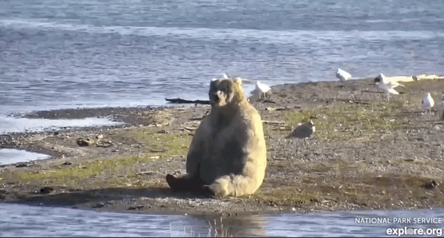
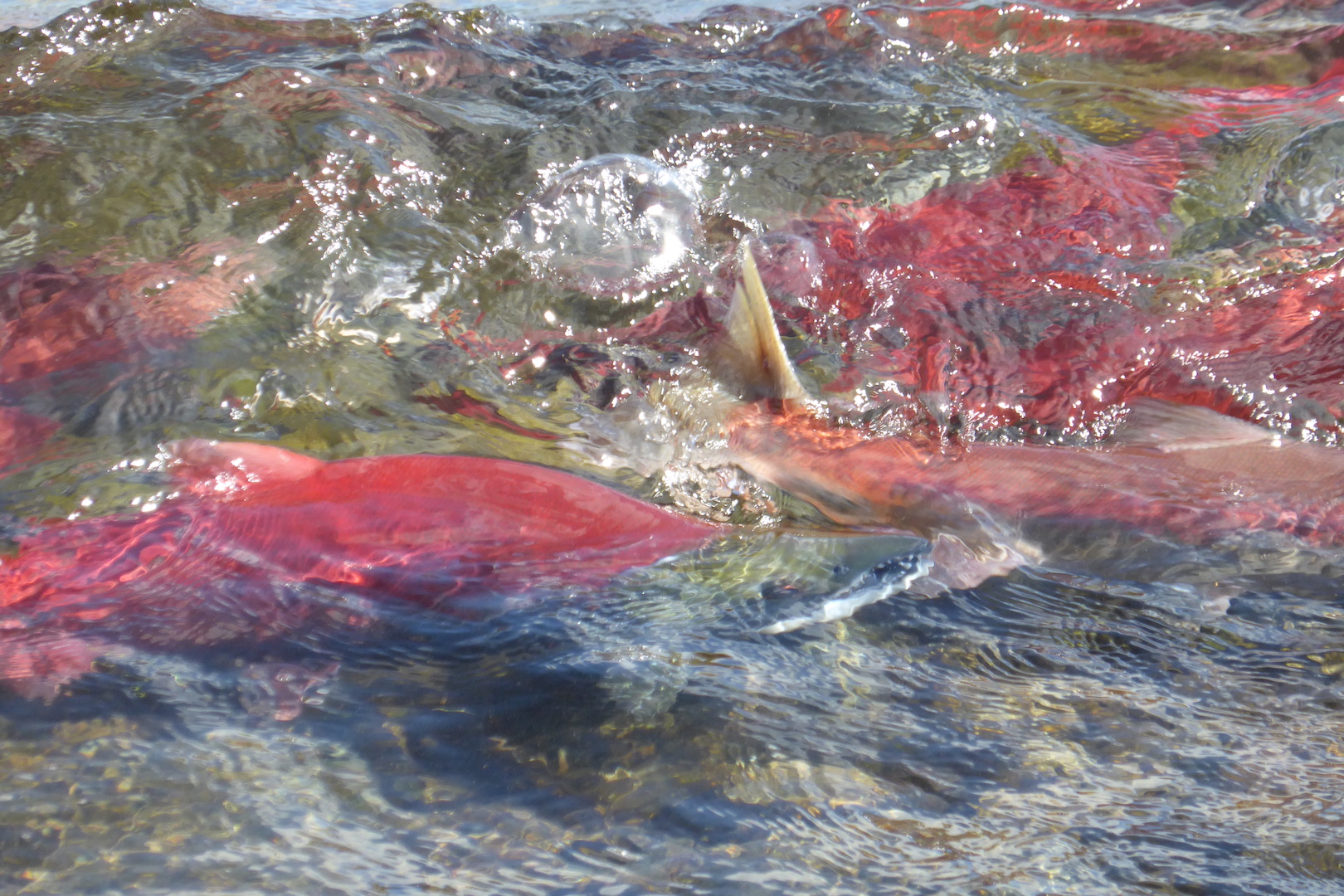
As I’ve written before (here, here, and here) and commented on (here and here), Pebble Mine represents an unacceptable threat to Bristol Bay, home to the last great salmon run left on Earth. Through June 29, you can submit comments on the Army Corps of Engineers draft Pebble Mine environmental impact statement. I encourage everyone who cares about wildlife and wild places to comment. Tell the Army Corps of Engineers that this mine is unacceptable.

I also realize that not everyone has the time to read the draft EIS, which is huge, containing about 1,400 pages. So, I’ve copied my comments on the draft EIS verbatim below. You can also download a rich text file of the comments. I hope they inform your comments about Pebble Mine, the development of which would be a grievous mistake.

red salmon swimming in shallow water

Draft Pebble Mine Environmental Impact Statement Comments

I firmly oppose the development of Pebble Mine. The draft EIS (DEIS) fails to adequately address the mine’s short-term and long-term impacts. Additionally, its development would create several permanent hazards to the watershed, and the mine merely represents the first of many potential large-scale developments that will continually degrade salmon habitat in Bristol Bay. After reviewing the DEIS, I urge the Army Corps of Engineers to reject the permit application for Pebble Mine and select the no action alternative.

Permanent Mine Hazards

The mine and its infrastructure create several permanent environmental hazards. Two of these hazards, the open pit lake and tailings storage areas, are particularly concerning, because the DEIS does not provide adequate or convincing information on how these hazards can be contained indefinitely. For example, page 8 of the executive summary states,

“Pyritic tailings and PAG waste rock would be placed into the open pit for long-term storage below the pit lake water level. Once the material has been transferred to the open pit, the pit lake (i.e., the water that would accumulate in the open pit as a lake at closure) would continue to fill, and would be allowed to rise to the pre-determined control elevation threshold (about 890 feet). Once the level of the open pit lake rises to the control elevation, water would be pumped from the open pit, treated as required to meet State water quality standards, and discharged to the environment.”

This final stage of the open pit requires indefinite water treatment and discharge of water from the open pit. This is neither acceptable nor feasible in perpetuity since treatment facilities must be funded and maintained forever. Even if Pebble Limited Partnership is required to establish a bond to fund treatment, government solvency cannot be guaranteed over time spans necessary to treat wastewater from the open pit. Additionally, if costs to treat wastewater exceed the money available in the bond, then the burden to prevent contamination to the watershed will fall to taxpayers.

Page 8 of the executive summary also states,

“The bulk TSF would be closed by grading its surface so that all drainage would be directed off the TSF, and then the tailings surface would be covered with soil and/or rock and possibly a geomembrane or other synthetic material. This would prevent water from ponding on the TSF surface, and is known as a dry closure. Once this surface runoff from the bulk TSF is demonstrated to meet water quality criteria, it would be directly discharged to the environment.”

Since geomembranes have only been in use for 30 to 40 years, we lack adequate information on how they perform over the time span (essentially forever) necessary to keep the bulk tailings storage facility dry and prevent groundwater from leaching in or out. Simply covering it with soil, rock, and a synthetic membrane only delays groundwater contamination. It will not prevent it. The impacts of a degraded geomembrane leading to groundwater contamination are reasonably foreseeable but are currently unevaluated in the DEIS. The EIS needs to evaluate the impacts and timeline of a degraded geomembrane, not just presume that it will protect groundwater forever. It won’t.

Importantly, it is also completely unethical for a private corporation to create permanent hazards of this type. The mine has the potential to become another superfund site. If the Corps is to evaluate whether this project is in the public’s best interest, then it cannot ethically allow the creation of these hazards.

Scope of DEIS

The DEIS repeatedly presents information on best-case scenarios or merely states that something is “expected to happen” in an ideal way. For example, page 39 of the executive summary states,

“Water extraction activities would be required to meet the requirements of the Alaska Department of Natural Resources for temporary water use authorizations, and the Alaska Department of Fish and Game (ADF&G) for fish habitat permits (if issued). The rate and volume of water withdrawals would be monitored at each source to ensure permit requirements are met (as per permit stipulations). Therefore, the magnitude of the impacts to surface water resources is generally expected to result in changes in water quantity likely within the limits of historic and seasonal variation. The duration of the impacts is likely to be the life of the road, and the geographic extent of the impacts is likely to be relatively close to the road.”

Page 41 of the executive summary states,

“Overall, downstream impacts from pit lake level management during post-closure would not be expected.”

For another example, page 43 of the executive summary states,

“Under Action Alternative 1, impacts to water quality would generally be limited to the mine site area, within the zone of contact water capture and treatment, with potential minor exceptions of temperature and turbidity effects. Potential effects of contact and runoff water during construction of downstream water and sediment quality would be minimized through treatment prior to discharge, and would be expected to be minor.”

Statements such as these presuppose nothing will go wrong, ever, not with water treatment, not with the tailings storage areas, not with the fuel or the natural gas pipeline, not with the water extraction sites along the road. It downplays potentially significant risks. The DEIS does not adequately evaluate cumulative, foreseeable, long-term impacts.

Problems maintaining water quality can be expected over the life of the mine and are likely to increase after the mine is decommissioned. The mine will result in a net loss of spawning and rearing areas for salmon, and the habitat cannot be reclaimed. Throughout the DIES, the text downplays the ultimate impacts of the project. To gloss over impacts to the watershed in this manner represents a lack of due diligence on the part of Army Corps of Engineers and Pebble Limited Partnership.

Potential for Catastrophic Mine Impacts

While a credible worst-case spill from the mine, such as a tailings dam failure, is not likely in 20 years, if it were to occur the environmental effects would be devastating. The DEIS, again, neglects to include the possibility of unlikely–but foreseeable–catastrophic events. The agency’s review does not analyze a full breach of the tailings dams. It instead looks at a much smaller partial breach suggesting, “Action Alternative 1 and variants would not be expected to result in a longterm change in the health of the commercial fisheries in Bristol Bay or Cook Inlet.” (DEIS Executive Summary, page 54)

The potential for a tailings dam failure might have been calculated to be small (DEIS K4.15-16) over the near term, for example, but the risk cannot be eliminated and it will increase over time without additional mitigation measures. What is the likelihood of dam failure (large or small) over the next several hundred years? How would a catastrophic tailings dam failure impact the watershed, salmon, other wildlife, and the people who rely on Bristol Bay? This must be evaluated in the EIS. It is a reasonably foreseeable impact for this type of development since tailings dams fail frequently in the United States.

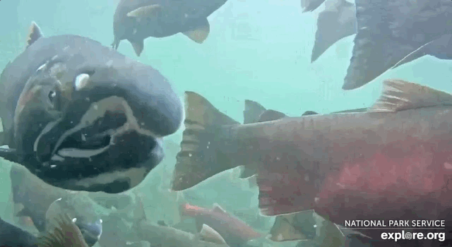
Impacts to Fish and Wildlife

The DEIS does not adequately evaluate the direct or otherwise foreseeable impacts on waters accessible to anadromous fish. As an example,

“The magnitude and extent of impacts, when compared to the total mileage of currently documented anadromous waters in the three tributaries associated with the mine site (i.e., the NFK, SFK, and the UTC), the loss of Tributary 1.19 habitat would represent 4 percent and 3 percent of spawning and rearing habitat for coho salmon, respectively; and 3 percent of Chinook salmon rearing habitat in these tributaries. In the context of the entire Bristol Bay drainage, with its 9,816 miles of currently documented anadromous waters, the loss of Tributary 1.19 represents an 0.08 percent reduction of documented anadromous stream habitat.” (Executive Summary, pg. 49)

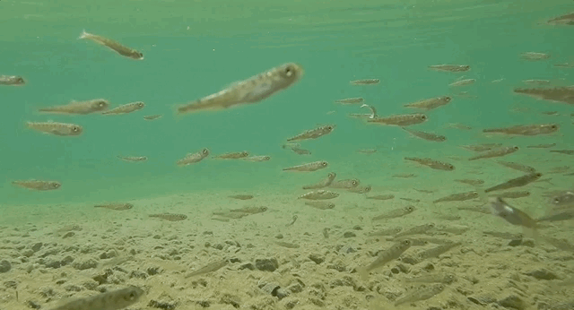
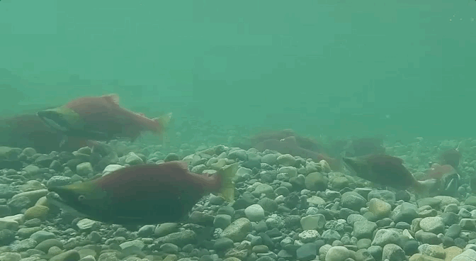
Fish populations fluctuate significantly over many years and Pacific salmon utilize different habitats during different life stages. Some places in a creek are good for spawning but not rearing, for example. These habitats do not necessarily occur along a stream’s entire distance, nor do streams support salmon at the same rates consistently. Productivity within a watershed can fluctuate greatly over annual and decadal scales. As recent research1 on the Nushagak watershed demonstrated, entire landscapes stabilize biological production. Patterns of high and low production shift among locations throughout time. Simply acknowledging a stream supports anadromous fish does not adequately acknowledge the complexity of salmon habitat. Subsequent chapters in the DEIS do not present information on the type and relative importance of the habitat that will be lost. Therefore, the DEIS’ conclusions may not reflect the true importance of the stream miles impacted by the mine.

The quoted text is also written in a manner that minimizes the mine’s impact on fish (“In the context of the entire Bristol Bay drainage…the loss of Tributary 1.19 represents an 0.08 percent reduction of documented anadromous stream habitat.”). A more ecologically accurate measure would be to calculate this statistic as a percentage of the North Fork Koktuli River watershed. As I note above, not all anadromous streams are created equal. The North Fork Koktuli River watershed likely supports unique stocks of anadromous fish. Sacrificing .08% of Bristol Bay is not inconsequential and should not be written in a manner that suggests as much.

Regarding the transportation corridor, each of the DEIS alternatives are flawed due to the lack of information on the infrastructure impacts on fish and wildlife. For example, the DEIS does not address whether shipping across Lake Iliamna will impact harbor seals. The seals who live in Lake Iliamna are a unique population2. They live their entire lives in freshwater and have never experienced consistent shipping traffic on the scale proposed. The DEIS, therefore, needs to evaluate the impacts of shipping on wildlife in Lake Iliamna.

Water Extraction

At the mine and along the proposed transportation corridor, dozens of “water extraction sites” are proposed, pumping hundreds of millions of gallons of combined from surface features such as ponds, lakes, and streams (DEIS 2-58, 2-59, 2-96, 2-111). The pumping will continue year-round for the lifespan of the mine, and potentially longer as long as the infrastructure exists. However, I was unable to locate information in the DEIS on the impact of water extraction. Text on water extraction cites Appendix K2, which only includes a table about the estimated extraction rate per year.

There is no analysis of the impact of removing 500-1000 gallons per minute from dozens of surface water features. Are the streams identified for water extraction included in Alaska’s anadromous fish catalog? How will each stream react to that level of water removal? Flow rates in Bristol Bay streams vary greatly across seasons. Can the proposed extraction rates be maintained during years of drought or during winter when flow rates are low with no significant impact on aquatic habitat?

Each water feature is hydrologically unique and should be evaluated separately. A lack of evaluation on water extraction on fisheries and wildlife is a major flaw in the DEIS.

Long-term infrastructure use by communities

The DEIS states in several places that mine infrastructure will improve the quality of life for some communities.

“As described in Section 4.12, Transportation and Navigation, Alternative 1 would result in the construction of roads and ports. Although the road and port would have limited access, PLP has stated that they would work with all local communities to identify the best solutions for controlled-access use of the road and ferry for community transportation. Communities adjacent to the natural gas pipeline (Kokhanok, Newhalen, and Iliamna) would have the opportunity to connect to the pipeline. During operations, PLP would work with local communities to identify safe, practicable ways for residents to use the access roads, such as scheduled, escorted convoys for private vehicle transport.” (4.4)

“Communities adjacent to the natural gas pipeline (Kokhanok, Newhalen, and Iliamna) would have the opportunity to connect to the pipeline. Natural gas would likely be less expensive than diesel heating oil, which could lower the cost of living once equipment (e.g., furnace, water heater) is converted to natural gas” (4.4-5)

However, the DEIS repeatedly states that infrastructure will be abandoned or removed after 20 years.

“If no longer required at closure, the pipeline would be cleaned and either abandoned in place or removed, subject to state and federal regulatory review and approval at the decommissioning stage of the project. Surface utilities associated with the pipeline would be removed and reclaimed.” (Executive Summary, pg. 13)

Due to the high cost of living in the area, communities along the infrastructure corridor are likely to use the access road and the natural gas pipeline as soon as they are permitted to do so. These same communities wouldn’t want to give it up that access after 20 years. Therefore, the likely impacts of a natural gas pipeline and roads are not limited to 20 years. Impacts extend indefinitely. The DEIS should be revised so that it evaluates the impacts of a potentially permanent pipeline and road corridor.

Potential for Larger Mine

The DEIS is a rough evaluation of a mine with a 20-year lifespan, but that is one of the least likely development scenarios. If Pebble Mine is permitted to be developed, then it will open the door for an expanded and much larger mine that will operate for nearly 80 years as well as several other large-scale mineral prospects. The DEIS acknowledges this on page 4.1-8 when it states the Pebble Project Expansion is “reasonably foreseeable” and “would develop an additional 58% of mineral deposits”. The impacts of a much larger Pebble mine and a mining district in the headwaters of Bristol Bay are potentially exponentially greater compared to the mine proposed in the DEIS. This will cause irreparable harm to Bristol Bay’s fishery.

The potential for an expanded mine also increases the likelihood that the Pebble’s supporting infrastructure will remain in place indefinitely. The infrastructure is unlikely to be reclaimed as outlined in the DEIS. It will be used to service not only the larger Pebble Mine but others as well. This will lead to a cumulative degradation of salmon habitat, greater impacts to other species of wildlife, and greater risk for Bristol Bay’s fishing industry and culture. Although it’s not possible for the DEIS to evaluate the impacts of all foreseeable project expansions and other mines, the likelihood of this should at least be acknowledged more prominently, ideally in the executive summary. As currently written it is buried in Chapter 4 and easy to overlook.

In support of the No Action Alternative

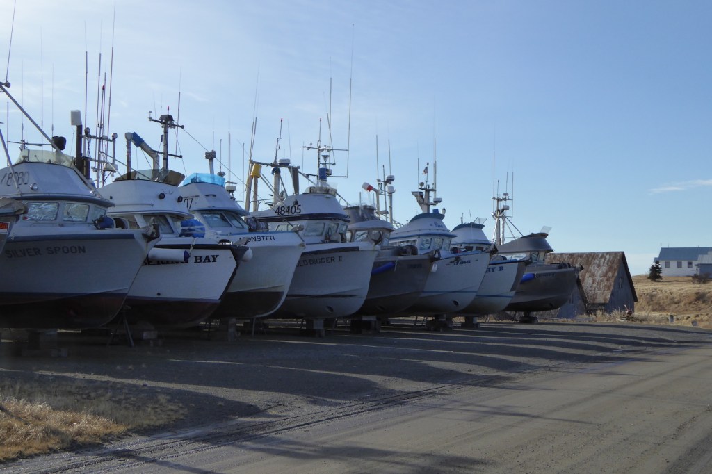
Large scale development, especially open-pit mining, is incompatible with salmon habitat. We know this because large scale development has significantly degraded salmon runs and salmon habitat across much of the North Pacific and North Atlantic. Bristol Bay harbors the last great salmon run on Earth. If Pebble Mine is developed, then we will have acknowledged we have learned nothing from the collapse of salmon runs in New England, California, Oregon, or Washington.

The DEIS is largely based on Pebble Limited Partnership’s data. With so many flaws in the DEIS, it’s clear that the applicant’s plan is inadequate and has not met the burden of information necessary to justify their plans.

The cheapest, most feasible, and most environmentally ethical decision is to conclude this mine poses unacceptable risks to Bristol Bay—specifically the Nushagak and Kvichak watersheds—reject the mine alternatives, and choose the no action alternative for the final EIS. This is well within the Corps’ legal authority: “No Action Alternative could be selected if USACE determines during its Public Interest Review (33 CFR Part 320.4[A]) that it is in the best interest of the public, based on an evaluation of the probable impacts of the proposed activity and its intended use on the public interest.” (Ch. 2-8)

Although modern society uses rare earth minerals like gold and copper in many ways, civilization will not collapse if Pebble Mine is not developed. We won’t even be inconvenienced. If developed though, Pebble Mine represents the beginning of the end of Bristol Bay’s salmon. Mining impacts won’t cease after 20 years, and the hazards cannot be mitigated in perpetuity. The infrastructure is a beachhead for a larger scale Pebble Mine as well as many others in the region. The cumulative impacts of each mine will result in the net loss of larger and larger percentages of available anadromous fish habitat. On no metric does the value ore at Pebble exceed the value a healthy Bristol Bay watershed, its tens of millions of spawning salmon, and the economy and culture based on it.

There is no doubt the no action alternative is in the best interest to the public. We have so little to lose by leaving the ore at Pebble Mine in the ground and so much to gain by protecting it for current and future generations. The decision is clear.

The only acceptable alternative proposed in the DEIS is the no-action alternative. Do not permit this mine to be developed. If you do, it will become one of the greatest environmental tragedies of the 21st century, representative of our failure to do what is right by the land, the fish, and the people of Bristol Bay. It will become a monument to human greed and hubris.

Sincerely,
Michael Fitz
Concrete, WA
May 24, 2019

  1. Brennan, S. R., et al. Shifting habitat mosaics and fish production across river basins. Science. Vol. 364. Issue 6442. 24 May 2019
  2. Brennan, S. R., et al. Isotopes in teeth and a cryptic population of coastal freshwater seals. Conservation Biology. Accepted Author Manuscript. 2019. https://doi.org/10.1111/cobi.13303


Bristol Bay at Risk

Imagine a place where the watershed is un-engineered, where the ecosystem’s productivity and potential is fully realized. It produces half the world’s wild sockeye salmon and is home to more brown bears than people. Then imagine that greed for minerals, driven by mass consumption, threatens it.

Alaska’s Bristol Bay is that place.

GIF of underwater footage of adult coho salmon

Bristol Bay is a 42,000 square mile (1.87 million hectare) watershed that encompasses the southeast corner of the Bering Sea. Ringed by the Kuskokwim Mountains to the north and the Aleutian Range to the south and east, the area is almost wholly undeveloped. The watershed includes two of the nation’s largest national parks (Katmai and Lake Clark), three giant national wildlife refuges (Alaska Peninsula, Becharof, and Togiak), the nation’s largest state park (Wood-Tikchik), as well as millions of acres of undeveloped lands and waters. In short, it is one of the most spectacular and wildest landscapes on the continent.

Wildness, however, doesn’t equate unpeopled. Humans have lived in the Bristol Bay region for at least 9,000 years and likely longer (the oldest human habitation sites were probably flooded by rising sea levels at the end of the last ice age).  Bristol Bay’s Yupik, Alutiiq, and Dena’ina developed a complex relationship with the resources they used to survive, especially salmon. Today, salmon remain the cultural, economic, ecological heartbeat of the region.

Born in freshwater and grown large in the sea, salmon are a conveyor of energy and nutrients. Their upriver migration feeds everything from mink, otter, eagles, and brown bears to 30 inch-long rainbow trout and 10-pound char. After spawning, they die and their decomposing bodies distribute millions of pounds of fertilizer, substantially increasing the productivity of an otherwise nutrient poor freshwater system. Salmon even help plants grow faster.

The area’s abundance isn’t fantasy either. Bristol Bay’s 2018 salmon run was the largest on record, with over 62 million wild salmon returning. Of that run, 21 million sockeye went uncaught and escaped upstream to spawn. 2018 was the fourth consecutive year that sockeye salmon runs exceeded 50 million fish. Exvessel value, the activities that occur when a commercial fishing boat lands or unloads a catch, was worth $281 million dollars. In 2010, during a much smaller run compared to 2018, harvesting, processing, and retailing Bristol Bay salmon created $1.5 billion in sales across the U.S. The value of salmon is even higher when all salmon related jobs—fishing, processing, tourism, supplies, services, and government—are taken into account.

Pebble Mine puts all that at risk.

GIF of underwater footage of sockeye salmon

Pebble Mine is a proposed open pit copper and gold mine at the northern headwaters of Bristol Bay. The fully developed mine site would encompass over 8,000 acres. Tailings ponds and an open pit would straddle two incredibly productive salmon producing watersheds—the Kvichak and Nushagak. Supporting infrastructure would include a 270-megawatt power generating plant, a 188-mile natural gas pipeline, dozens of miles of roads, and up to three new ports where no development currently exists.

As part of the required permitting process, the Army Corps of Engineers is currently soliciting comments on its draft Pebble Mine Environmental Impact Statement (DEIS). Comments will be accepted until May 30. I’m working on my comments now and plan to share them in another post, but the draft is huge, over a thousand pages long, so it’s taking me some time to read. However, my initial evaluation of the document has revealed major concerns.

  • The DEIS evaluates the mine’s active phase (20 years), but pays little attention to the true lifespan of the mine’s footprint, which will extend for hundreds, even thousands of years and create a permanent hazard to the watershed. After the mine’s proposed 20-year operation phase is complete, the landscape is supposed to be reclaimed. Tailings and waste rock will be stored underground or underwater in the former open pit. The open pit will be allowed to fill with water. Once the open pit lake rises high enough, water would be pumped from it, treated to meet water quality standards, and discharged into the watershed. This must happen forever to prevent groundwater contamination.
  • The DEIS does not evaluate the effects of a catastrophic tailings dam failure, which would release a toxic slurry of material into the Kvickchak and Nushagak watersheds. The risk of this is low, but that’s beside the point. The risk still exists and cannot be eliminated.
  • The DEIS does not evaluate who will pay for and maintain permanent water treatment in the open pit.* There is currently no financial plan to fund wastewater treatment after the 20-year operational phase when the mine is to be “reclaimed.” Who’s to pick up the tab when the Pebble Partnership, the mining consortium owned by Northern Dynasty Minerals, decides to walk away? The partnership claims financial assurance for site closure and monitoring is required before construction, but this does not assure funding for perpetual waste-water treatment. Since the corporation cannot guarantee financial solvency forever, it should not be allowed to create hazards that last forever.
  • The DEIS does not sufficiently evaluate the cultural impact the loss of salmon would represent to local residents, especially Native Alaskans. I’ve never been to any place where a single group of animals means as much to a regional culture as salmon do for the residents of Bristol Bay. For them, loss of salmon would be equivalent to the loss of bison for American Indians across the Great Plains.
  • Supporting roads, ports, and other infrastructure have the potential to disrupt some the best, untrammeled bear habitat in the region, especially for bears that use the McNeil River area just north of Katmai National Park.

Pebble’s proponents argue that the mine and salmon can coexist, but the two are at fundamental odds and always will be. Mike Heatwole, president of Public Affairs at the Pebble Partnership, told Mashable that the mine will cause no “population-level challenges to fish and wildlife resources.”

Screen shot from Pebble Partnership website. Text says, "Where is Pebble? Despite what you may have heard, Pebble is not at the headwaters of Bristol Bay. It is located at the upper reaches of three small tributaries — out of more than 50,000 in the Kvichak and Nushagak watersheds."

Pebble Partnership also claims the mine isn’t at the headwaters of Bristol Bay, which is blatantly false. This screen shot is taken directly from their website.

Despite talk that the salmon “population” won’t be affected, the mine reduces spawning and rearing habitat no matter what. Even under a best-case scenario where Pebble Partnership keeps its word, this is still precisely how we begin to lose salmon—one impassible culvert, one dam, one mine at a time. A few yards of stream here, a little more there. Does that matter? It sure does, as the story of salmon in the contiguous 48 states illustrates.

When Lewis and Clark explored the lower Columbia, they found the riverbanks lined with people, and a regional subsistence and trade economy based on the river’s salmon. In less than 150 years, it was gone. Farther upstream at Spokane Falls, people once gathered for thousands of years to catch 60 – 80 pound chinook. Those runs too are nothing more than memory.

In Washington State today, we bicker over the last of the wild salmon, considering whether to cull sea lions to help save an endangered population of starving orcas. Not far from where I live, Baker River sockeye are completely dependent on human intervention for their survival, because dams now completely block access to their spawning grounds. The outlook for salmon isn’t good on the rest of the west coast either. By 1999, wild salmon had disappeared from about 40 percent of their historic range in Oregon, Washington, Idaho, and California. Across the continent in Maine, where people have taken great strides to clean up rivers and remove some barriers to salmon migration, almost no wild Atlantic salmon remain. Twelve Atlantic salmon returned to Maine’s second and third largest rivers, the Androscoggin and Kennebec, respectively, in 2018. Twelve.

No single factor caused the collapse of salmon runs in New England or the west coast. It was death by a thousand cuts. They were treated as an afterthought at best, undervalued and willingly sacrificed for “progress.” Similarly, if developed, Pebble Mine probably won’t be the end to salmon in Bristol Bay, but it could certainly be the beginning of the end. As Van Victor, president of the Bristol Bay Economic Development Corporation, rhetorically asked, “At the end of the day, do we really want to risk what is truly one of mother nature’s wonders of the world for copper and gold?”

GIF of underwater footage of salmon fry

Young salmon fry feed in one of Bristol Bay untarnished rivers.

If you haven’t seen Bristol Bay, if you haven’t experienced what a truly wild and healthy ecosystem is like, then it might be easy to dismiss my concerns. It can be hard to imagine rivers and streams flooded with fish, where wildlife and people flourish on the seasonal treasure. That dynamic simply no longer exists in most of the rest of North America and we, unfortunately, consider it normal. In conservation biology, this generational amnesia is called shifting baseline syndrome: Every generation sees nature through a different lens and what we view as normal is actually degraded. Our threshold for acceptable environmental conditions is continually being lowered.

Thankfully, we don’t have imagine or scour history books to understand what Bristol Bay’s fishery and ecosystem was once like because it is what it has been since the last of the Ice Age glaciers melted from the landscape. We can still experience it at its full potential. It’s a treasure to savor and protect.

But we could lose it, quite easily in fact. Pebble Mine represents greed over sustainability. If developed, it provides clear evidence we won’t stop till the entire world is consumed. Future generations will judge us poorly if we take everything and leave nothing. It takes a special kind of naiveté to believe otherwise.


*I’d like to add a correction on this point. According to James Fueg of the Pebble Partnership, a closure bond would have to be in place before construction can begin, with the bond’s purpose to fund perpetual wastewater treatment by the state. This is good and something I didn’t know about. However, this is of little consolation. It is unethical for a private corporation to create a permanent hazard that the government then must forever ensure is contained. It’s not in the public’s best interest, and shouldn’t be allowed.

My Live Bearcam Broadcasts in 2018

This was a busy year on the bearcams, courtesy of explore.org and Katmai National Park. We hosted more live broadcasts this  year than any other year since the bearcams first went live in 2012.

During play-by-play broadcasts Katmai rangers and myself narrated the Brooks River’s wildlife activity, much like broadcasters for sporting event (although the lives of brown bears and salmon is no game). We never knew what might happen during a play-by-play. Watching the prolonged posturing between two of Brooks River’s largest adult males, 856 and 32 Chunk, on July 12 and integrating the ranger’s radio traffic into the September 17th broadcast are two of my favorite play-by-play moments.

The other broadcasts, live chats, typically focused on a specific topic such as bear fishing styles, hibernation, and bear research at Brooks River. Rangers Andrew LaValle and Russ Taylor from Katmai joined me as frequent co-hosts for live chats and I was also fortunate enough to speak with many special guests. Perhaps the most memorable moment from these broadcasts occurred when bear 132 and her spring cub almost stepped on Ranger Andrew and I during our Katmai centennial live chat on September 24.

If you enjoy these, then please watch many other broadcasts hosted by Katmai National Park rangers and staff on explore.org’s education channel on YouTube.