Compared to summer, winter can seem like a dull companion, especially in my corner of the globe. The buzzing of insects ceased months ago. The forest floor rests under one to three feet of snow. Trees, shrubs, invertebrates, amphibians, and fungi lie dormant. Ice insulates wetlands that were vibrating with life not long ago. Migrating birds vanished months ago. Then, there’s the dangers posed by cold weather. Numbed toes and fingers aren’t pleasant, nor are the perpetual threats of frostbite and hypothermia. All-in-all, I could convince myself that winter is a season to be endured rather than embraced. This would be a mistake, though.
While I miss the sheer volume of aliveness that accompanies summertime, winter has many endearing qualities. It helps me appreciate the abundance of summer. Off-trail travel is often easier when wetlands are frozen and snow smooths the terrain. And few experiences are as peaceful as the immense quiet that accompanies a snowstorm in an isolated grove of trees.
But this post isn’t about falling snow. Rather, it’s about a story written in the snow. Instead of looking at the wintertime forest as lonesome and empty, snow allows me to better understand how the landscape is a fully inhabited place.
Last Monday, I highlighted the travels of a fisher during More to Explore, a bi-weekly highlight show on explore.org cohosted by Brian Byrd and me.
In the interest of brevity for the show, I skipped some details of the fisher’s trail. Tracking is an art that I’m still learning and I argue that I’m a slow study, but a few clues revealed I was looking at a fisher’s trail rather than a fox, coyote, marten, or lynx, all of whom inhabit the area.
Claw marks registered in most of the prints that I examined carefully, effectively ruling out felines since their claws are retractable and don’t register reliably in tracks.
The clearest tracks had five toes—an important clue that rules out the canines such as foxes and coyotes. Porcupines, bears, skunks, hares, and rodents can make five-toed tracks too, but they have other features that make them distinctive.*
The tracks’ size were too large for other members of the weasel family who live here such as short- and long-tailed weasels, mink, and marten. I could rule out river otters too since there was no evidence that the animal slid across the snow (something otters routinely do) or sought liquid water. The trackway crossed a beaver-created swamp but the tracks did not lead to water as an otter would have.
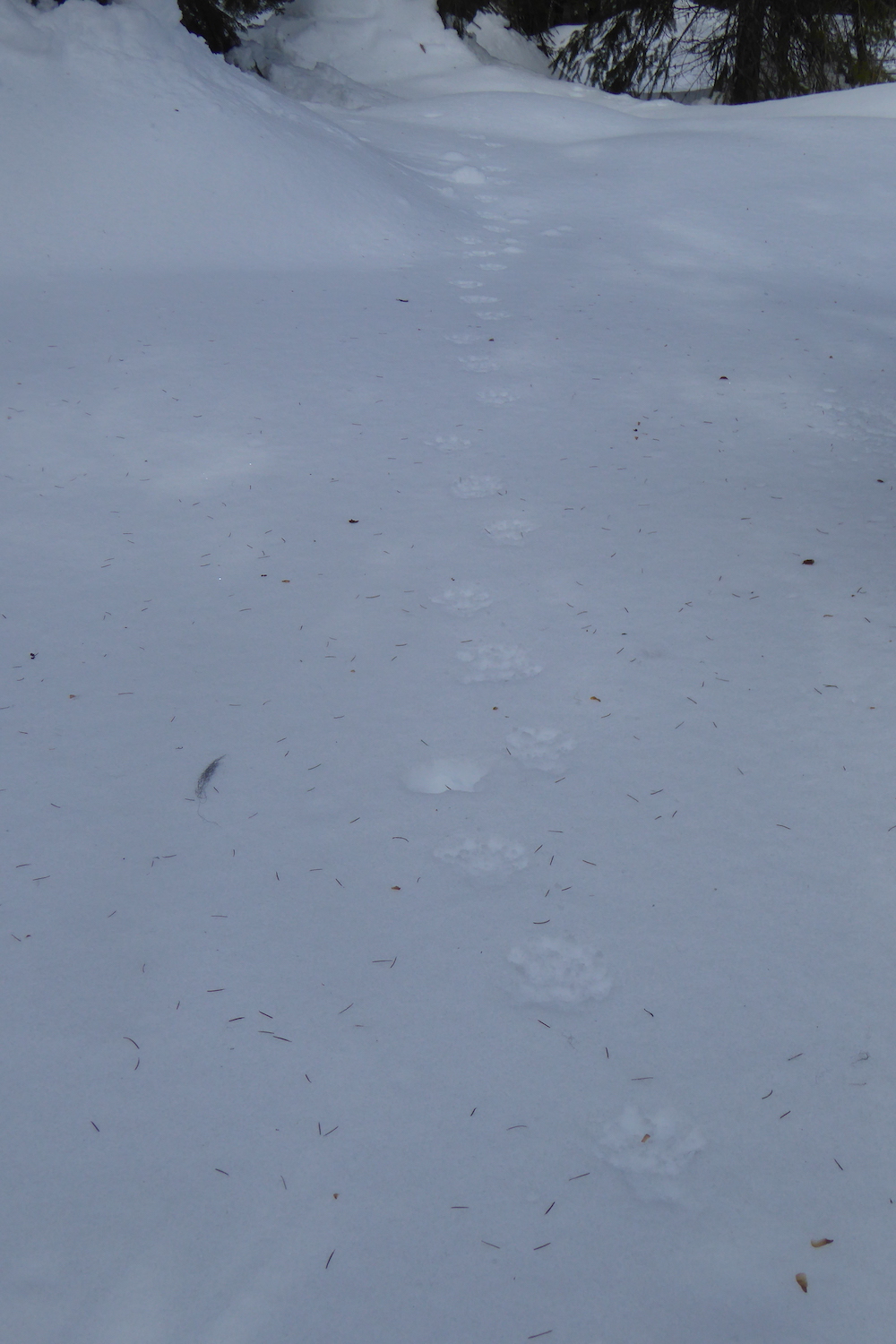
The animal’s gait was a mostly loping in a 3 x 4 pattern, which is a common way for fishers to travel. The 3 x 4 lope is a method of travel where a fisher places a front and rear foot from one side of the body in the same place, while the feet on the other side do not overlap. This gives the impression of only three tracks instead of four. Fishers walk, lope in a 2 x 2 pattern, and gallop too, but in my experience they’ll use a 3 x 4 pattern much more often in firm snow than American martens.
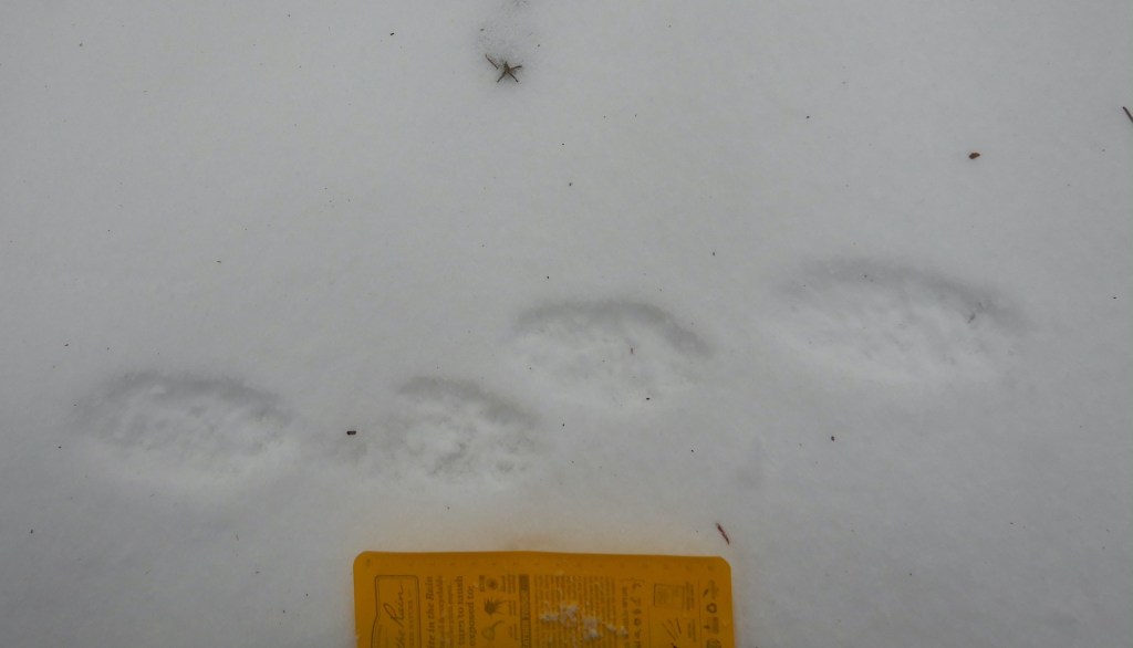
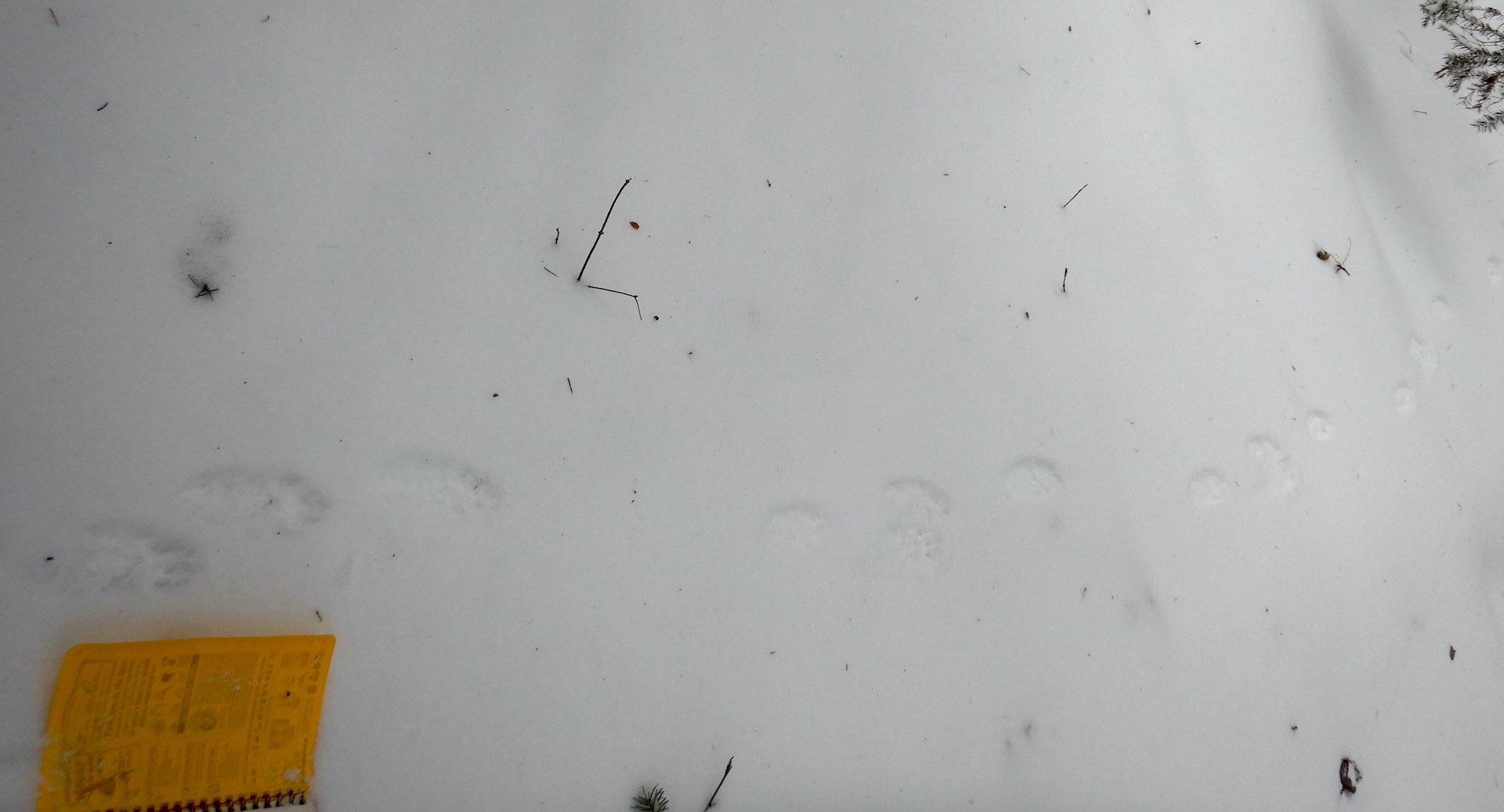
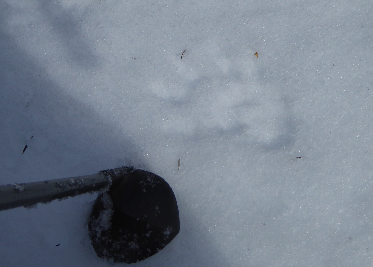
A clear set of fisher prints. Her five toes are perhaps easiest to see in the second track from left. Also note that the fisher created four prints here so she slightly deviated from her typical 3 x 4 lope.A trackway from the fisher. She was moving with a 3 x 4 lope across firm snow. My notebook is about 17 cm wide for scale.
Several other mammals were active that day as well. Snowshoe hares, red fox, red squirrels, mice, and voles all left tracks or scat to reveal their presence. I was only lucky enough to be chastised by a couple of squirrels and didn’t see any other mammals for the majority of the day but walking slowly and quietly gives one the opportunity to be surprised. In a moment of quiet contemplation, the kind you experience while gazing through trees pondering your next move, a glimmer of movement appeared in the corner of my eye. I turned my head to find a weasel bounding through the snow. I didn’t dare reach for my camera knowing I’d spook it into hiding, although I remember clearly my confusion upon seeing it.
A long-tailed weasel changes its fur color from summer brown to winter white and back again with the seasons. In winter, they are nearly pure white except for the tip of their tail, which is black—a feature that seems to misdirect attacking predators away from the head. This weasel, however, appeared to have a dark tail and head.
My brain needed to register a few more bounds by the weasel to clear the confusion. it wasn’t oddly colored. The weasel was carrying a vole or mouse in his mouth. As he disappeared in a thicket, I was offered a special opportunity to examine its prints for clues about that may help me better understand how small weasels move in snow when they are burdened by the weight of their prey.
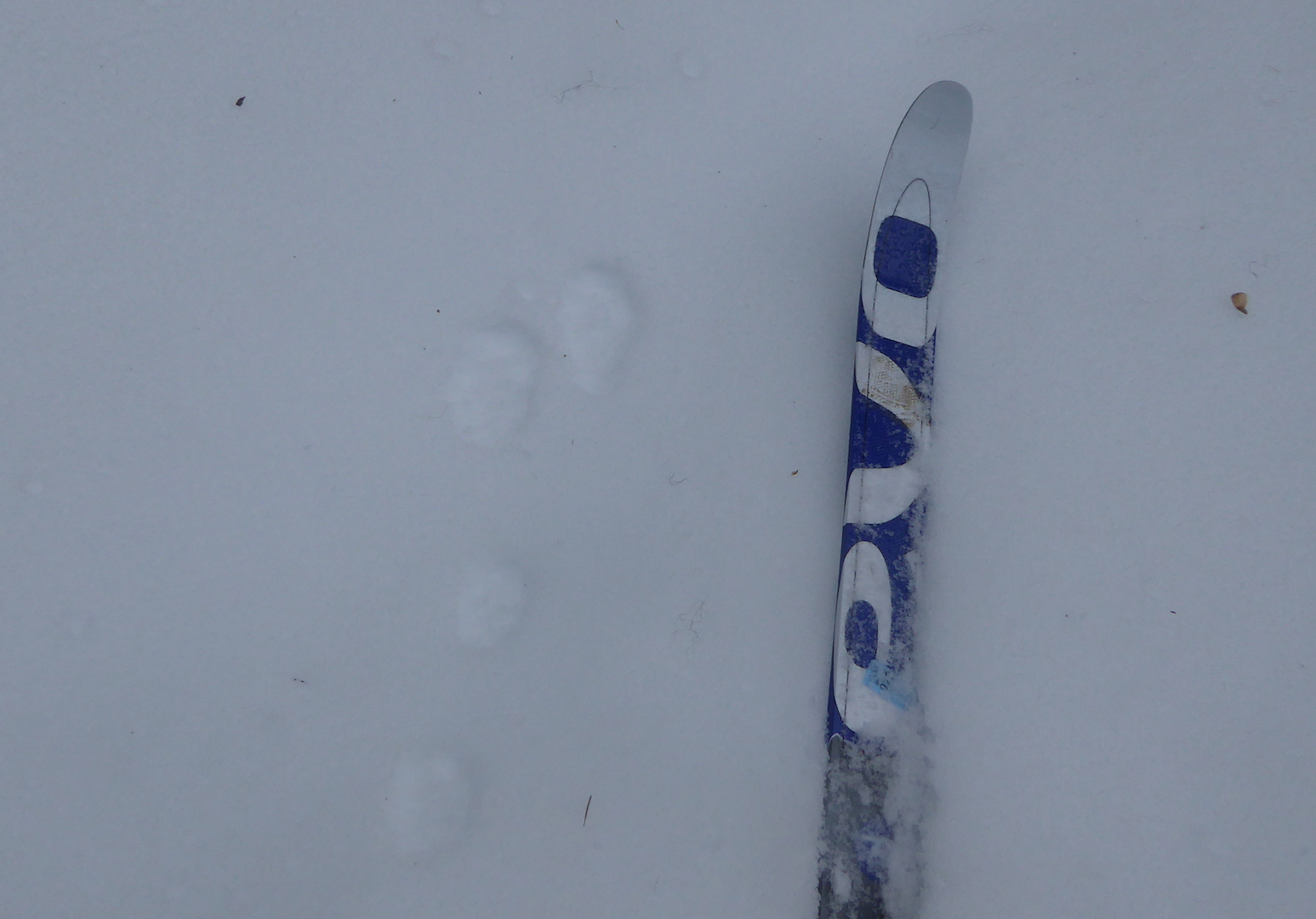
Long-tailed weasels and the smaller short-tailed weasel (ermine) travel most often in snow by using a 2 x 2 lope. When you see them traveling in this way, it looks almost like a long hop, with the front feet hitting the ground first. The front feet quickly lift into the air while the hind feet land in the same place. The weasel I watched used this method and he seemed to carry his rodent cargo with ease—an impressive display of relative strength. His prey, though, left an important clue. Each of the weasel’s bounds were accompanied by a slash in the snow, which must have been created by part of the dead rodent (a foot? a tail?) dragging in the snow with each leap of the weasel.
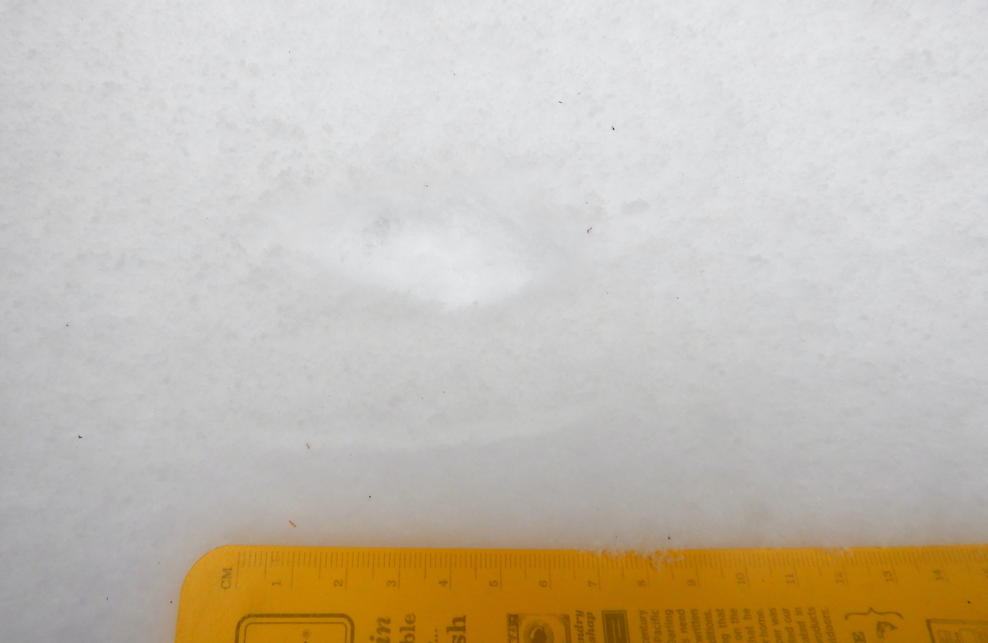
A long-tailed weasel’s prints are underscored by a slash in the snow created by the rodent prey it carried.Two sets of prints from a long-tailed weasel. Note the repeating slash next to each track. The weasel traveled from right to left.
As I discussed in the video segment above, the life of a fisher would be far more mysterious without the record it leaves in snow. I would have no real clue how much fishers leave scent marks or climb trees without reading their trackways. Likewise, if I’d not been in the right place at the right time or been looking in a different direction I would have missed the weasel and its meal completely. Had I stumbled upon its trail with the strange, repeating mark next to each print I’m not sure I’d reason it was from the weasel’s prey. But now, I’ll be looking for other examples like it.
I hope you have the opportunity to utilize snow to learn more about your neighbors. When the snow pack melts in spring, I welcome the change although I must admit that forest seems a bit lonelier when I don’t know who has been visiting.
Mid winter is the wonderful time of year when I wake up every morning wondering if I need to shovel snow. To be honest, I don’t mind the chore when I have the time to do it. I do mind that it is work that I wouldn’t have to do if my household wasn’t reliant on a car. I’m thankful, though, that we made the move away from gas guzzlers. Our primary vehicles are my bicycles and an electric car.
You’ve probably seen the marketing campaigns for electric vehicles (EV) or a charging station along a highway. But given that EVs still represent a small portion of cars on the road then maybe you haven’t spoken to anyone who owns or drives one. As one such person, please allow me to share some of the advantages and frustrations of electric vehicles.
My wife and I purchased a Chevy Bolt in 2019 when we lived in western Washington. She had an unreasonably long commute, her 2011 Subaru Forester wasn’t as efficient with gas compared to its youth, and gas had been hovering around $3.50 per gallon or higher at the time. Plus, the climate and pollution impacts of its internal combustion engines wasn’t something that I could ignore anymore. I did some basic math and found that driving an EV would be far less expensive than driving her Forester. We made the purchase and haven’t looked back. (BTW, we still own the gas guzzler, but we’ve hardly driven it in the last three years.)
We plug in the EV at home at our convenience and only need to consider using a commercial charging station on trips more than 200 miles. There’s no engine oil or transmission fluid to worry about. In fact, the only liquid I’ve ever given the car has been for the windshield washer. The Bolt has an approximately 65 kw battery* and we pay about $0.16 per kilowatt-hour for electricity so it costs us $10.50 to fully charge the car. Its range in summer is about 300 miles. In winter, it’s closer to 250 or 200 miles depending on how cold the air temperature is and how much we need to run the heat and defroster (more on that later).
*The battery’s true capacity might be a little less than this it’s but definitely above 60 kilowatts.
To compare that to a gas-powered car, let’s buy 3 gallons of gas at $3.50 per gallon, which is $10.50, exactly what it would cost us to fully charge the Bolt from a near dead battery. A gas car would need to get 67 miles per gallon to equal the Bolt’s charging cost when the batteries provide 200 miles of driving range. A gas car would need to get 100 miles per gallon to equal the Bolt over 300 miles. That’s just money, though, not true efficiency. A battery-powered car is able to apply more than 60% of its energy under ideal conditions toward propelling the vehicle. An internal combustion engine in a car is remarkably inefficient, using only 12-30% of its energy to move a vehicle forward.
Overall, the Bolt is quiet, clean (there are no emissions), and far cheaper to use than the Forester, yet we’ve never taken it on an extended trip until recently. In late November and early December 2022, my wife and I drove from northern Maine to Pittsburgh to Cleveland and back. We knew that we’d need a little more patience and time to get where we wanted to go.
Nov. 23: Home to Augusta, Maine
Distance: ~200 miles. Northern Maine is a bit of a EV charging station desert. Even Tesla, which has an extensive charging network for their vehicles, only has one charging station north of Bangor currently.
Northern Maine has very few public EV charging stations along the public road corridors. Screen capture from PlugShare.com.
We’ve made the mistake of almost running out of juice a couple of times returning home from central and southern Maine. It’s a bit alarming when the car no longer tells you an estimated range, starts beeping warnings, and flashes a low battery warning light. Thankfully, there’s no worry for us today. We leave home with a full charge and the weather cooperates with above freezing air temperatures. After 200 miles of mostly interstate driving, we use a high capacity (level 3) ChargePoint charger for about 45 minutes south of Augusta to push the battery up to about 66%.
This being the Wednesday before Thanksgiving, a lot of people were on the road. At the Gardiner rest stop on I-95, there are four L3 chargers, but only two were working reliably that evening and both were occupied when we arrived. We wait about a half hour for a space at a working charger. This turned out to be a prologue. High demand and too few working chargers would be a repeated frustration over the next several days of travel. It wasn’t the waiting that was the issue, necessarily, but waiting, instead, simply because the charging stations aren’t working.
Nov. 25 Augusta, Maine to Springfield, Massachusetts.
Distance: ~250 miles. During the past day and half, we mooched electricity from a regular wall outlet at my in-laws to top off the car’s battery. Starting the day fully charged, we drive south. At the Kittery rest stop just north of the Maine/New Hampshire border, one of the level 3 ChargePoint chargers is occupied while the other isn’t working. However, our afternoon destination is Lowell National Historical Park and we have more than enough juice to get there. At Lowell, we park in a garage with a level 2 charger, which is equivalent to our plug at home. This charges at about 6 kw per hour while we visit the national historic site and eat a late lunch.
A 1920s era weaving loom at the Boott Cotton Mills at Lowell National Historical Park.
Afterward, we drive in the dark via various interstate highways. I have trouble connecting the the car to a large bank of level 3 Electrify America chargers at a mall. It’s probably just a quirk of the electronics or car’s charging port because the issue repeats at several stations. The charging cords are stiff and heavy, which might hinder a proper connection. I found that holding the plug firmly while the charger initiates gets the station to connect without further issue. In Springfield we spend the night in a hotel with a L2 charger and plug in overnight.
Nov. 26 Springfield, Massachusetts to East Stroudsburg, Pennsylvania.
Distance: ~200 miles. Breakfast is at an Italian bakery with a most excellent chocolate cannoli. We then spend an hour at the museum for Springfield Armory National Historic Site. On the drive south through Connecticut, the weather is mild with temperatures in the 40˚s and 50˚s F. The Bolt continues to get about 4 miles per kilowatt even while driving 65 miles per hour most of the way.
We stop at an Electrify America L3 charger located in a Walmart parking lot in Newburg, NY. A line of people already wait there. Two of the four chargers are out of service on one of the year’s busiest weekends for travel. We stay only about 15 minutes then leave when it looks like our place in the queue wouldn’t get us access to a working charger for at least an hour. This turned out to be the right choice anyway. There are few things I consider less pleasant than visiting Walmart and they are doubly hellish spaces on the weekend after Thanksgiving when the worst of the mass-consumption brainwashing compels people to buy garbage that they don’t need.
Our alternative was another level 3 charger about 30 miles away in Middletown, NY. This turned out to be one of the more enjoyable places we stopped to charge. The charger worked without issue, it accepted a credit card so we didn’t have to download and use a special app, and there was no one else waiting to charge, I could walk through the town to stretch my legs, and there were a few restaurants within easy walking distance. More towns should put EV chargers in their city center rather than sprawling parking lots surrounding monuments to runaway consumerism.
We detour through Delaware Water Gap National Recreation Area at sunset on the way to our night’s destination. I wish we would’ve had more daylight to explore the forest and river. Our hotel for the night advertised an EV charger but neither of the two stations are working when we get there (lesson: call ahead and ask). We poach some electricity by using a 110 volt wall outlet on the outside of the hotel.
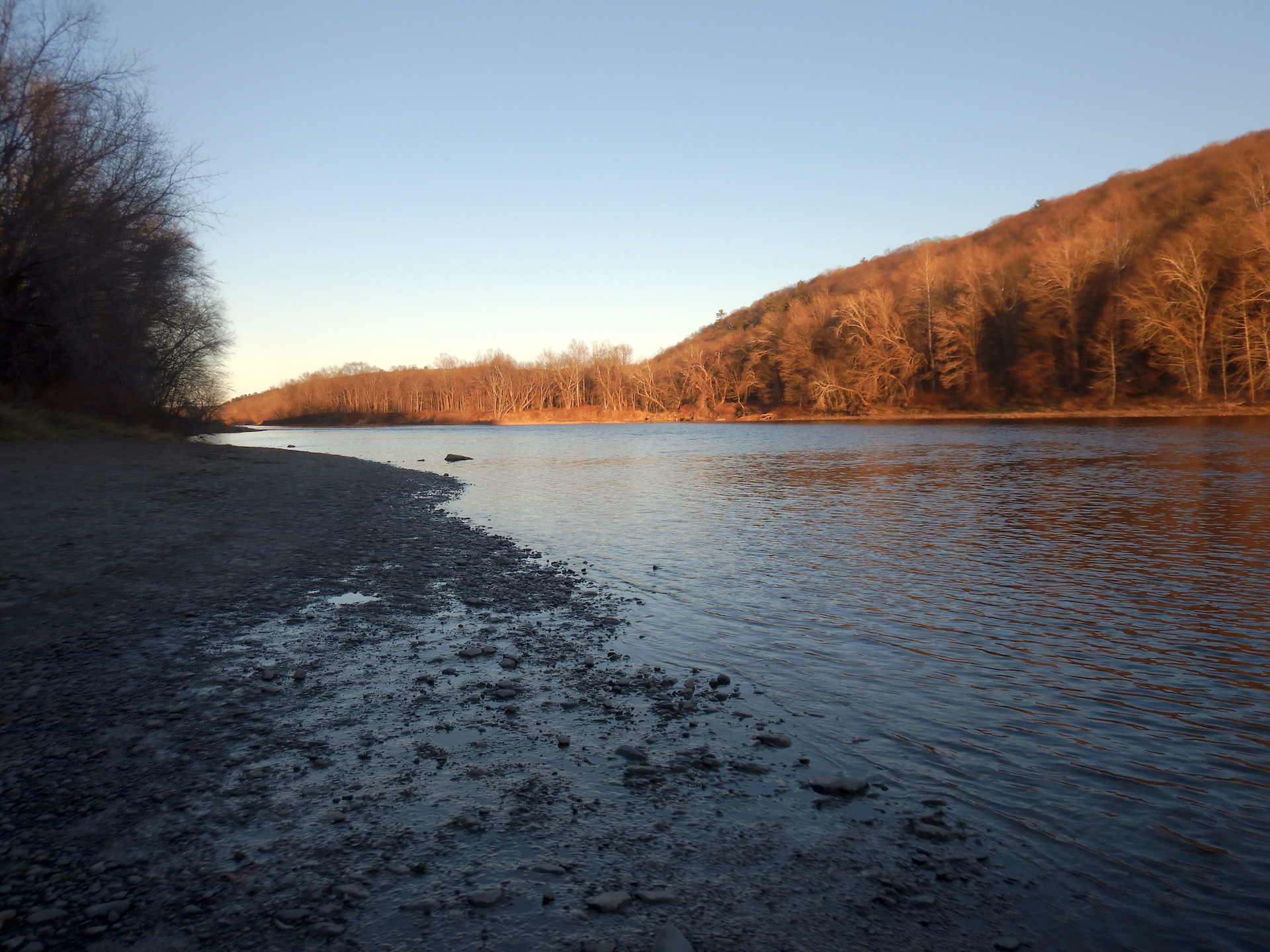
The Delaware River at sunset.
Nov. 27: East Stroudsburg, Pennsylvania to Gettysburg, Pennsylvania
Distance: ~200 miles. We leave the hotel with the car’s battery charged to about 60%, which is more than enough to get us to an Electrify America L3 charger in Allentown. It’s early on a Sunday morning but three of the four charging spots are occupied and the fourth doesn’t work. We wait about 20 minutes to plug in to jump the battery from about 45% to 66%—enough to probably get us to Gettysburg without issue. We assist a couple who are driving a new Bolt but have never stopped at one of these chargers before.
After a rainy walk through Hopewell Furnace National Historic Site, we plug into a free level 2 charger while we eat lunch at Furnace Creek State Park. I would’ve liked to have spent more time exploring here if it weren’t for the limited daylight hours of late fall.
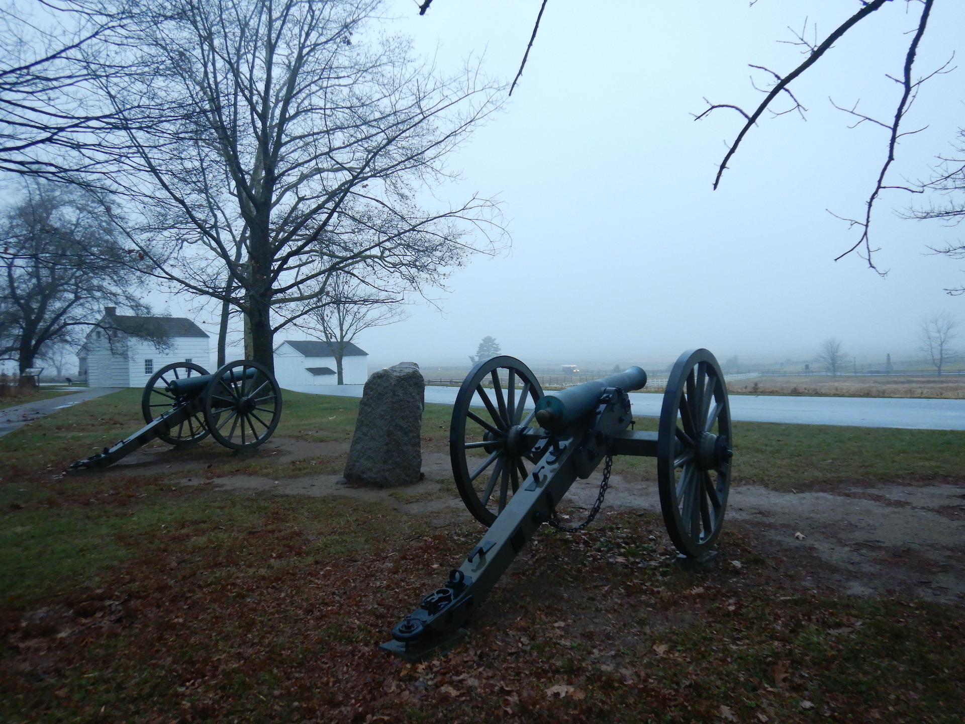
We make it to Gettysburg with about 25% of our battery left and plug in for the evening at a hotel. At dusk, I walk along a nearby section of the battlefield and national cemetery feeling profoundly sad for the pain and death that happened there. Later, I can’t sleep and get up to unplug the car after it is fully charged at 1 a.m., you know, just in case some other EV drives up in the middle of the night.
Canons near where U.S. troops repelled the last Confederate assault during the Battle of Gettysburg. In less than an hour on July 3, 1863, thousands of people died in the nearby fields.
Nov. 28: Gettysburg, Pennsylvania to Pittsburgh, Pennsylvania
Distance: ~200 miles. We tour the park’s museum and battlefield in the morning. The level 3 chargers at the museum don’t work so I’m glad for the hotel’s overnight charging option.
We mostly follow U.S. 30 to Pittsburgh, which is a mountainous route by PA standards. On the steep, long climbs the car uses a lot of electricity, but on the way down we recoup some of that energy using the regenerative braking system. This helps to milk the best range out of the battery. Trying to drive in the most efficient manner also motivates you to not drive like an asshole. We add a kilowatt of energy to the battery when dropping off Laurel Ridge into Ligonier.
In Bedford, we wait about 15 minutes for space at a level 3 charger. Almost predictably, one of the four chargers was out of order. We leave after bumping the battery up to 80% full since at least two other EVs are waiting in line.
A stop at the Flight 93 National Memorial breaks up the day but triggers a lot of emotions. Around dinner time, we get to Pittsburgh with about half the battery’s charge left in the tank. At my sister’s house we can’t plug in for the night. Her house is perched on a steep hill—one of those Pittsburgh houses you need to ascend the equivalent of two flights of stairs to get into. Adopting an EV would be a challenge for her and others who live where the only parking option is on the street. (And, FWIW, my sister doesn’t own a car which is much more of an environmentally friendly choice than owning an EV. She does, however, have a Pittsburgh toilet.)
Nov. 29: Pittsburgh, Pennsylvania to Cleveland, Ohio
Distance: ~170 miles. At a gas station surrounded by four to six lane highways in Cranberry, northwest of Pittsburgh, two of the four Electrify America chargers aren’t working. Luckily, we only had to wait about 5 minutes for a spot. Once plugged in, our charge speed varied between 20 – 30 kw, which is typical for our Bolt at all level 3 chargers we’ve used. Since our car is a 2019 model, the electrical system doesn’t seem accept the same amount of juice as a newer versions. Eavesdropping on the charging speeds of most other EVs plugged in at the same time, they’ll get 50, 75, even 125 kw of power.
I get dropped off to visit my mom for a few days while my other half continues to Cleveland for a conference. Before she departs, I take the car to the level 2 charger at Jennings Environmental Education Center, which I love. It boasts an extensive, well maintained trail system that takes you through some unique habitats with locally endangered species. I grew up nearby but didn’t fully appreciate the spot when I was younger. The car is almost fully charged when my wife needs to leave about three hours later. She drives to Cleveland without needing to stop anywhere to charge.
A few days later, I take a bus from downtown Pittsburgh to downtown Cleveland in the morning. My wife parked the EV at a nearby garage to charge during the morning so I go pick it up. The charge was free but parking in the garage was expensive.
Dec. 3: Cleveland, Ohio to Canandaigua, New York
Distance: ~275 miles. We leave Cleveland with a full charge and head east on I-90. Some of the level 3 chargers on the way to Buffalo were reportedly not working (surprise!) so we stop in Erie after about 100 miles of driving. No one is at the Electrify America station when we arrive. The chargers are in another crummy location—another Walmart parking lot surrounded by more parking lots and big box stores. At least we can see the lake in the distance.
The weather remains mild for the season and the roads are free of snow. Outside of Buffalo, we stop at another level three Electrify America station where, once again, only 3 out of 4 chargers are working. It’s located at another Walmart in retail sprawl. Ugh. But it gives us the juice to get us to our night’s destination with a 50 mile buffer in case the hotel’s charger doesn’t work, which at first it did not.
Unable to charge, I go to the hotel’s front desk to find that the attendant couldn’t help because there was no maintenance person on duty that day. This was a non-networked station, which meant that there was no customer service to call. I searched and found a wall outlet to plug into but decided to try the charger again after noticing that the light indicating a fault error on the charger was off. I plugged in and it worked, thankfully.
Temperatures remained in the 40˚s throughout the day and the car got about 4 mi/kw again despite driving almost entirely at interstate speeds of about 65 miles per hour.
Dec. 4: Canandaigua, New York to Saratoga Springs, New York
Distance: ~233 miles. Full charge by the morning. We get to Women’s Rights National Historic Site to explore its museum as soon as it opens. After continuing east, we take a break to walk outside the fort at Fort Stanwix National Monument even though the visitor center, fort, and the parking garage with a charger are closed for the day. We hit a L3 charger in downtown Utica, and spent the charging time looking for a place for me to pee, finally deciding just to sneak into a hotel and use their restroom since the few open shops didn’t provide the proper facilities. It was getting to a point where I was considering using an alley. After a short stop to Saratoga National Historical Park at sunset, we charge the car overnight at a hotel in Saratoga Springs.
Dec. 5: Saratoga Springs, New York to Augusta, Maine
Distance: ~300 miles. We drive a meandering and hilly route back to Maine through Vermont (one of three U.S. states I’d yet to visit) and New Hampshire. In Rutland, VT, we stop at a L3 Charge Point charger for about 45 minutes to get the battery up to 80 percent. One of two wasn’t working but luckily no one was at the chargers when we arrived. Through New Hampshire and back in Maine at dusk, we stop at another L3 charger in Windham. This was also surrounded by retail sprawl but at least there was a decent sushi restaurant nearby where we could eat dinner while the car did its thing. Finally, and less than 10 miles from the in-laws’ house, we use the L3 chargers at the West Gardiner rest area on I-95.
Dec. 6: Augusta, Maine to Home
Distance: 200 miles. By jumping the car’s batteries back up to 80% the night before and combining that with the juice we get from the in-laws’ 110v wall outlet overnight we have a near full charge by morning when we make our way home. Temperatures stay in the 40˚s F. We make it home with about one-third of the battery to spare.
You may have noticed that we weren’t in a hurry. Our itinerary was relaxed, giving us the opportunity to take lots of breaks and make many stops. We looked for charging stations more frequently than necessary too since so many were broken. I didn’t want to deplete the battery too far and limp to a charger that didn’t work. We were also fortunate on the road trip since there was no particularly cold weather or snow. As I write this in late January, I’ve had plenty of time to become reacquainted with the wintertime complications of the EV driving experience.
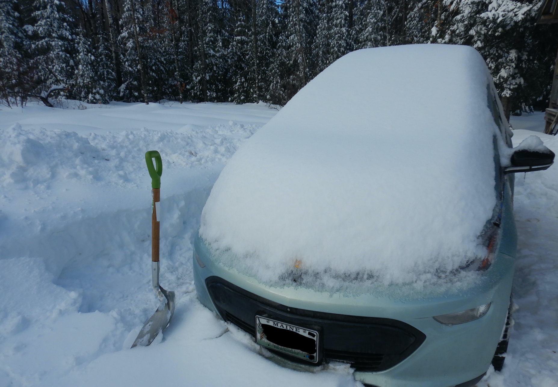
The Bolt at home after a snow storm.
First, the Bolt’s batteries are certainly less efficient when temperatures are below 30˚F (-1˚C). This is especially true when temperatures are below 10˚F (-18˚C). We don’t have a garage (and there’s no way I’m building one), so the car sits outside and during cold days the batteries will use some energy to condition themselves for more optimal performance. Using any climate control accessories like the windshield defroster and heater also eats noticeably into the batteries’ energy stores. Instead of the 300 miles per full charge the Bolt gets in the summer, it is much closer to 200 miles and sometimes less in winter. Gas guzzlers are far less efficient in cold weather too. To me, however, the impacts to the EV’s driving range seem more conspicuous compared to a traditional car.
I should note that I don’t typically enjoy driving and I often find road trips to be frustrating endeavors. The pace is too quick and travel by car insulates you from the landscape in a negative way. And, before you comment about how EVs are not the best solution to our transportation issues and climate change woes: I agree. Roadway deaths in the U.S. are as high or higher than ever before even as cars get safer. Automobiles are a disaster for wildlife too. Tires leach chemicals that kill salmon, and hundreds of millions of vertebrate animals in the U.S. are killed when they are struck by cars. In more ways than one, EVs perpetuate this unacceptable status quo. My favorite vehicle remains my trusty steed, Rocinante, and we certainly need to prioritize passenger trains, buses, and safe biking routes over more cars. The environmental impacts of mining minerals to produce EV batteries can’t be ignored either.
And, before you comment about how EV’s are too inconvenient to usurp internal combustion engines for commuting and long-distance passenger travel, please consider instead that convenience should not be our first consideration in today’s world. Certainly not with a very real climate crisis. We could’ve and should’ve started transitioning to renewable energy and electrifying our transportation grid in the 1990s when it was already clear that climate change was coming fast. But our elected leaders did virtually nothing and the public wasn’t demanding change, partly because the threat seemed abstract and distant (at least that’s how I remember thinking about it; people—including me—generally aren’t good at seeing past our immediate needs and wants) and also because fossil fuel companies used a disinformation campaign straight out of the tobacco company playbook to successfully sow doubt about climate science and create apathy for change within the public. It worked on me too. I can remember stating that the consequences of climate change were not well understood during programs that I gave as a park ranger. Now the stakes are higher and the changes necessary to stave off the worst climate impacts are harder. Convenience, therefore, cannot rule the day. That opportunity is long gone.
So if you’re going to buy a car or another car, should it be an EV? Get a traditional bicycle or an electric-assist bicycle, first. Then if that can’t work for you then get an EV. If it’s not for the pollution benefits, then get it for the low operating and maintenance cost (cheap to drive, no oil changes, no expensive gas, etc). Although a little more patience is necessary on long trips currently, an EV will get you where you need to go.
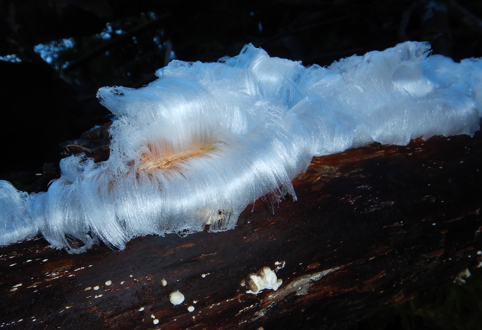
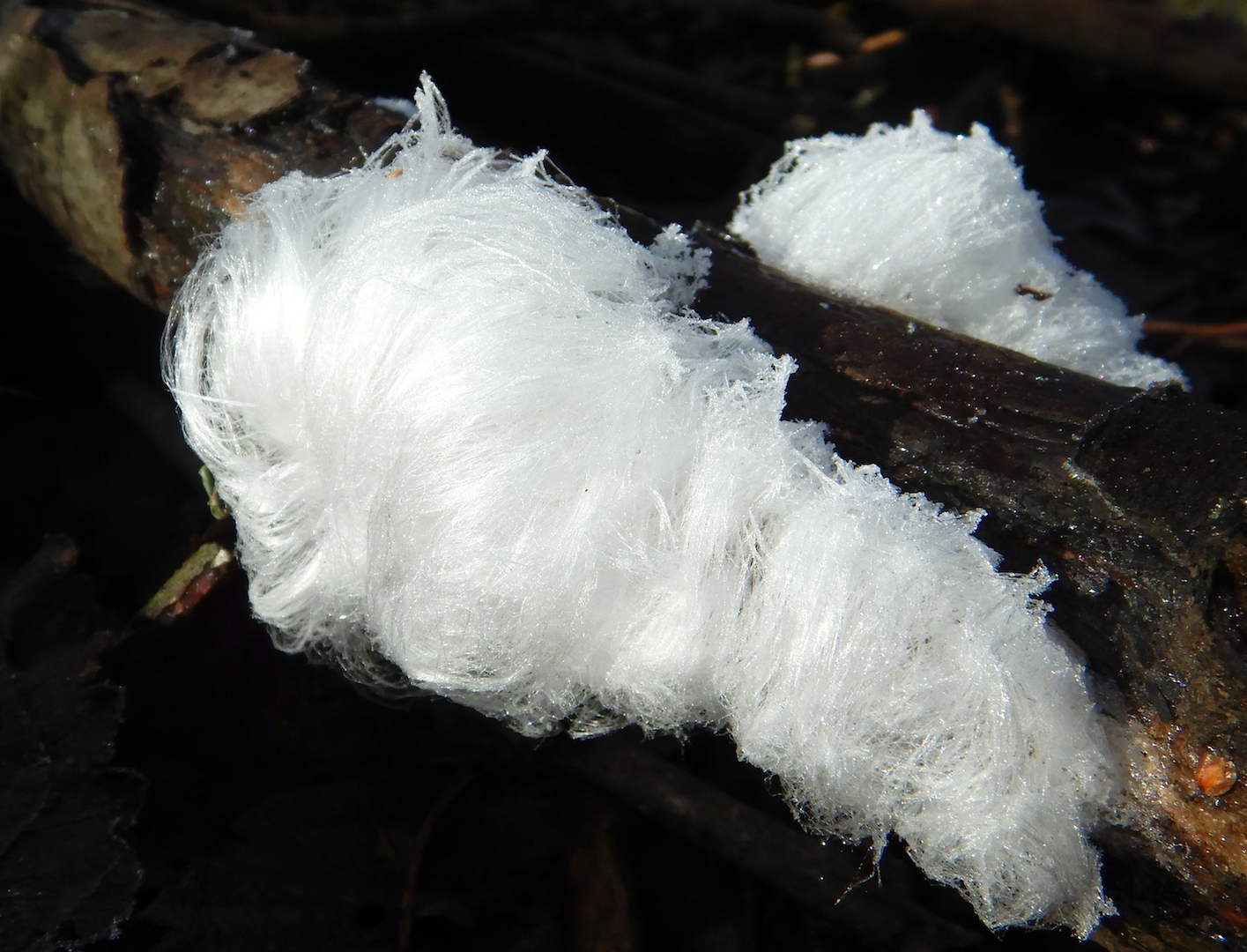
Late one frosty morning, I paused my walk to admire ice crystals that had grown from a small branch lying on the ground. Delicate and lacy to the extreme, the ice had a silky and well-kempt appearance. The formation was gorgeous.
This was my first glimpse of hair ice, a phenomenon that originates in a surprising way.
If you live in a temperate climate that experiences hard frosts, you might be familiar needle ice. Even though it forms on frosty nights, this type of ice isn’t frost because it doesn’t condense out of the atmosphere. According Dr. James Carter of Illinois State University, it forms instead from in water in soil through ice segregation, a process when “above freezing and below freezing temperatures are juxtaposed. At the Earth’s surface this is most common in fall at night as the air cools to below freezing while the land surface stays relatively warm.” As ice forms on the soil surface, liquid water is pulled up from below through capillary action and freezes to the existing ice. This forces the ice to grow away from the freezing surface. The process stops when the temperature becomes cold enough to freeze everything up, the temperature rises above the freezing point of water and everything melts, or the soil surface becomes too dry.
Hair ice however, forms under even more specific, and perhaps unusual, circumstances. Like needle ice in soil, hair ice needs air temperatures just below freezing and a water saturated substrate. Unlike needle ice though, hair ice forms only on wood, specifically the dead and bark-free wood of broadleaf trees. Why only on dead wood?
In 2015, researchers from Germany and Switzerland published a very interesting (and highly readable for a scientific paper) study titled, “Evidence for the Biological Shaping of Hair Ice.” Through repeated observations and laboratory experiments, they confirmed that the biological action of a winter-active fungus, Exidiopsis effuse, is required to enable the growth of hair ice.
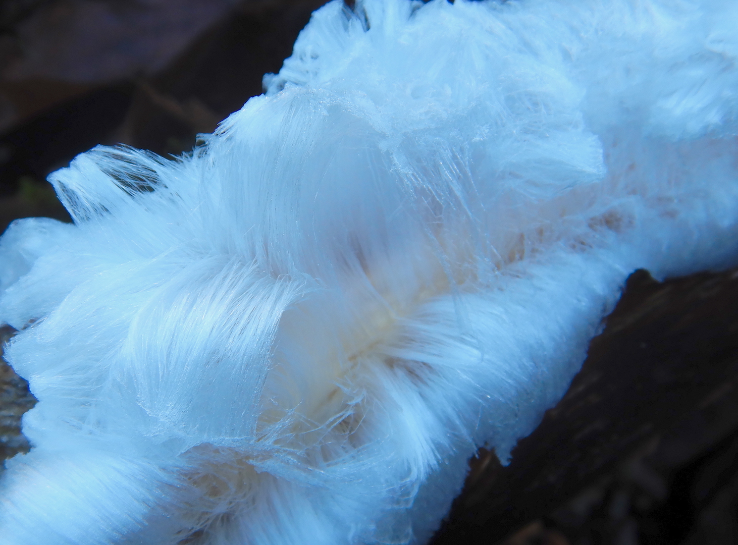
Looking at the cross section of a small branch, wood rays radiate from the center of a branch like spokes on a bicycle wheel. From these rays, hair ice threads emerge and grow perpendicularly from the wood surface. The thickness of individual hair ice stalks corresponds to the diameter of the wood ray channels. Perhaps for the first time in my life, I could visualize the true scale of these cellular channels.
But this doesn’t explain how the ice maintains its shape. Threads of hair ice are extremely thin, sometimes .02 millimeters in diameter or smaller. Yet, they can grow to be 20 centimeters long (that’s 1,000 times longer than it’s thickness!) and maintain their shape for days. Normally, ice this fine couldn’t retain its shape for so long. It would recrystallize into larger crystals quickly at temperatures near freezing.
While the chemical process that preserves its fine and delicate structure is not fully understood, it seems that the ice, according to the 2015 study’s authors, is “doped” into maintaining its shape by fungi. Samples of melted hair ice contain lignin, tannins, and other compounds. Lignin cannot be digested by animals, only by fungus and some bacteria. It’s presence in the water, therefore indicates fungal activity. (We can thank fungi that forested habitats aren’t buried in dead trees.) The lignin and tannins might act as a crystallization surface for the ice and the fungi might help to initially shape the ice as it forms at the surface of the wood rays.
When researchers applied fungicide or hot water (90-95˚C) the hair ice wood for several minutes, hair ice formation was suppressed for many days. Instead of hair ice, an simple ice crust formed on the wood. This indicates that hair ice formation is somehow catalyzed by fungal activity and that high temperatures inhibit the activity of Exidiopsis effusa.
Since I first observed it, air temperatures have been too warm in my neck of the woods for hair ice to reappear. Given its ephemeral nature and remarkable delicacy, I’ll be sure to search for it once the temperature drops again. If I find it, I’ll surely be astonished by ice that was—in a sense—doped by a magic mushroom.
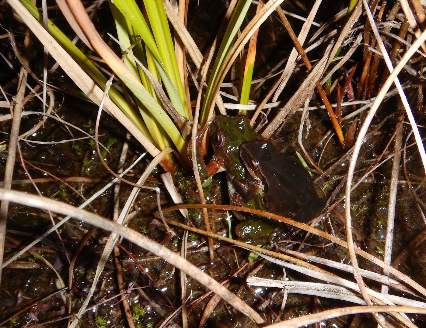
At Oregon’s South Beach State Park last month, I heard a chorus of frogs hidden among the grassy dunes. Following the calls, I found a few dozen Pacific tree frogs (Pseudacris regilla) in a shallow ephemeral pool where the males were calling loudly in an effort to attract females. When I stooped low to record a video, they were so loud I should’ve been wearing earplugs.
A few of the males got lucky too.
bow-chicka-wow-wow
These frogs can be active all year when conditions are right. My night at the state park coincided with a stretch of very warm weather that coaxed the frogs out of their torpor. (The daytime high in Newport was 62˚F, a new record for the date.)
Winter weather in coastal Oregon and northern California is often wet and chilly, but low elevation areas rarely experience freezing temperatures. For someone who grew up in Pennsylvania and spent several winters on the Alaska Peninsula, “normal” winter still includes ice and snow, so the climate along Pacific Ocean remains somewhat novel. Seeing frogs in January, especially, enhanced that feeling.
It was late January, but I enjoyed nearly perfect hiking weather in Big Bend National Park. The sky was clear, the wind was calm, and the temperatures hovered in the hiking Goldilocks range (for me, that’s the low 60˚s F). I had spotted a few piles of bear scat earlier that day, but all were dry and desiccated. Then in the late afternoon, I found one particularly fresh pile of crap.
This scat was soft and pliable and hadn’t been exposed to the dry desert air for very long. (I poked it with a stick to gain a very scientific measure of its age.) Was there a bear nearby? I hoped to find out.
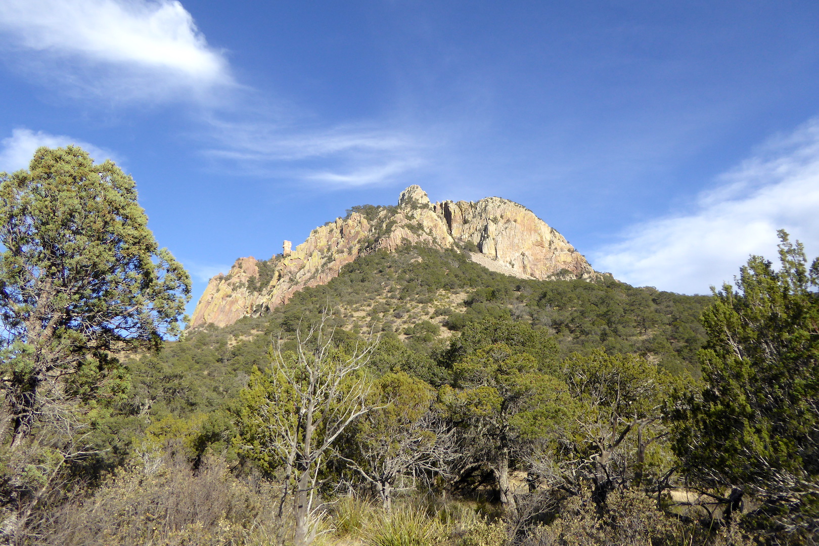
The previous day, I stopped in the Chisos Basin Visitor Center to purchase a book to help me search for the park’s endemic oaks. A map on the visitor center wall was marked with sticky notes identifying when and where people had spotted black bears. At least a dozen had been seen over the past two weeks. I made a mental note to watch carefully for bear sign. Maybe, just maybe, I would be lucky enough to see one for myself.
The pinyon-oak-juniper habitat near Emory Peak (center) is preferred habitat for Big Bend’s black bears.
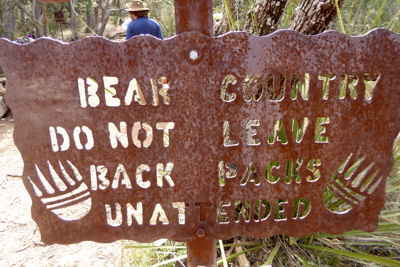
Although I spent considerable time searching for the endemic oaks (and found at least a couple, plus some species rarely found in the U.S.), bears were never far from my mind. Backcountry campsites all had bear-resistant food storage boxes, and signs clearly informed people that bears will take your unattended pack.
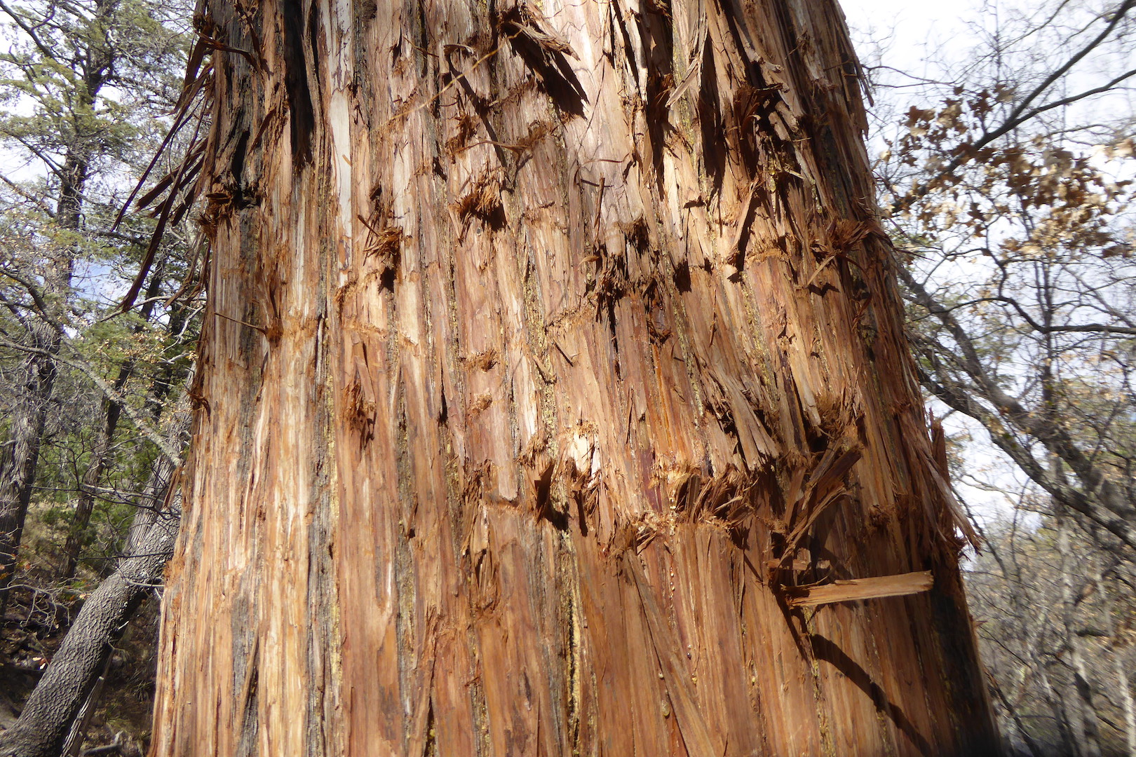
Occasionally, I’d find old piles of bear scat or a marking tree.
Black bears used this Arizona cypress (Hesperocyparis arizonica) near Boot Spring as a marking tree.
No long after I photographed the marking tree, I stumbled on the aforementioned scat. Its freshness caught my attention, but it wasn’t steaming so I couldn’t be sure if a bear was close or not. I only knew it was there earlier in the day. As I proceeded up the trail, motivated to pick up my pace and return to the campground before dark, two hikers traveling in the opposite direction told me they had just seen a bear not far from the trail. This was their first wild black bear sighting, and they spoke excitedly about their experience. I thanked them for the info and continued on, now even more alert.
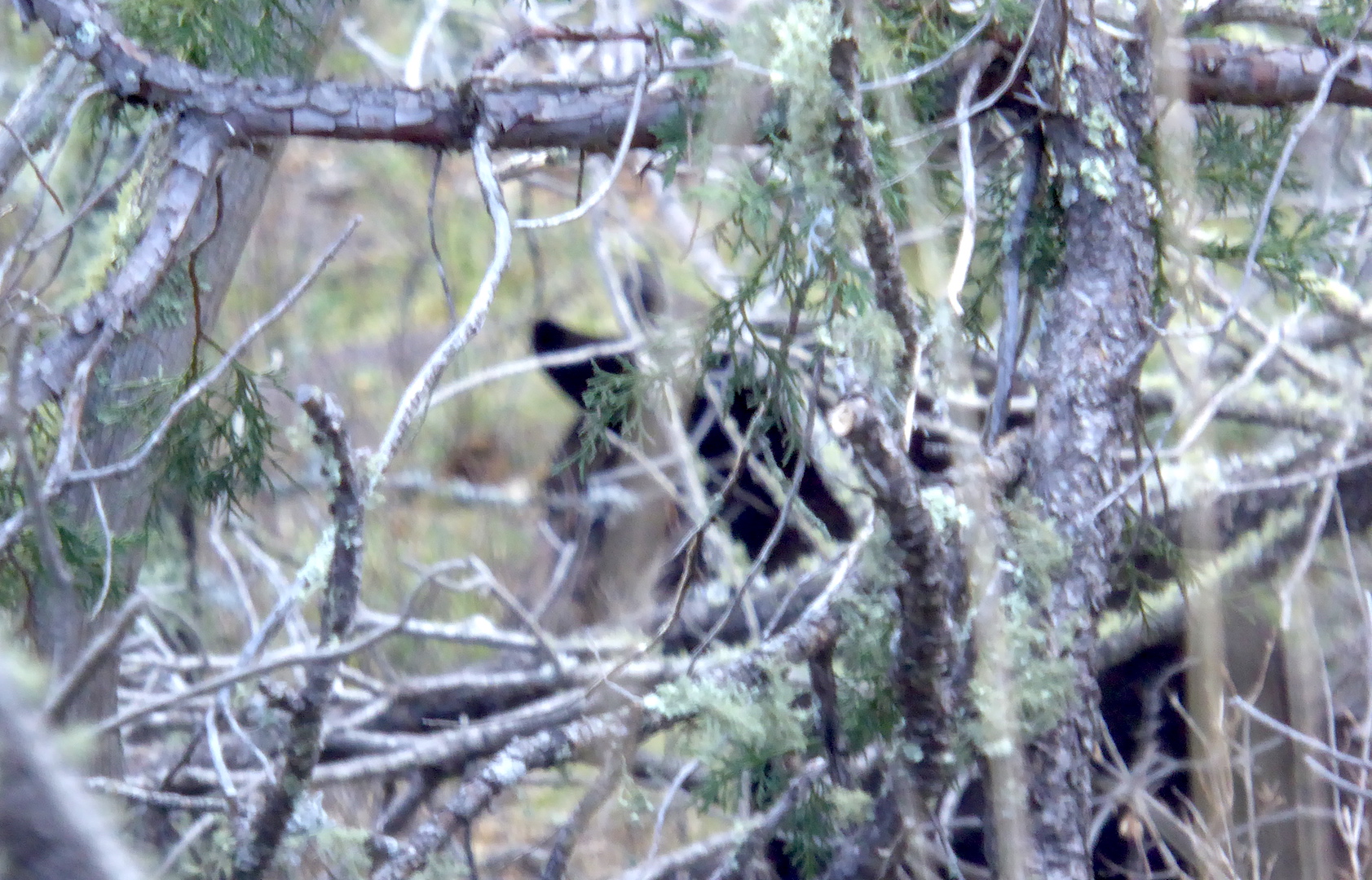
The hikers said the bear was near a switchback in the trail, not far from a backcountry campsite. I slowed my pace as I approached that location, not wanting to startle the animal. A moment later, through some thick vegetation, I heard cracking branches and there it was—a black bear.
My soon-to-be award winning wildlife photo of a black bear in Big Bend National Park. Move over Tom Mangelsen.
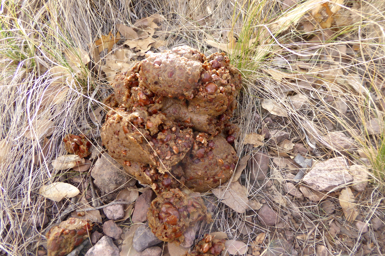
What would a bear be doing out in January? Since bears are omnivorous and eat a wide variety of food, their scat reveals a world of information about where they’ve been and what they’ve been up to. The fresh bear scat I found 10 minutes before, like the older scat on the trails, was filled with fragments of pinyon nuts and shells. Pine nuts are exceptionally nutritious, containing almost 700 calories per 100 grams. The pinyons pines in the Chisos Mountains seemed to have produced a sizable cone crop in 2016, one which helped sustain the bears into mid winter.
Pinyon pine nut shells and fragments fill this fresh pile of bear scat. I found this scat just moments before seeing an active bear.
The density of the shrubs made it difficult for me to se exactly what the actual bear was doing, but it appeared to have its nose to the ground and it wasn’t moving far. Perhaps it was still feeding on pine nuts.
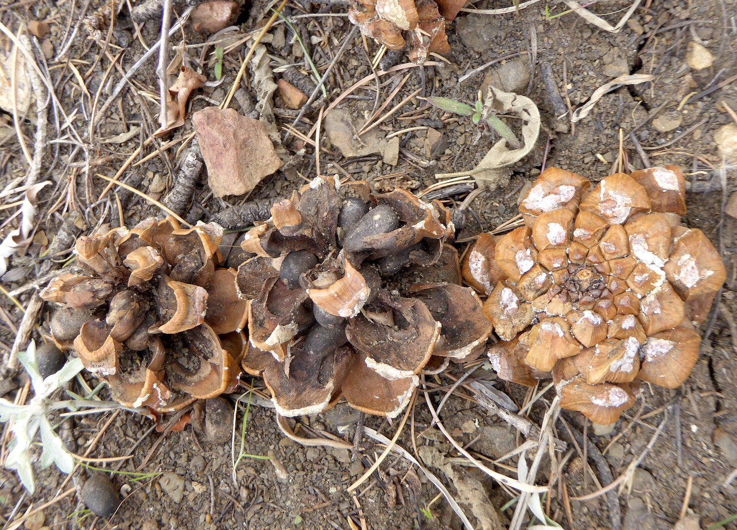
These Mexican pinyon pine (Pinus cembroides) cones still hold their fatty nuts.
Black bears in more northernly locations hibernate well before January. However, bears in Big Bend don’t typically enter their dens until late January or February, and when they do many don’t seem to fully enter hibernation. Male bears, especially, are more likely to remain active. Pregnant females in Big Bend, like other bear populations in North America, have the longest average denning period, beginning in mid to late December and ending in late April.
This winter activity isn’t unique to Big Bend’s bears. Black bears in Florida have similar winter dormancy patterns. Mild weather and the prospect of food, especially, can keep bears active for longer time spans. After all, bears are avoiding winter famine more than winter weather when they hibernate. The bear I saw probably wasn’t doing anything abnormal for a Big Bend black bear. It was just another bear doing bear things like eating and shitting in the woods.
Most mammals aren’t keen to reveal themselves to people, which I understand. I don’t want to be around people much of the time either. Unless I’m very lucky or very observant (sometimes it’s both), I typically don’t see the more elusive animals that inhabit the North Cascades ecosystem. Winter, however, provides an opportunity to see the animals without actually seeing them.
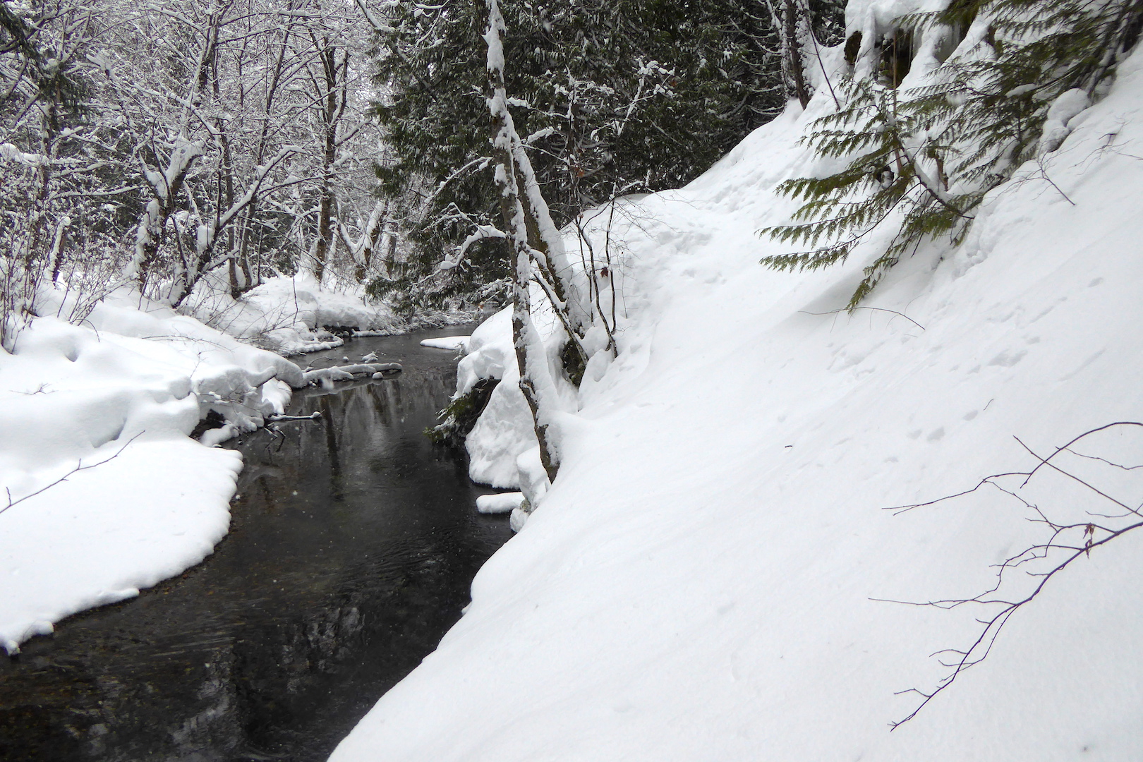
In winter, animal tracks in snow reveal stories I could never read otherwise. Without tracks, I would be oblivious to the presence of most animals, so on every trip outside I look for them. On a recent ski journey, I found some tracks I did not expect to see.
The day was comfortable (35˚F/2˚C) and sunny. The snow was reasonable firm. I parked Large Marge at the end of plowed section of road and skied up valley. Skiing wasn’t fast, but it wasn’t a slog either. With long sleeves, I felt overdressed in bright sun, so I paused frequently to cool down and enjoy the view.
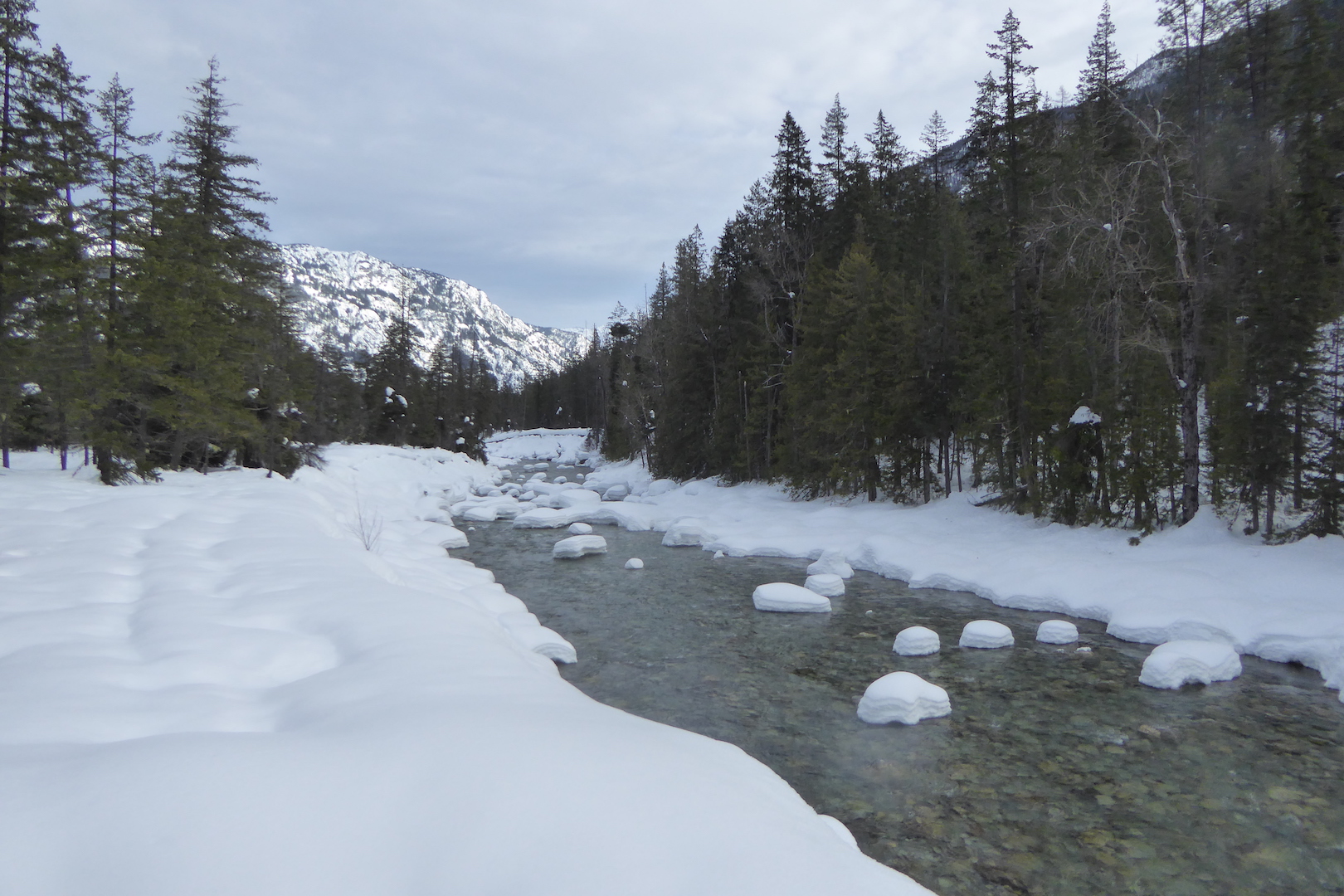
Pillows of snow sat on rocks in Stehekin River downstream of High Bridge in Lake Chelan National Recreation Area.
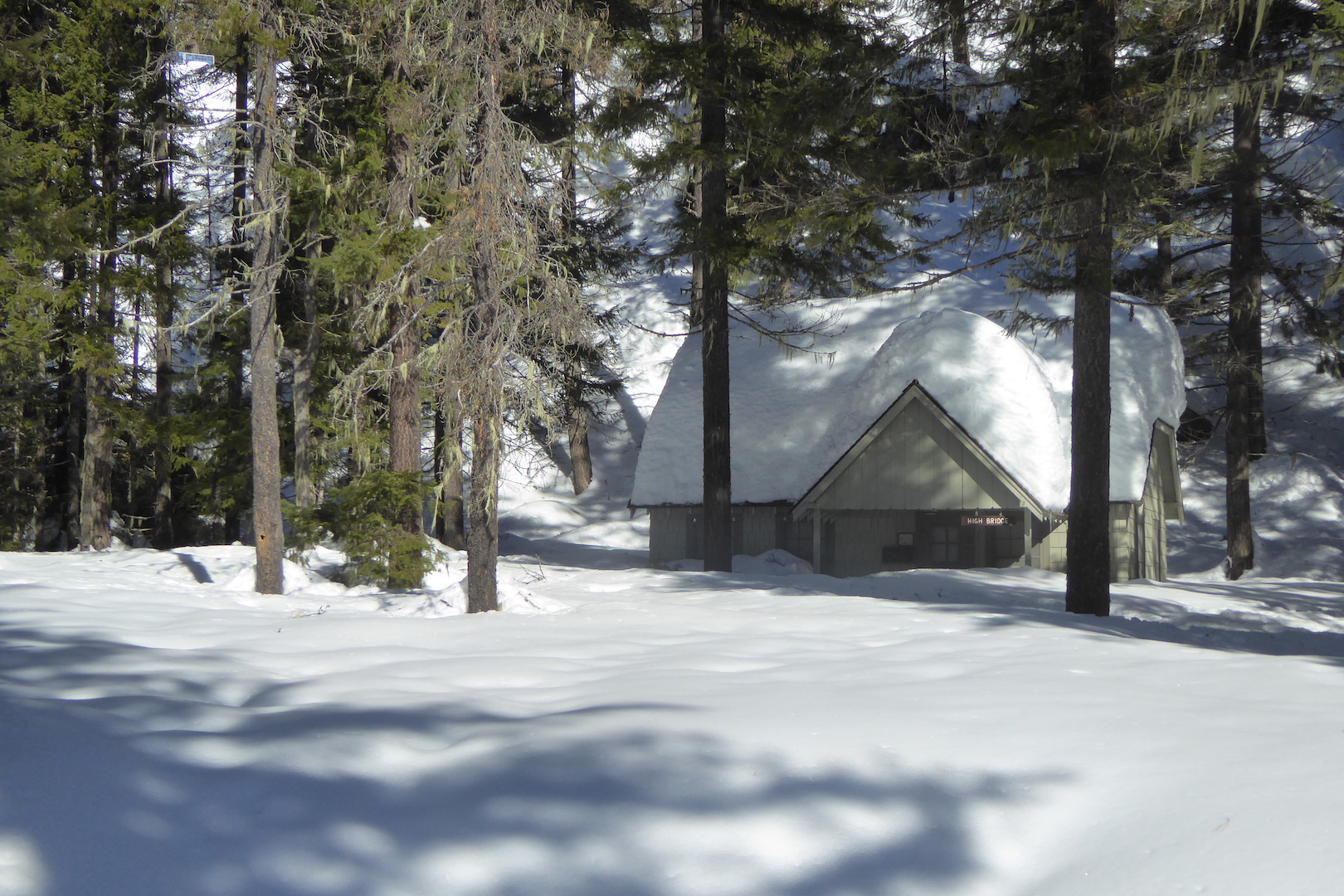
I found High Bridge, which is the boundary between the national recreation area and the national park, buried under several feet of snow.
The NPS cabin at High Bridge was mostly buried by snow.
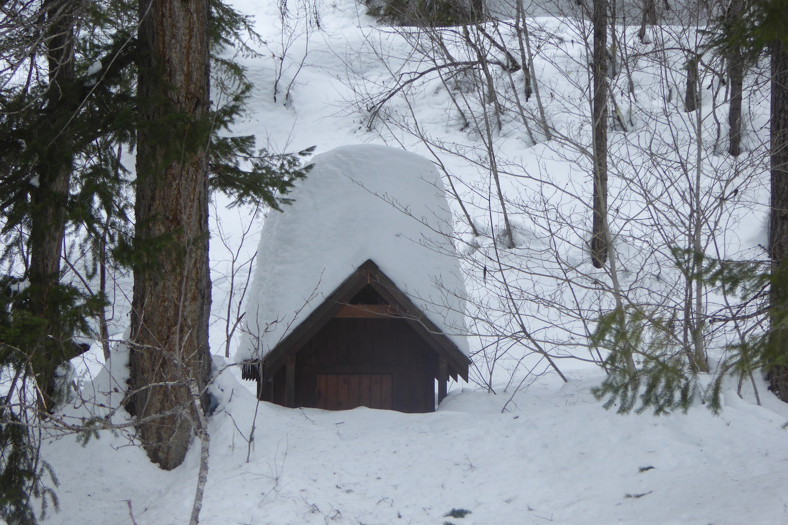
Good thing I didn’t have to use a toilet, because this outhouse at High Bridge wasn’t accessible.
Up to this point, I had seen or heard little evidence of animals. Douglas squirrels were active because I found bracts from Douglas-fir cones scattered under a couple of trees. Red-breasted nuthatches occasionally called from the tree tops (this species is one of the most common in the Stehekin Valley in the winter; at least one of the most vocal.) There was no sign of large or even medium sized mammals.
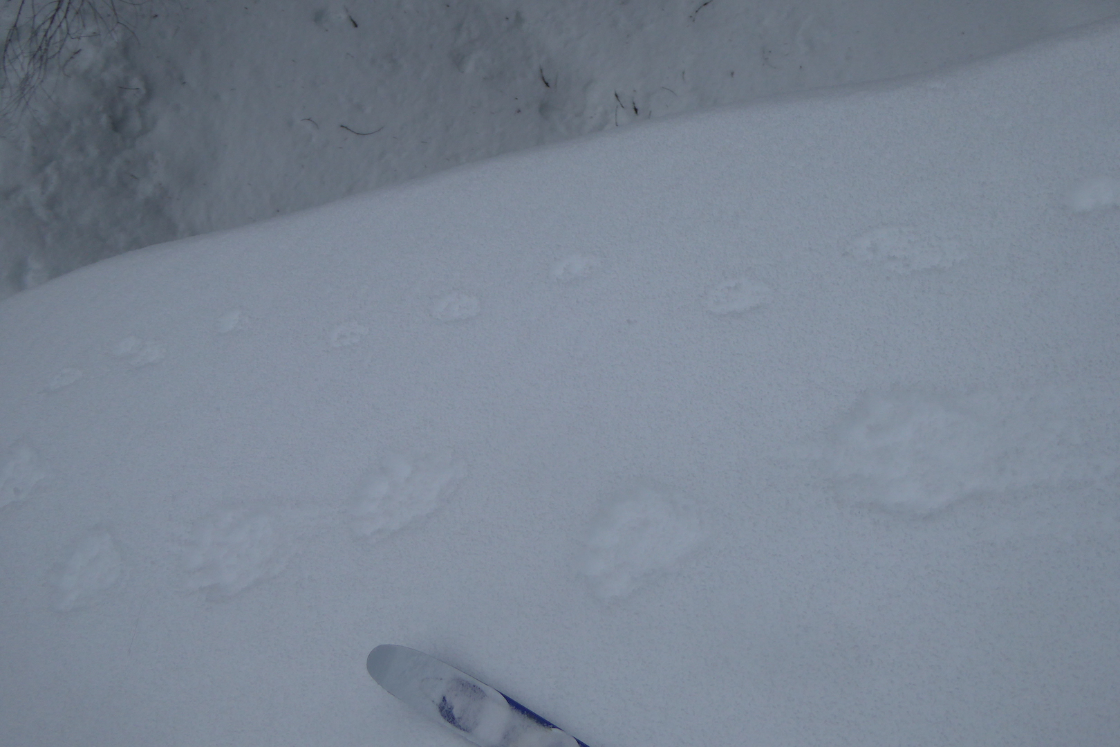
The snowy road offered a convenient path so I followed it up valley, especially since the avalanche forecast was high and I didn’t want to risk getting caught in any slide. About a mile from High Bridge, I noticed a set of faint, but fairly large tracks in the snow.
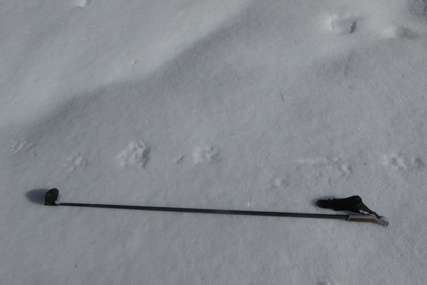
The set of tracks I found. What animal made them?
The tracks were fairly large, although I lacked measuring tape to get accurate measurements. My first thought was “mountain lion,” but then logic started to creep in (thanks Spock). Mountain lions eat many animals, but prey probably isn’t abundant enough in the mid to upper Stehekin River valley at this time of the year to sustain a mountain lion. I saw no deer tracks, even though deer are common in the lower valley now. Other characteristics of the tracks eliminated mountain lion as the source.
The tracks weren’t the right size or shape.
Their pattern, or gait, was a 3 x 4 lope.
Claws marks registered with almost every track.
The tracks rarely broke through the snow’s surface crust. This animal, despite its size, could float on the snow.
Fur marks often registered around the toes.
Most importantly, this animal had five toes.
This was a wolverine.
This fairly distinct wolverine track clearly shows the animal’s five toes. The basket on the ski pole is 7.5 x 7 cm.
The track pattern indicated it was walking in some places, but loping most of the time.
Wolverine tracks in snow. Each set of three, starting from the bottom, represents a one lope made by the animal.
Wolverines are the largest members of the weasel family and occupy huge home ranges. The tracks were fresh, their crispness suggested they were made early in the morning or overnight. If they had been made the day before, the warm sun would’ve obscured some of their finer details.
What might it eat in this habitat? Perhaps one of the squirrels or hares out and about.
A Douglas squirrel had recently torn apart a Douglas-fir cone on this pile of snow.
Snowshoe hares were also moving about the forest.
At Tumwater Bridge, the wolverine continued across right next to tracks of a marten, a smaller more arboreal member of the weasel family.
Wolverine tracks (bottom) run parallel to marten tracks.
The day was waning at this point, so I turned around and left the wolverine and its tracks behind.
Last year, a large male was trapped and radio collared at Easy Pass by the U.S. Forest Service and Washington Department of Fish and Wildlife. This is almost 20 kilometers due north of the tracks I found. Could it have been the same one?
Maybe, maybe not. Wolverines occupy huge territories and are rare in this area. I was lucky to stumble upon this set of tracks before they disappeared in overnight rain. That day, I was probably the only human in the south unit of North Cascades National Park, but I certainly wasn’t the only mammal prone to wander.
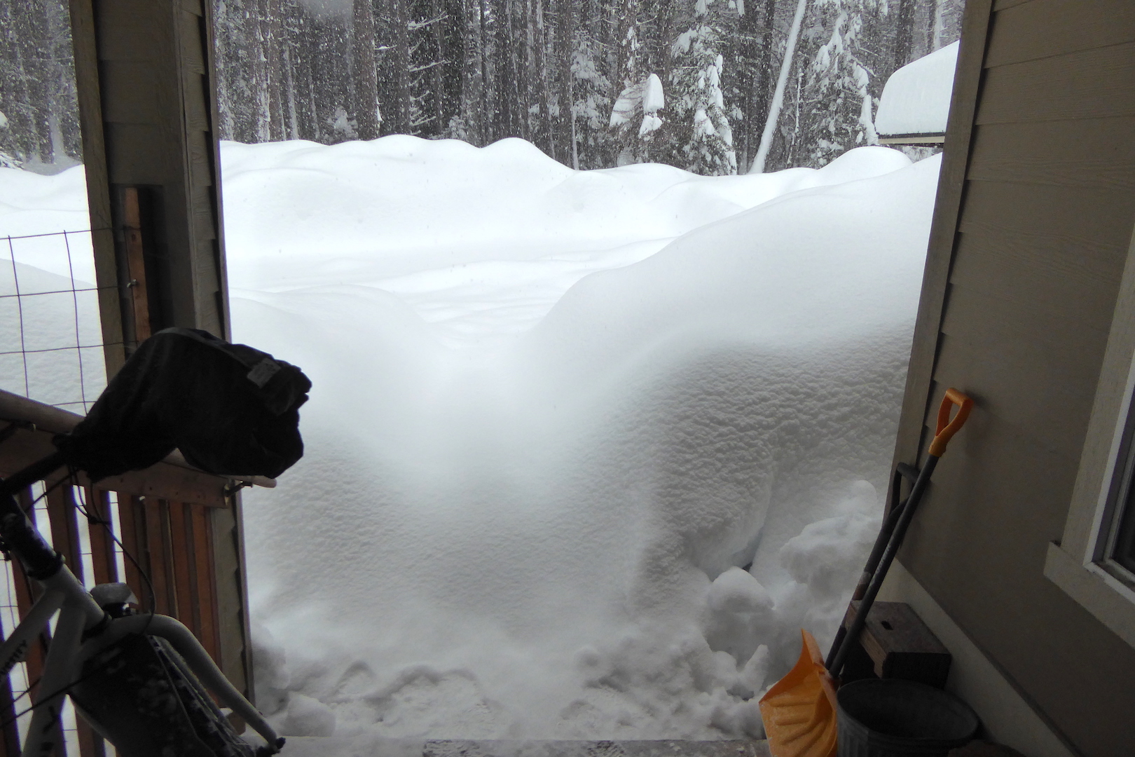
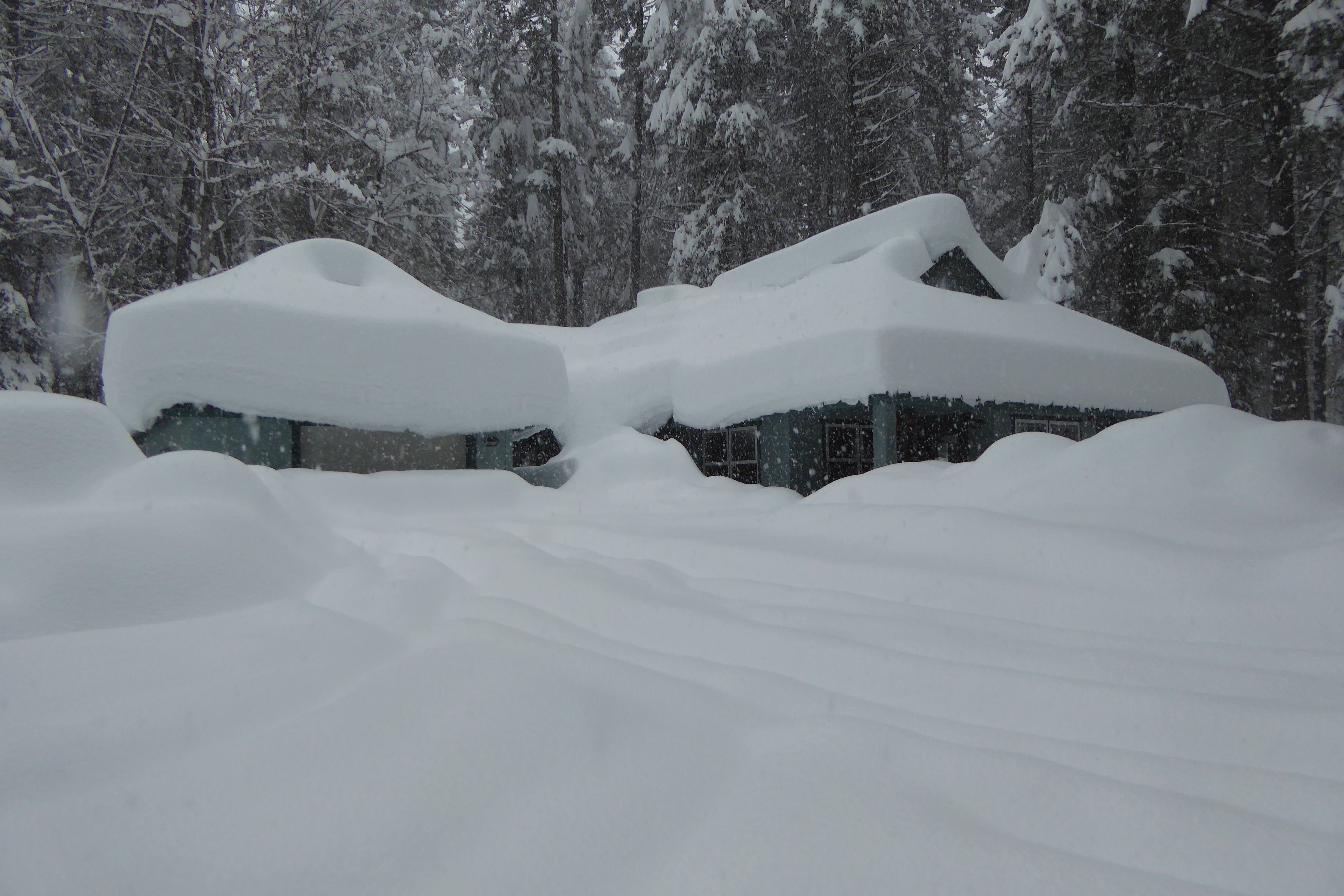
And, snow was slowly enveloping the neighbor’s house.
This is nothing abnormal for the region, and in many way’s it is expected. In winter, the jet stream over Alaska and Canada shifts south over the Pacific Ocean. Air masses traveling across the Pacific at this time of the year are “immodestly moistened,” as Daniel Matthews describes in Cascade-Olympic Natural History, bringing heavy precipitation to Washington, Oregon and California. The Cascade Mountains and Sierra Nevada are effective moisture traps for these storms. When storms encounter the mountains, the air rises and cools causing it to precipitate its moisture. The Stehekin Valley in Lake Chelan National Recreation lies east of the Cascade Crest, so the area experiences drier weather than the wetter Skagit River valley to the west. However, the valley is not far enough east to experience the Cascades’ full rain shadow, hence the ample snowfall recently.
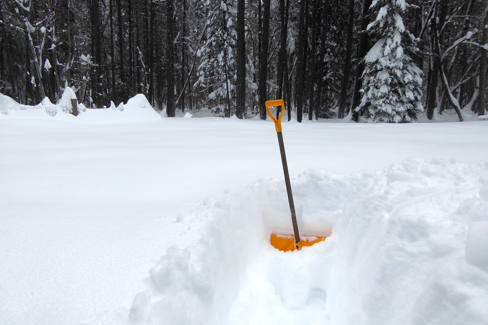
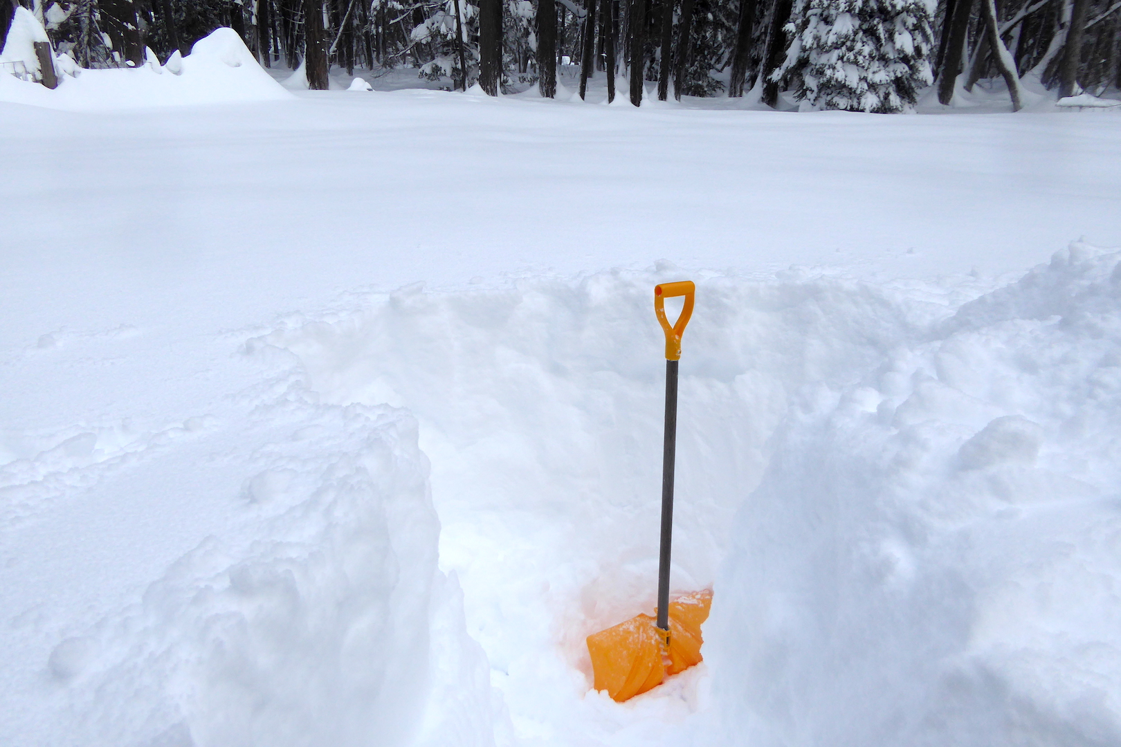
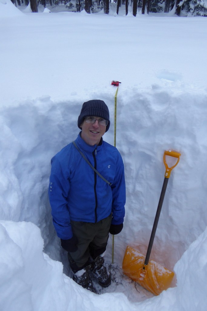
In my estimation, at least three feet (approximately 50-100 cm) of snow has accumulated over the past five days, much of it falling in the last 24 hours. Higher elevations certainly gained more. I was curious to know the exact snow depth near my house, which lies at a modest 1100 feet (335 meters). After the snowfall abated yesterday afternoon I got out the snow shovel prepared to dig in.
I chose to measure the snow out in a small meadow away from the influence of trees, but getting there took some effort. The first few feet of snow was very soft. The base to stand on, if you could call it that, was well under the surface.
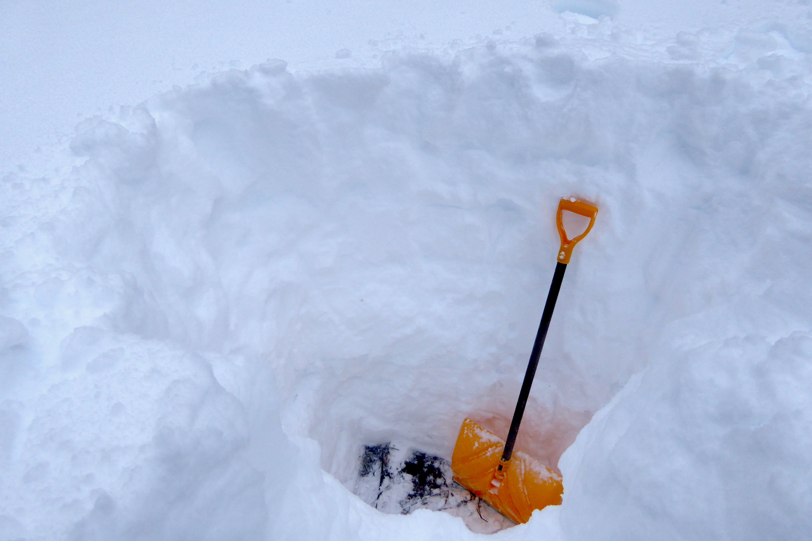
After floundering my way into the meadow, I started digging…
and digging…
…and digging and digging until I reached the soil.
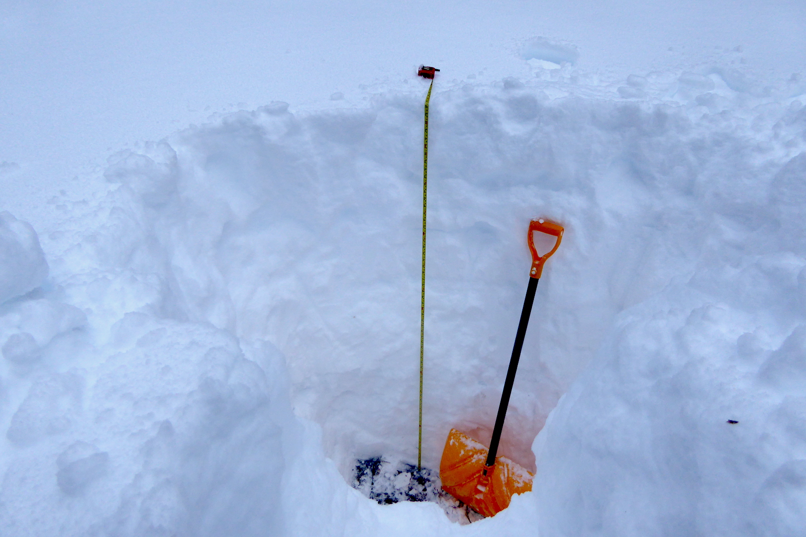
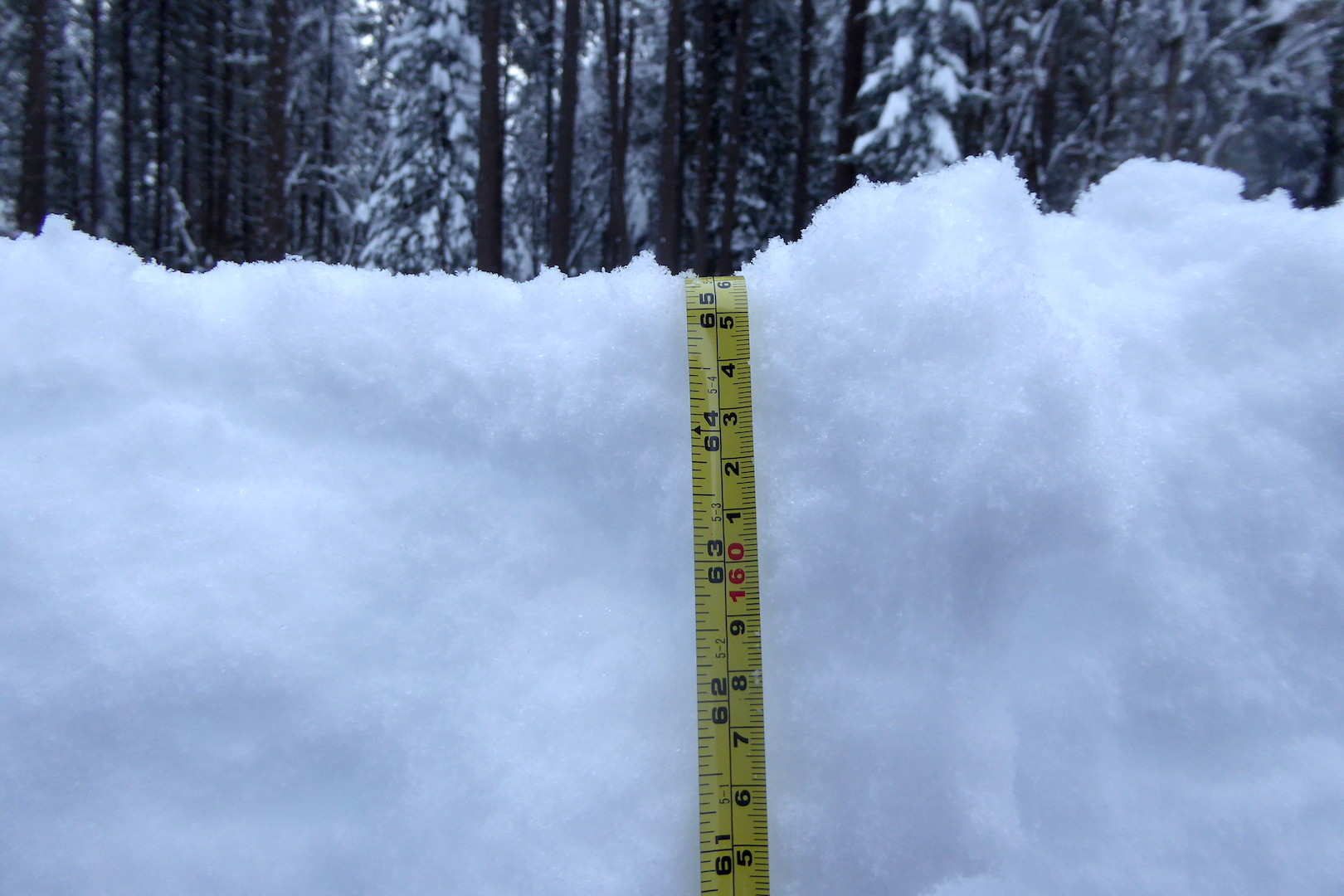
The pit was over 65 inches (166 cm) deep!
Long time residents describe winters with lots of snow and occasional rain too. Rain compacts the snow, increasing its density but decreasing its depth. This winter, I’m told, is a bit of an exception with lots of snow, but without temperatures warm enough for the occasional rain storm.
Winter snowfall is essential to the well being of millions of people across the West, especially farmers who cannot depend on summer rain to sustain crops. Snowmelt in rivers quenches the thirst of residents in Los Angeles, Las Vegas, Phoenix, Salt Lake City, and many, many other places. It’s a reservoir, slowly releasing its water in spring and summer when it is needed most.
Climate models indicate changing weather patterns will come to the West as temperatures rise. The North Cascades region won’t be without snow, but changes will be felt, and in a lot of ways the region is already experiencing them. More rain will fall and less snow will collect on the mountains. At first this may seem insignificant. However, this will change the timing and duration of peak stream flows. Currently, stream discharges peak in the spring and early summer when snowmelt is heaviest. The pattern seems to be shifting toward more frequent peak flows in spring and fall. Rain on snow events can cause heavy flooding, damaging roads and homes. (Stehekin River has experienced three 100 year floods since 1995.) Warmer springs temperatures melt snow faster, affecting sensitive habitats like montane wetlands, places that harbor sensitive species like the Cascades frog. Soils dry faster without snow too, increasing the risk of wildfire.
Snow is often viewed as an annoyance or danger, delaying and restricting travel, but it is a key component of ecosystems where it occurs. Snow on mountains is a water tower, one we can’t afford to lose. (It’s also a lot of fun to play in.)
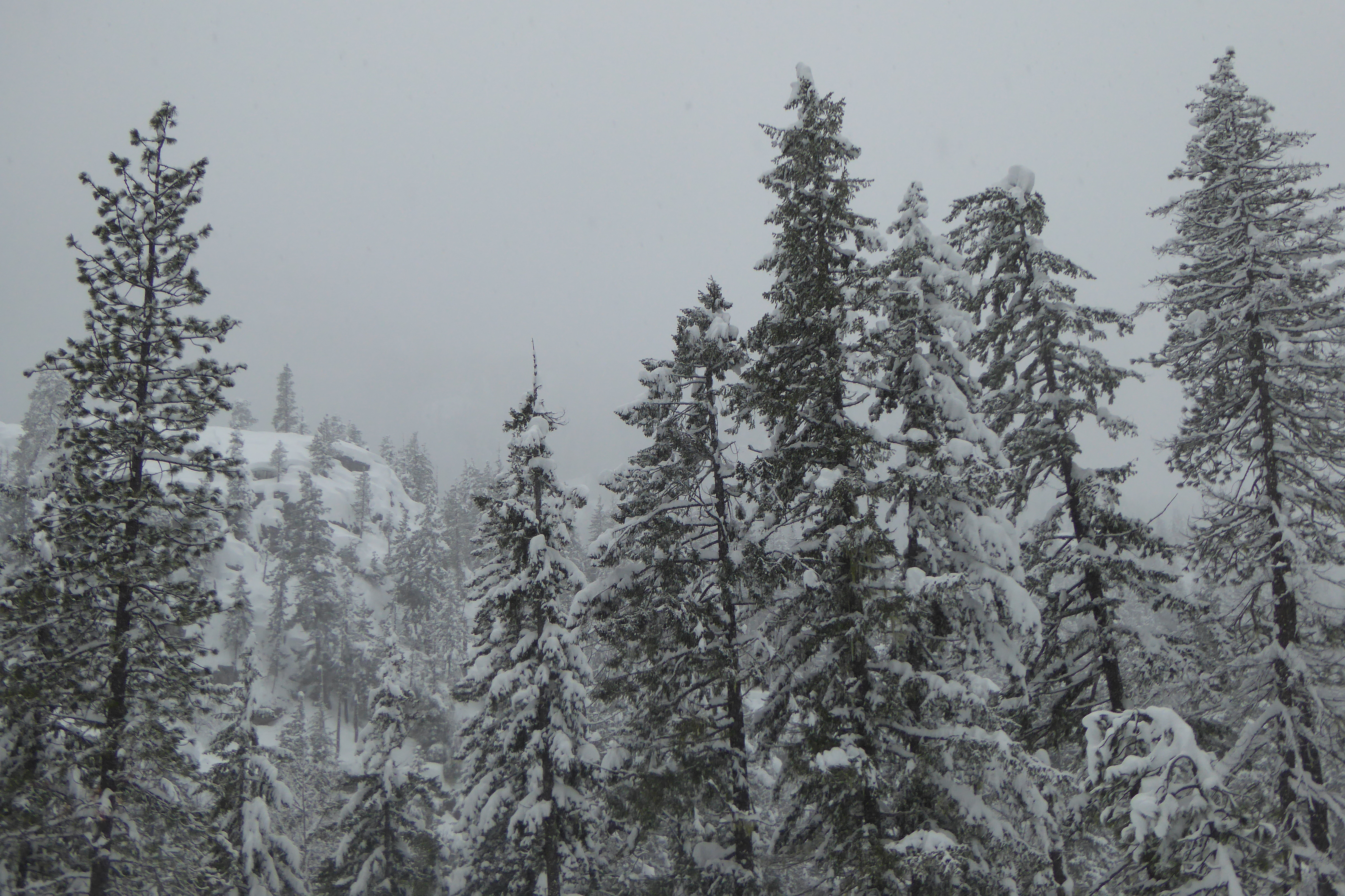
After three months of aimless wandering, I’m back in Stehekin and, well, there’s a lot of snow.
Stehekin and Lake Chelan National Recreation Area lie just east of the Cascade Crest, but well within the Cascade Mountains. When moisture-laden winter storms move east from the Pacific Ocean over the Cascades, they dump prodigious amounts of snow. Stehekin averages 120 inches of snowfall each winter. In 1996, 298 inches of snow fell, almost 25 feet. Although I don’t know how much snow has fallen so far this winter, it’s not a trivial amount.
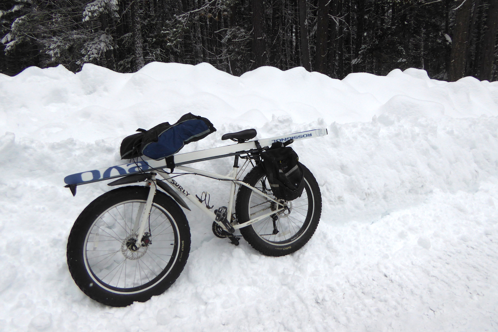
Earlier this week, I was eager to explore the snow-shrouded landscape, so I strapped some skis on to Large Marge and headed out.
No, not that Large Marge. This Large Marge, my fat tire bike.
Two tools of winter exploration: Large Marge and cross-country skis.
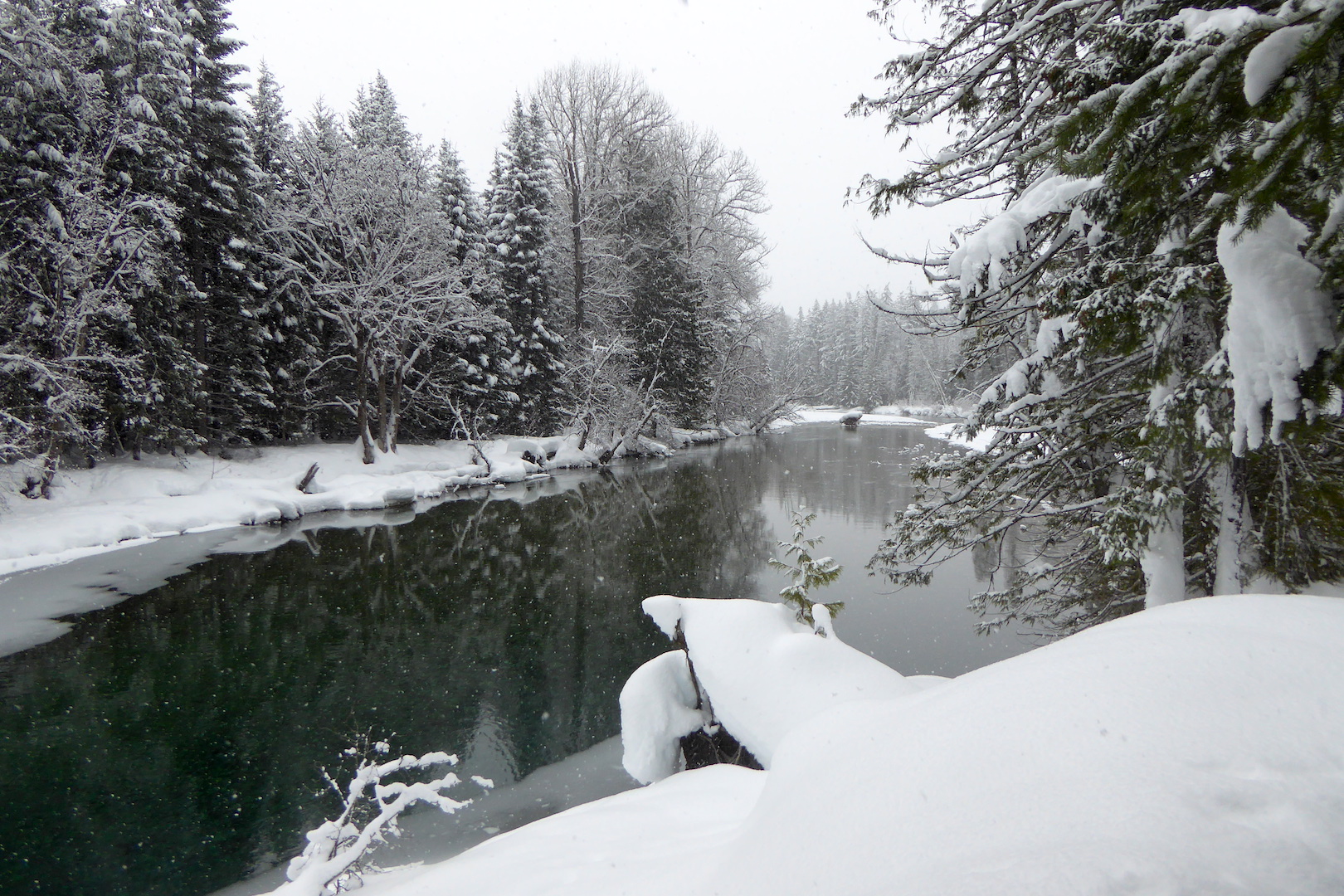
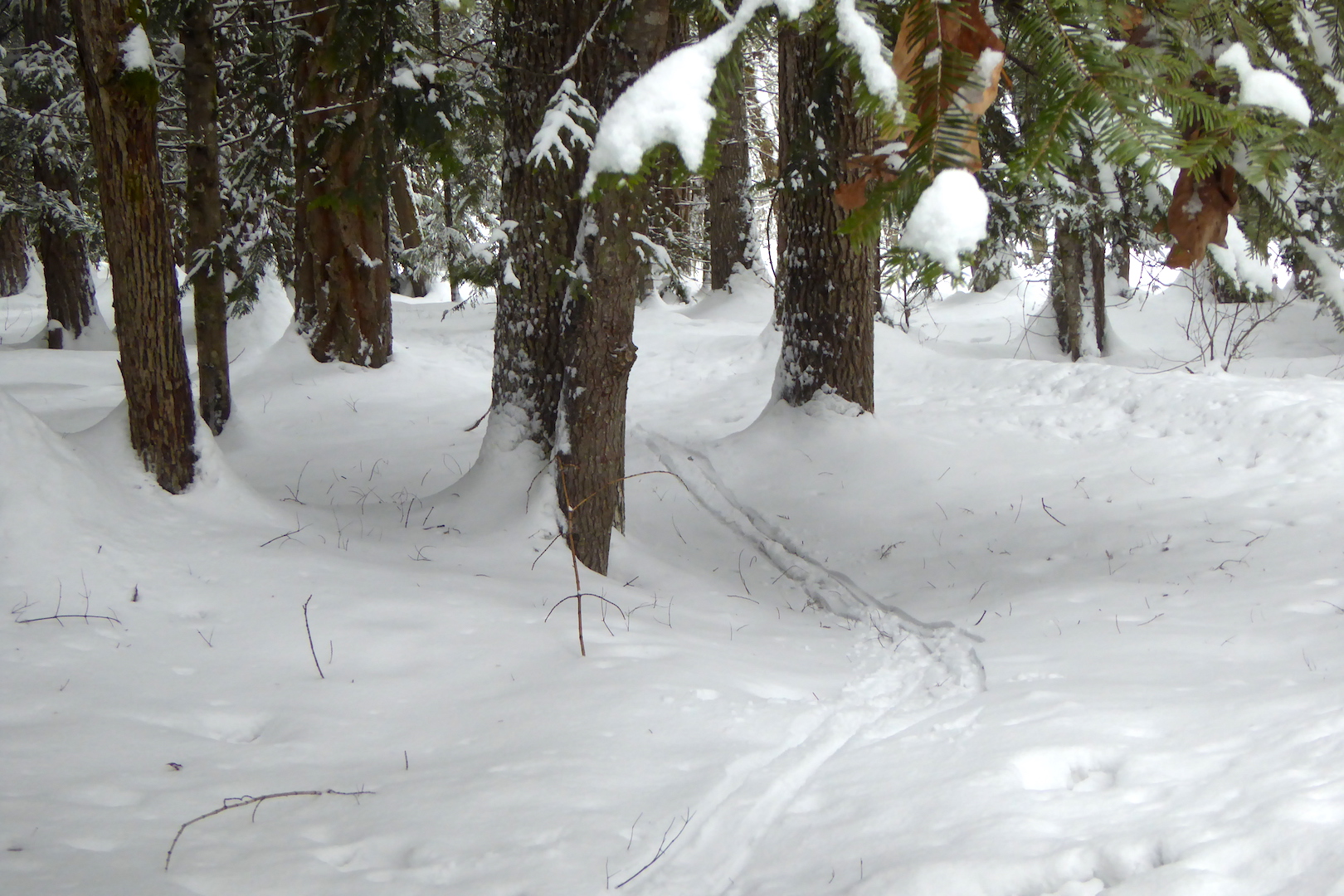
I cycled on an icy, freshly plowed road to the Stehekin landing strip to ski the Stehekin River Trail, which parallels the Stehekin River downstream to Lake Chelan. It’s a pleasant hike in summer when the trail is easy to follow. The snow changed this familiar trail greatly. Where thick snow obscured the exact route I had to watch gaps in the vegetation carefully to stay on the trail.
Where’s the trail?
I needn’t worry about getting lost though. The trail is bordered by Stehekin River one on side and 8,000 ft. tall mountains on the other. I only had to stay in between. The trail has no significant elevation gain, but traverses some tricky spots for someone like me who sucks at skiing.
Caption: Short, steep bluffs next to the river’s side channels were difficult to negotiate on narrow skis. I often side-stepped up and down these places instead of risking a fall into open water.
The scenery was worth the effort, however.
Stehekin River.
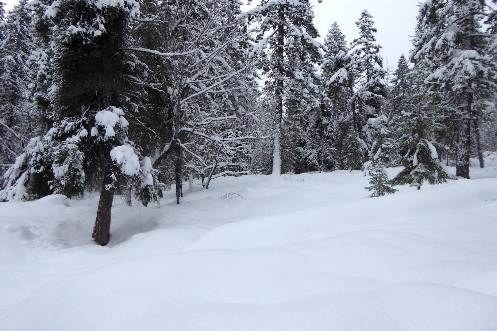
Animal tracking is always on my mind when there’s snow. The snow records much about an animal’s behavior as it moves through the landscape. The deep snow of the Cascade Mountains present a very difficult challenge for large and medium-sized animals, however. If you’re not a small mammal that can live under the snow or in the trees, then you either hibernate or abandon the high country and migrate to areas with less snow pack.
Partly because of lots of fresh snow and partly because most animals are either under the snow or in a different area altogether I didn’t see many animal tracks. A few Douglas squirrels were out and barked a warning when I skied under their tree, but there were few fresh signs of large animals on the upper half of the trail in the deep, soft snow.
Where the trail passed under a thick canopy of Douglas-fir and grand fir, I found the skiing easier. Tall conifers intercept a lot snow before it falls to the ground. When it does fall, it often does in large clumps that compact quickly on the ground. In these areas, deer and elk often “yard-up” to avoid getting mired in the deeper snow of open areas. Might I find deer and elk sign here?
I encountered little fresh powder where conifer trees grew thickly. These areas are often preferred places for deer and elk to travel and rest. In open areas, my feet plowed through at least 20 centimeters of newly fallen snow, making travel more difficult.
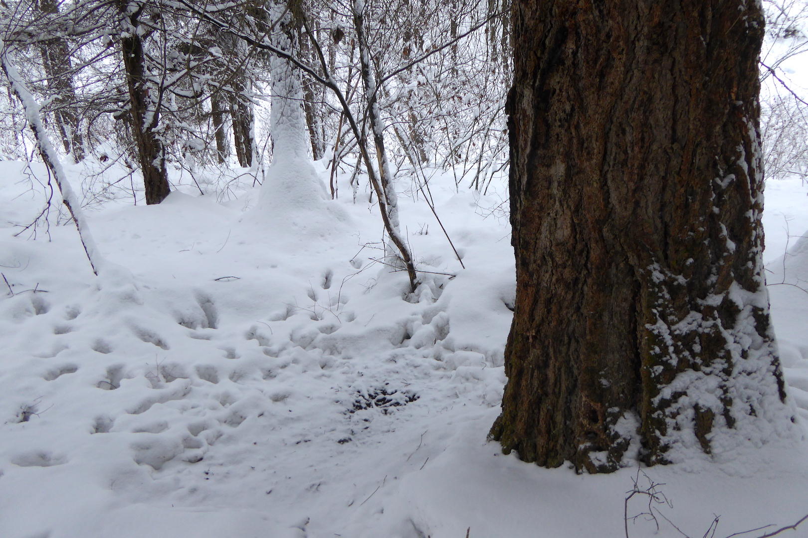
On the river’s floodplain, under a tall Douglas-fir, I found a depression where barely an inch of snow covered the ground. Elk tracks radiated away from it, and a few pellets of elk scat lay within it. Evidently, this was a frequently used resting place for at least one elk.
An elk had repeatedly used this bed to rest. For scale, the Douglas-fir trunk is larger than one meter in diameter.
Shortly afterward, my approach spooked an elk away from the fallen branch it was feeding on.
Twigs nibbled by members of the deer family have ragged edges. An elk recently nipped the end of this Douglas-fir twig.
I only caught a glimpse of the elk, but it was a bull with sizable antlers. Carrying antlers into late winter seems counterintuitive and a waste of calories. Those antlers weigh a lot, and it can’t be cheap, energetically speaking, to keep them on your head. Shouldn’t this animal have shed its antlers by now?
Unlike deer and moose, who shed their antlers in early winter, elk often keep their antlers until spring. Different selection pressures may have controlled the timing of antler shedding. Antlers can be used for defense, but they are most often used to maintain dominance. This is especially important during the fall rut. For elk, antlers may be needed to help maintain dominance in the winter as well when access to food is limited. Deer and moose tend to overwinter in small groups or solo where competition with fellow moose or deer for browse may not be an issue. Elk, in contrast, overwinter in larger herds where antlers may be needed to maintain dominance; not for access to females of course, but for access to food.
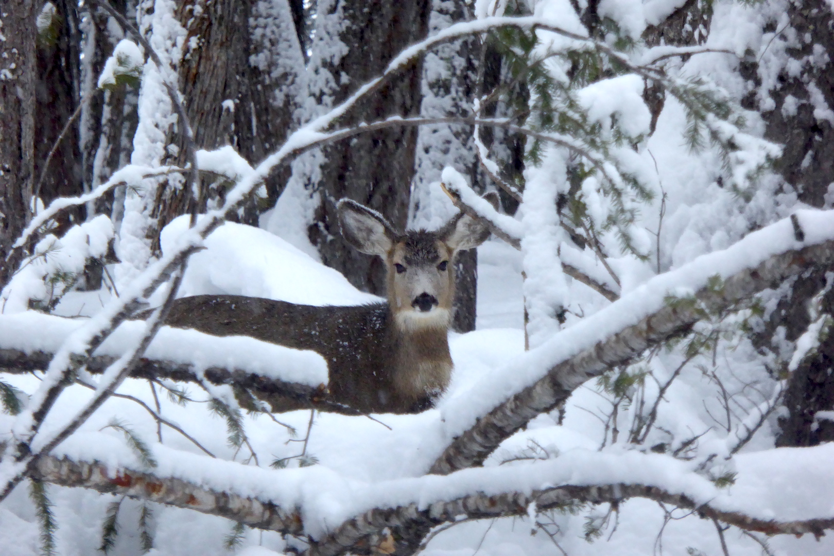
That elk appeared to be alone, but as I approached the end of the trail near the lake, I skied past two deer, at least one of which was a buck, sans antlers.
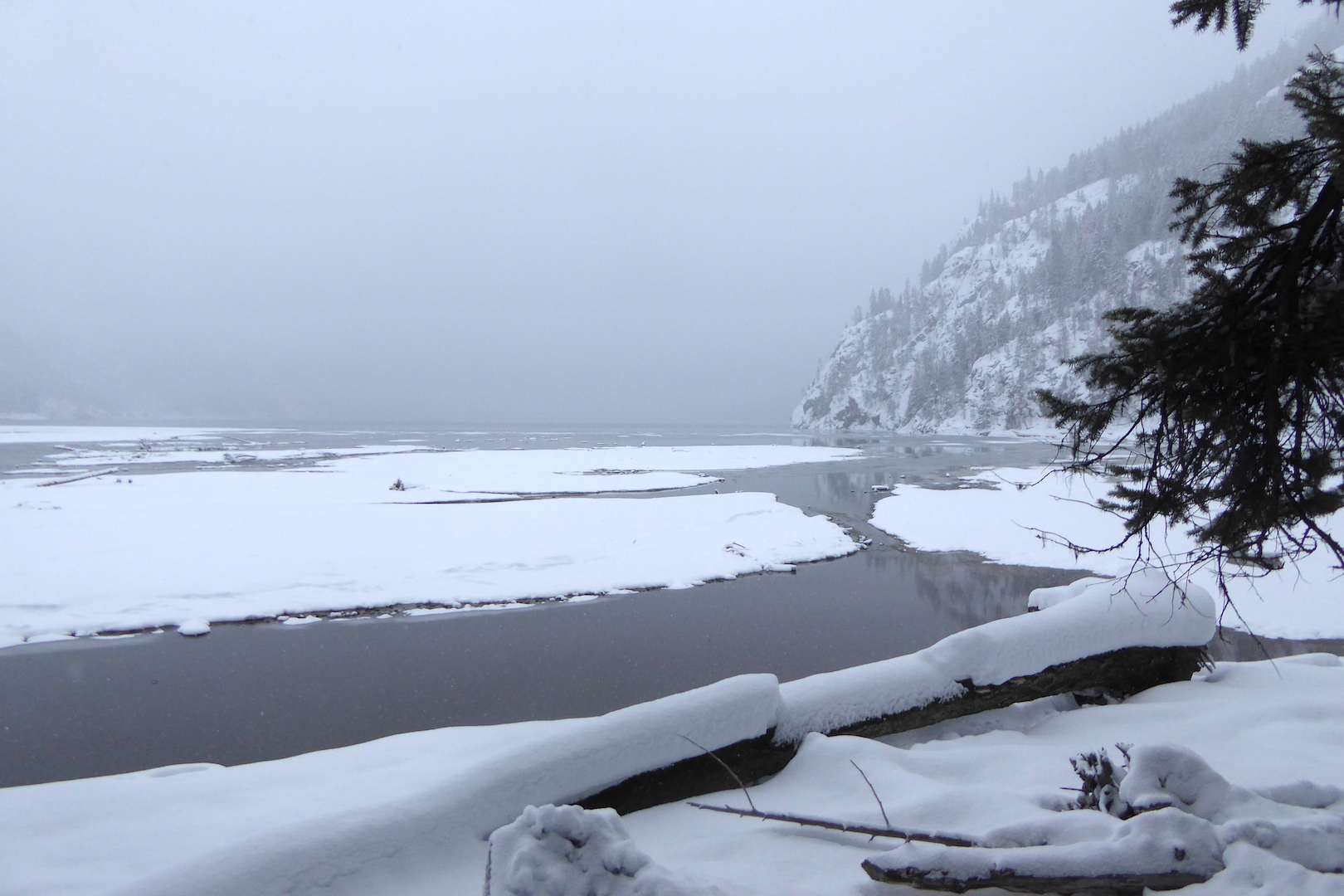
The Stehekin River Trail ends at Weaver Point where the National Park Service maintains a boat-in/hike-in campground. Snow reduced visibility in the dim afternoon light, but the scene was gorgeous.
Lake Chelan seen from Weaver Point.
Seeing the land blanketed in a meter of snow gives it a very different appearance. It was almost as if I was exploring the area for the first time. In a way, I was. Winter in the Stehekin Valley is wholly different than summer.


