An Unexpected Forest

Last August, I disappeared for a much anticipated week of bicycling, camping, and hiking. I hadn’t taken a bicycle trip longer than three nights in far too long, so it felt good to get back on Rocinante and pedal away from home with no phone or internet to distract me. Despite nagging high humidity and some heavy rain during the middle of the trip, it was a blissful time when I disconnected from everything but the immediate world around me (a privilege, yes I realize, but one I’ve worked to maintain).

In total, I didn’t ride my bike all that much. It was about 140 miles, so a reasonable fit person could cover my route in two days—and a younger version of me would’ve felt antsy when taking so much time to cover so little distance, but the point wasn’t to move quickly. Instead, I sought experiences best gathered through careful observation. Each day offered new discoveries, even if they were within the confines of the familiarity that accompanies travel near your home turf. Toward the end of the trip, for example, a day-long hike showcased groves of trees that had experienced a great deal of change, and offered a chance to consider how they might change in the near future.

Bicycle with drop handle bars, gray paint, and bags on racks on front and rear. Bike is surrounded by goldenrods and other plants.
Rocinante loaded and ready to carry me on the journey.

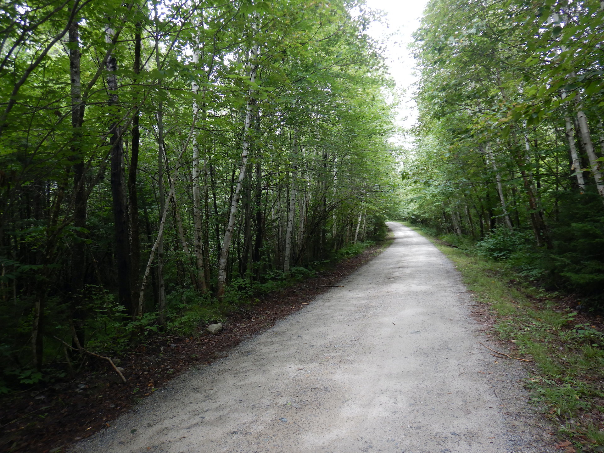
Starting near Patten on a Friday afternoon, I headed west to the Matagamon Gate at the northeast corner of Baxter State Park where, long story short, I spent the next four nights. After a fifth night of camping closer to the small town of Millinocket and resupplying on food, I made my way north into Katahdin Woods and Waters National Monument

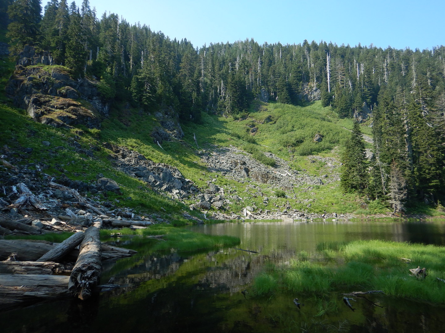
I spent the remainder of my trip at Esker Camp in the national monument. On my next to last day, I ventured to the top of Deasey Mountain, one of the highest points in the park, on the International Appalachian Trail (IAT). While many hikers see the mountaintop and its historic fire lookout as the highlight, I find myself still thinking of the mountain’s trees. 

Maine’s modern history is intertwined with logging. A lot of trees and a lot of water to transport logs and power sawmills made the state ideal for this industry. In the 1800s, Bangor earned a reputation as the lumber capital of the world. Lumberers looked first for the tall, straight-boled white pines that were so valuable for ship masts. When Henry David Thoreau journeyed to the Katahdin region in the late 1850s, he could not find a mature standing white pine. Trees for lumber were the next to go. Then once the paper-making industry arrived, almost every tree more than a foot in diameter at its base was on the market. Harvest rates increased through much of the 1900s until the paper industry began to decline and eventually collapsed in the state.

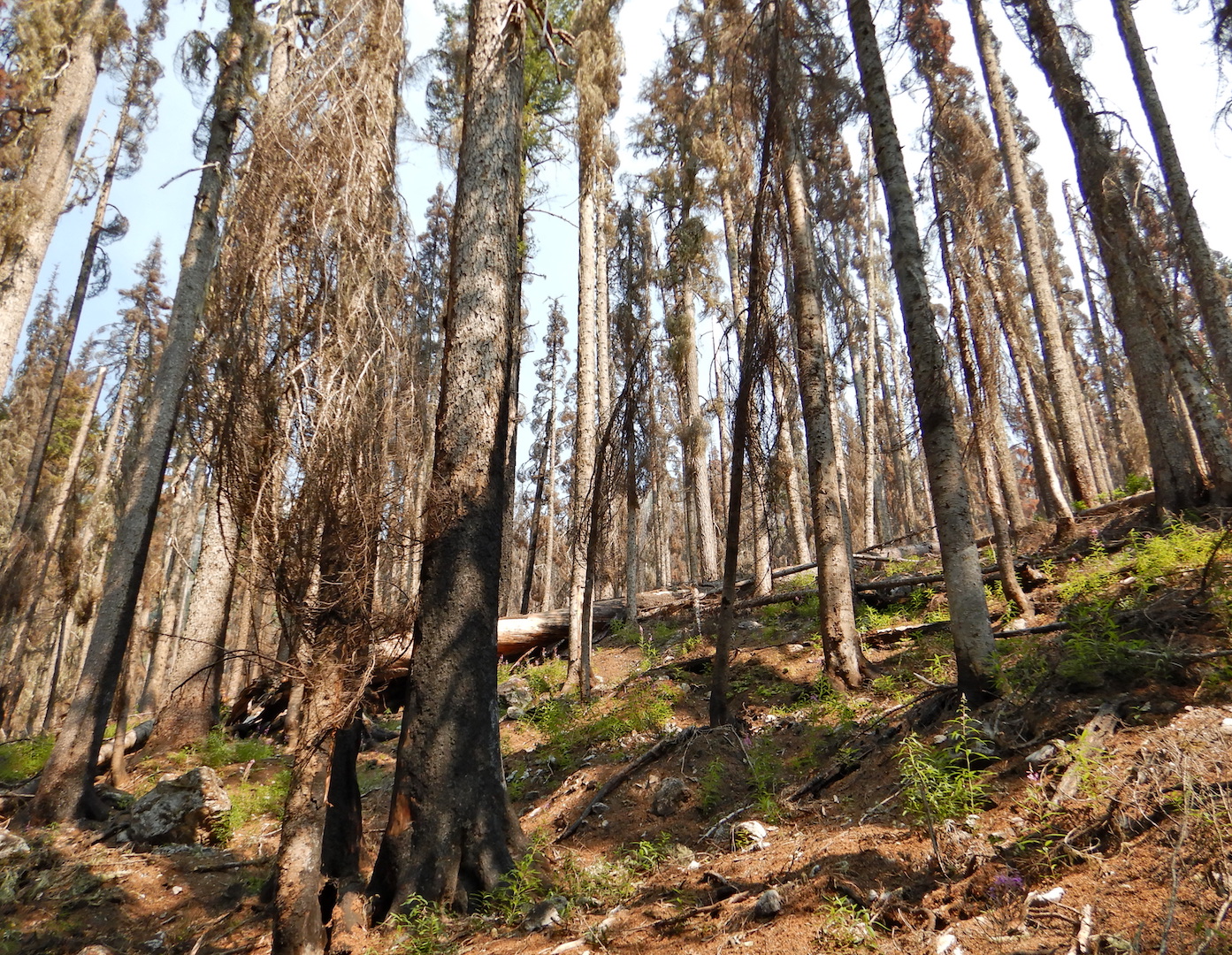
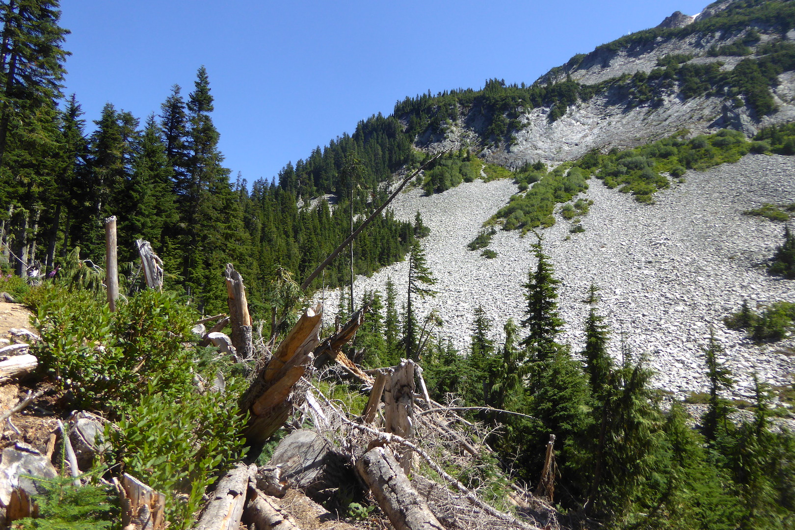
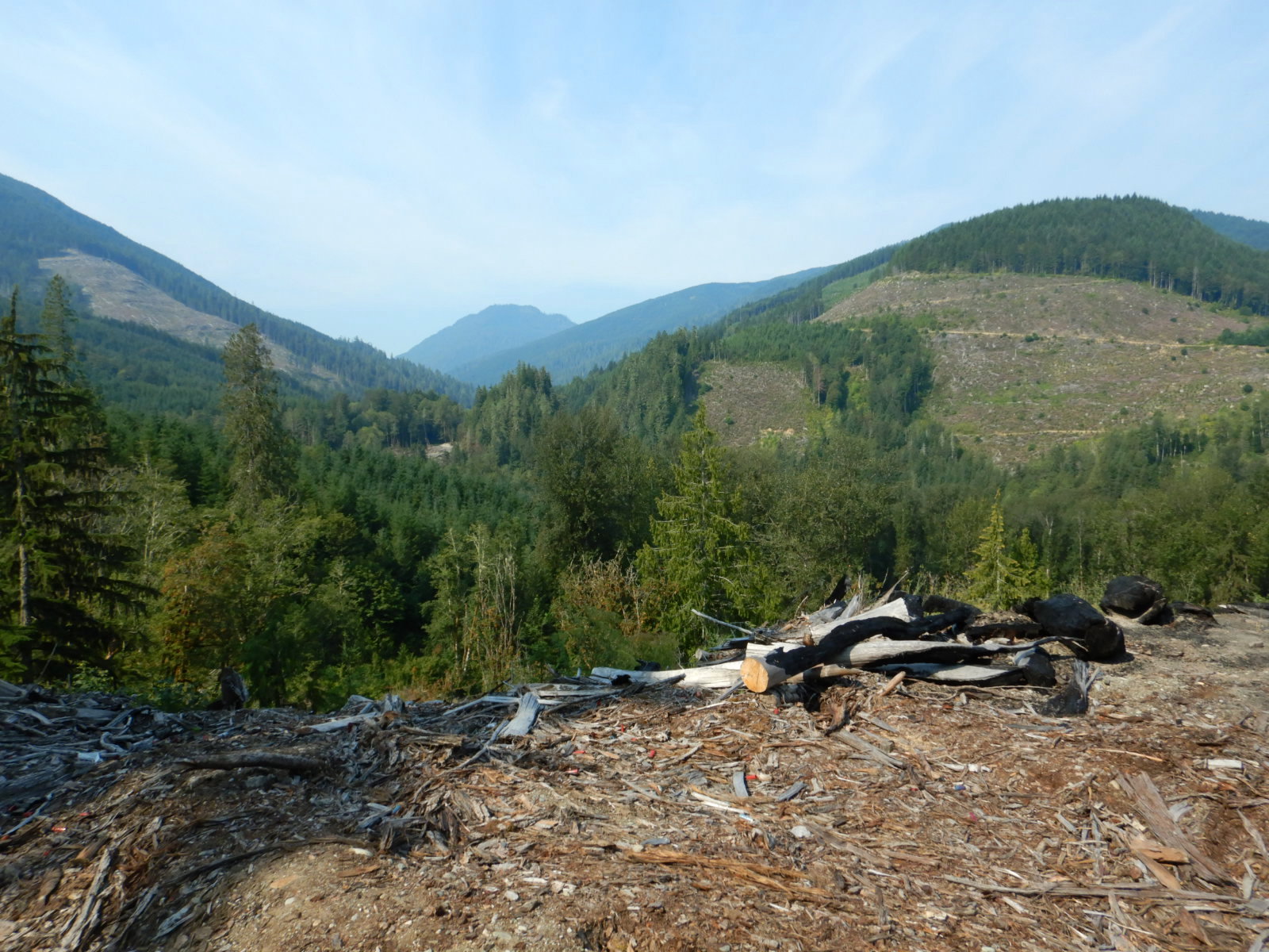
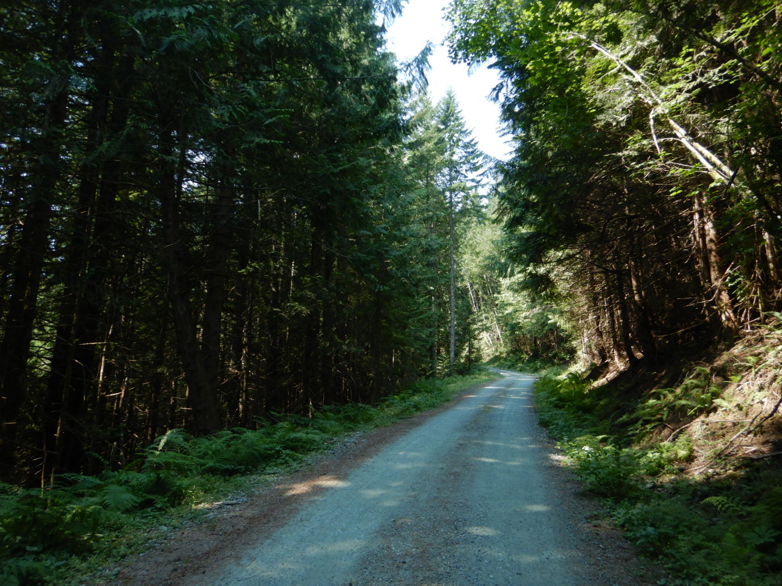
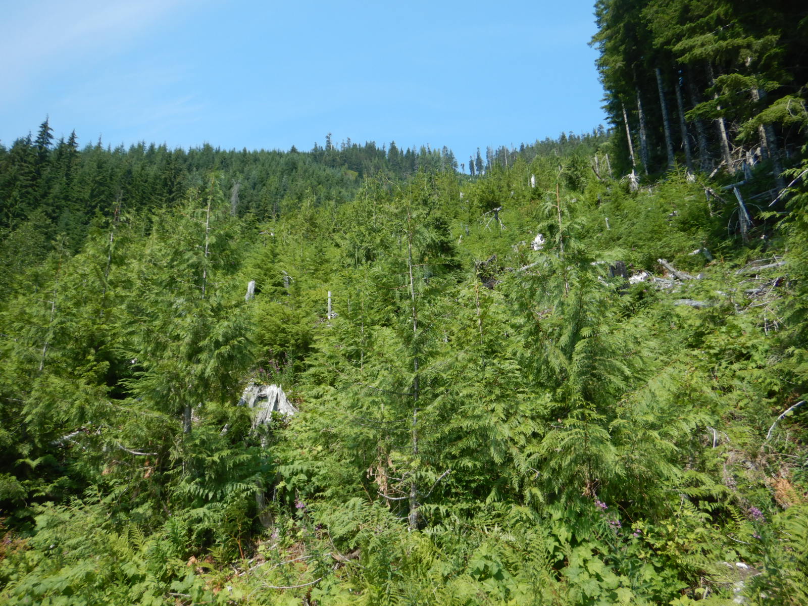
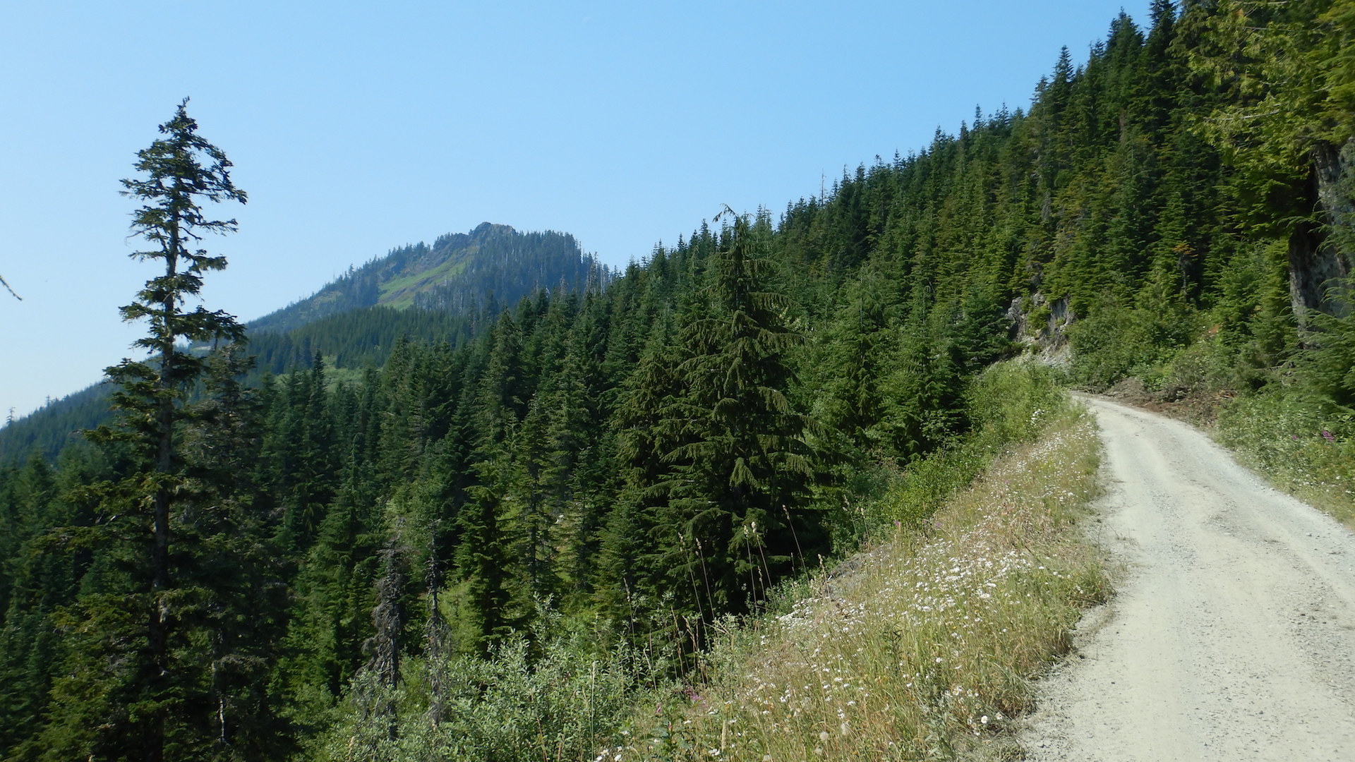
The timber industry isn’t what it used to be in Maine, but harvesting of trees remains heavy, and anything more than a quick glance on a drive in northern Maine reveals there’s a wide variety in logging strategies depending on the landowner’s wants and the harvest company’s practices. Overall though, most of the forests you’ll see in Maine are relatively young. In a lot of the cuts I’ve visited at random, many trees are harvested at the tender age of 50 years old and sometimes younger. The national monument’s forests are no exception. On satellite images, the landscape is a checkerboard of logging roads, many of which were blazed in the last 60 years to truck out logs.

Gravel road surrounded by white-barked birch and other trees.
Young paper birch and other trees line a section of the monument loop road.
Satellite image of forested area. Logging roads and trails can be seen as scars in between trees. A large stream flows at upper right. Image taken in April 2016. Green represents spruce, fir, and pine. Brown indicates deciduous trees.
Dendritic-patterned logging roads and trails occupy much of Katahdin Woods and Waters National Monument. This is the area near the Wassataquoik lean-to and tent site along the IAT.

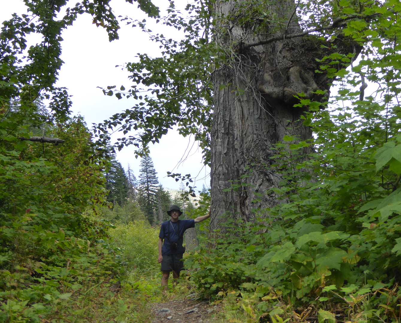
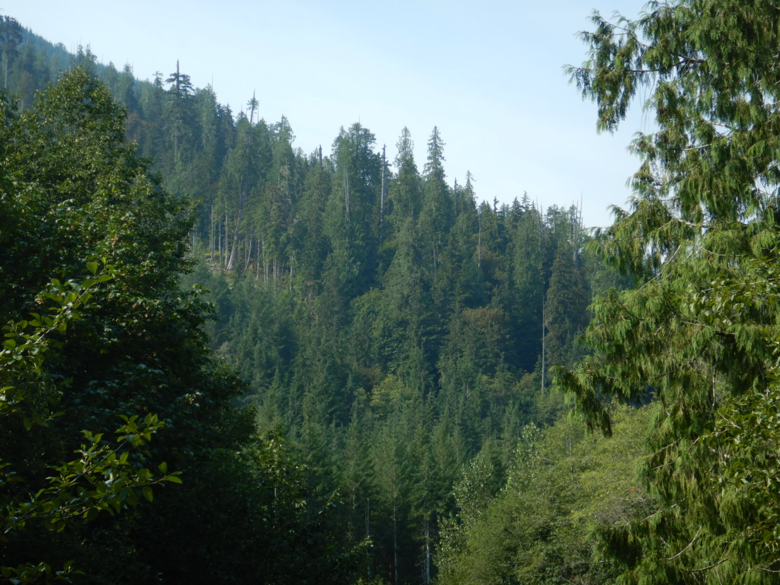
Deasey Mountain’s modest height (1,942 feet in elevation) and its proximity to Wassataquoik Stream and the East Branch of Penobscot River—major river drive watersheds before road building reached the area’s forests—made its trees a prime target for logging crews. Dozens of dams, including one not far upstream of Esker Camp, were built in the Wassataquoik and East Branch watersheds to facilitate the river drives. Large, human-caused fires had also burned through the area in the late 1800s and early 1900s. With so much recent disturbance I expected to hike through a regenerating forest for most if not the whole way to the summit.

The first task was to ford Wassataquoik Stream at the IAT crossing, which was straightforward due to the river’s knee-deep water that day. After leaving the Wassataquoik’s immediate floodplain the IAT utilized an old road for a brief clip that roughly followed the route used by some of the first Katahdin climbers, then ox teams in early logging efforts, then the heavy equipment of 20th century industrial logging. On the old road north from the Wassataquoik I walked through relatively young, even-aged trees. 

dense small trees, both evergreen and deciduous, surround a footpath that follows an old road
A section of the IAT follows the Old Keep Path, a long abandoned road.
Moss covered stump at lower left sits among young trees in background and forest floor covered in brown leaves and twigs
Stumps hidden among the young trees hinted at a harvest within the last few decades.

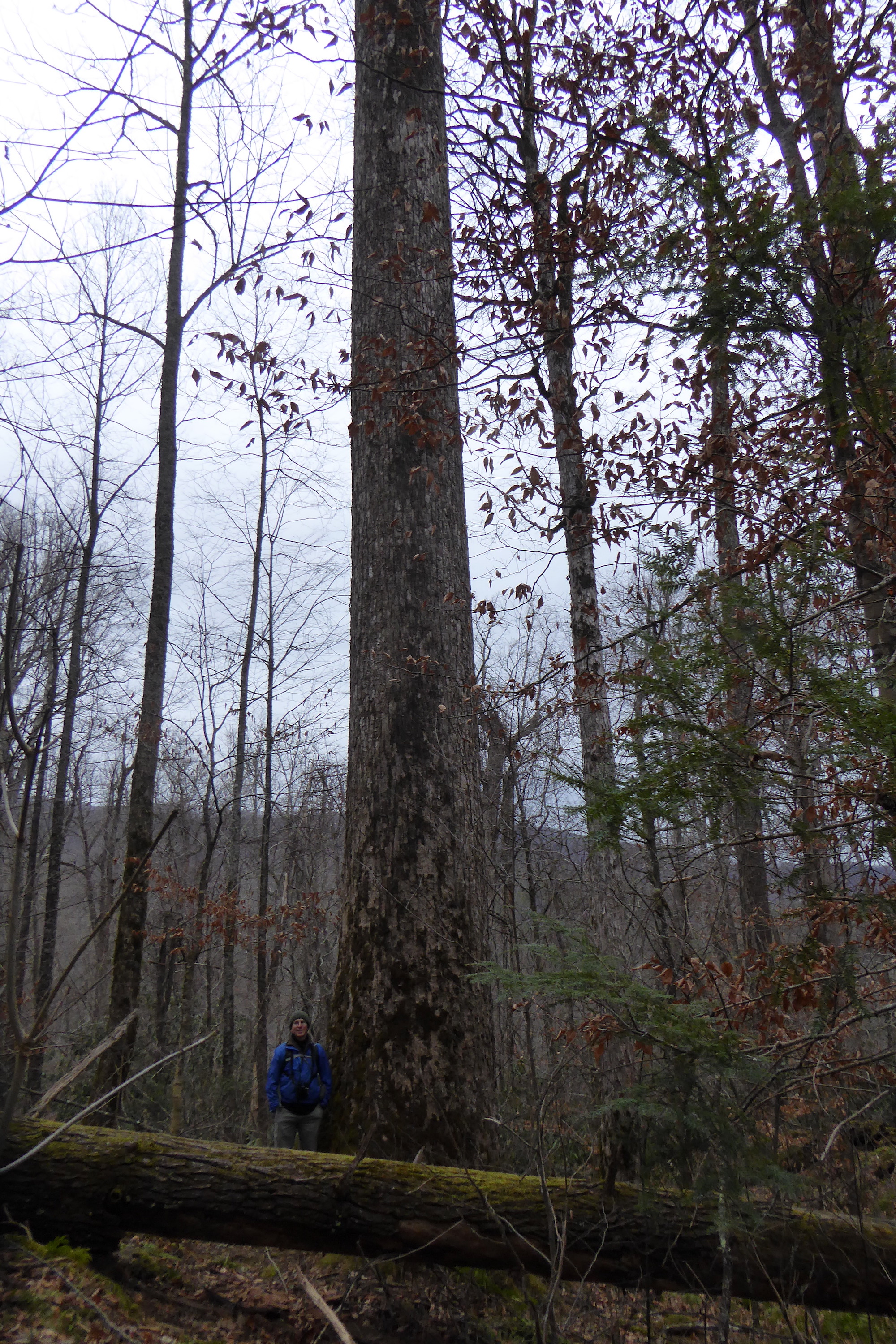
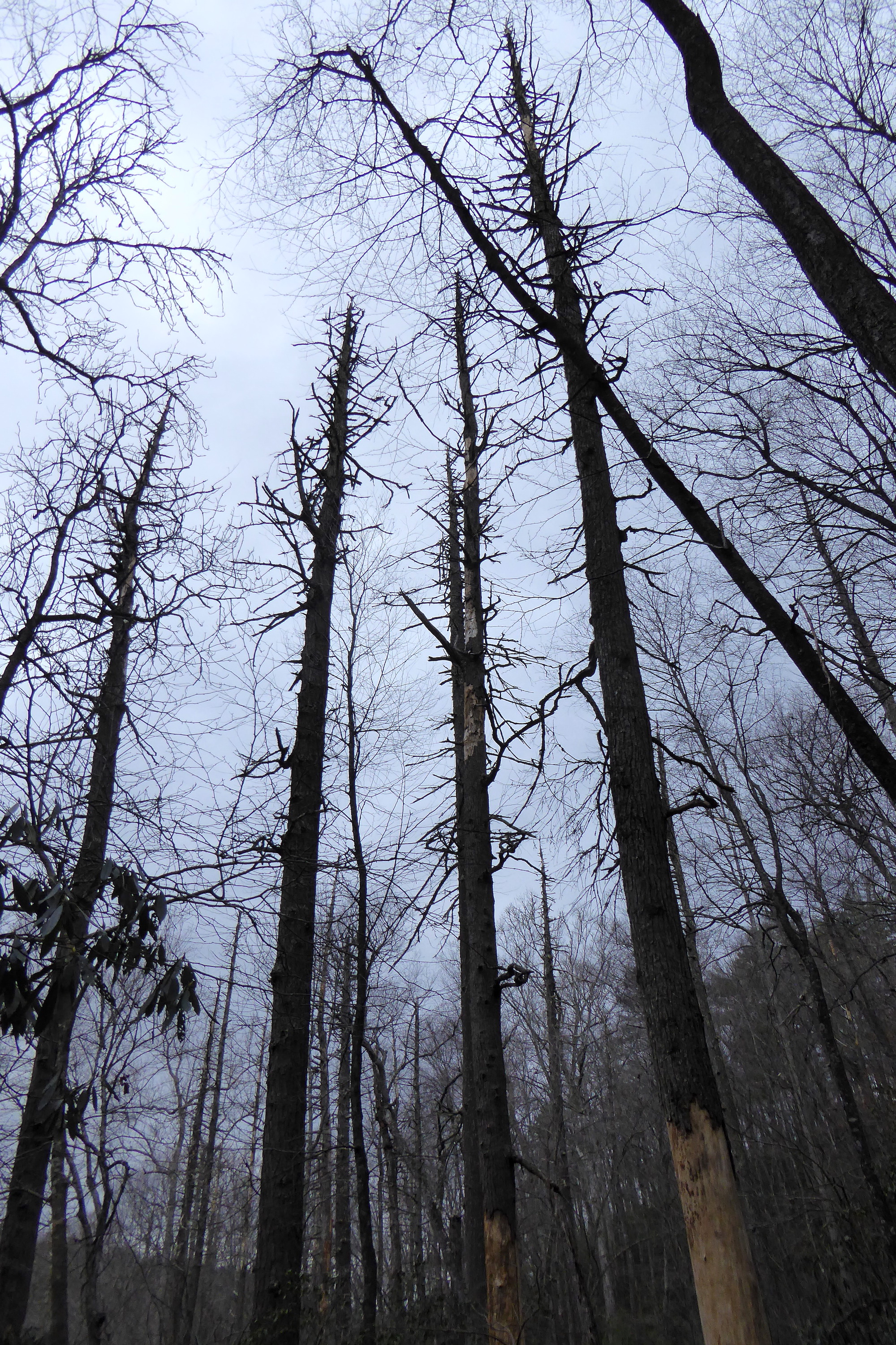
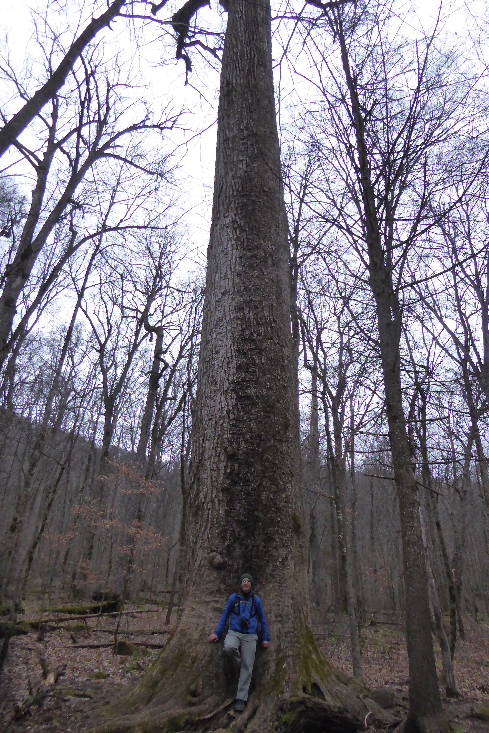
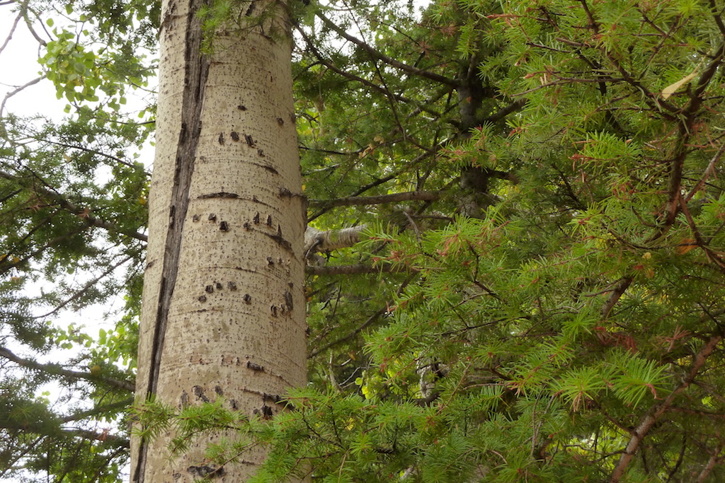
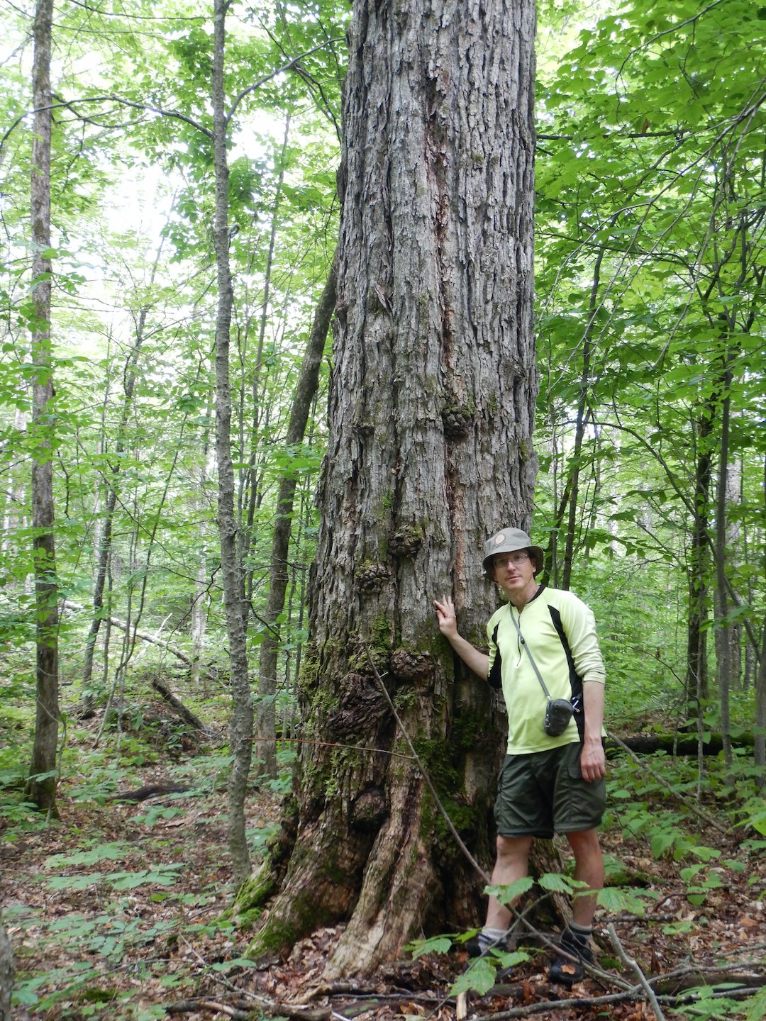
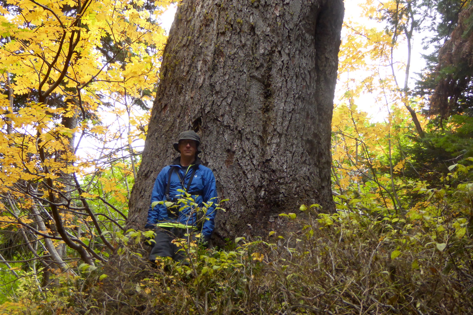
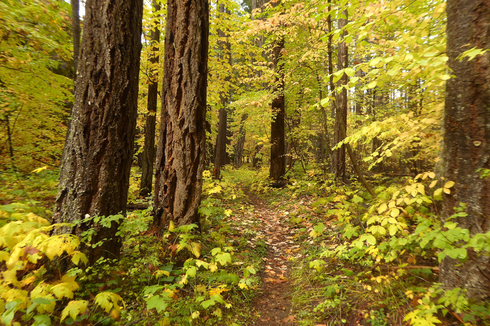
But to my surprise, the forest immediately changed after the trail left the old roads. Instead of spindly, closely spaced trees, i was surrounded by groves of large eastern hemlocks with plenty of big sugar maple, white ash, and spruce. Although the views from the mountain summit I experienced later that day were enjoyable, it was this section of forest which most captured my attention and curiosity.

tall trees in a maturing forest, primarily hemlock, maple, and ash.
A grove of older large trees on the slopes of Deasey Mountain

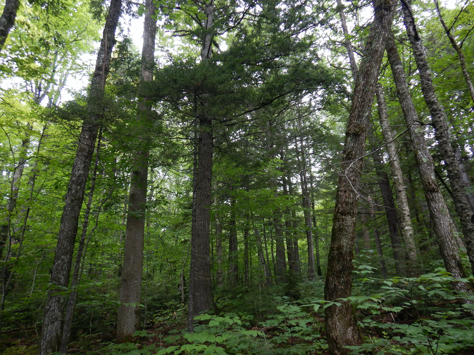
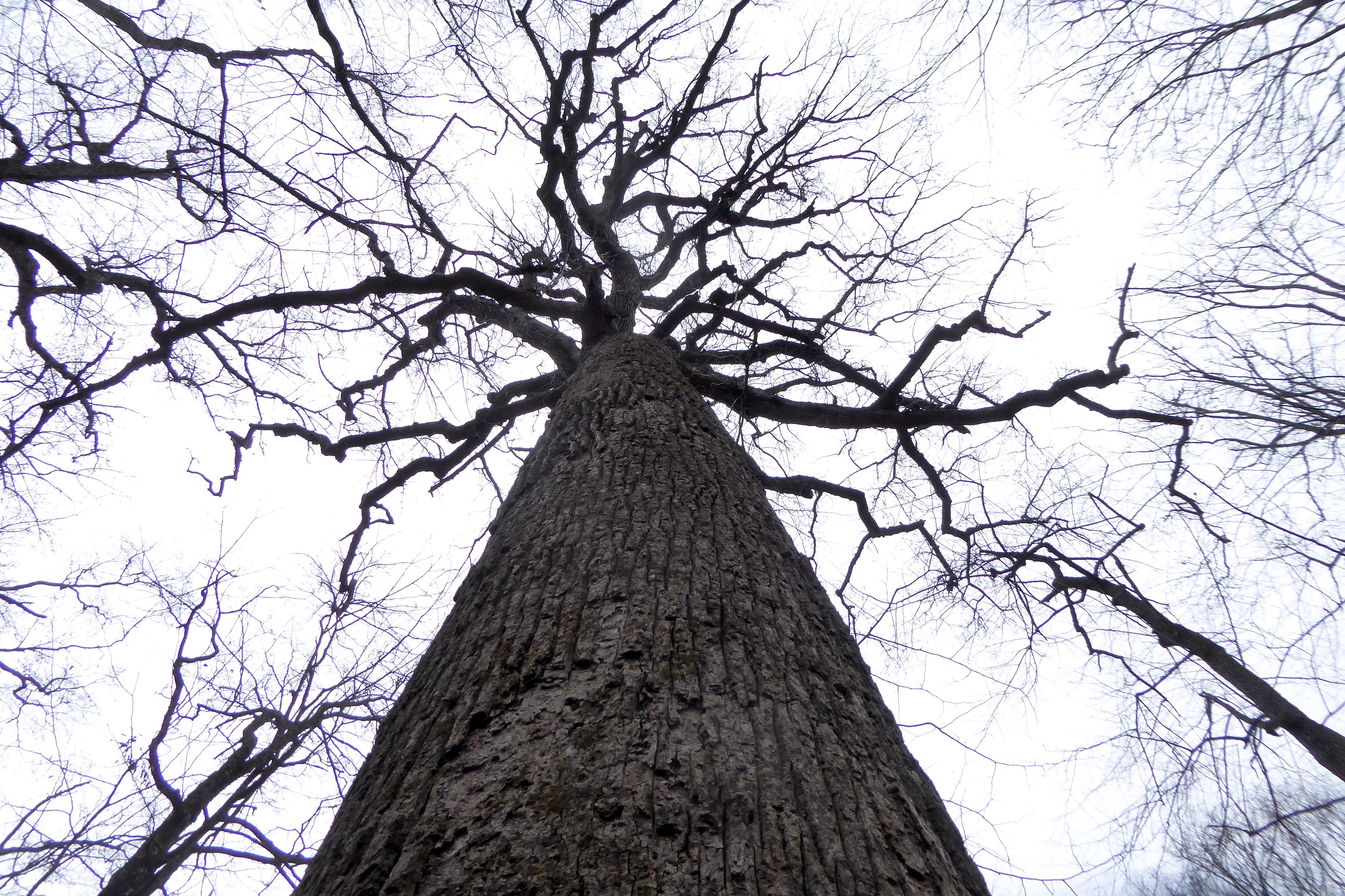
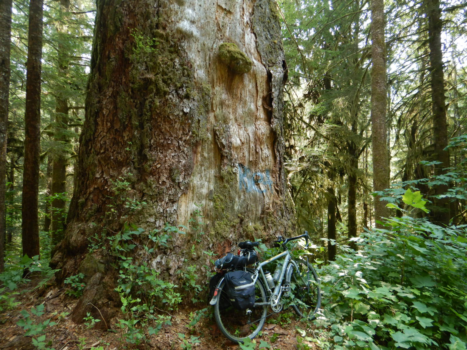
Now, these weren’t the largest trees I’ve ever seen and if you’re used to hiking through the old-growth forests of the Cascades in Washington and Oregon or the Smokies of North Carolina and Tennessee, then I’ll excuse you if you consider these trees to be modest at best. While eastern hemlocks have the potential to live more than 500 hundred years and grow more than 150 feet tall, the natural disturbance regimes in eastern North America coupled with modern logging practices and invasive insects such as hemlock woolly adelgid rarely allow them to reach their maximum age or size. 

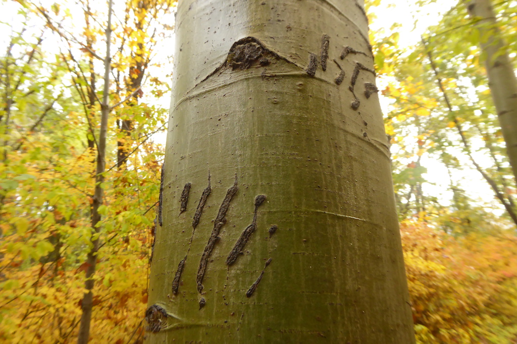
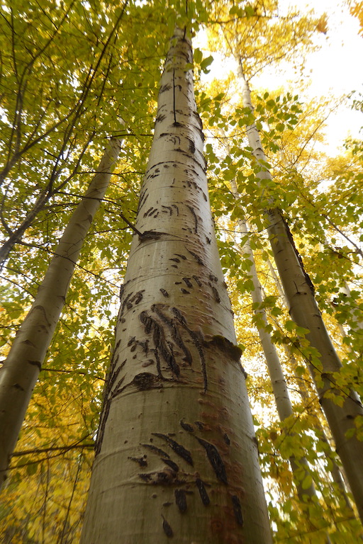
The pocket of older trees extended along at least a mile of trail. Despite looking, I didn’t find stumps from cut trees or long-abandoned roads or skidder trails, which would have been the obvious signs of harvest in this stand during the last 100 years. I also failed to find charcoaled stumps. By a stroke of luck, this patch of forest did not burn during the large wildfires in the late 1800s and early 1900s. Parts of the Wassataquoik watershed were made near barren after an intense fire in 1903, for example. Short-lived and fast growing trees that fill recently harvested and fire-burned areas such as aspen were also largely absent, which suggests this forest hadn’t seen a major disturbance from an axe, chainsaw, fire, or windstorm in a very long time—at least long enough for the relatively slow growing hemlocks to mature to their current stature.

boles of two trees, a large hemlock at right and a large spruce at left, fill the foreground of a photo of a grove of large trees

5' 7" tall person leans against a 3-4 feet DBH sugar maple
Hemlocks weren’t the only large trees in the grove. This absolute unit of a sugar maple loomed in a shady, sheltered swale. Sugar maples of this size are uncommon in the working forests of northern Maine.

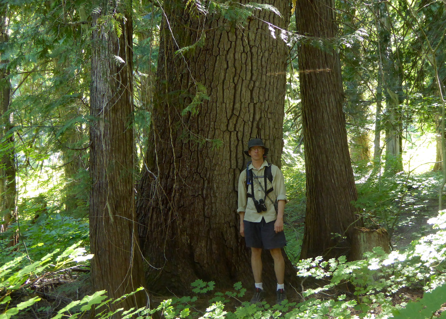
I would be surprised if this pocket of forest had not experienced at least some harvest in the last 200 years. Before the modern era of roads and feller bunchers (machines that cut, trim, and stack trees), loggers used sluiceways, ox and horse teams, and sometimes Lombard Steam Haulers to transport timber to places where the logs could be left until the river drives of spring thaw. Even the headwaters of the Wassataquoik watershed, now occupying the wildest portions of Baxter State Park, saw intense logging in the late 1800s.

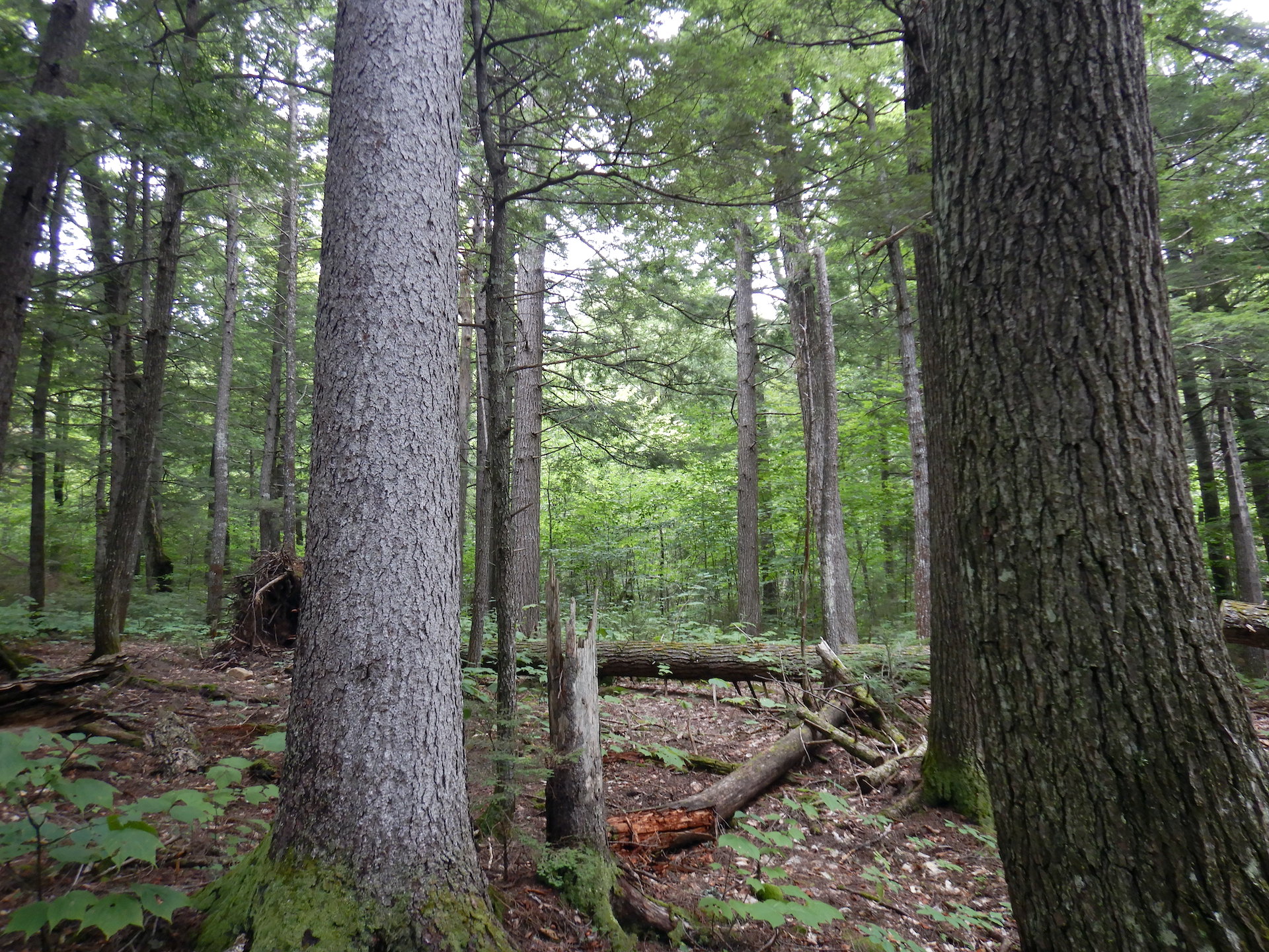
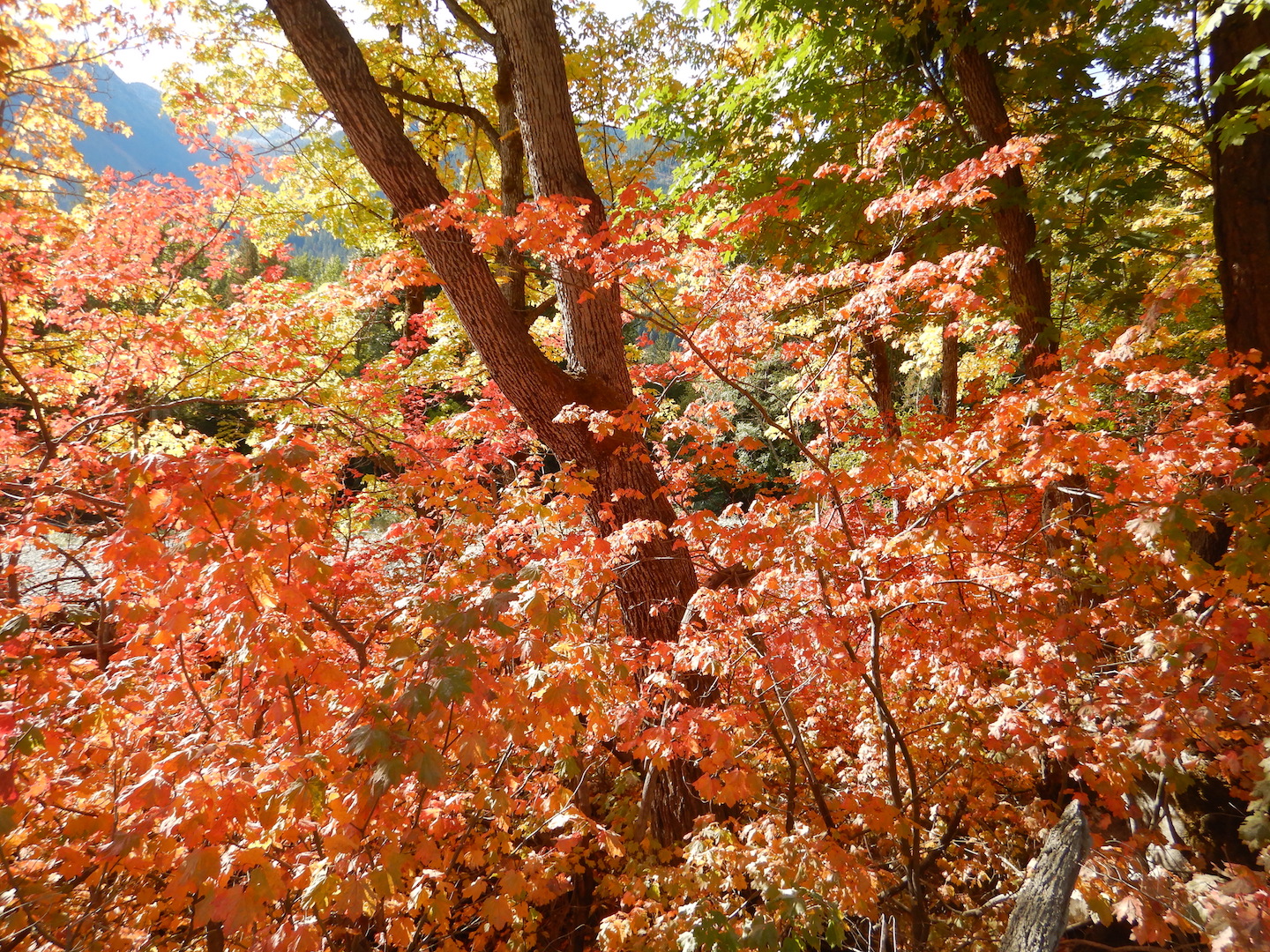
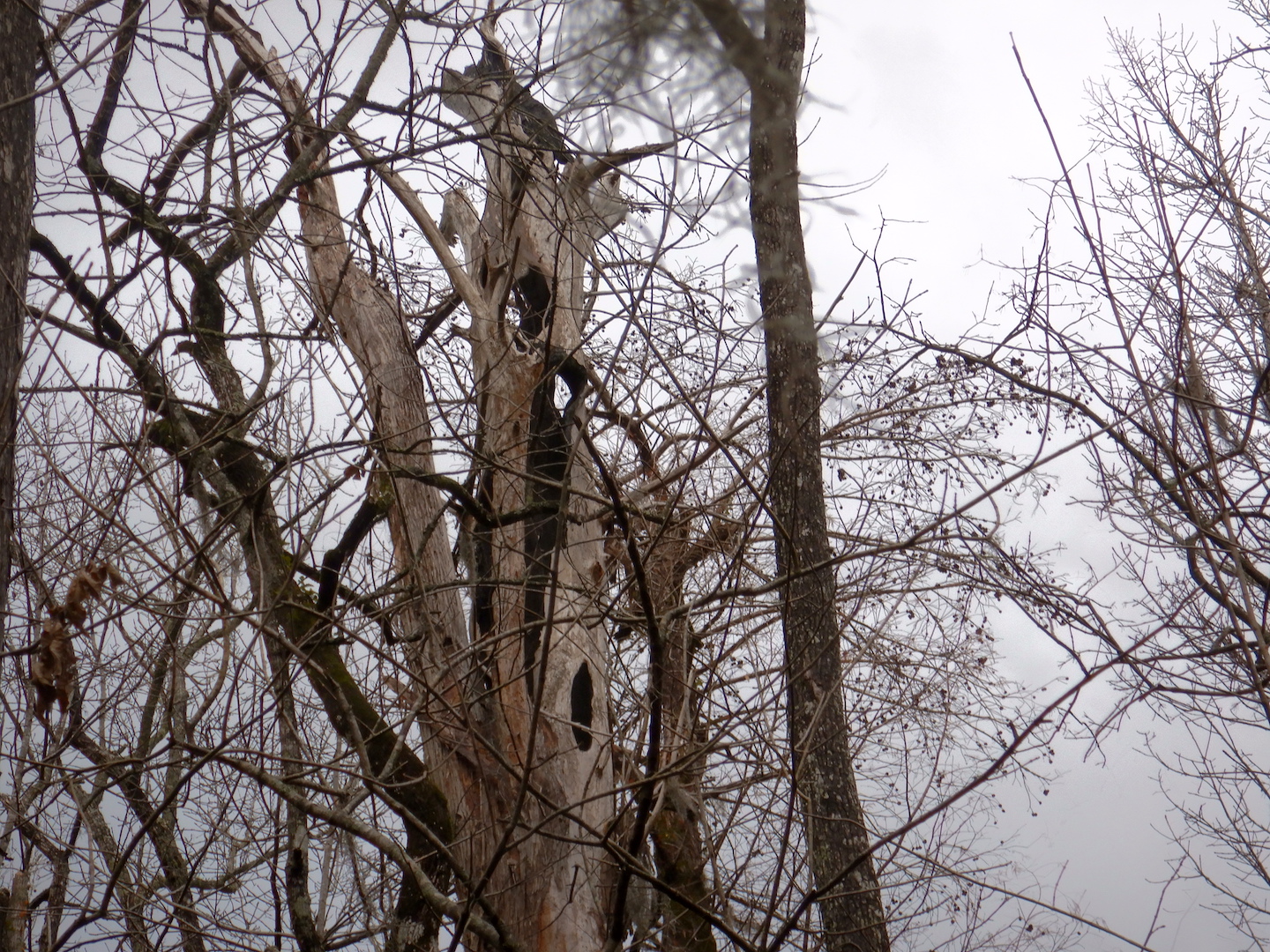
Although I couldn’t find evidence of recent logging and there’s no recorded history of agriculture on the mountain, I suspect this section of forest isn’t old growth, at least not yet. The definition of old growth remains a subject of debate among scientists, yet most seem to agree that old growth forests are complex. Rather than even-aged trees, old growth stands in the northeastern U.S. contain a wide spectrum of tree ages and sizes. Certainly they often contain very large trees but also lots of dead wood. The canopy is complex with trees of different heights and broken tops. If browsing by deer and moose isn’t too intense, the understory is filled with a diversity of shrubs, small trees, and ephemeral herbs.

Other than the large trees, I saw only modest representations of these features on Deasey. Large dead trees, either standing or on the ground, were not common (although there were some thrilling examples of standing dead snags), and the understory was thin in some places. Sometimes this is the result of heavy deer and moose browse, but here I wondered if it was more of the product of the deep shade cast by the hemlocks and spruce. When storms and insects cull the live trees the subsequent gaps flood the forest floor with light, which allows the shade suppressed plants to burst upward. 

With much of Katahdin Woods and Waters in stages of early succession after 20th and early 21st century logging and fires, it’ll be many decades before large areas of the national monument’s forests grow into anything that partially resembles the structure they held before industry arrived in the region. Even then, it won’t be the same as before. Ignoring the fact that North America no longer harbors its large Pleistocene mammals which exerted great influence on plants, and the losses associated with Indigenous forestry across most of the landscape, such as burning which maintained open woodlands and prairies, the disturbance regimes now forced on the land in the last 200 years have created novel forest communities. Many forest types we consider “normal” such as stands of near-continually young birch and aspen have no past analogs. 

Beyond that, if people never manipulate this forest through harvest or with fire (purposeful or accidental) again we’ve already set into motion a cascade of effects that will influence the forest for many thousands of years. Introduced disease has ravaged Maine’s American beech—a formerly large, long-lived, shade tolerant tree. Hemlock woolly adelgid and emerald ash borer continue to advance and will likely kill most of the ash and hemlock they encounter. Climate change will make the area less hospitable to spruce, balsam fir, and sugar maple while perhaps improving growing conditions for oaks. Species that live farther south currently such as tulip tree and hickories could become new additions to Maine’s forests as annual temperatures rise. High levels of atmospheric CO2 may accelerate tree growth, but at the same time new diseases, new insect infestations, and increased forest fire potential—all fueled by climate change—are likely to be greater threats to these forests than today. Whatever emerges as a result of these influences will be largely a forest of our own making, whether we want it to be that way or not. 

Sometimes I wish I could live long enough to experience the distant future, mostly out of curiosity. I wonder if we have the collective foresight and the will to protect what’s left, to ensure that hemlock and ash trees aren’t reduced to functional extinction like the American chestnut. Could I return in 200 years and find hemlocks on Deasey Mountain? In 500 years?

Welcome, dear trees, to the Anthropocene. It might be a rough ride, but I hope we’ll help you get through it.

A (Sometimes) Overlooked Significance

Recently, I stumbled upon this question.

Honestly, it’s something that I think about regularly when I’m planning a trip to a national park. While people frequently visit parks and other protected areas to experience unique and special landscapes, sometimes we fail to see their forests for the trees, or even see their forests at all.

I think this is particularly true of North Cascades National Park and the adjacent recreation areas, Lake Chelan and Ross Lake. The region is most famous for its rugged mountain topography, which I must admit is quite pretty, but visiting here solely to see mountains risks missing some of the best, uncut forests left in the Pacific Northwest. I’m not implying that a visit to a park without admiring trees is somehow less worthy than my slow forest strolls. Far from it; national parks mean different things to different people. But, I find myself drawn to trees, no matter where I go, even among some of the Lower 48’s craggiest mountains.

view of forested valley with tall craggy mountains on horizon

The North Cascades are defined by their ruggedness, and the area’s vertical relief is impressively steep. Ridges and mountain peaks frequently rise above 7,000 feet while deep valleys incise the landscape to near sea level in some places. The Skagit River at Newhalem, for example, flows at 500 feet in elevation while several peaks ascend over 5,000 feet within a few miles. In Stehekin, Lake Chelan sits at a modest 1,100 feet above sea level, but within two and half horizontal miles of the lakeshore, Castle Rock reaches above 8,100 feet.

view of snowy mountains rising above lake

Castle Rock rises 7,000 feet above Lake Chelan.

The rugged topography slowed the march of industrial logging into the mountains, so by the time the North Cascades National Park Service Complex was established in the 1960s and 1970s, much of the forest within the newly protected area had never been logged. In the park today, nearly every low elevation valley holds wonderful examples of wild, unmanaged forests.

Some of the most spectacular and significant trees are found along Big Beaver Creek, which flows southeast into Ross Lake. A section of trail about five miles from Ross Lake passes through a grove of thousand year-old western redcedar.  Preservation of these trees was the catalyst that stopped the expansion of Ross Dam.

bole of large tree with two hiking poles leaning against it

Some western redcedar in the Big Beaver valley are over three meters in diameter at chest height.

hiking trail lined by large redcedar trees

Big Beaver Trail

Along their entire length, both the Big Beaver and Little Beaver valleys harbor incredible forests. The same goes for the Chilliwack River valley and Brush Creek area, so if you hike from Hannegan Pass to Ross Lake, you’re in for a spectacular forest hike.

trail winding through dense forest with large trees

Little Beaver Trail

person standing next to trunk of large Douglas-fir

Yours truly and a large Douglas-fir at Graybeal Camp in the Brush Creek valley.

Those places are remote, however, requiring most of a day’s hike just to get near them and several days of backpacking to traverse the valleys. Many other old-growth forests are more accessible. The Stetattle Creek Trail, which starts in the Seattle City Light company town Diablo, ends in a classic example of a climax forest on the west side of the Cascades. This trail is often overlooked and rarely busy. What it lacks in mountain vistas it makes up for in trees.

view of old growth forest with large coniferous trees

Forest near the end of Stetattle Creek Trail

Hiking south from the Colonial Creek Campground, an easy four-mile round trip along Thunder Creek brings you through stately Douglas-fir and western redcedar. People often march through this section, barely stopping to look, as they have their sights set on up-valley destinations, but if you go plan some extra time to stop and admire these trees.

tall trees with foot bridge at bottom

The forest along Thunder Creek

Disturbance—whether brought by fire, avalanche, landslides, or people—is a hallmark of this ecosystem as well. Many large trees stand as witnesses to past and current change.

person standing in front of large tree

Englemann spruce, McAlester Lake Trail

person standing next to large tree with smaller trees nearby

Western white pine, Old Wagon Road Trail

person standing next to large deciduous tree

Black cottonwood, Upper Stehekin Valley Trail

Those that didn’t survive allow us to explore how the ecosystem may cope with future disturbance. I find myself pausing frequently in burned areas and avalanche tracks to admire how quickly the landscape can change.

lightly burned forest with standing dead trees and some minor green vegetation on ground

A recently burned forest along the Park Creek Trail

broken trees in foreground with forests and mountain in background

Avalanches can sometimes devastate otherwise healthy stands of trees. This example comes from the upper Brush Creek valley.

Often overlooked and visited far less than the Highway 20 corridor, the Stehekin valley is the most diverse place in the park complex, both in terms of cultural and natural history. In Stehekin, you can find everything from a historic orchard to plants adapted to desert-like climates growing alongside old-growth groves.

trail through forest with bright yellow fall colors

Stehekin River Trail

red maple leaves in forest

Vine maple splashes the Stehekin valley with color each fall.

Trees persist and even thrive despite the forces constantly working against them. They create vertical habitat, greatly increasing the landscape’s capacity to support life. They tell tales survival and struggle, longevity and adaptability. They are living witnesses to history and catalysts for conservation. North Cascades provides a rare opportunity to explore unmanaged, old forests—habitats that are becoming increasingly rare. And, if you can’t get here, just go to your local park or maybe even your back yard where, I bet, there’s a tree worthy of your attention.

Francis Beilder Forest

Tucked away in a section of Four Holes Swamp, a tributary of the Edisto River in South Carolina, lies a pocket of remarkable forest. Currently owned and managed by the National Audubon Society, Francis Beilder Forest protects the largest virgin bald cypress and tupelo swamp remaining in North America.

silhouette of large bald cypress tree surrounded by other treesBald cypress (Taxodium distichum) is a deciduous member of the cypress family (Cupressaceae), which includes juniper, white-cedar, arborvitae, incense-cedar, Sequoia, and redwood. Like hickory trees, however, bald cypress shed their pinnate leaves each fall and grow new leaves in the spring. This characteristic inspired their common name since the trees are “bald” for at least part of the year. The species is long-lived and its wood is rot resistant. Recently, cypress logs dating back 25,000 to 50,000 years have been uncovered from sand quarries along the Pee–Dee River.

Visiting the Beilder forest is easy, requiring only the ability to traverse a level, 1.75 mile-long boardwalk. Walking into the forest, I could immediately see this was a special place.

black water swamp in winter with reflections of trees in water
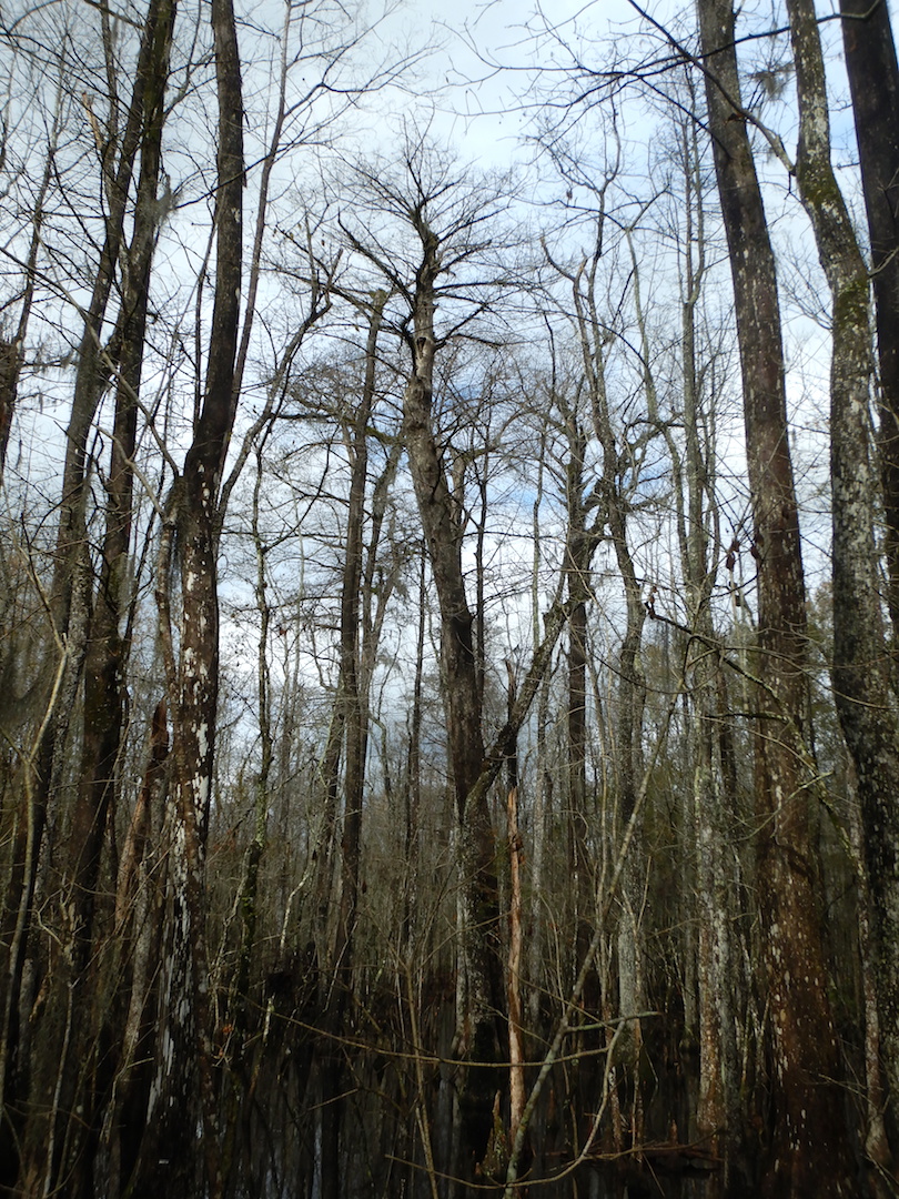
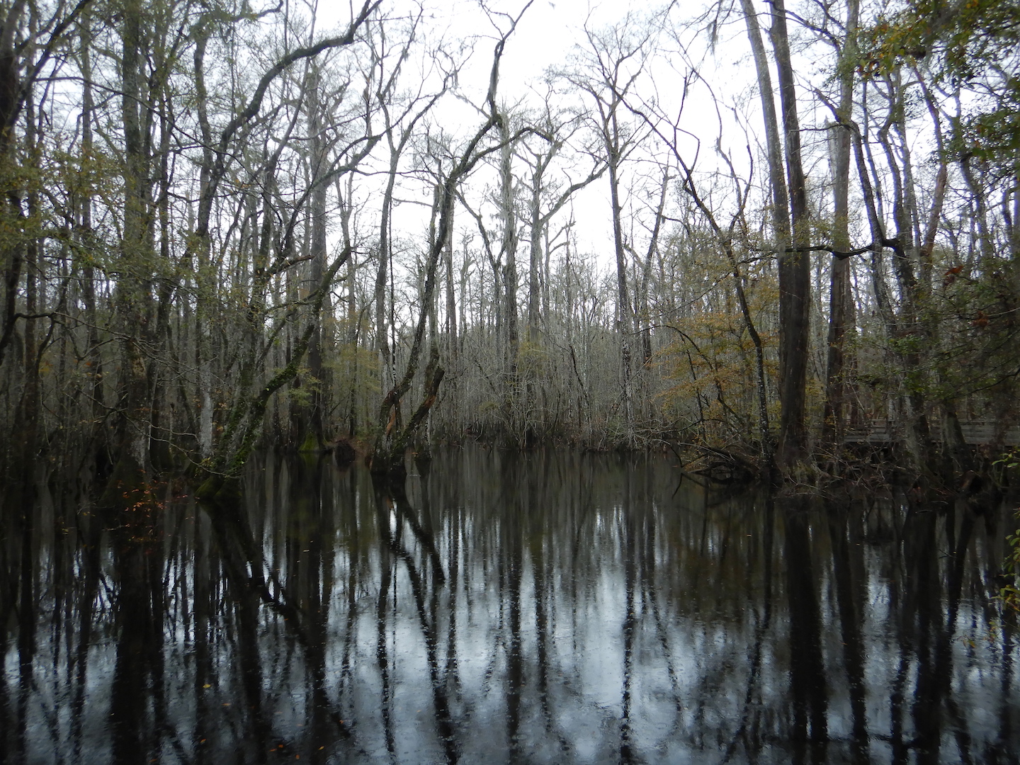
Bald cypress swamps experience seasonal flooding, and when I visited in mid December the forest was covered in a blanket of tea-colored water stained brown by tannins. The day was relatively warm and temperatures reached above 60˚ F. A few turtles and snakes took the opportunity to climb out of the water and sun themselves on fallen logs. My attention, however, was consistently drawn to the canopy and the craggy tops of centuries- and millennium-old bald cypress trees.

silhouette of large bald cypress tree
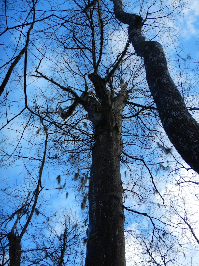
Bald cypress is one of the longest-lived trees in North America and the longest-lived tree in the eastern U.S. The oldest known tree at Beilder is nearly 1,600 years old. Along the boardwalk, you can find a 1,000-year giant, which outwardly looks healthy enough to stand another thousand years. (I asked the Audubon staff if I could see the 1,600 year-old tree and to my delight it could be found along the boardwalk. But, I won’t disclose its exact location since the staff would like to avoid making it a target for vandals.)

silhouette of large bald cypress tree

A thousand year-old giant in Francis Beilder Forest. This tree grows adjacent to the boardwalk and is identified by a sign.

At Beilder, many trees are massively trunked, resembling the silhouette of giant sequoia. Above their basal swell, they barely seem to taper until their branches splay outward in the canopy.

silhouette of large bald cypress tree; tree is surrounded by a boardwalk
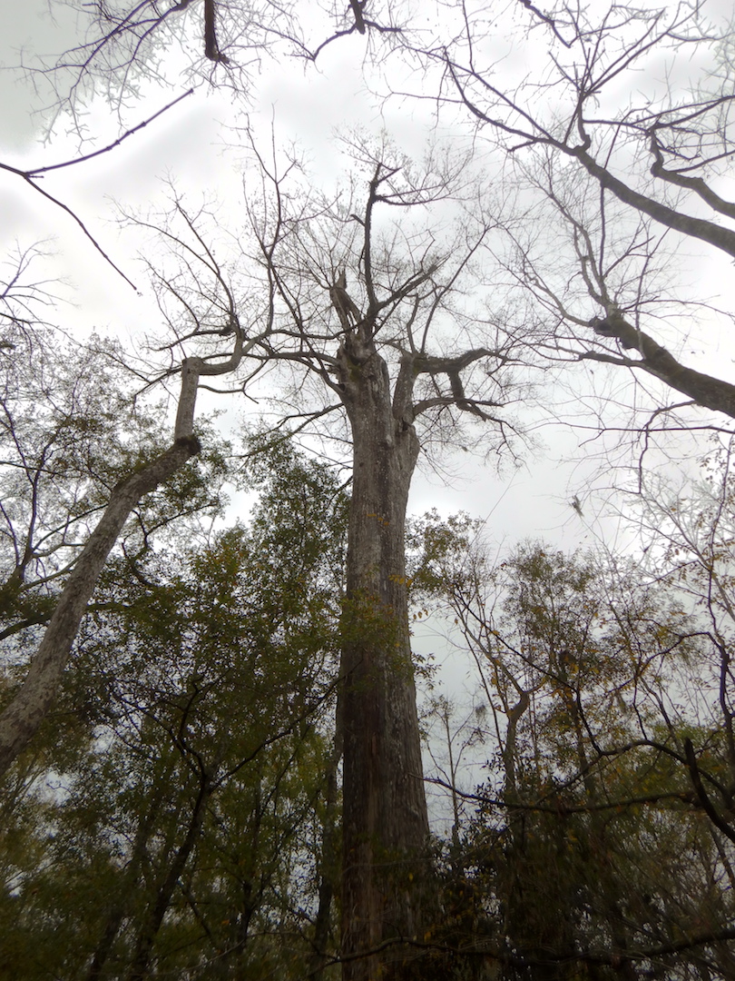
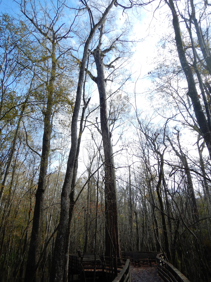
When you live to be over 1,000 years old you’re bound to acquire a scar or two. Reaching over 100 feet high, each bald cypress carries a legacy of the battles with insects, fire, and severe weather like thunderstorms, tornados, and hurricanes.

crown of large bald cypress with broken branch

Some time ago, a large branch broke off of this tree, perhaps allowing carpenter ants an easy means of entry. Larger holes in the same branch are the work of large woodpeckers like pileated woodpeckers. One hundred and fifty years ago, ivory-billed woodpeckers would’ve inhabited this place too. Could some of these woodpecker holes be from this extinct bird?

top of trunk of hollow bald cypress tree

The charcoaled interior of this large bald cypress preserves a moment in time when it was struck by lightning and burned.

Collectively and individually, these trees tell a fascinating story, if we are willing to listen. Maybe the most poignant of those, from my perspective, is loss.

I marveled at the trees at Francis Beidler, but I marveled at a fragment. Their longevity and physical proportions might only be remarkable because we’ve eradicated nearly all other bald cypress of the same size and age. Francis Beidler Forest is one of the few places where old-growth bald cypress trees still exist. According to one estimate, over 42 million acres of bald cypress forests once covered the southeastern United States, an area nearly the size of Missouri. Now, only 10,000 acres remain, equivalent to .02% of the original bald cypress forest! The rest was logged for lumber, furniture, and shingles with no forethought for future generations who may find great value (monetary or otherwise) in healthy ecosystems or for the species who depended on this habitat.

Through uncontrolled hunting and the loss of old-growth forests like bald cypress swamps, we drove the Carolina parakeet and ivory-billed woodpecker to extinction. Knowing what we consumed in the past, understanding that we continue to cause extinctions and change the climate today, can we ethically expand our footprint on Earth? How much extinction does it take before we say enough is enough?

The trees at Beilder felt the pounding of the ivory-bill and heard the calls of parakeets. Perhaps they were even enveloped by passenger pigeons, a species once so abundant in North America that their flocks extended for miles and blackened the skies. The air in this forest used to ring with the echoes of these birds. When we lose forests, we lose much more than trees.


Gee Point

While browsing a map of the Mount Baker-Snoqualmie National Forest, I spotted what appeared to be a little used trail in a tract of the forest south of Skagit River. I quickly assessed whether it was worthy of my short list for exploration: Is it interesting and is it within cycling distance? With an affirmative yes to both criteria, I set off with my bike, Rocinante, to Gee Point.

I pedaled about eight miles south on the usually quiet Concrete-Sauk Valley Road. Only slightly rolling, this road was a good warm up for the rest of the day, which I knew would require a lot of climbing. Upon reaching the Finney Creek Road, I began a slow ascent through a mosaic of forested land—fields of stumps in recent clear cuts, thick second and third-growth stands, and occasionally a pocket of old growth forest.

view of forest area with maturing trees and recently clear cut areas

In contrast to younger forest, old-growth stands are characterized not only by large and tall living trees, but also by a complex, uneven canopy and a relatively high amount of dead standing snags and down trees. Even from a distance, the old-growth can be easy to spot once you learn to look for these signs.

view of forest with tall trees on horizon

Large trees with an uneven canopy reveal a stand of old-growth trees on the edge of a former clear cut.

Most of these old-growth trees were inaccessible from the road (perhaps the only reason they remain standing), but a few other giants were spared the chainsaw. Perhaps too dangerous to cut, or perched precariously on the edge of a cliff, or already dead, these trees stood as the last remnants of the forest that used to be.

bicycle leaning against bole of large dead tree

A few miles up the Finney Creek Road stands a giant dead Douglas-fir tree. These trees remind me that, with the exception of fire-maintained prairies and frequently flooded areas, nearly all of the Sauk and Skagit river valleys were covered with old growth trees.

Specific trees, like Sitka spruce, along Finney Creek also indicated this was often a wet place. Sitka spruce is typically found in areas with cool summers and high rainfall.

silhouette of Sitka spruce

The North Cascades, however, experience a bi-modal climate. Its cool, wet winters stand in start contrast to hot and droughty summers, and I was soon reminded of the region’s aridity even as I cycled underneath a thick canopy of needles. As the road transitioned between gravel and broken pavement, the dirt was so dry I kicked up a rooster tail of dust anytime I gained appreciable speed and each pickup truck left a cloud in their wake. (I saw about a dozen motor vehicles in this stretch of national forest. With the exception of one ATV, all were pickup trucks.)

By the time I reached FS Road 1720, I was within a few miles of Gee Point, but I still had most of the climbing ahead of me.

view of dirt road lined with thick forest

It’s a lot steeper than it looks.

The road, now completely dust and gravel but pleasantly lacking washboards, switch-backed through young, even-aged trees as it gained elevation. The terrain was changing as I climbed and signs of winter’s harshness began to appear. I crossed through an avalanche chute at least three times, which gave me an excuse to stop and catch my breath as I admired the power of snow to snap trees in half.

view of short trees caused by avalanche

Winter and springtime avalanches are a frequent occurrence in the North Cascades area, pruning any plant too tall or any too stiff to flex under their tremendous force. In summer, the brushy chutes are prime habitat for bears and I caught a glimpse of a black bear in this one.

The bright, hot sunshine and steepness of the road slowed my speed dramatically and I accumulated a sizeable escort of biting flies, but the views kept getting better, even with a slight haze from wildfire smoke.

dirt road leading toward mountain peak

To reach Gee Point though, I had to hike, so I locked Rocinante to a convenient fir tree at the end of the road and started walking. About a half mile in, I entered a beautiful, uncut forest dominated by large western hemlock and Pacific silver fir. At over 4,000 feet in elevation, which is not particularly high for the Cascades and in stark contrast to the tired burned out green of lower elevations, the forest floor had a noticeably fresh appearance.

The trail soon gained a ridge line and swung to the top of Gee Point where I was rewarded with a panoramic view.


The air, so calm and comfortably warm, easily could’ve induced a nap, but then I remembered that I was running low on water and time, so I reluctantly retraced my steps to the trailhead. After taking one final break to filter drinking water from Little Gee Lake, I bombed down the mountainside.

view of alpine lake and basin

On the rapid descent, I was glad to have wide 700x38cc tires to handle the rough surface and working brakes to check my speed. The ride home was quick, taking me half the time to ride back compared to riding there. When I reached home, my lower legs were caked in a fine powder. They felt worked too, but it was a good kind of tired.

Cross Country By Rail Continued

In my last post, I left Bellingham, WA and crossed the Cascade Mountains via Amtrak’s Empire Builder. On day two of the journey to Pittsburgh, the route and landscape would prove to be even more contrasting than the previous twenty-four hours.

Overnight the train route crossed eastern Washington and Idaho. I woke around sunrise to a foggy scene along the Kootenai River. The river along this stretch harbored few rapids that I could see, but it was brimming with muddy water. Spring and early summer is the season of high runoff in the Rockies.

river flowing through foggy valley
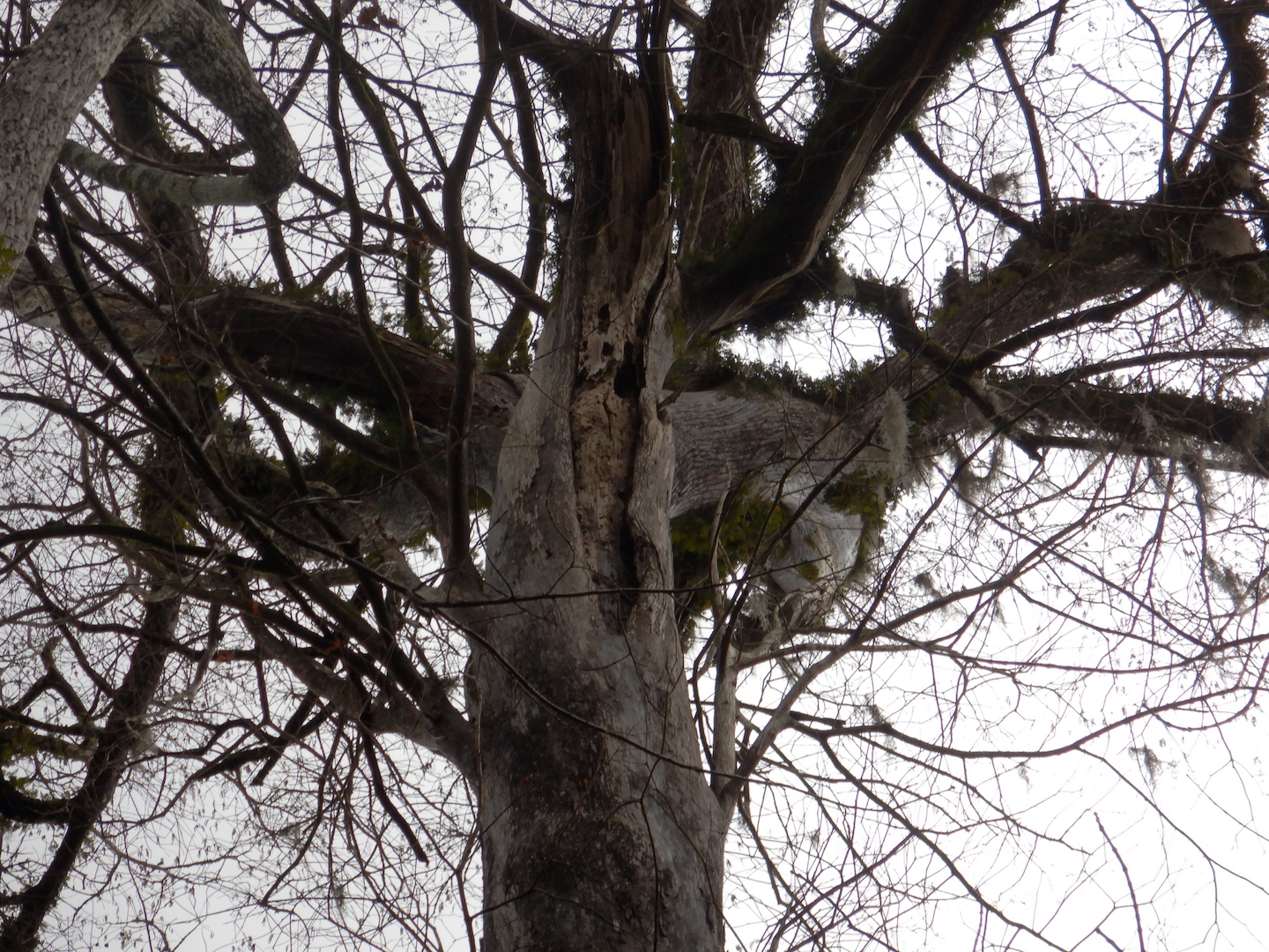
The train soon left the Kootenai River and passed through the Salish Mountains to the Flathead River valley. After Whitefish, Montana we began a slow climb toward the continental divide. Along the middle fork of the Flathead River, between Glacier National Park to the north and the Great Bear Wilderness to the south, lies one of the most scenic stretches of rail on the route. Every bend provided new views of the snow-capped mountains bounding the narrow valley.

view of forested mountains
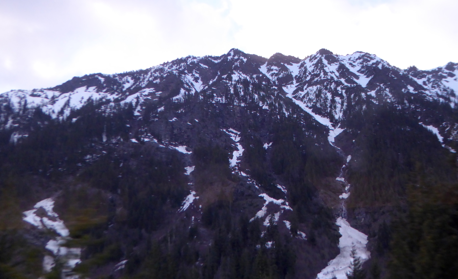
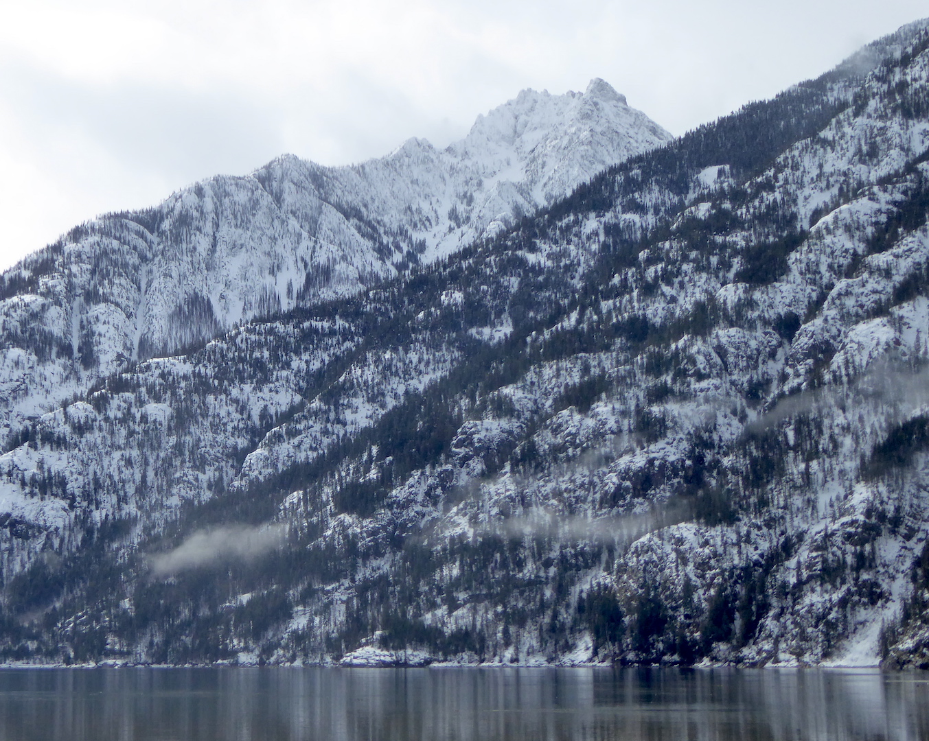
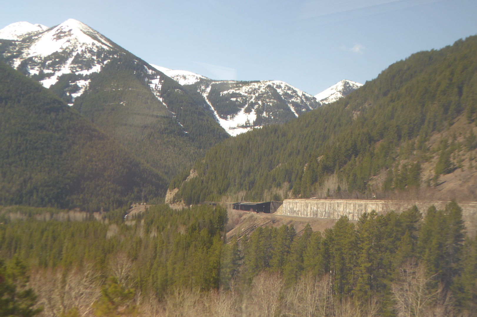
While I enjoyed the mountain scenery, for me the real highlight of this section was the stark contrasts in vegetation and climate. The low valleys on the west side Glacier National Park capture enough precipitation to support the growth of species also found within the wet forests Washington’s Cascades. At West Glacier I caught glimpses of the some of the eastern-most stands of western red-cedar (Thuja plicata). This species, you could say, likes it feet wet and it won’t grow where soil moisture is too low. In this part of North America, a lack of suitable habitat squeezes the red-cedars into narrower and narrower confines, and it quickly disappeared as we traveled east.

Western red-cedars wouldn’t be the only species to vanish in the next fifty miles. On the approach to the continental divide, lodgepole pine (Pinus contorta) and Douglas-fir (Pseudotsuga menziesii) predominated. Lodgepole pine was especially abundant in areas that had experienced forest fires in the last two decades. As the train crossed the continental divide at Marias Pass (el. ~5200 feet) the forest began to disappear, partly from the elevation (treeline was only a thousand or so feet higher) and largely from increasing aridity.

Terrestrial habitats often intergrade slowly, mixing in quilted patches before one finally yields to another. At East Glacier, Montana though, the montane Rocky Mountain forest seemed to simply end where the short grass prairie began. Here is one of the most dramatic terrestrial biome shifts to be found in the United States.

rolling prairie with snow-capped mountains in background
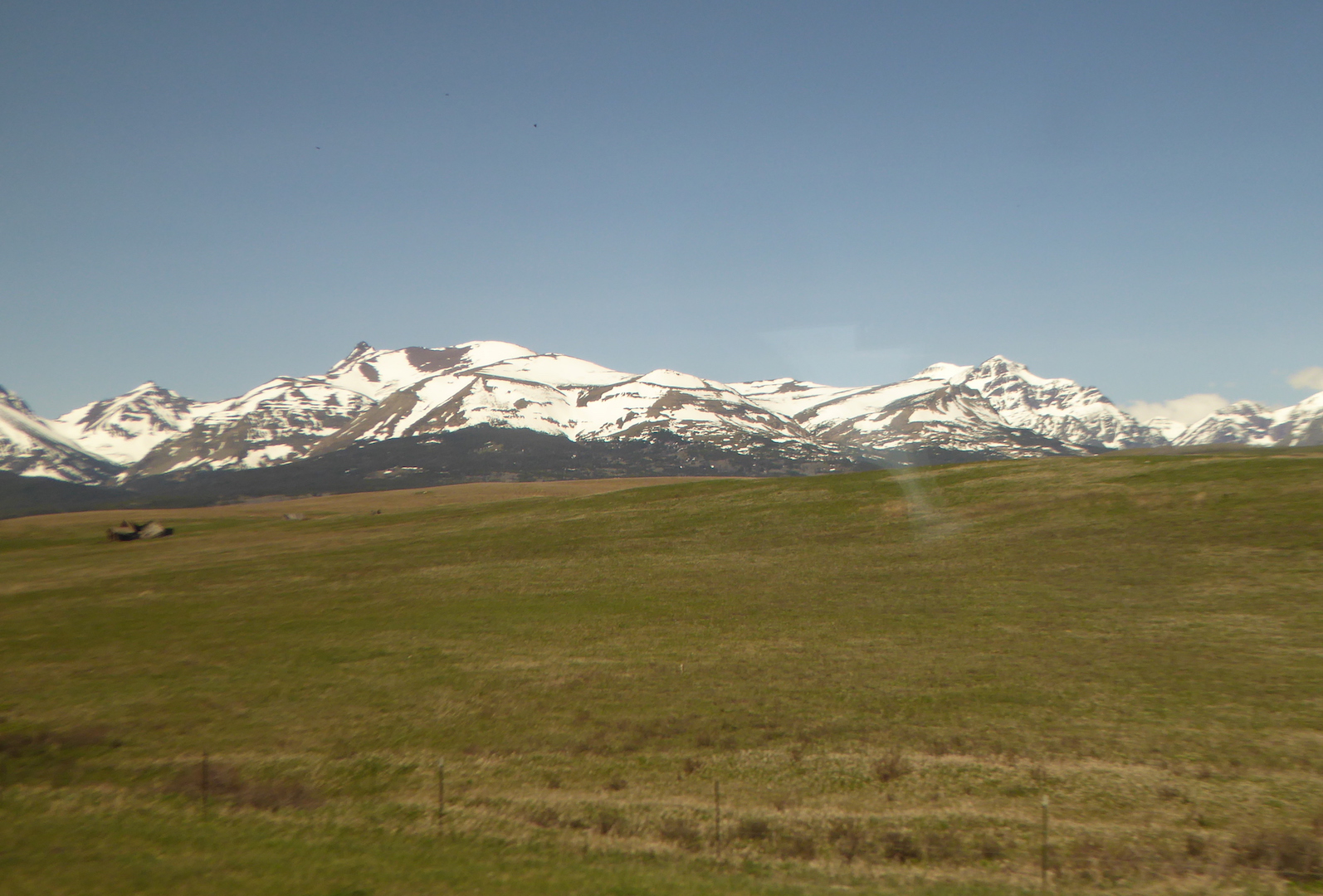
Like the Cascades, the Rocky Mountains create a strong rain shadow across northwestern Montana. Browning, MT, east of the mountains, receives only half the precipitation of West Glacier. For the next thousand miles across Montana and North Dakota prairie dominated where the land was not cultivated or otherwise appropriated by people. The only trees were either planted or grew along creek and river bottoms where their roots could tap into a shallow water table.

prairie and wheat fields across north central Montana
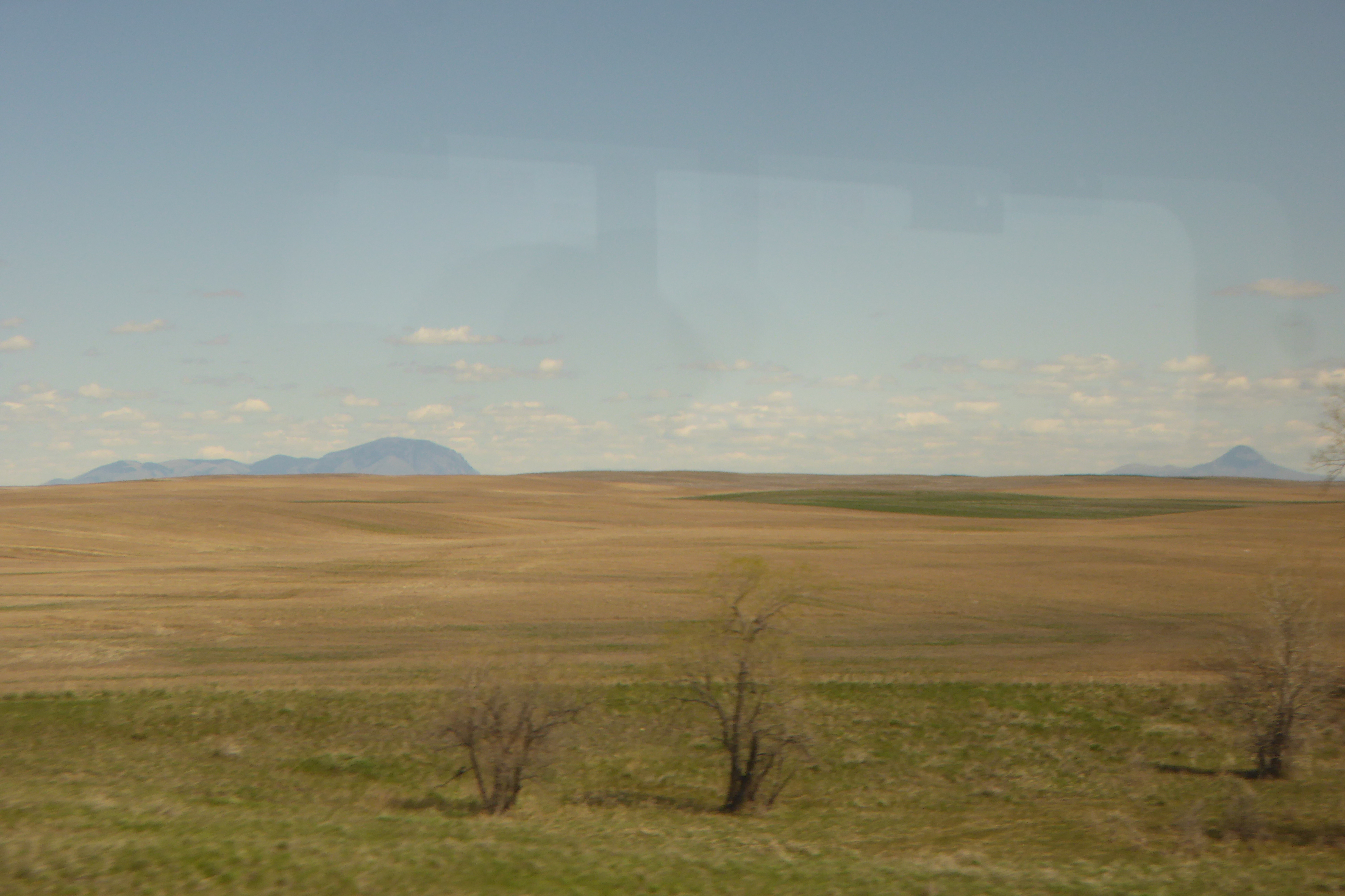
Wildlife became easier to spot on the open prairie. Through Montana the railroad took us just south of the true prairie pothole region, but many of the low-lying areas adjacent to the track held water. Every little puddle seemed to harbor a few pairs of ducks and geese. I casually spotted at least ten waterfowl species during the day. Undoubtedly more used the habitat. I just failed to see them. Small prairie dog towns, frequented by red-tailed and Swainson’s hawks, occupied some of the ranching areas. I counted at least two-dozen pronghorn grazing or resting small, scattered bands.

In eastern Montana, badlands appeared in the distance and became more prominent as we approached and crossed the North Dakota state line. Parts of this area are rich with fossils and I wanted more than a little bit to poke around the hills for ancient bones.

badland bluff
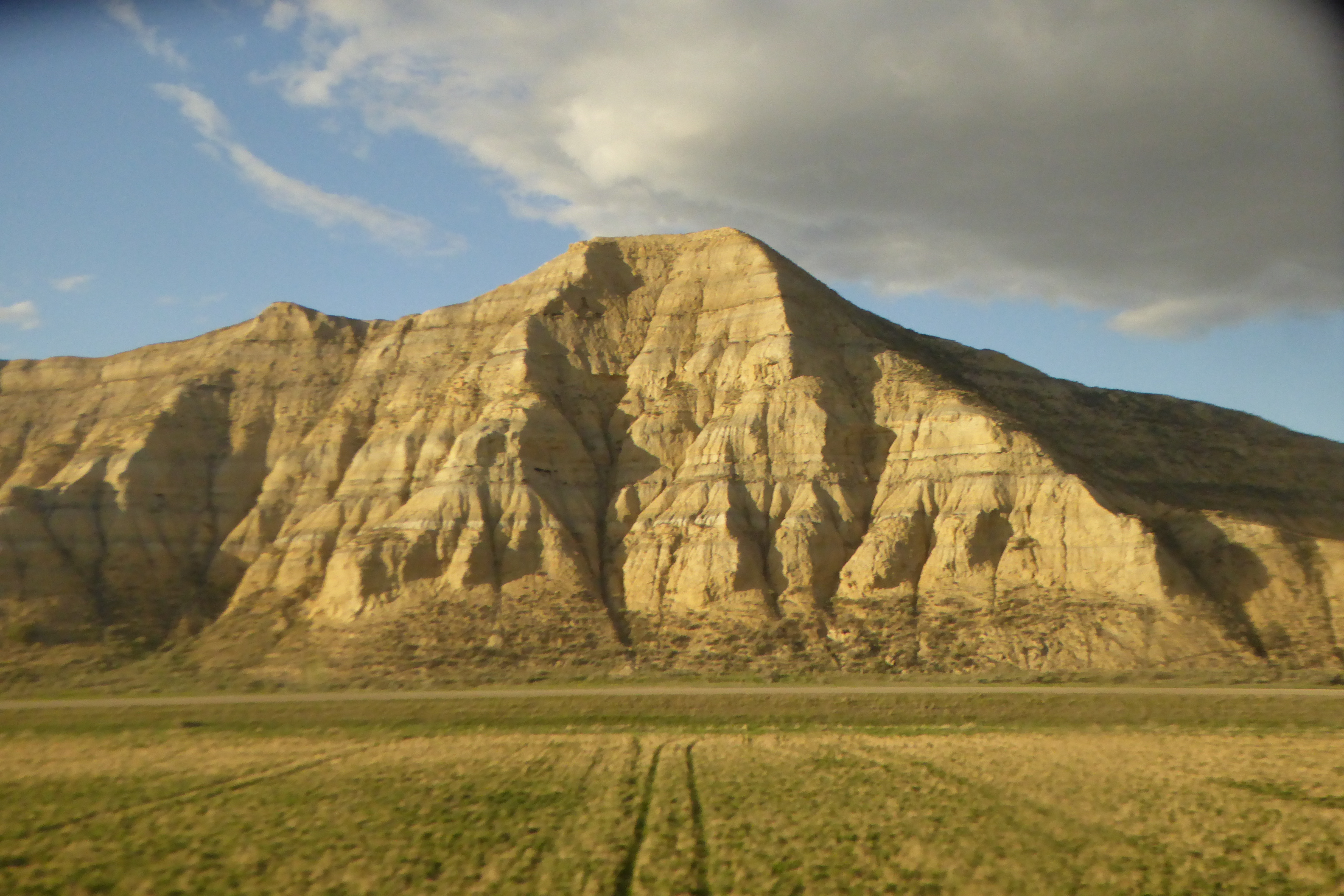
In North Dakota, fracking wells became a prominent sight as the sun set.

oil wells silhouetted by the setting sun
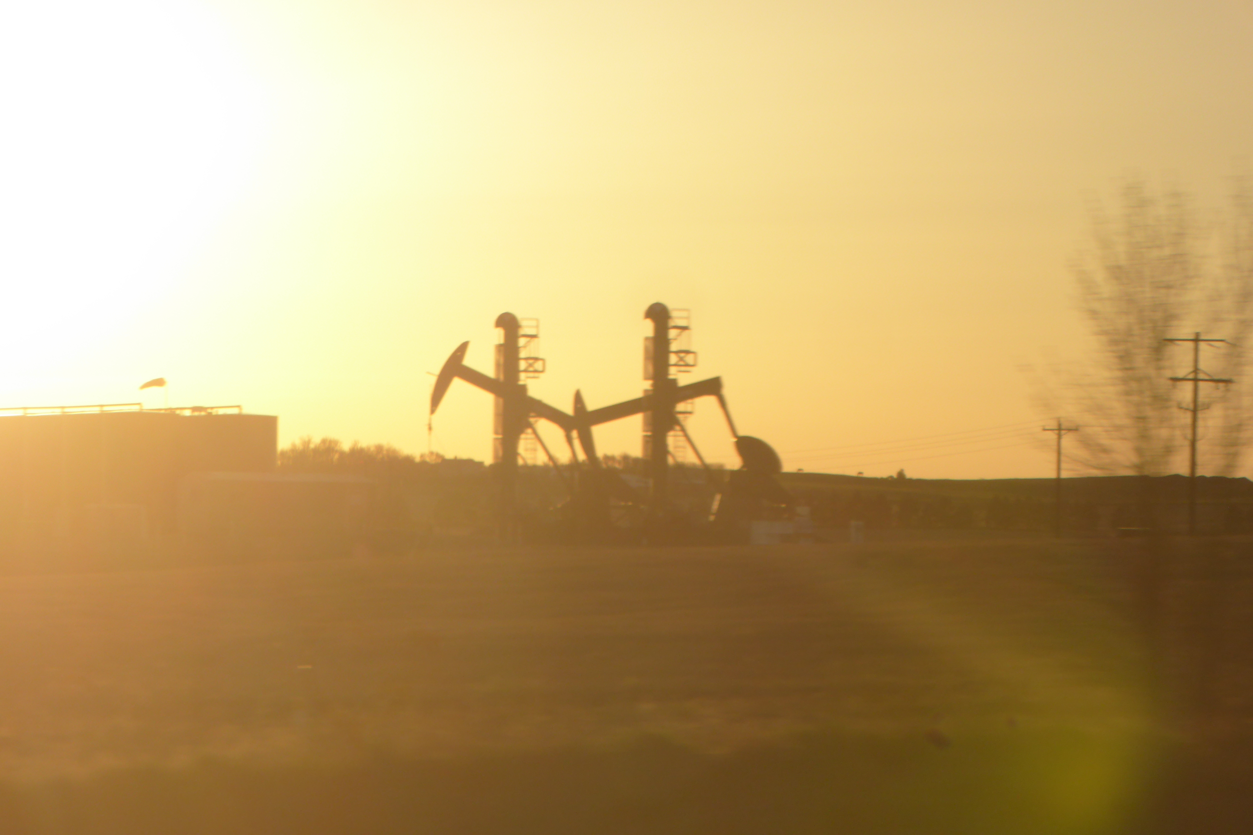
On the morning of my third and final full day on the train I woke up somewhere in Minnesota where the prairie had long since yielded to cornfields. This was, historically, a battleground between prairie and forest. In this area, where precipitation is great enough to support tree growth, fire was the prairie’s greatest ally. Periodic burning kept the forest at bay. After American settlement, the prairie was plowed and fires suppressed. Along this ecosystem margin today, you’re more likely to see farm fields bordered by trees than a patchwork of prairie and forest.

Spring was also much less advanced in west-central Minnesota compared to the Puget Sound area where my trip began. Quaking aspen was washed with small vibrant leaves but some of the paper birches had barely broken bud.

For over a hundred miles south of Minneapolis and St. Paul, the route followed the Mississippi River where tall bluffs bordered the river valley…

wide river with tall bluffs in background
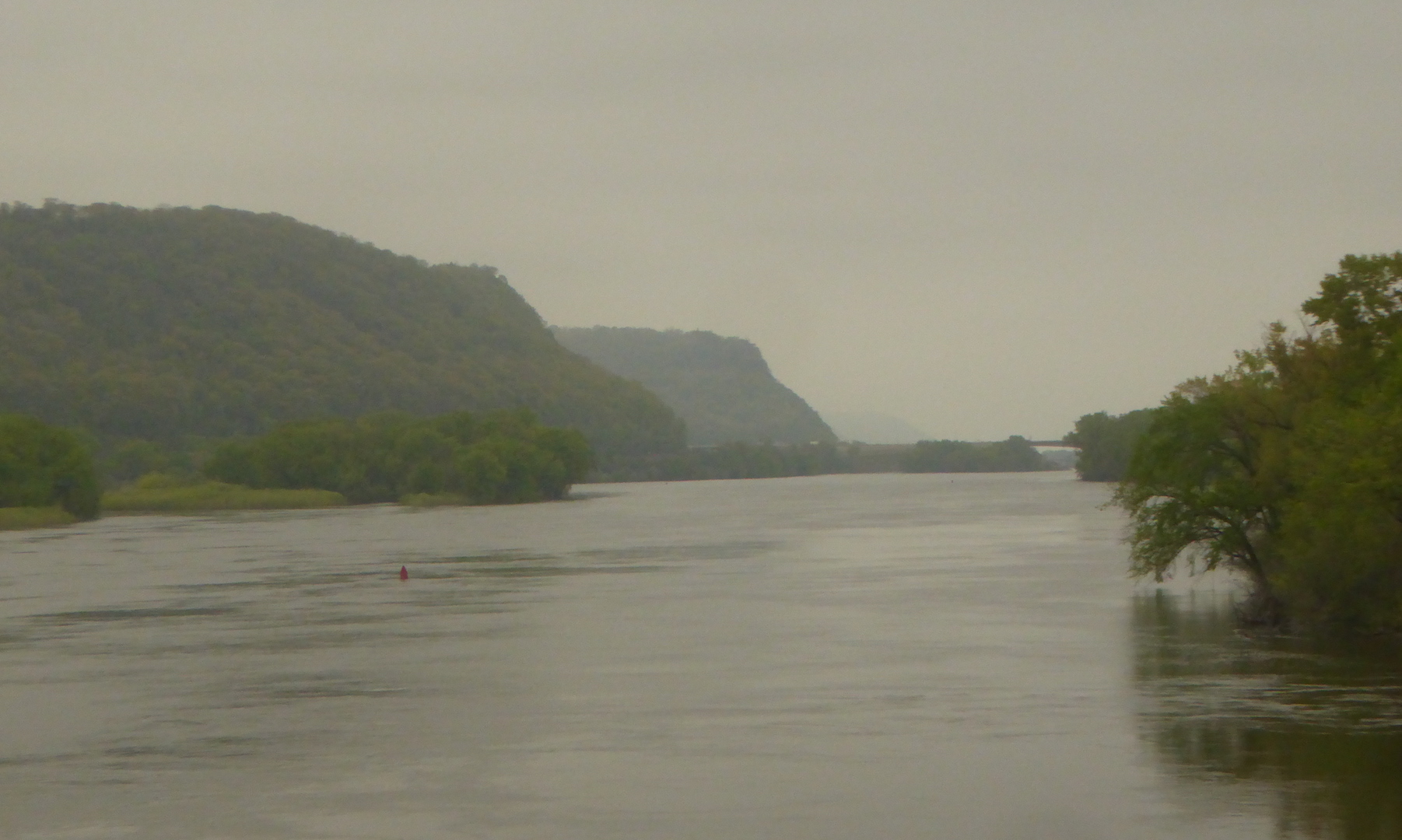
…and the floodplain forest drowned in water.

flooded marsh bordered by forest
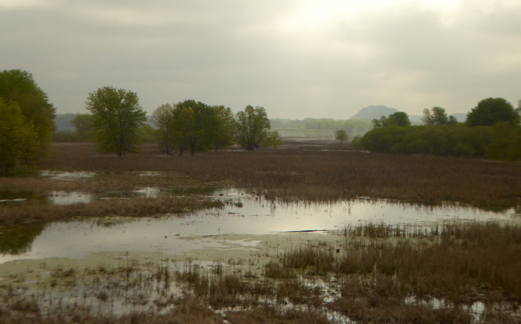
The train crossed the Mississippi one final time at La Crosse, WI. Heading upland into central Wisconsin, jack pine (Pinus banksiana) appeared on sandy soil. This species is essentially the eastern equivalent of lodgepole pine and the two hybridize where their ranges overlap. Like it’s western sibling, jack pine is well adapted to fire, often holding serotinous cones on its branches for years before fire melts the cones’ resin and releases its seeds.

forest and rolling hills

You’ll have to take my word for it: Those are jack pines in the middle ground.

East of Madison, the landscape quickly became suburbanized then urbanized as we approached Milwaukee. We never seemed far from Lake Michigan, but I only caught a couple of glimpses of the great lake.

I transferred trains in Chicago for the final leg of the journey to Pittsburgh. Through Gary, Indiana, the land remained very urban with the exception of the forested dunes on the inland side of Indiana Dunes National Lakeshore. Night hid most of Indiana and all of Ohio. After a rough night of sleep, I arrived in Pittsburgh at 5 a.m.

There’s a lot of sitting on a railroad trip from Puget Sound in Washington to Pittsburgh and I felt very antsy, so I capped off my first day in town with a fifty-mile bike ride on the Great Allegheny Passage. The exercise and change of pace was welcome, but so was watching the landscape through the train window.

Cross Country By Rail Day One

Since I live across the continent from most of my family, I’m obliged to return east periodically. During my time in Alaska I flew almost exclusively on this migration, primarily because it was the most expedient way to get to where I needed to go. If I have the time though, I’d rather travel by other means. With some time to spare before my summer job at North Cascades National Park begins, I traveled by train from Bellingham, WA to Pittsburgh, PA.

I’m not a train fanatic, but the railroad allows me see a good deal of the landscape and perhaps some wildlife without the risks involved with highway driving. On the train, I could sit in my seat and gaze eagerly out the window to watch the landscape pass by. My first wildlife sighting began even before I stepped onboard.

While waiting for the train in Bellingham, I watched a crow land in a parking lot with something large in its bill. This was nothing unusual as crows are fond of scavenging garbage, but as soon as the crow landed I noticed its prize was moving. I hurriedly yanked my binoculars out of my daypack to get a better look.

The crow had caught and was killing a semi-neonate cottontail rabbit. After it dispatched and partly consumed its prey, the crow returned to catch and kill another kit. With more than it could eat, the crow cached pieces of the rabbits in nearby trees and shrubs. It was a fairly gruesome death for the rabbits, but crows gotta eat too.

view through fence of crow

Life and death struggles happen even in city parking lots.

Once onboard the train and traveling from Bellingham to Seattle, I witnessed no more battles between predator and prey. The rest of the ride, in fact, was quite pleasant. The Cascade route provided plenty of views of Puget Sound, where many birds lounged and fished in the water near shore. I enjoyed glimpses of birds like blue herons, cormorants, gulls, more crows, and brant.

view of water with clouds and boulder in middle foreground

Puget Sound is a glacially carved trough. The boulder in the middle foreground is likely a glacial erratic.

Where I couldn’t see the water, the route often passed through rich farmland where large rivers like the Skagit and Snohomish have deposited broad floodplains.

Fallow farm fields and farmhouse
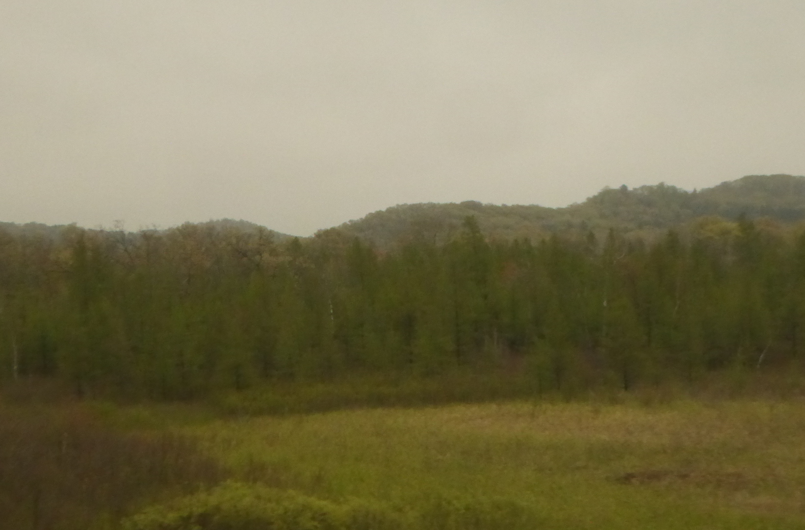
After transferring to the Empire Builder in Seattle, my route reversed north before it turned east up the Snohomish and Skykomish rivers valleys toward the Cascade Mountains, which were quite showy under clear skies.

Farmland with view of tall snowcapped mountains in background
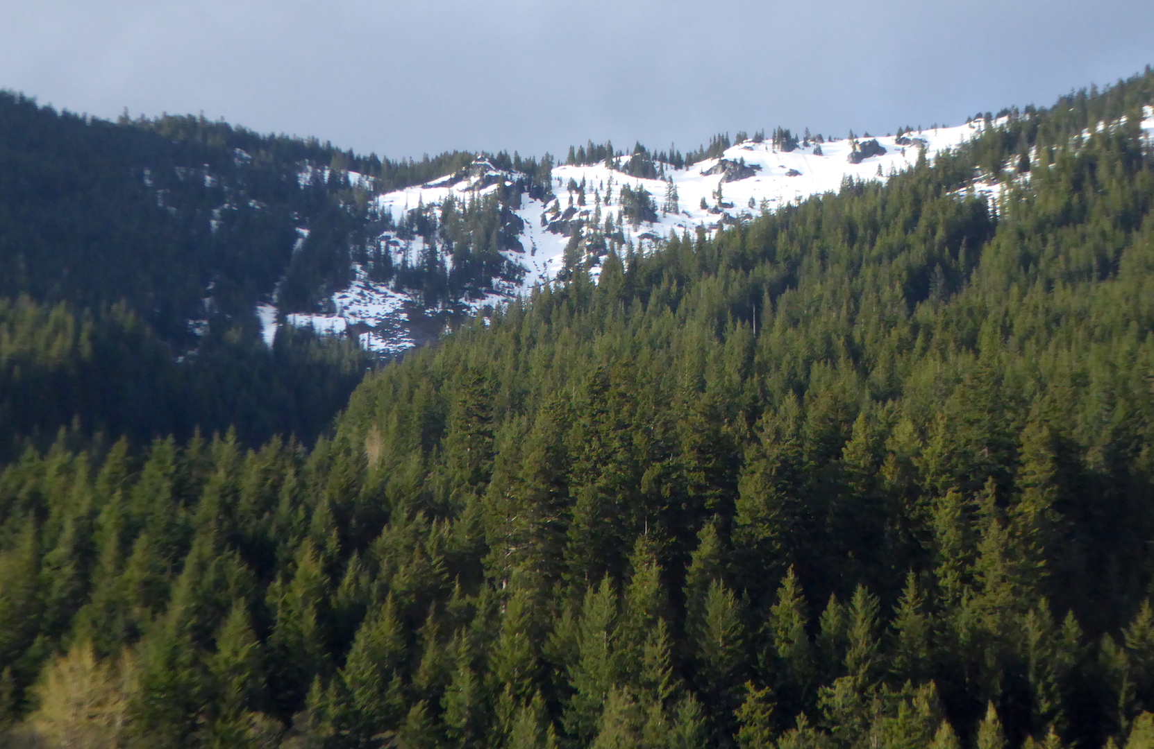
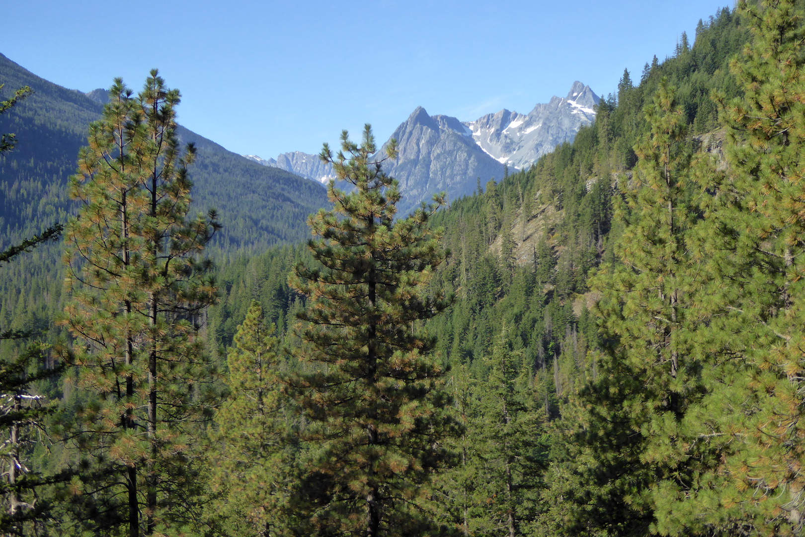
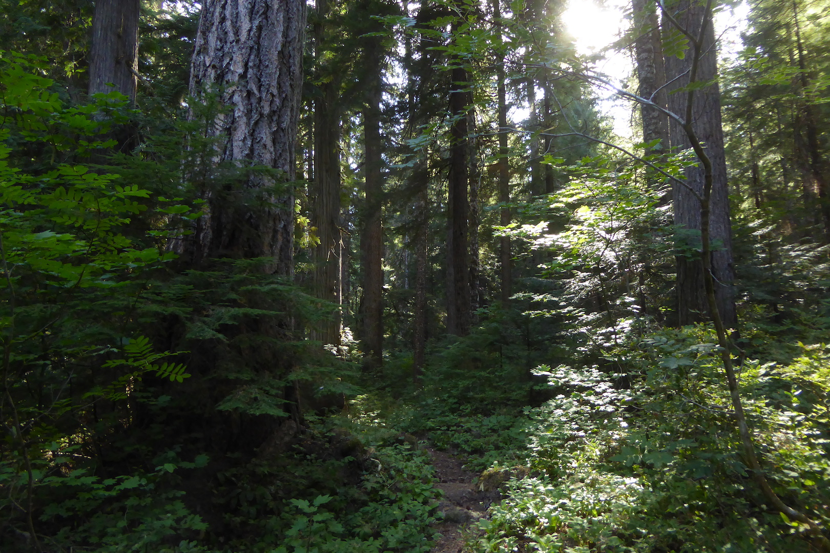
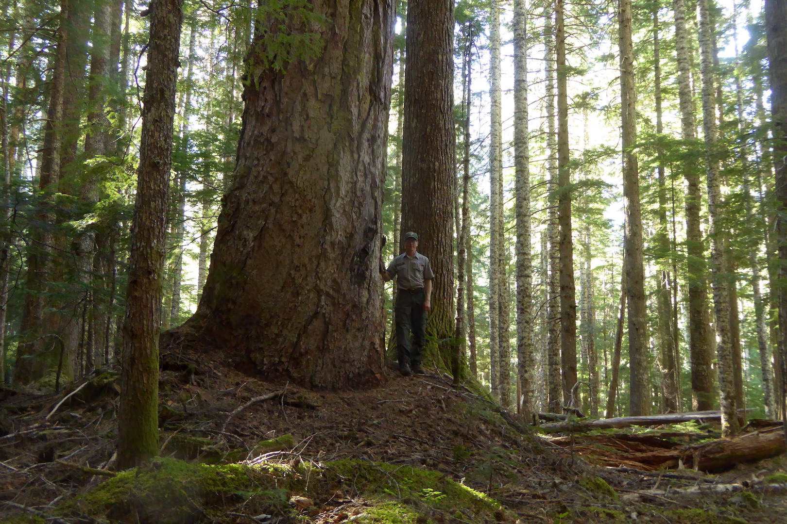
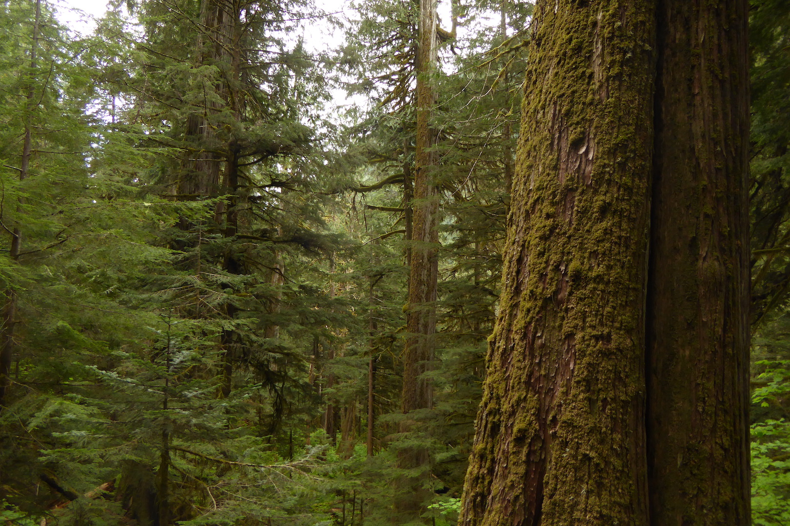
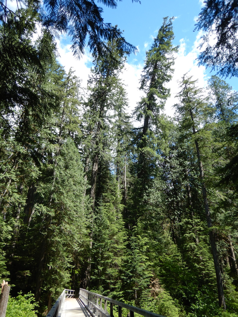
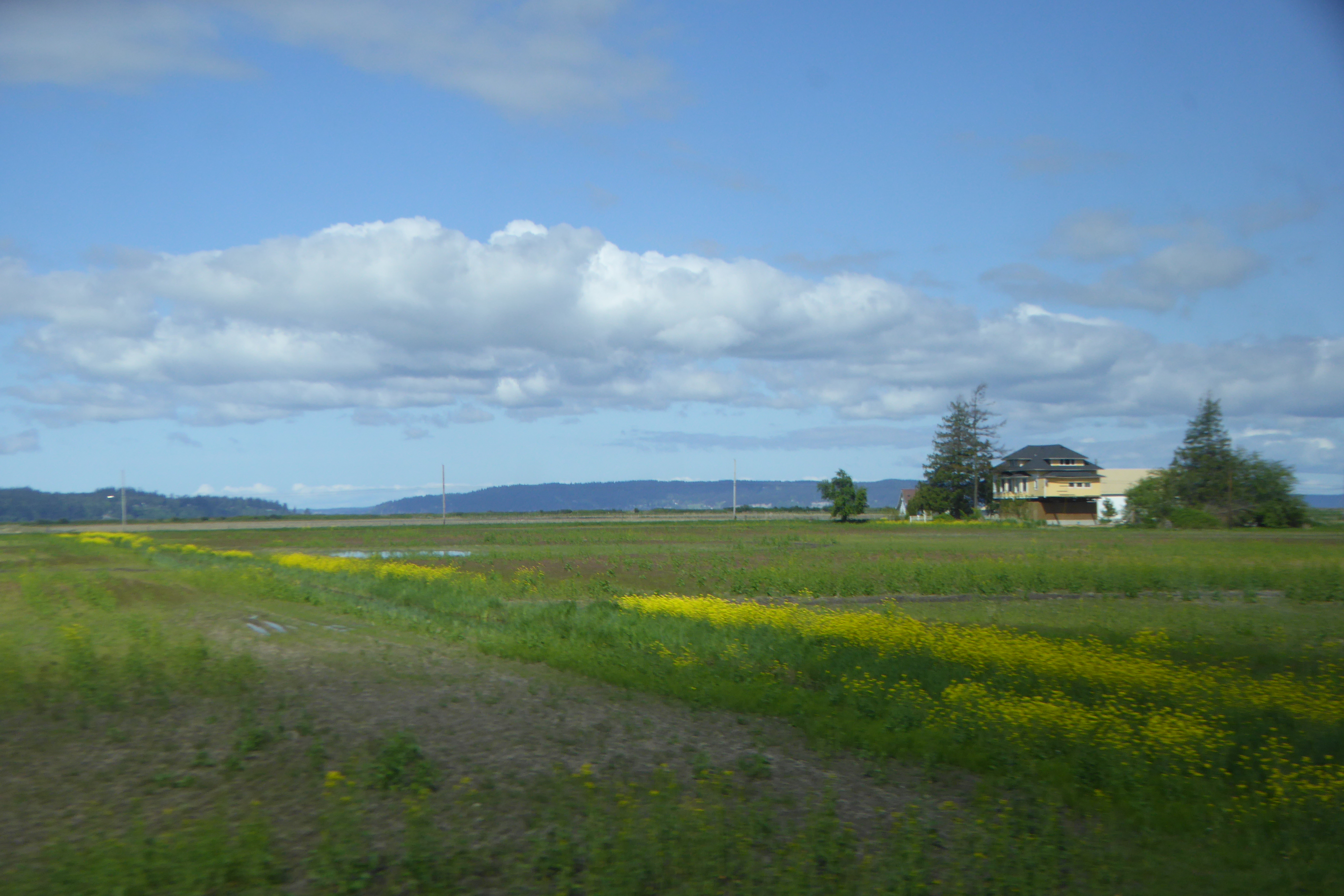
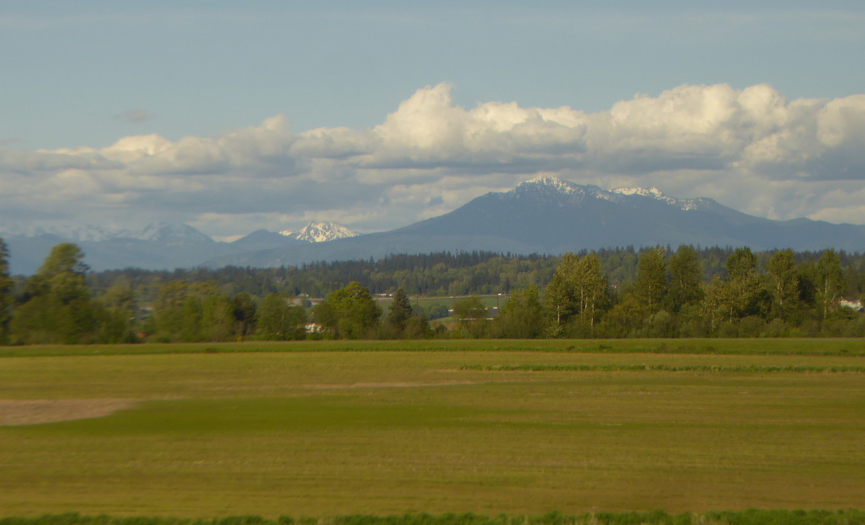
This section of rail, besides letting me enjoy scenes of lush forest, provided a conspicuous example of habitat changes due to climate, particularly the Cascades’ rain shadow effect. When moisture-laden storms from the Pacific reach the Cascades, the rising air cools and drops a considerable amount of its moisture on the west side of the mountains. Far less remains to wet the mountains’ eastern slopes.

Skykomish, WA at 900 feet in elevation, for example, receives a whopping 91 inches of precipitation per year. The forests of this valley, except where recently clear-cut, are lush and thick and moss hangs prominently from stout big leaf maple branches.

Forests on snow-covered mountainside

Lush forest cloak the western slopes of the Cascades.


Around 2900 feet in elevation, the train entered an eight-mile long tunnel and passed underneath the Cascade crest. When the train exited the tunnel on the east side of the Cascades, the forest was noticeably different. Trees were sparser and included a higher proportion of drought tolerant species like ponderosa pine.

Sparsely snow covered mountain

Many mountainsides east of the Cascade crest are noticeably drier and less forested than equivalent areas to the west.

As the train descended the Wenatchee River valley to the Columbia River, the climate became drier and drier. Soon enough, sagebrush and bitterbrush mixed with widely scattered trees as we approached Wenatchee around sunset. About 780 feet in elevation, Wenatchee receives only 11 inches of annual precipitation. Along the Columbia River, as night fell, the route crossed a dramatically drier environment compared to the lush forests not far to the west. I could see few trees except those planted by people.

Darkness concealed central and eastern Washington’s landscape, which I knew would happen but was still disappointing because I missed viewing any of the unique and spectacular channeled scablands. I went to bed looking forward to more sightseeing.

In a future post, I’ll describe days two and three on the train where the land continued to offer more reasons to be glued to the window.

Joyce Kilmer Memorial Forest

Old growth forests in the eastern U.S were formidable barriers to colonization, places to be subdued and civilized, to fuel industrialization, not preserved. Today, we view old growth forests differently. They give refuge to rare species, support diverse ecological communities, and often provide the conditions necessary for trees to attain their maximum size and age. While visiting Joyce Kilmer Memorial Forest in the Nantahala National Forest, I thought about why these forests remain so important despite the some negative changes they’ve recently undergone.

Prior to European colonization, forests in the eastern U.S. formed a mosaic of complex habitats, owing to natural disturbance regimes and the influences of American Indian nations. An unbroken old growth canopy stretching for the Atlantic Ocean to the Mississippi River is mythical and never existed. Lightning-caused fires, human-caused fires, tornadoes, ice storms, hurricanes, and insects imparted constant change. Some forests were likely disturbed every few decades at minimum, while others grew undisturbed for hundreds of years.

Joyce Kilmer Memorial Forest is one of those places that grew relatively undisturbed. It is a pocket of old growth tucked away in the rugged mountains of western North Carolina. While many impressive trees grow here, the most impressive and largest trees are Liriodendron tulipifera, the tulip tree. Also known as tulip-poplar or yellow-poplar, tulip trees grow fast and tall (the tallest individual tree in the eastern U.S. is currently a tulip tree) and are easy to identify in summer because of their distinctively-shaped leaves.

No live leaves hung from the tulip trees on the overcast, early January day when I visited, but this allowed me to contemplate the trees’ full scale. The tulip trees at Joyce Kilmer are the largest of the species that I’ve ever seen. Many exceed 15 feet in circumference at chest height, approach 150 feet tall, and are several hundred years old.

person standing at base of large tree

I was impressed by complex crowns of the largest trees. Most trees in the eastern U.S. today don’t attain such large, complex crowns. They simply aren’t allowed to grow long enough. Many of the crowns were scarred and broken by centuries of battles with wind, ice, and other forces that try to break the tree down.

crown of large tulip tree

Since tulip poplars are intolerant of shade, the largest tulip trees at Joyce Kilmer likely sprouted and began to dominate the canopy after a major disturbance, like a fire or tornado, swept through the area several hundred years ago. The now towering tulip trees effectively shade the understory, suppressing the germination and growth of their offspring. Instead of young tulip trees, the understory of the forest was filled with more shade tolerant species like sugar maple and American beech. In a couple of hundred years future visitors may see giant sugar maples growing over the decaying remnants of tulip poplars.

Despite the beauty and stateliness of the trees at Joyce Kilmer, this isn’t forest primeval. No such thing exists in the eastern U.S. Evidence of significant, human-caused changes are easy to find here. Until recently, Joyce Kilmer Memorial Forest contained many large eastern hemlock trees. Now, however, almost every hemlock tree in the grove has been killed by hemlock woolly adelgid, a non-native, invasive insect that basically sucks starch out of the hemlock. I found only a handful of live hemlocks in the grove, and none were particularly large.

dead hemlock trees

These hemlocks were killed by hemlock woolly adelgid.

Disturbed, young forests are easy to find. Joyce Kilmer Memorial Forest is different. It represents the forests which used to exist and provides examples of the threats forests face today. The tulip trees at Joyce Kilmer are massive, dwarfing almost everything there, especially me. I walked under the trees in wonder even though this place is very changed. I can’t pretend this is the same forest with the same species composition as it was even a hundred years ago. Among other changes, the hemlocks are dead or dying, American chestnuts are functionally extinct, and passenger pigeons no longer darken the skies. Still, I don’t want to demean this place as less special because it’s not what it once was. On the contrary, it is more special because forests like this are so rare.

person standing at base of large tree

Sometimes Individuals Lose While Species Win

pine cones on the ground

Many seeds in these cones wait to be released.

Fire is a boon to some species and a detriment to others. When fire sweeps across the landscape there are winners and losers.The cones of lodgepole pine (Pinus contorta) demonstrate adaptations that allow the species to survive potentially catastrophic changes.

Serotiny is an adaptation of some plants to release seeds in response to an environmental trigger. Serotiny is expressed in lodgepole pine through its cones. In fire prone habitats, lodgepole pine cones are glued shut by resin. Heat from fires melts the resin allowing the cone scales to separate and release seeds. Since it’s not safe to watch a wildfire burn through lodgepole pines, I placed a tightly sealed serotinous cone from a lodgepole pine in a toaster oven to watch how it responded to temperature changes.

The cone scales began to expand noticeably when the temperature reached about 50˚C (122˚F).  According to the U.S. Forest Service, more precise lab experiments have found the resinous bonds between the cone scales begin to break between 45˚C and 60˚C, so serotinous cones lying at or near the soil surface can also open with these ground temperatures. If this cone was kissed by fire its scales would have expanded and allowed the seed to be slowly released. (I let the temperature in the oven rise to over 200˚C (400˚F) just because I felt like watching the scales fully expand.) Serotinous cones collect on the ground or on tree branches for many years. The seeds under the scales lie in a state of dormancy, waiting for the opportunity to sprout.

Not all stands of lodgepole pines have serotinous cones. Serotinous cones are not common in eastern Oregon, rare in coastal populations, absent in some fire prone habitats like the Sierra Nevada, and “many stands in the Rockies have less than 50 percent serotinous-cone trees.” Wherever it grows through, lodgepole pine thrives in full sun. Its seeds sprout best in or on bare mineral soil and disturbed duff free of competing vegetation—the exact conditions many fires create.

small pine trees under taller, dead-standing trees

After huge wildfires burned large swaths of Yellowstone National Park in 1988, lodgepole pine sprouted back in earnest. This NPS photo was taken ten years after the ’88 fires. The lodgepole trees are much larger now.

Serotiny in lodgepole pine makes large quantities of seeds available to germinate following a fire. In many cases, especially regarding lodgepole pines, fire may be an enemy to the individual, but not to the species.

The Best Thing You’ll Read About Bark Today (If You Don’t Read Anything Else about Bark)

Black bear claw marks on quaking aspen, Beaver Ponds Trail.JPG

This post is about bark.

I know what you’re thinking. “Bark—an enthralling topic!” I couldn’t agree more, but bark is often overlooked and ignored by most people. Yet bark records many events in a tree’s history.

Thin and smooth barked trees like quaking aspen (Populus tremuloides) are especially good at recording animal sign. Aspen is the most widely distributed native tree in North America. Its bark becomes thick and furrowed only on old trees, and usually only near the ground. Most of the time aspen bark is smooth, colored white to gray (even greenish on young trees) with dark chevrons where self-pruned branches fell to the ground.

Since aspen bark is thin-skinned, it’s easily scarred. Along hiking trails, you’ll commonly find names and initials carved into it. (Don’t do this. No one cares if you were there with your “true love,” who you probably dumped the week after, and it opens the tree to possible infection.) Aspen bark records more than human impulses though. In bear country, you can often find evidence of bears climbing the trees.

p1230573

Black bears have five toes each equipped with claws superbly designed for climbing. Scars on trees from climbing bears usually come in sets of five.

Black bears are particularly adept at climbing trees. Their strength and relatively short, sharply curved claws help them gain purchase even on smooth barked trees like aspen. If I’m in an area where black bears live, I almost always look for bear claw marks on aspen. In the Stehekin Valley, bear claw marks are easily seen on aspen along the Stehekin River Trail and Agnes Gorge Trail.

The claw marks represent a moment in time. Under what circumstances were they made? Was a bear startled by a person? Another bear? Was it simply playing or exploring? Black bears are omnivorous, but I have read no records or seen any signs of them eating any part of aspen trees, so they probably weren’t climbing the tree for food. In the eastern U.S. though, black bears often climb another smooth barked tree, American beech (Fagus grandifolia), to feast on beechnuts.

The next time you find an aspen, take a closer look at its bark. Bark isn’t as static as its outward appearance suggests. You might find a story there.

p1230575