If you poop in the woods, does a ranger clean it up?

A recent article in The Guardian (‘Worst work in the world’: US park rangers grapple with tide of human waste) got me thinking. There’s a dirty side to your national park experience and it doesn’t get talked about enough.

The Guardian article is short and worth reading (h/t to blog reader Rebecca F. for alerting me to it). It focuses on Rocky Mountain National Park’s effort to deal with human waste in alpine areas where the volume and lack of decomposition creates health hazards and pollutes water. Along the route to Longs Peak in Rocky, the National Park Service installed new toilets that separate urine from solids and, purportedly, lessen the workload and hazards for rangers. It’s a big and expensive effort to contain something we all do naturally.

While the ranger life is often romanticized in various ways, that friendly park ranger you meet on the trail could very well have been on their way to checking a seldom maintained privy or have just finished cleaning an unpleasant mess from the trailside. Rarely do we give much thought to what happens after we flush a toilet or use an outhouse in a park.  With visitation in many national parks continuing to increase, more and more seemingly remote reaches of parks experience significant human waste issues.

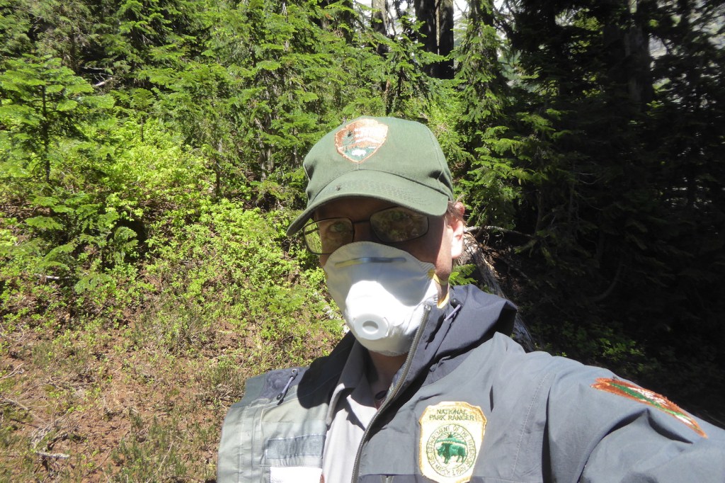
For most of my adult life, I worked as a park ranger at several different national parks. And, if you’re a ranger you are bound to deal with poop at some point, sometimes often. I’ll spare you the details of my dirtiest national park human waste story (pro tip: avoid the handrails in Carlsbad Cavern). Yet, I want to take the opportunity to discuss what a backcountry ranger might deal with during their day on a trail. Take a short journey with me to North Cascades National Park.

view of mountain scenery with craggy peaks and snowfields.

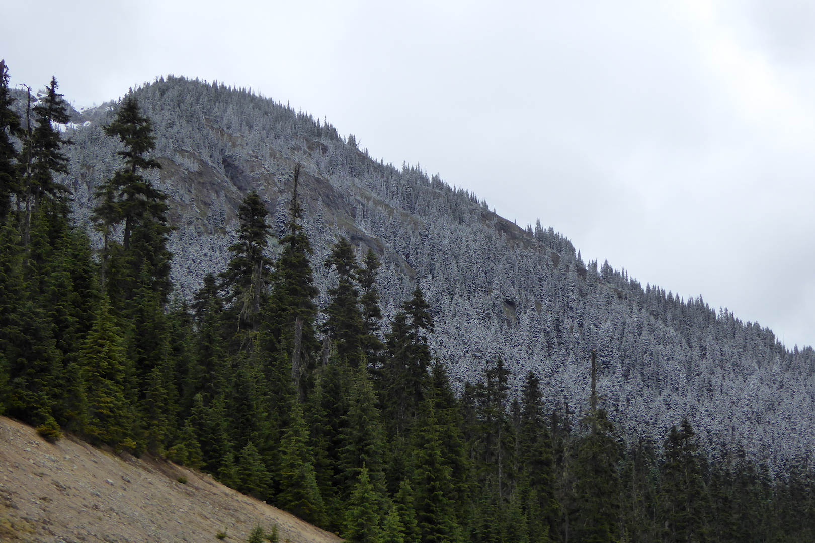
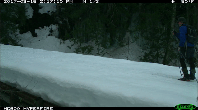
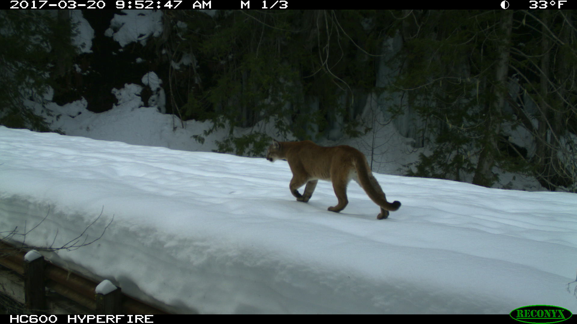
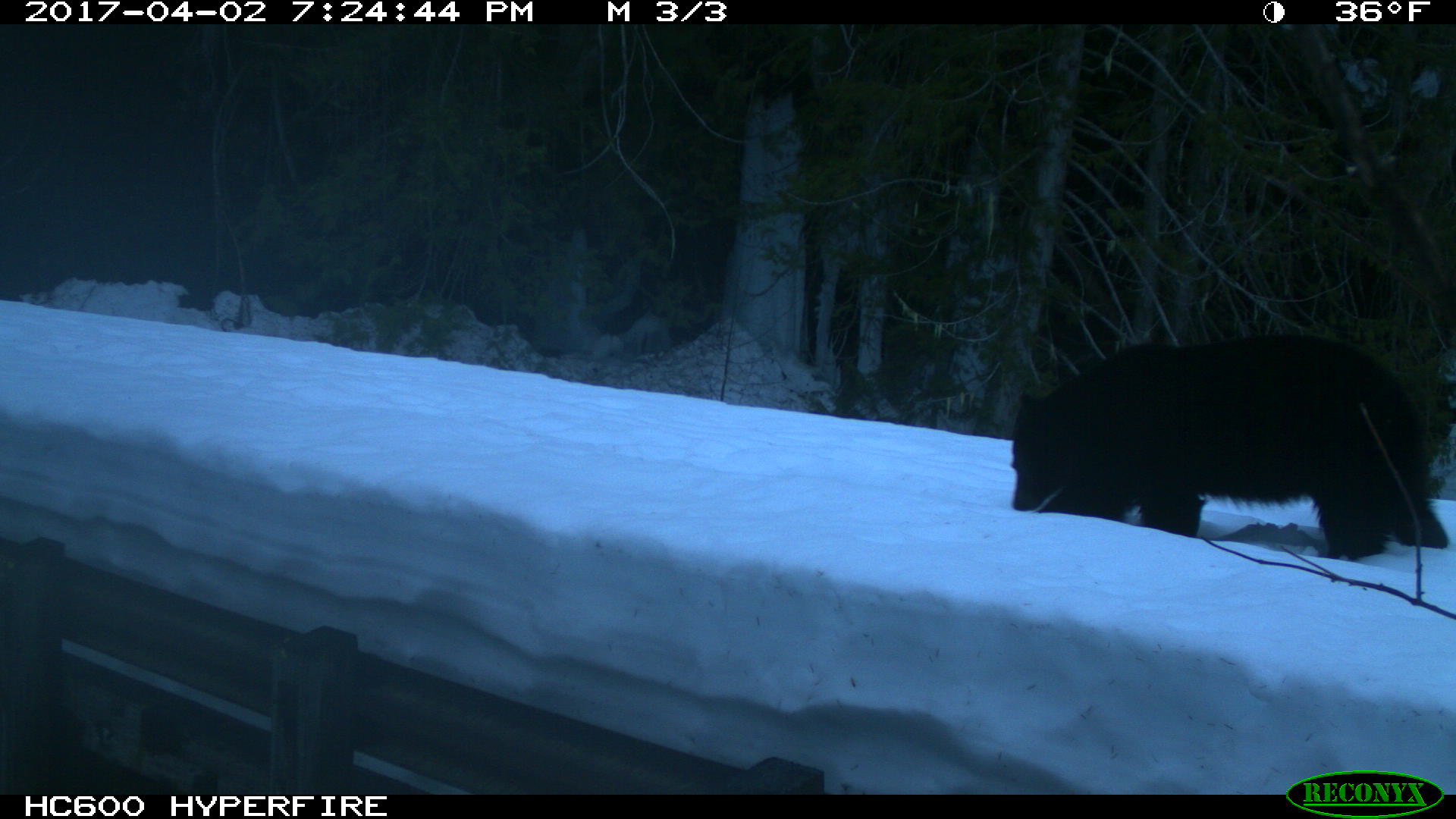
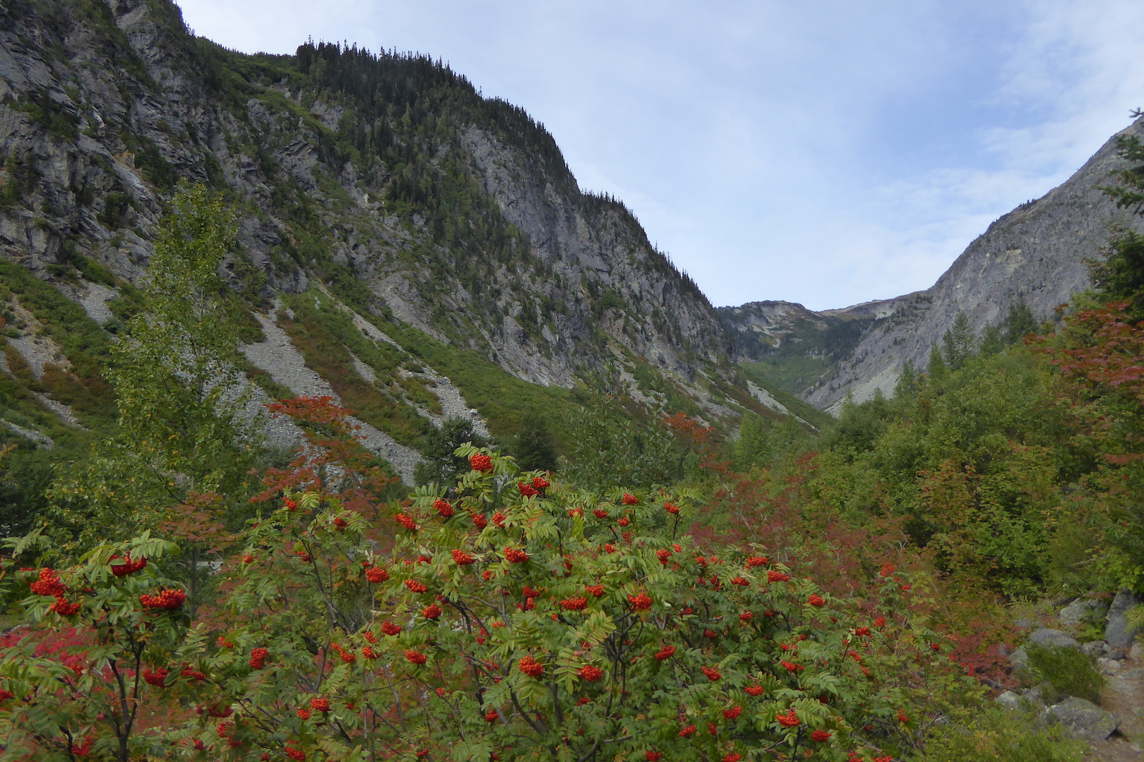
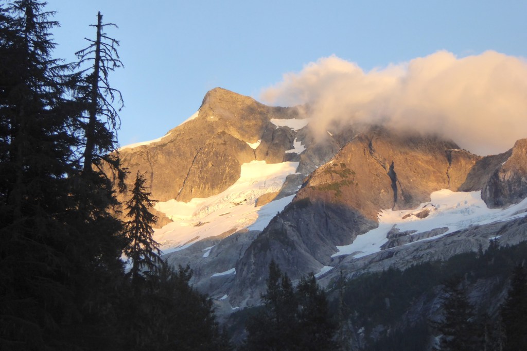
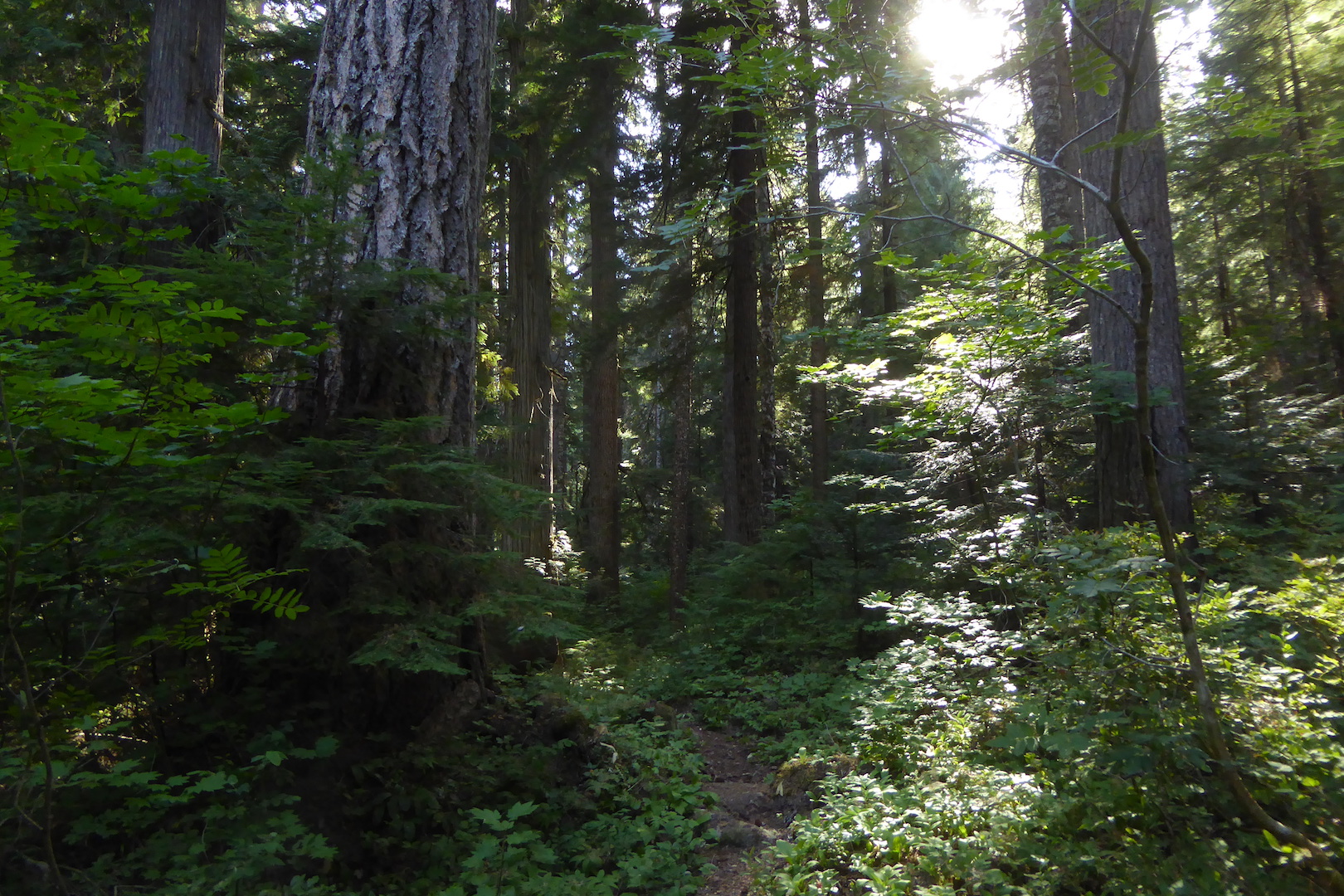
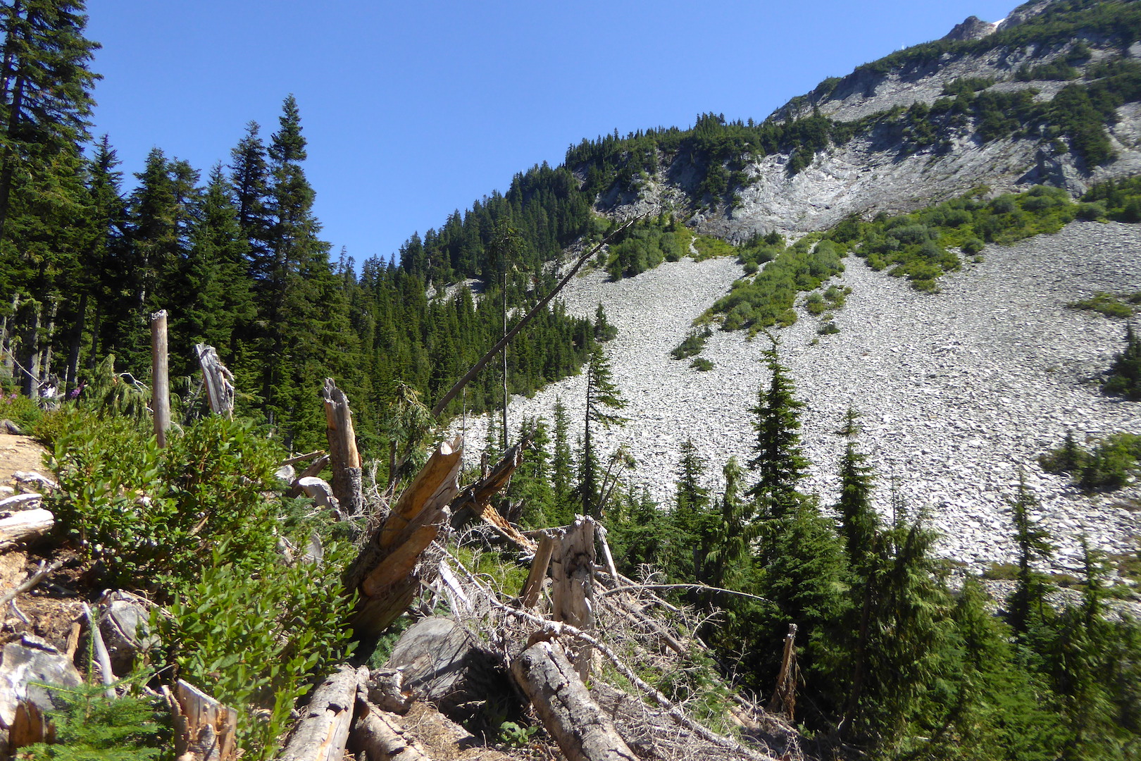
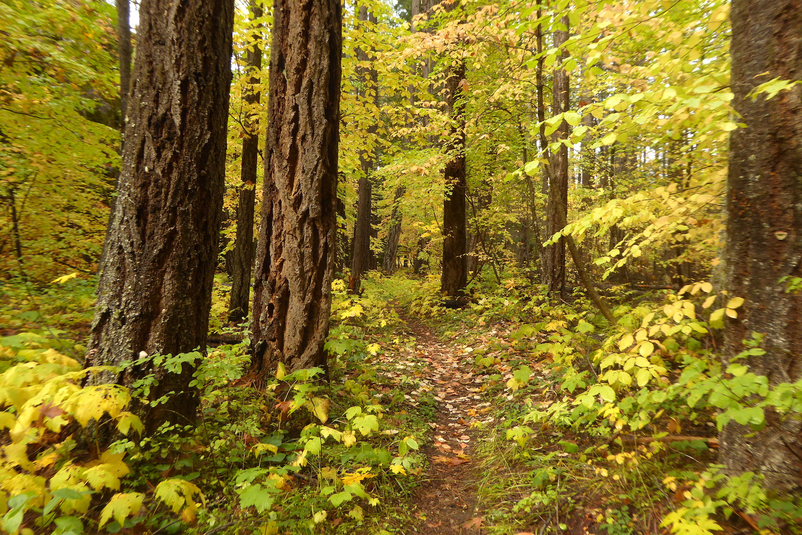
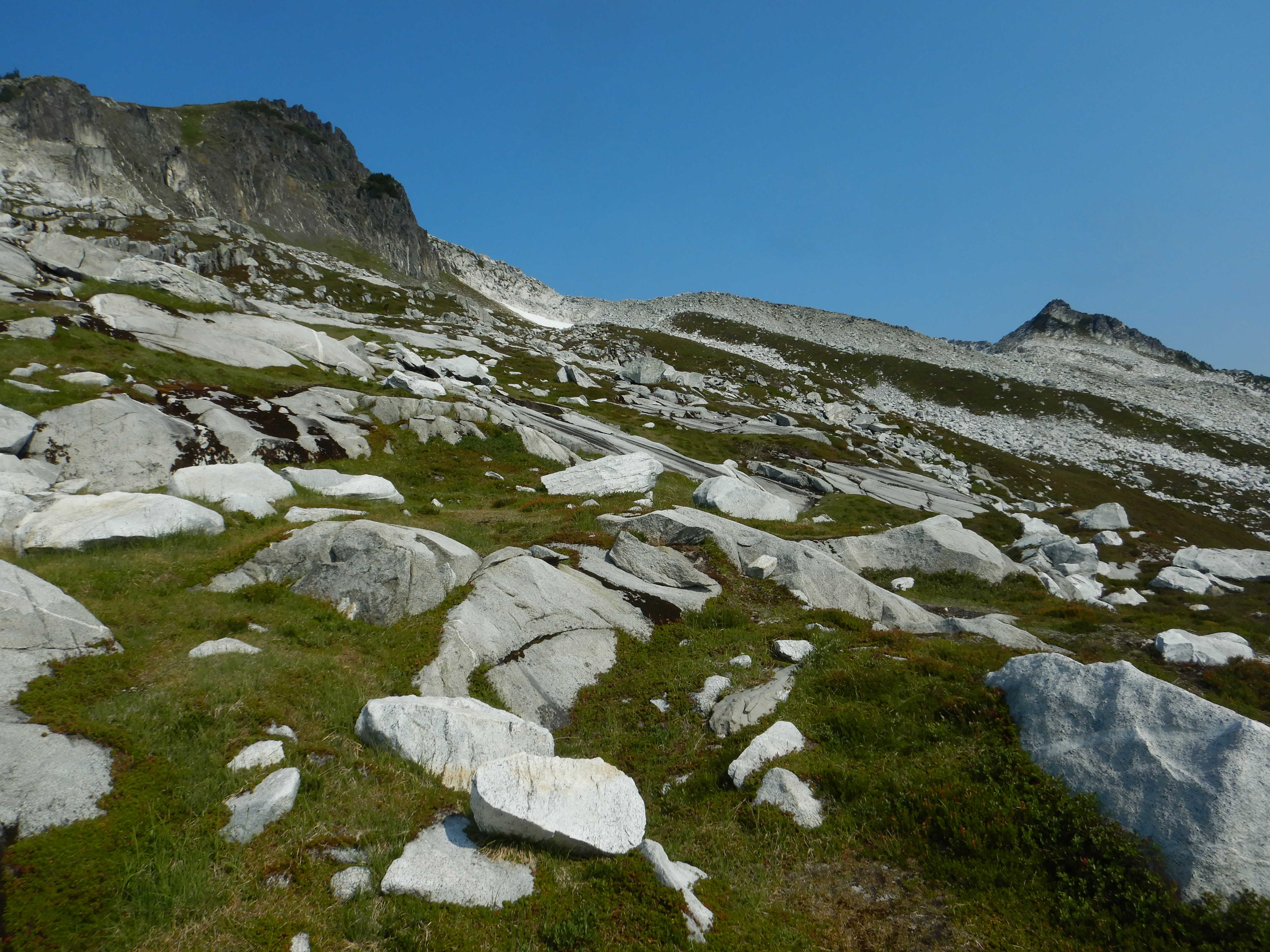
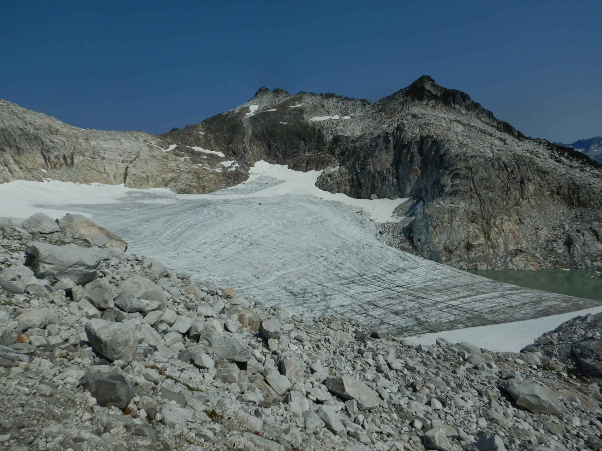
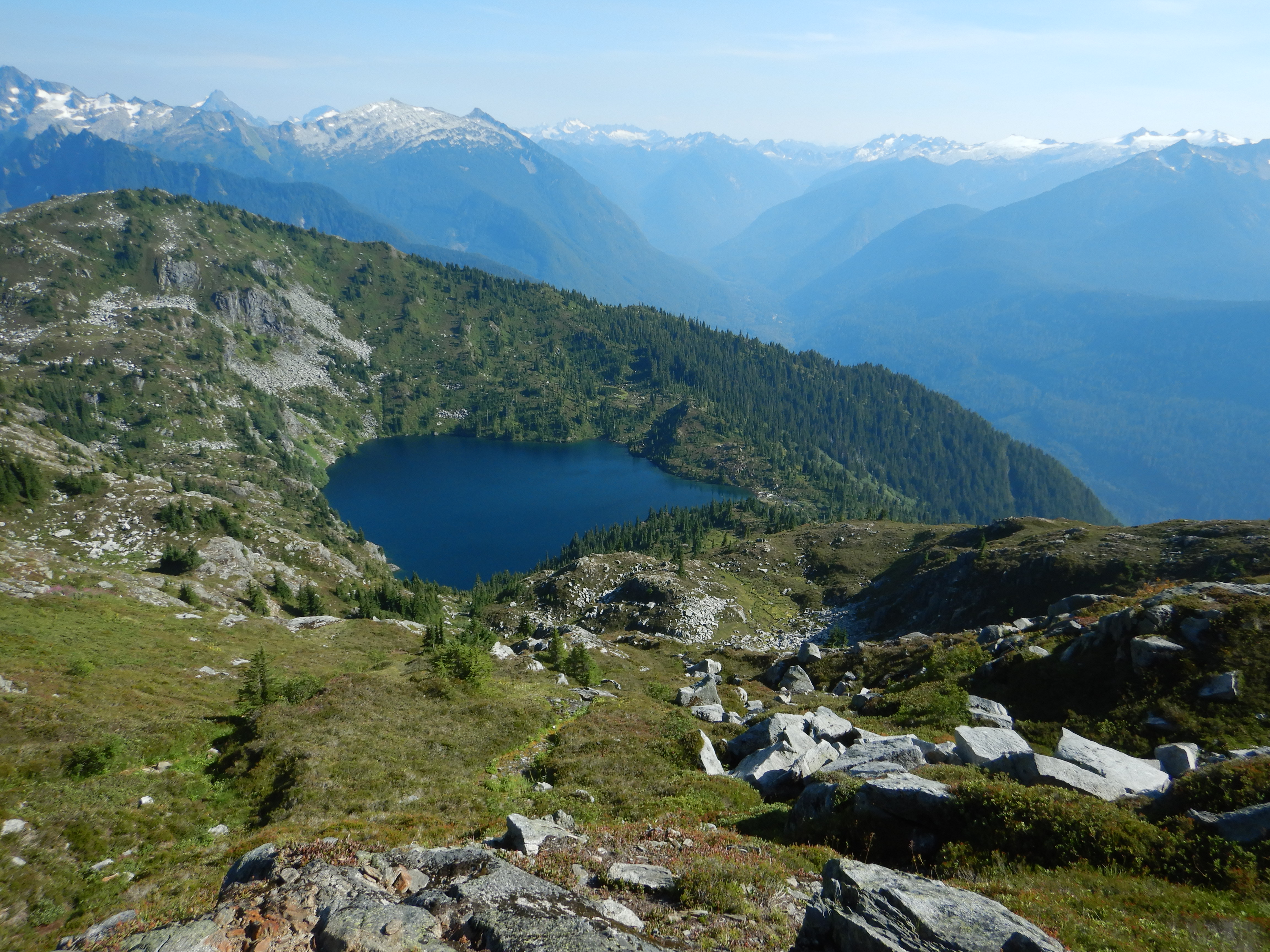
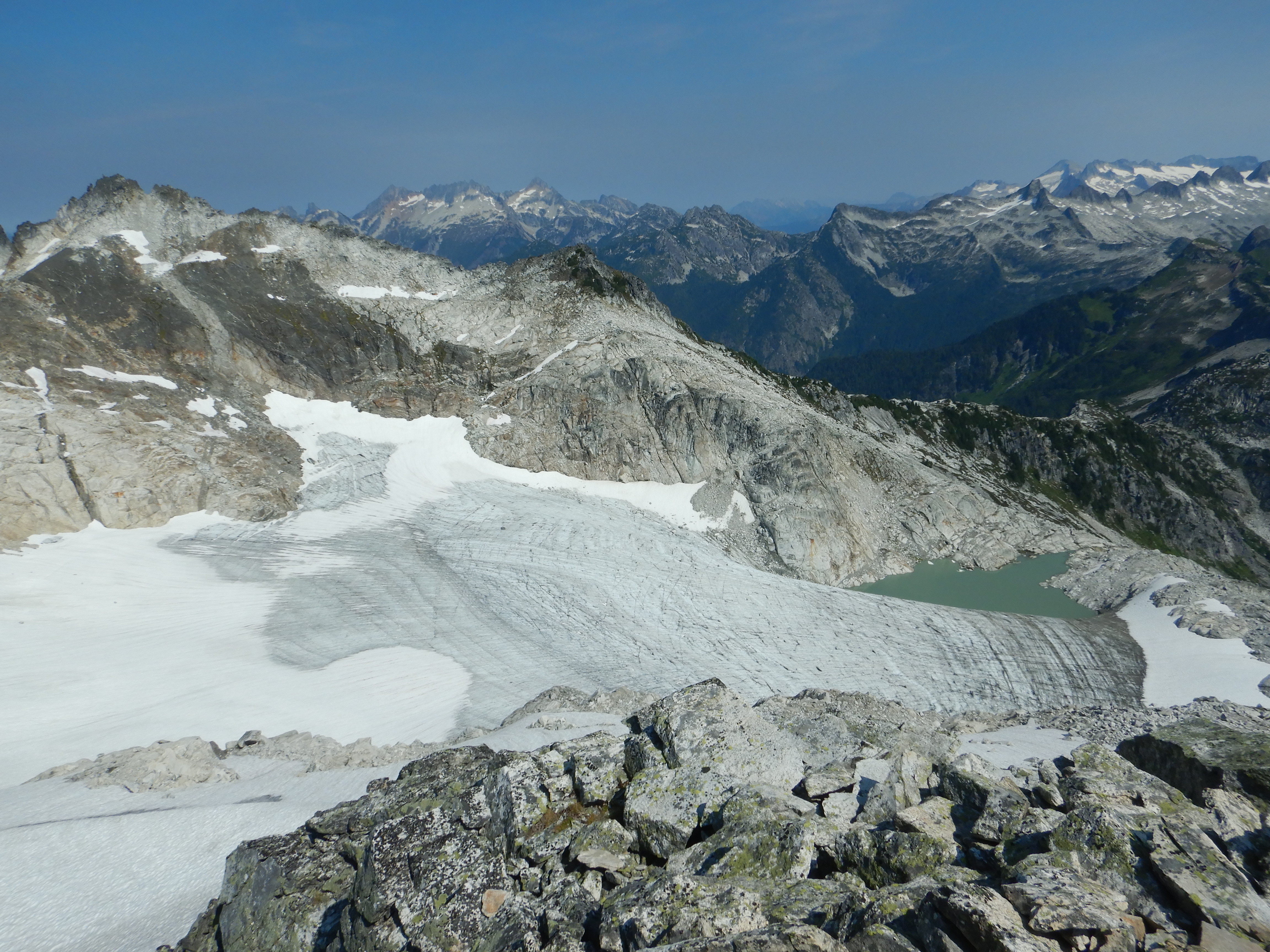
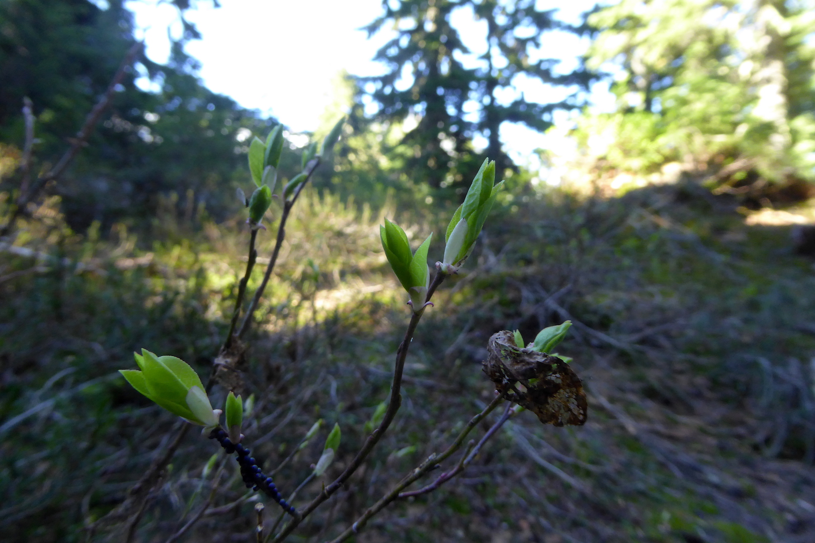
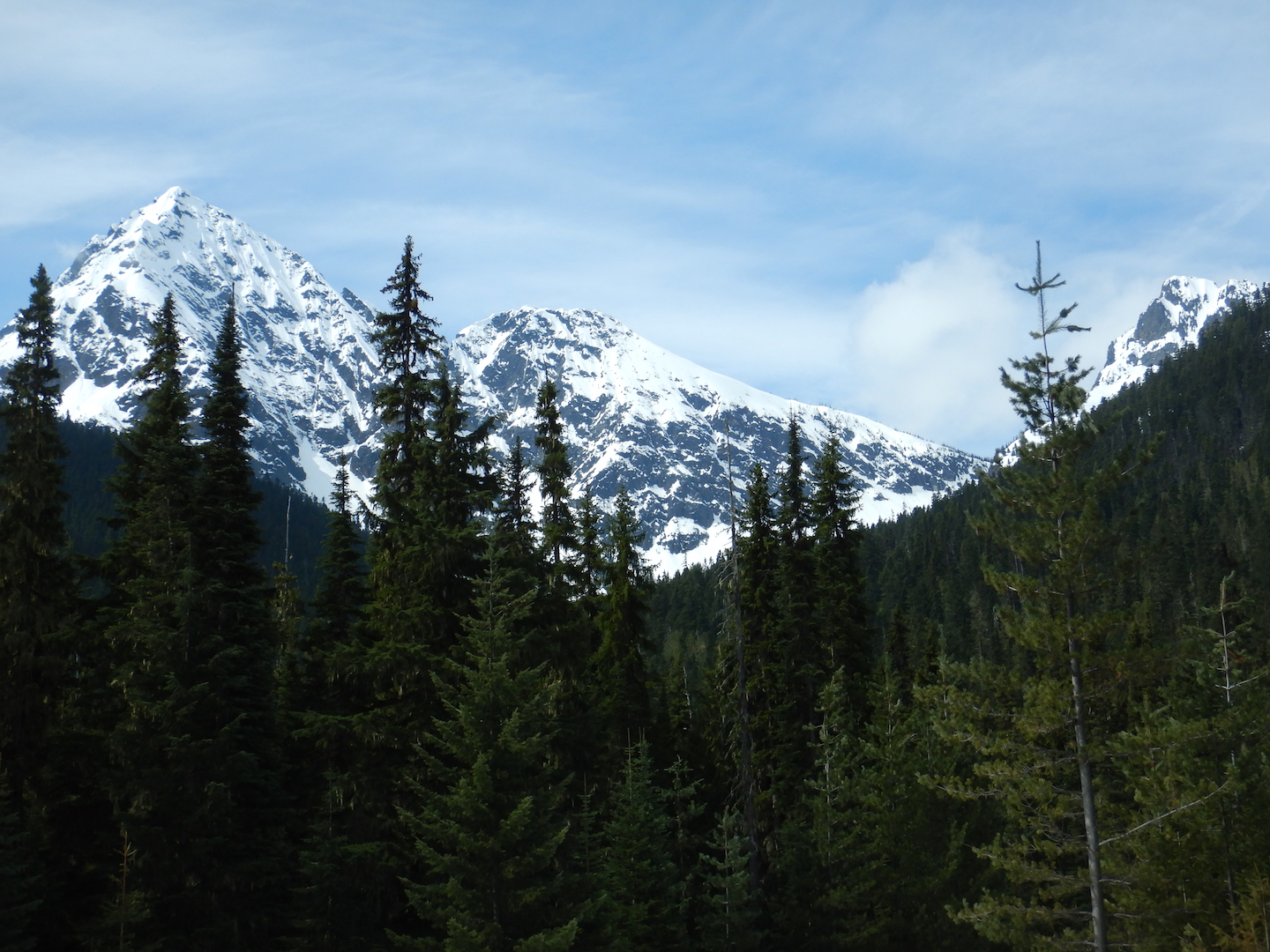
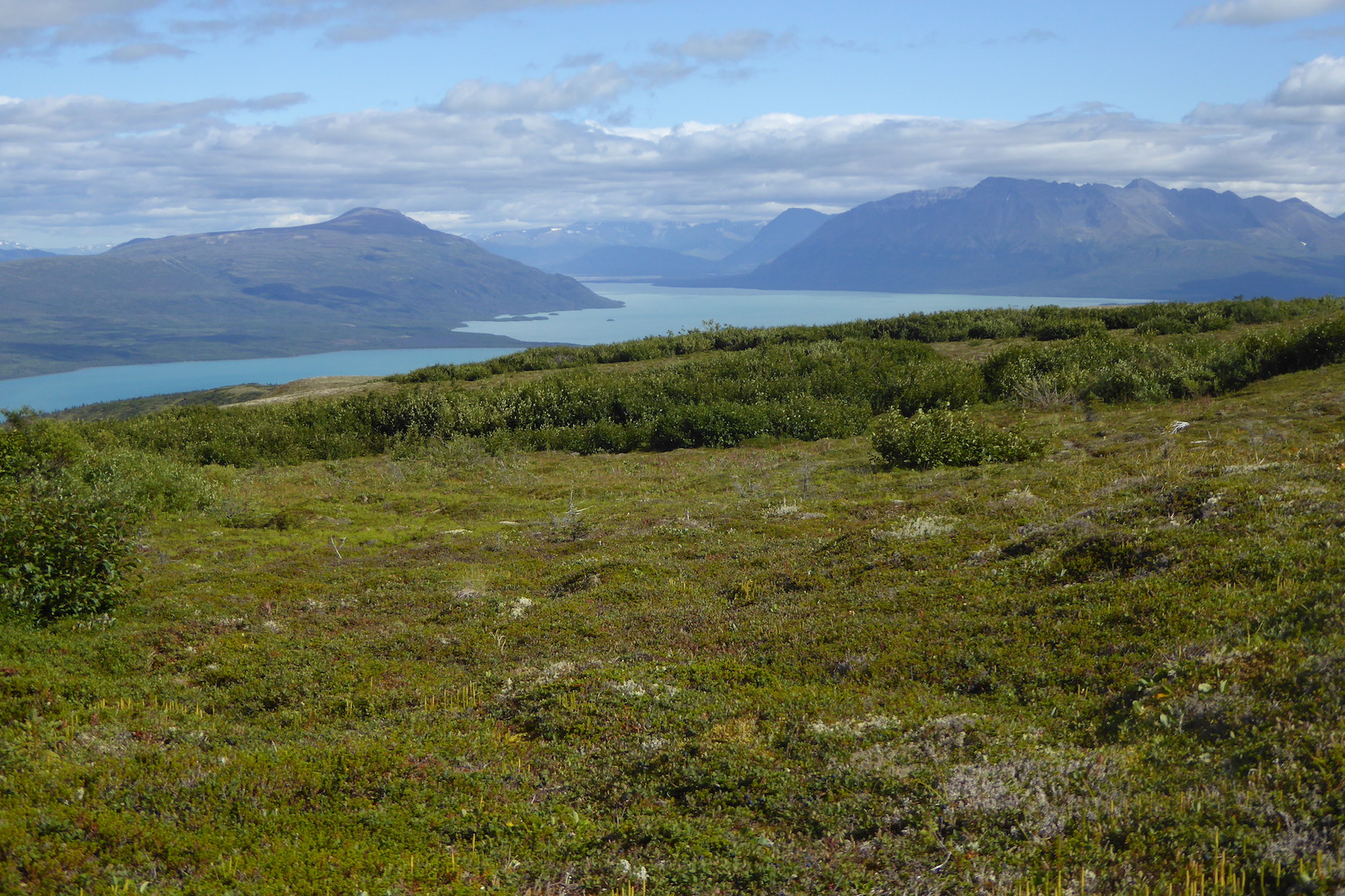
In 2017, I was fortunate enough to work in North Cascades, one of the more rugged national parks in the contiguous 48 states. Once every two weeks, I was assigned a three to five night backpacking route through the park and adjacent national recreation areas to assess trail and campsite conditions, make minor trail repairs, check to see that people complied with park rules, and generally ensure that people were having a good experience. I enjoyed those trips, especially the evenings when work was finished and I could relax at a secluded campsite looking at trees and watching for wildlife.

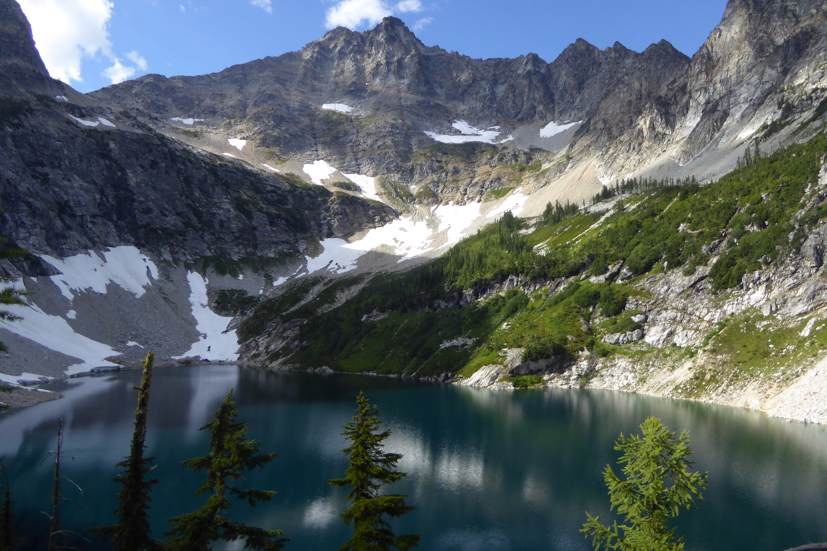
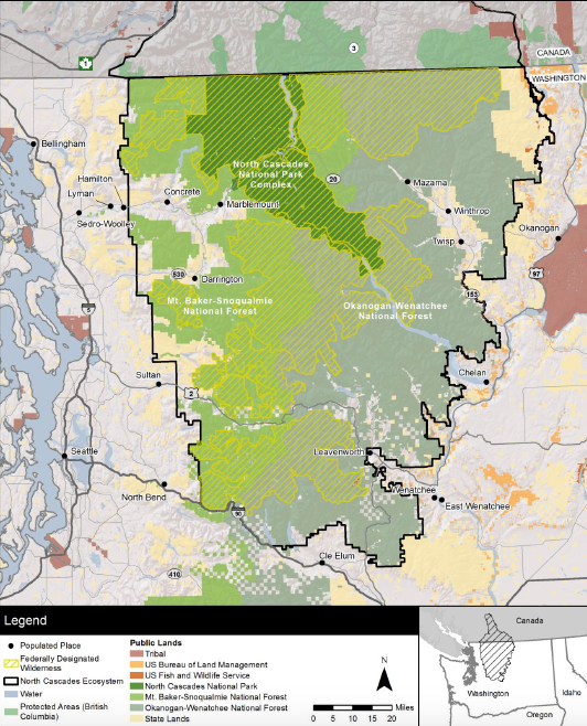
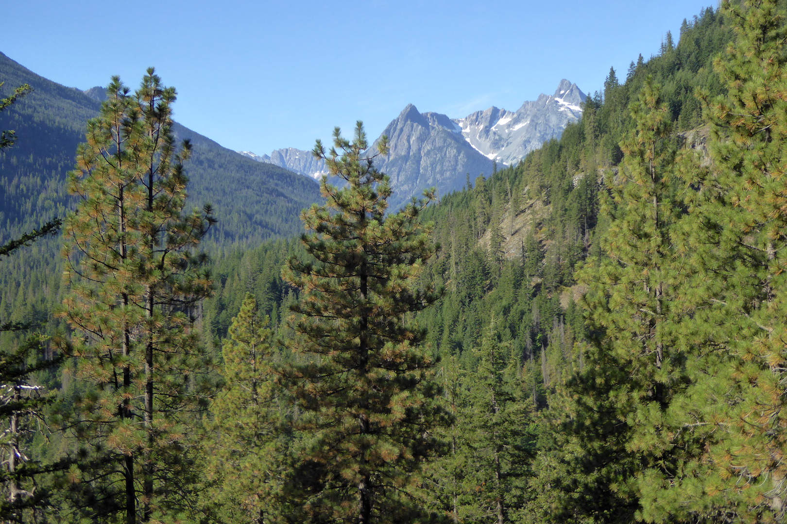
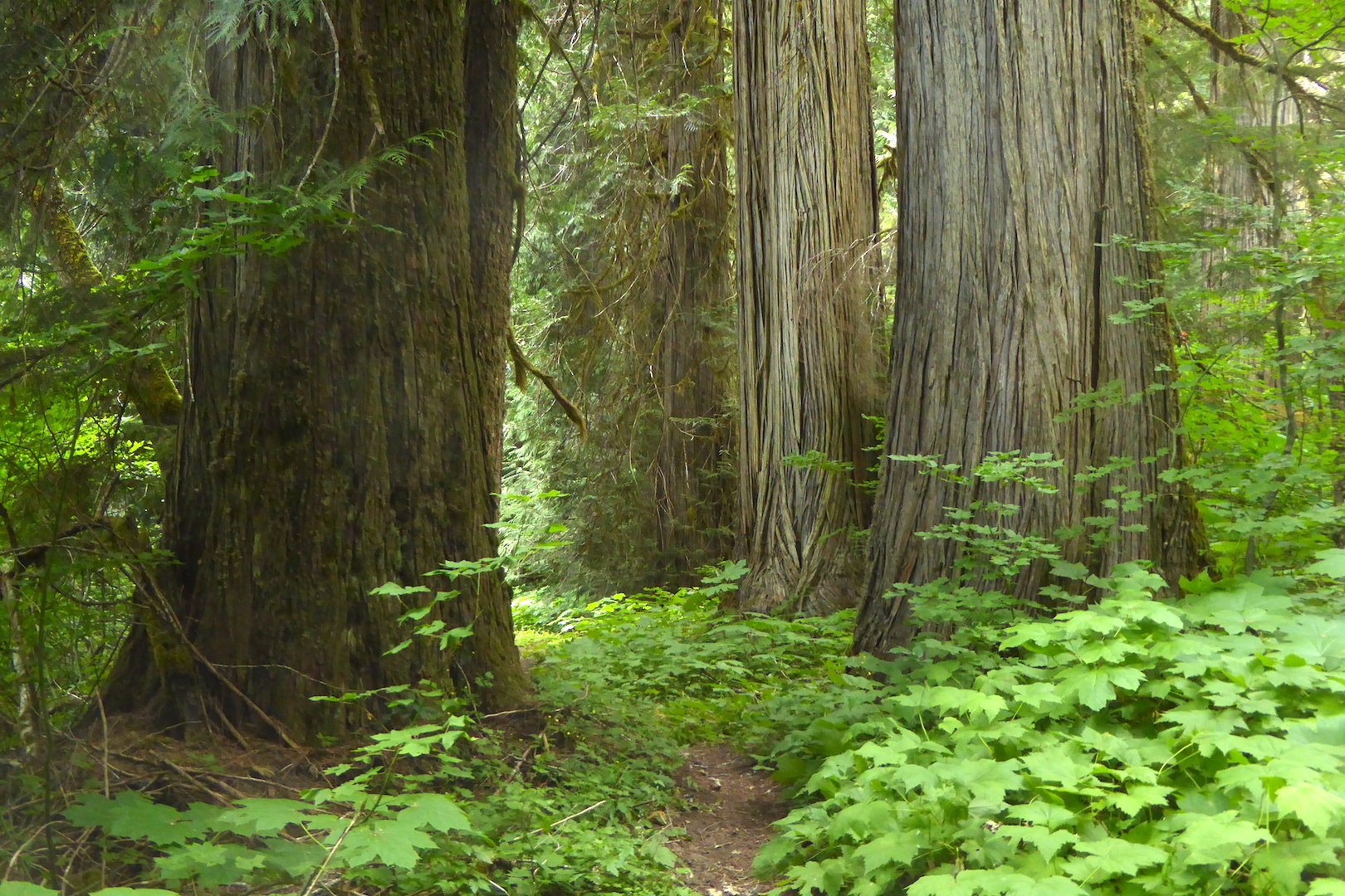
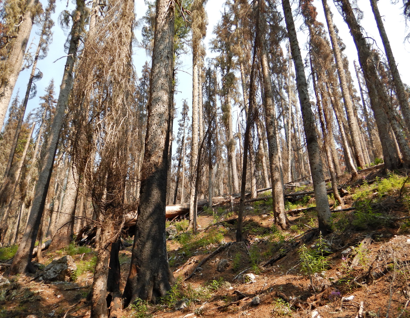
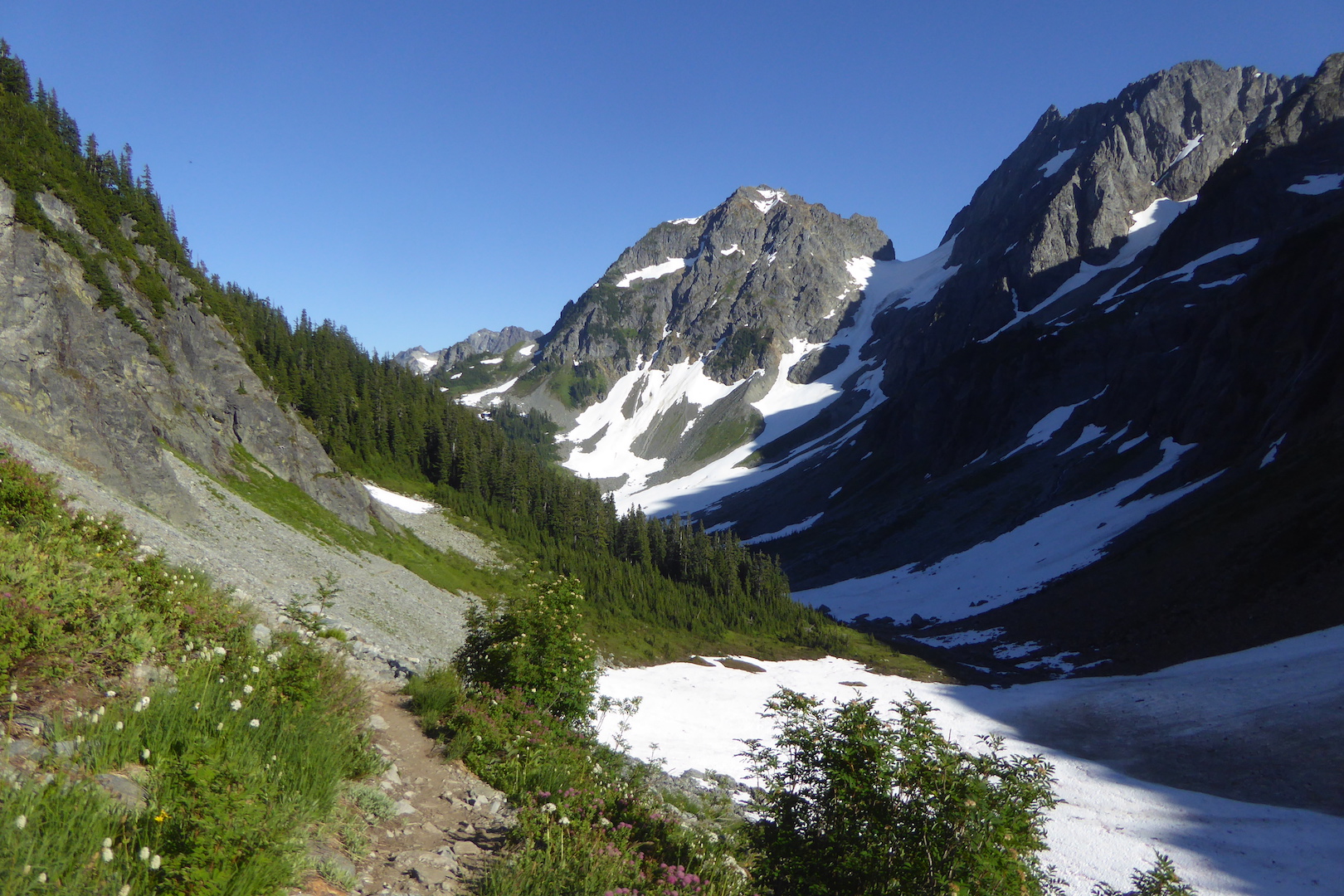
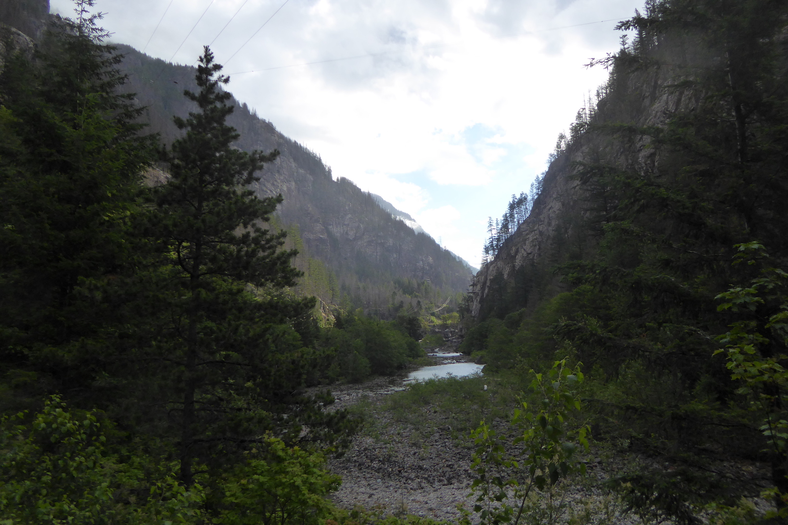
North Cascades is cherry-stemmed with a well-maintained, extensive trail network and almost every trail is dotted with a few backcountry camps. The luxuries of each camp vary—some are little more than a dirt tent pad—but one thing you can count on is some sort of toilet.  Except at boat-in sites and some high elevation camps, most are simple privies consisting of a box over a hand-dug hole in the ground.

A toilet box in a forest.
A privy box sits above a too large hole at Fireweed Camp in North Cascades National Park. Once filled to capacity a ranger or, more often, the trail crew digs a new hole nearby and moves the box seat over it or replaces it with a new one.

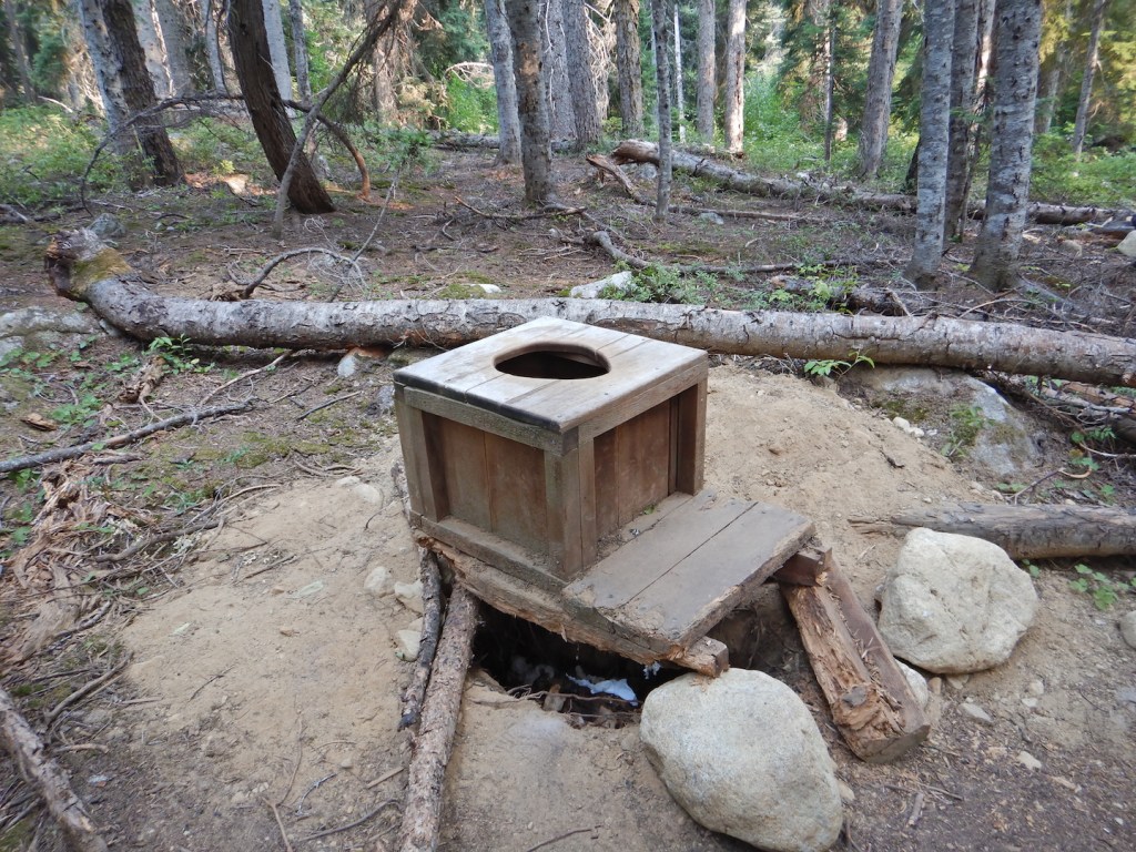
Checking toilets was a frequent duty on the trail. I would glance into every backcountry privy and assess its condition, which meant I looked into a lot of toilets during a typical multi-day trip. Most didn’t need attention, thankfully. Yet I always approached slowly, mentally prepared to encounter unpleasant conditions in need of remedy.

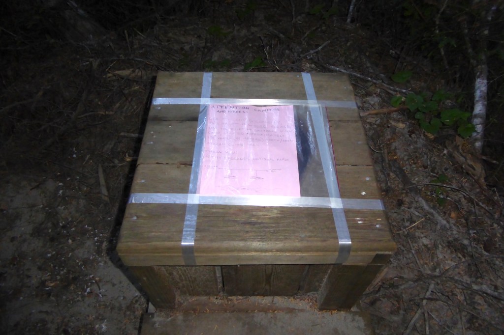
Along Brush Creek at the isolated Graybeal Camp—on the third day of a five day hike that previously included stirring a composting toilet and bagging up human waste deposited inappropriately on the surface of the ground adjacent to a tiny stream—I arrived to find the privy nearly full to the brim. Faced with such situations, there are various tricks one can use to increase a privy’s capacity. For example, a ranger I knew would use using a long, stout branch to knock over the cone of feces and toilet paper deeper into the privy hole at a heavily used site, perhaps prolonging the need to dig a new hole for a couple of weeks. In this case at Graybeal though, there appeared to be no room at the inn.

Graybeal Camp is lightly used compared to more popular destinations like Ross Lake, Cascade Pass, Sahale Arm, and Copper Ridge. Only a few weeks remained in the hiking season when I arrived in late August and many feet of snow would soon bury the camp for the winter. But this camp needed a new privy hole and I couldn’t in good conscience pawn the problem off on another ranger.

I located the trail crew’s cache of tools at a nearby group site and prepared to dig a new hole and move the toilet to it. That is, until I realized there was a risk of disturbing something I shouldn’t.

The places we call national parks were never unpeopled and areas that we consider good campsites today were also likely to have been used by indigenous peoples. I didn’t know if park archeologists had inventoried the campsite for artifacts or even assessed the potential for them. The last thing I wanted to do was disturb an archeological site for a lowly hand-dug privy hole.

After I confirmed with the backcountry office that archeologists did not clear the site for digging, I needed another plan. The tool cache had a roll of fiberglass tape. I carried a re-sealable plastic freezer bag, some paper, and a pencil. So I wrote a note closing the toilet “due to limited capacity,” placed it in the bag, and taped it over the toilet hole.

Was this a satisfactory solution? Not at all. I had, unfortunately, pawned the work off to other park staff. But, it kept people from pooping on the ground* and the toilet at the group campsite was relatively close, so the risk of human waste proliferating everywhere was minimal.

A toilet box with a note taped over the hole.
*People were, in fact, pooping on the ground. Unbeknownst to me (I had not been to that campsite before), the trail crew later discovered that a flash flood had washed the toilet off its hole and placed it directly on the ground in the forest. What I thought was a mound of human waste extending a few feet into the earth was merely a foot tall mound of human waste sitting on sandy outwash.
late day sun on craggy mountain peak and clouds
Alpenglow on Whatcom Peak as seen from Graybeal Camp.

Privies work well at relatively low elevation, forested sites if use isn’t heavy and moderate levels of decomposition can work its magic. But what to do in places that are too dry, too cold, too rocky, or too well trodden to for a traditional privy to work?

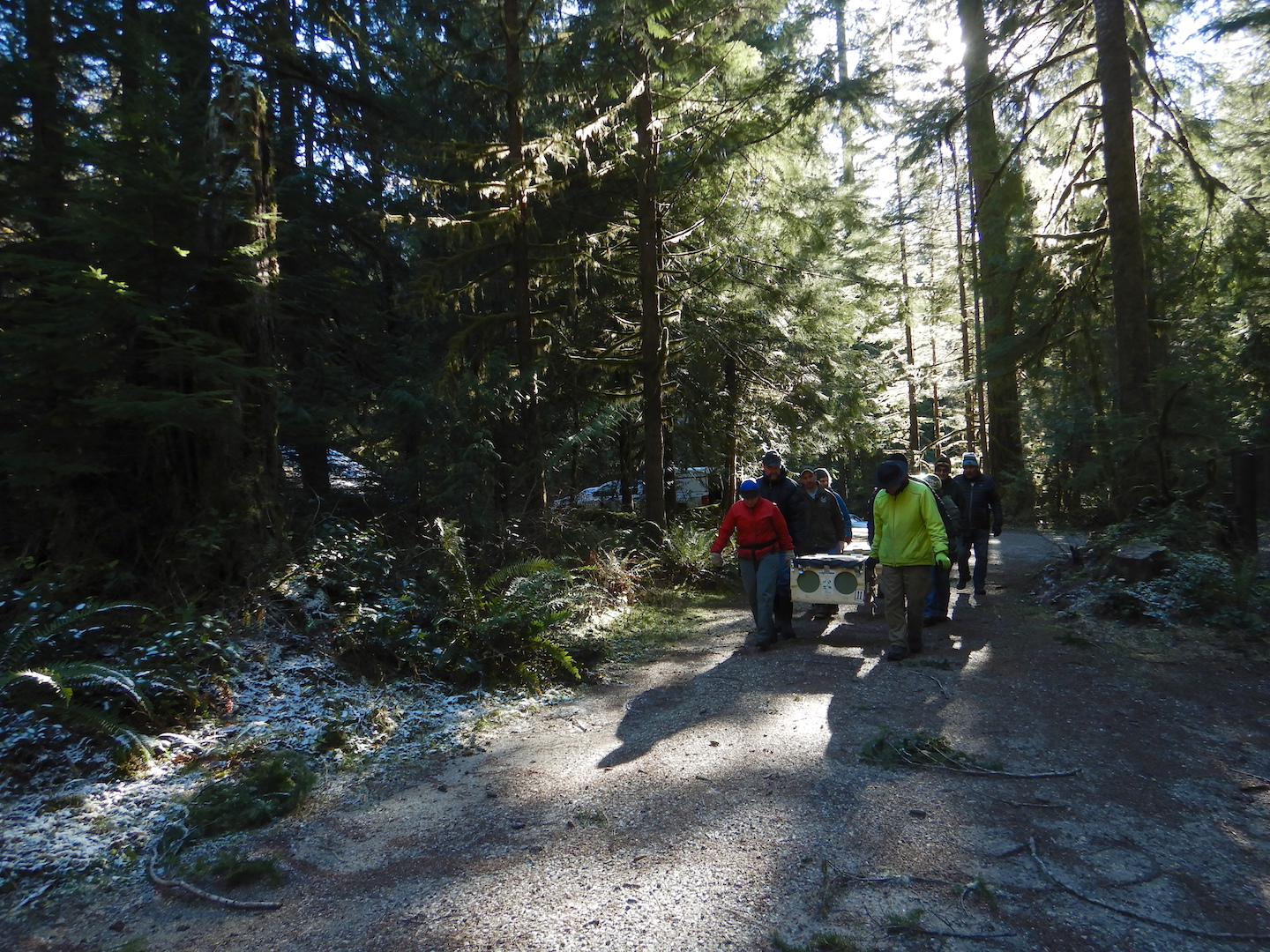
That’s the issue that Rocky Mountain National Park rangers deal with on the route to Longs Peak, and why they chose to utilize a new toilet design. Still, I am aware of no backcountry toilet that doesn’t require some maintenance. When the vaults on the toilets at Longs Peak are full, then the waste must be flown out by helicopter. Many other high-elevation backcountry toilets require more labor.

There are many backcountry sites within North Cascades where a simple privy won’t work, so for many years the park has used a type of above-ground composting toilet.

A vault-like toilet sits in a forest
A compositing toilet at Pelton Basin.

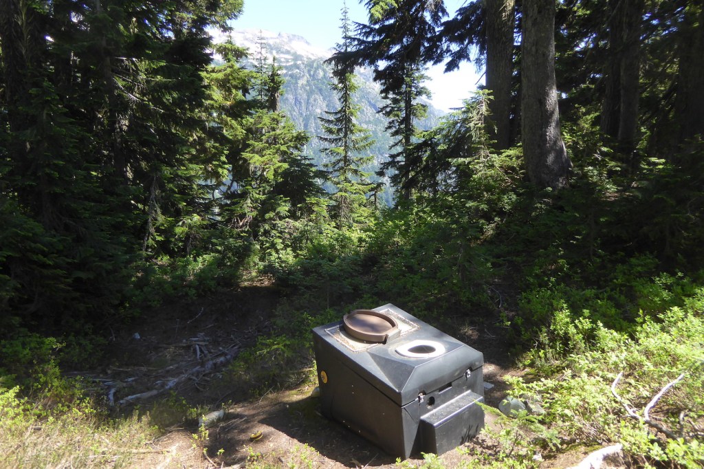
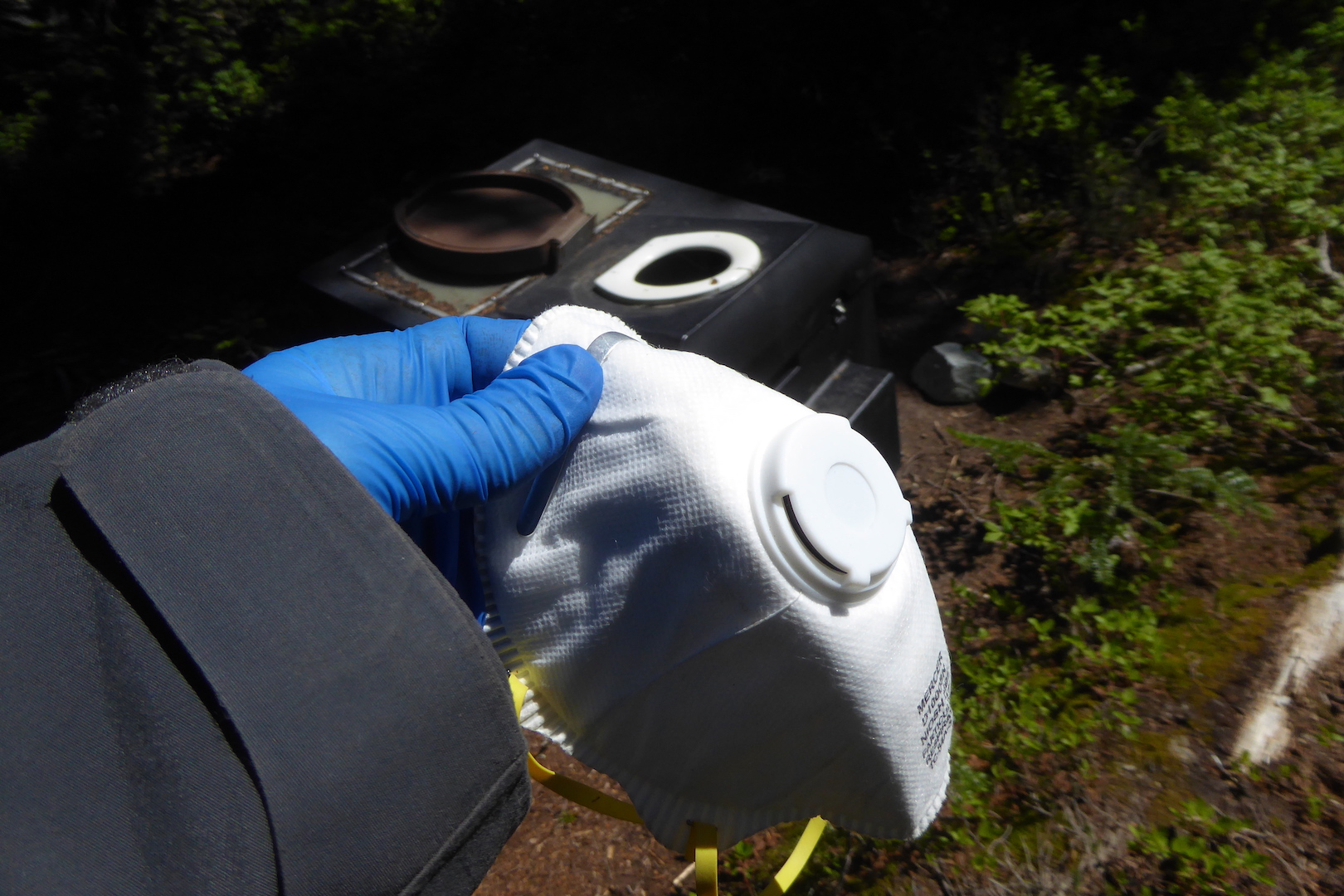
For these to work well, though, the toilet can’t be used too frequently, the contents can’t get too wet with urine or precipitation, the dry-matter to human waste ratio can’t skew too much toward feces, and they should be stirred regularly to promote composting. A full toilet requires someone to shovel the contents into a drum that can be flown out by helicopter.

Dealing with composting toilets was one of the more unpleasant tasks during my time in the backcountry. Excessive moisture often prevented composting, so they were often filled with a festering sludge. After a trial-by-fire experience stirring one for the first time, I found that slow, deliberate movements as well as covering as much of my skin as I could were necessary safety precautions when maintaining this style of toilet. There is a real risk working around a vat of human feces, especially when you are more than a day’s hike away from the trailhead.

N95 mask held by hand in latex glove
Long sleeves? Facemask? Disposable gloves? Some sort of eye protection? Check.
Selfie of ranger wearing NPS hat, black coat, and N95 mask
Ready to stir. Remember the days when N95 masks didn’t need to be rationed? Good times.

I’m not complaining about the toilet work. Because, honestly, looking at a few turds each day isn’t that bad in the scheme of things. I’d do it again without complaint, accepting it as a necessary duty so that less human waste pollutes our parks. People gonna poop and the urge doesn’t always strike us at convenient times or places. However, as visitation continues to increase in many national parks, the burden and hazards of human waste grows too, in both easily accessible places as well as remote backcountry locations.

If you visit a national park (and, really, consider postponing your trip while COVID19 rages), you could personally thank the park staff for the work they do to. However, a more rewarding thank you would be to do your part keep wild areas and parks clean.

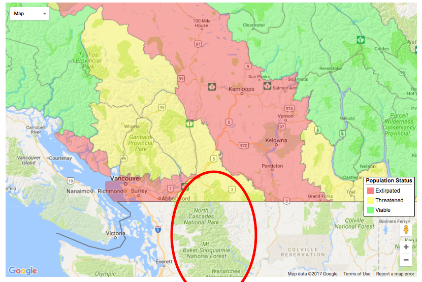
North Cascades was long considered a hidden gem of a park; one in which you could go on a summer weekend and find a place to camp fairly easily. Since its establishment in 1968, however, the population of Washington State has more than doubled. Mountaineering, hiking, skiing, and backpacking are more popular than ever. Millions of people live only a two to three hour drive from Washington’s iconic national parks and national forests. These destinations, however, operate with essentially the same number of campsites that they did in the 1970s. The North Cascades park complex (including Ross Lake and Lake Chelan National Recreation Areas) is no longer a place where you can expect to easily find a campsite on summer weekends. Finding a campsite is even becoming increasingly difficult on weekdays.

As we approach and exceed the carrying capacity of developed areas of parks,  then increasing numbers of people spill into areas that have been traditionally off the beaten path. We bring our waste and waste issues with us. National parks, forests, and other recreational areas are increasing challenged to meet the demands posed by current levels of visitation. Turds included.

A (Sometimes) Overlooked Significance

Recently, I stumbled upon this question.

Honestly, it’s something that I think about regularly when I’m planning a trip to a national park. While people frequently visit parks and other protected areas to experience unique and special landscapes, sometimes we fail to see their forests for the trees, or even see their forests at all.

I think this is particularly true of North Cascades National Park and the adjacent recreation areas, Lake Chelan and Ross Lake. The region is most famous for its rugged mountain topography, which I must admit is quite pretty, but visiting here solely to see mountains risks missing some of the best, uncut forests left in the Pacific Northwest. I’m not implying that a visit to a park without admiring trees is somehow less worthy than my slow forest strolls. Far from it; national parks mean different things to different people. But, I find myself drawn to trees, no matter where I go, even among some of the Lower 48’s craggiest mountains.

view of forested valley with tall craggy mountains on horizon

The North Cascades are defined by their ruggedness, and the area’s vertical relief is impressively steep. Ridges and mountain peaks frequently rise above 7,000 feet while deep valleys incise the landscape to near sea level in some places. The Skagit River at Newhalem, for example, flows at 500 feet in elevation while several peaks ascend over 5,000 feet within a few miles. In Stehekin, Lake Chelan sits at a modest 1,100 feet above sea level, but within two and half horizontal miles of the lakeshore, Castle Rock reaches above 8,100 feet.

view of snowy mountains rising above lake

Castle Rock rises 7,000 feet above Lake Chelan.

The rugged topography slowed the march of industrial logging into the mountains, so by the time the North Cascades National Park Service Complex was established in the 1960s and 1970s, much of the forest within the newly protected area had never been logged. In the park today, nearly every low elevation valley holds wonderful examples of wild, unmanaged forests.

Some of the most spectacular and significant trees are found along Big Beaver Creek, which flows southeast into Ross Lake. A section of trail about five miles from Ross Lake passes through a grove of thousand year-old western redcedar.  Preservation of these trees was the catalyst that stopped the expansion of Ross Dam.

bole of large tree with two hiking poles leaning against it

Some western redcedar in the Big Beaver valley are over three meters in diameter at chest height.

hiking trail lined by large redcedar trees

Big Beaver Trail

Along their entire length, both the Big Beaver and Little Beaver valleys harbor incredible forests. The same goes for the Chilliwack River valley and Brush Creek area, so if you hike from Hannegan Pass to Ross Lake, you’re in for a spectacular forest hike.

trail winding through dense forest with large trees

Little Beaver Trail

person standing next to trunk of large Douglas-fir

Yours truly and a large Douglas-fir at Graybeal Camp in the Brush Creek valley.

Those places are remote, however, requiring most of a day’s hike just to get near them and several days of backpacking to traverse the valleys. Many other old-growth forests are more accessible. The Stetattle Creek Trail, which starts in the Seattle City Light company town Diablo, ends in a classic example of a climax forest on the west side of the Cascades. This trail is often overlooked and rarely busy. What it lacks in mountain vistas it makes up for in trees.

view of old growth forest with large coniferous trees

Forest near the end of Stetattle Creek Trail

Hiking south from the Colonial Creek Campground, an easy four-mile round trip along Thunder Creek brings you through stately Douglas-fir and western redcedar. People often march through this section, barely stopping to look, as they have their sights set on up-valley destinations, but if you go plan some extra time to stop and admire these trees.

tall trees with foot bridge at bottom

The forest along Thunder Creek

Disturbance—whether brought by fire, avalanche, landslides, or people—is a hallmark of this ecosystem as well. Many large trees stand as witnesses to past and current change.

person standing in front of large tree

Englemann spruce, McAlester Lake Trail

person standing next to large tree with smaller trees nearby

Western white pine, Old Wagon Road Trail

person standing next to large deciduous tree

Black cottonwood, Upper Stehekin Valley Trail

Those that didn’t survive allow us to explore how the ecosystem may cope with future disturbance. I find myself pausing frequently in burned areas and avalanche tracks to admire how quickly the landscape can change.

lightly burned forest with standing dead trees and some minor green vegetation on ground

A recently burned forest along the Park Creek Trail

broken trees in foreground with forests and mountain in background

Avalanches can sometimes devastate otherwise healthy stands of trees. This example comes from the upper Brush Creek valley.

Often overlooked and visited far less than the Highway 20 corridor, the Stehekin valley is the most diverse place in the park complex, both in terms of cultural and natural history. In Stehekin, you can find everything from a historic orchard to plants adapted to desert-like climates growing alongside old-growth groves.

trail through forest with bright yellow fall colors

Stehekin River Trail

red maple leaves in forest

Vine maple splashes the Stehekin valley with color each fall.

Trees persist and even thrive despite the forces constantly working against them. They create vertical habitat, greatly increasing the landscape’s capacity to support life. They tell tales survival and struggle, longevity and adaptability. They are living witnesses to history and catalysts for conservation. North Cascades provides a rare opportunity to explore unmanaged, old forests—habitats that are becoming increasingly rare. And, if you can’t get here, just go to your local park or maybe even your back yard where, I bet, there’s a tree worthy of your attention.

Fishers Return to North Cascades

On an uncommonly sunny day in early February, I stood in a tract of old-growth forest not far from the Suiattle River to watch a missing mammal return to the North Cascades. With the return of the fisher, this area is one step closer to whole.

The fisher (Pekania pennanti) is one of the largest North American weasels. Adult females weigh four to six pounds and measure about 30 to 36 inches long, including tail, when fully grown. Males are about 20% larger, growing upwards of 13 pounds and nearly four feet long. Despite the name, fish are not a primary prey. Instead, fishers are wolverines of the forest. Highly arboreal, cylindrical in shape, and agile in motion, they are formidable predators of rodents, rabbits, hares, grouse, and other small to medium-sized animals.

fisher running to escape a box, people standing behind it

One of the first fishers to be released on February 6. The common name, fisher, is probably a modern English language corruption of “fitch,” a Middle English term for the pelt of the European polecat (Mustela putorius), also known as the common ferret. Not coincidentally, the colonial Dutch fisse and visse as well as the French fiche and fichet, all words for the polecat, sound quite similar to fisher. (NPS Photo)

Fishers were functionally extirpated from Washington by the mid 20th century due to habitat fragmentation and, especially, unregulated trapping. Surveys in the 1990s and early 2000s failed to find evidence of any viable fisher populations. As a first step to recover the species in the state, a coalition of public agencies, tribes, and private organizations released fishers in Olympic National Park from 2008-2010. This was followed by similar efforts in Gifford Pinchot National Forest and Mount Rainier National Park from 2015-2017. The North Cascades National Park Service Complex and Mount Baker-Snoqualmie National Forest began to host the fisher’s return last fall, which is how I found myself standing in the woods with about twenty other people on February 6.

Fishers prefer mature forests with a high canopy, relatively large diameter trees, and an abundance of downed trees. Dead standing trees are particularly important to fishers, as they den exclusively in tree cavities. The release site for the fishers this day seemed particularly well suited to their needs.

forest and stream

Fortunately and conveniently, healthy populations of fishers remain in British Columbia and Alberta and they serve as the source for the restoration effort. Fishers from western Canada are also genetically similar to those that used to inhabit Washington. Canadian trappers were paid to capture live, healthy animals. The Calgary Zoo temporarily housed the fishers while veterinarians evaluated their health and surgically implanted tiny radio transmitters to assist biologists in tracking them.

Twelve hours before release, these particular animals were still in Calgary. At 1 a.m., the fishers were flown to Abbotsford, British Columbia where they were picked up by biologists and driven into Washington. By early afternoon, a gang of biologists and a few interested souls like me were unloading the cargo and carrying the fishers a short distance to the release site.

Fisher release, Buck Creek Campground, Mount Baker-Snoqualmie National Forest_02062019_4

Fishers were transported in specially designed crates. Two fishers, separated by a partition, are in each crate.

view through screened hole of fisher in a box

A fisher peeks through a window toward the outside world.

people carrying wooden crates on forested path

Our group formed a semi-circle around the crates to watch the release. Conversations quieted to a whisper or died in anticipation as the crates were opened one at a time. To coax them out, a screened vent was opened at the top and a volunteer blew a puff of air into the container. I’m unsure if this was as annoying as someone blowing air into my ear, but the trick worked. The fishers shot out like a flash and bolted into the forest.

Six fishers were released that day bringing the total number currently released in the area to 24. The release efforts will continue until about 80 fishers are reintroduced to the area. Biologists will track, monitor, and study the animals to assess survival rates, identify where they go after release and where they establish home ranges, the types of foods they eat, and the diseases and parasites they suffer from.

The effort has a high chance of success. Reintroductions, however, are rarely so simple. Fishers, although not well known among the general public, are relatively non-controversial animals. They don’t evoke the same emotional reactions in people as grizzly bears or wolves, for example.

More than that, however, the forested habitats along the core and margins of the North Cascades are largely intact. Land managers needn’t take extreme, expensive, time-consuming measures to restore the ecosystem to a point where it could support fishers again. It could always support them. We just didn’t allow fishers to survive here.

Because prior generations had the foresight to protect places like North Cascades National Park and Glacier Peak Wilderness, we have the opportunity to restore fishers to land they once knew as home. Situations like these are becoming increasingly uncommon. People have fundamentally altered so much of the Earth to preclude the reintroduction of many extirpated species into their historic ranges. (There’s no substantial habitat available for bison in Iowa, for example.)

view of old growth forest with large coniferous trees

Potential future fisher habitat along Stetattle Creek in North Cascades National Park.

As humanity’s footprint grows, undeveloped landscapes are increasingly valuable, not for the resources we can exploit within them (including supposedly non-consumptive uses like solitude), but as repositories of biodiversity and ecosystem health. To adapt an idea from Thoreau, future generations, I believe, will measure our legacy not by what we invented and consumed, not by our material wealth, but by what we can afford to let alone.

I’ll probably never see any of these fishers ever again. Even if the population increases to hundreds of individuals, they’ll remain reclusive neighbors. If I’m lucky, I may find a track in fresh snow or its scat on a log. But even that doesn’t matter. I’ll know they are there and I’ll know the landscape is healthier because of it. The return of the fisher represents, at least in one small way, the success of our ability to let one place—North Cascades—alone.

The Origin of an Alpine Lake

Despite the area’s formidable topography, the North Cascades are filled with lakes. On a hike late last summer, I glimpsed how many of them formed.

Monogram Lake sits in a small basin perched a few thousand feet above Cascade River. At this elevation, just shy of 5,000 feet above sea level, it’s surrounded by blueberry meadows and scattered woodlands of mountain hemlock and Pacific silver fir. It’s an inviting place to camp for a couple of nights, no matter if you want to lounge by the lakeside or strengthen your quads further by climbing to the surrounding ridges.

small lake surrounded by meadows and mountains

I hiked there late last August hoping to watch black bears feeding on blueberries. The blueberries were reaching peak ripeness when I arrived, but I found no black bears or even any fresh bear sign, so instead of relaxing at the lake I decided to explore the surround terrain and take in some of the iconic alpine views that make the North Cascades so famous.

Not having a specific destination in mind, I was free to wander. These are my most favorite hikes, when I travel more to see what might lie in front of me instead fixating on a pre-determined destination.

Bushwhacking around the lake, I passed through quiet sedge-filled wetlands…

sedge meadow and small pond in mountain basin

…stopped frequently to eat blueberries…

blueberry plants with ripe blueberries

…wandered over a gently sloping boulder field…

meadow and boulder field looking up to a mountain ridge

…to a glacier tucked in a pocket just south of Little Devil Peak.

small, mostly snow free glacier tucked in a basin below a mountain peak

Here, I ate my lunch while contemplating the scene. It was a near perfect analog for the formation of the Monogram Lake basin.

Glaciers form when snow is compressed into mostly air-free ice and attains enough mass to deform and flow. Under the influences of gravity, ice deformation (high pressure within a glacier causes deeply buried ice to behave plastically), and lubrication from water at the its bed, glaciers move along the paths of least resistance. Due to their mass and size, they become powerful agents of erosion. They entrain rock, sand, and anything else as they flow. Forced along by moving ice, rocks at a glacier’s bed are especially erosive. Glacial erosion mills rock so effectively that much is pulverized into a microscopic powder called rock flour. This is the substance that gives glacial runoff it’s milky appearance and can color lakes turquoise.

Where ice had only recently receded at this particular glacier, the bedrock recorded plenty of evidence of the glacier’s past movement.

hiking pole lying on bare rock. Rock shows faint horizontal striations.

Many faint striations were scored into the bedrock near the glacier. The striations run roughly parallel to the hiking pole.

concentric gouges in metamorphic rock

Chatter marks are small, crescentic grooves formed in bedrock by rocks frozen in ice. The rocks chip the glacier’s bed as they are forced forward. The convex face of the marks point in the direction of movement.

Since glacial erosion is most pronounced at a glacier’s base, if topography forces ice through a pinch point then it causes the glacier to carve the underlying land more deeply and quickly than at the glacier’s sides, a process called overdeepening. As ice retreats, overdeepened basins often fill with water. This is the origin of fjords and deep lake basins as well as cirques high on mountainsides.

Monogram Lake occupies a cirque, a half open and steep-sided valley or basin on the side of a mountain. Instead of a clear lake surrounded by meadows, it was once filled with ice just like the basin below Little Devil Peak.

View looking toward a lake in a glacial cirque. Deep valley and snow covered peaks on horizon.

Monogram Lake

view of glacier in mountain basin. Snow covered mountains on horizon.

The glacier south of Little Devil Peak as seen from an unnamed peak above Monogram Lake.

Uniformitarianism is a geologic principle that, in sum, means the key to interpreting the past is to understand processes that occur today. Excluding the three hydroelectric reservoirs in the Skagit Valley, glaciers carved the basins for nearly every lake in North Cascades National Park and Lake Chelan National Recreation area. Even though I wasn’t around to see Monogram Lake emerge in the wake of glacial retreat, all the evidence I needed for this process was right before me.

Spring cycling along the North Cascades Highway

Last June, I wrote about cycling to Rainy Pass on the North Cascades Highway. For half the year, however, this road is closed as snow accumulation and avalanche danger, especially, become too great to keep it open. On weekends in spring, when road crews pause their work to clear snow and avalanche debris, the highway opens to bicyclists, so last Friday I took a rare opportunity to ride a car-free road. I found springtime fully fledged at low elevations in the North Cascades and winter’s legacy still holding a firm grip on the high country.

At low elevations, near the town of Newhalem, the weather and vegetation reflect mature springtime conditions. Hummingbirds seek nectar from red-flowering currant, deciduous plants are nearly fully leafed-out, and the ground is snow-free.

pink flowers on shrub

Red-flowering currant (Ribes sanguineum)

Heading east through Ross Lake National Recreation Area, the road climbs most steeply where it skirts the three hydroelectric dams on the Skagit River. Even here, at elevations below 1000 feet, avalanches will sometimes crash across the road when winter conditions are right.

gully on mountainside

In February 2017, a large avalanche crossed the highway at this location, trapping a few dozen people on the other side for several days.

view of avalanche snow on road

An avalanche covering the road at the same place on February 25, 2018. Photo courtesy of Washington State DOT.]

After fifteen miles of riding, beyond Diablo Lake…

View of lake and mountains

…I reached the Ross Dam trailhead where the highway remained closed to cars.

gate across highway. sign reads "Active slide area proceed at your own risk" and "Stop"

Freed of the stress of close encounters with cars, cycling on car-free roads is wonderfully relaxing. Even as I remained reasonably alert for hazards and other cyclists, I was able to do stupid things I’d never try when sharing the road with motor vehicles—like riding down the centerline while recording video.

GIF of road and surrounded by mountains and trees

For me, the car-free environment also promotes stopping where anything catches my attention. Ascending higher into the mountains, I watched as the vegetation became less and less green. From a certain phenological perspective, I was moving backwards through time. By the time I reached 2,500 feet in elevation, most of the raucous birdsong of the Skagit lowlands disappeared and deciduous plants were just breaking bud.

green flowers at the end of a maple branch

Big leaf maple has already finished blooming at low elevations along the Skagit River, but it was still in full flower around 3000 feet in elevation along the highway.

Around highway mile 150, about 15 miles beyond the gate at Ross Dam and 4,000 feet above sea level, snow continuously covered the ground. It only became deeper as I pedaled farther. Just a couple of miles shy of Rainy Pass, where state road crews had halted their work for the week, snow remained five feet deep on the road.

bicycle leaning against snow bank with one lane of plowed highway


bicycle leaning on five-foot high snow bank

The end of the plowed road on May 4, 2018.

As it melts, the snow provides much needed water to streams and rivers in a mountainous region where summer drought is common. For many plants though, the deep snow hinders growth well into summer. On the day of my ride, temperatures hovered in the 60s˚ F, certainly well within the temperature tolerance of plants in the Cascades, but the deep snow keeps the underlying soil cold and dark. Under these conditions, most plants have to lie dormant until growing conditions improve. In the North Cascades, where snow accumulation is so deep and extensive, this set of conditions creates a perpetual spring season on the margins of the snow pack. This gives wildlife like deer and bears the opportunity to eat young and nutritious plants through July and August.

yellow-flowered lily

Yellow avalanche lilies (Erythronium grandiflorum) are currently blooming in the Diablo Lake area. More commonly associated with meadows at higher elevations, these perennials have a short growing season. They begin to grow from a perennial bulb as soon, and sometimes even before, snow cover melts away to take advantage of ephemerally moist soils. By late July, the soils where this specimen grows will have become powdery dry, but at higher elevations this species will still be in flower.

new leaves at the end of small twigs in shaded forest

Late last July, long after I began to feast on blueberries at low elevations, blueberry plants in a snowy portion of Pelton Basin has just begun to leaf out. Late season berries are an important food source for bears this area.

Even during this ride into the middle elevations of the North Cascades (the highest non-volcanic peaks here top out over 9,000 feet tall), it was easy to see how snow exerts a significant influence on the landscape. The week of my ride, road crews reported nine feet of snow at Rainy Pass (el. 4,855’). In a couple of months, when tender plants like yellow avalanche lilies have withered and dried at lower elevations, I can ride up here again and find a microcosm of spring along the edge of the remaining snow.

view of snow-capped mountains and coniferous forest

To Change or Not To Change: A National Park Question

Last year, Isle Royale National Park released a draft plan to determine whether and how to stabilize the park’s wolf population. After evaluating the merits of several alternatives, weeding through public feedback, and with only two wolves remaining, the park has decided to introduce 20-30 wolves over a three-year period. In the park’s decision, managers have affirmed their belief that wolves on Isle Royale are an irreplaceable part of the ecosystem, and their loss is unacceptable.

Parks are being increasingly managed for change, but the myth of national parks as static vignettes of primitive America remains pervasive. As I wrote on this issue last year, parks are not pure. We live in an era of unprecedented change, and situations like Isle Royale’s will only become more common.

The National Park Service has made strides toward acknowledging that parks will change, but it’s time to put a greater effort into planning for it. To help the public better understand the dynamic nature of national parks and their significance—what we’re willing to save and what we’re willing to let go—there should be an effort across the NPS to identify at-risk resources and decide whether to protect them. Resources to protect would be species, habitats, and processes that if lost would impair the significance of the park or reduce biodiversity. This could help guide current and future management of parks, leading the NPS to implement preventative or prescriptive actions to stave off unacceptable impairment instead of waiting until it’s nearly too late.

In areas with endemic or endangered species—such as Hawaii Volcanoes, Haleakala, and Channel Islands—it may be most appropriate to manage against change to mitigate the risk of losing unique habitats or species to extinction.

In other areas where forest compositions will shift, it may be more appropriate to let change happen as long as native biodiversity is protected.

view of tundra and shrubs with mountains and lake in background

In Katmai National Park, shrubs and trees now grow at higher elevations compared to 100 years ago.

view of mountain scenery with craggy peaks and snowfields.

Should this view be protected or should trees be allowed to encroach on the scene? At North Cascades National Park, tree line is expected to rise in elevation which may threaten views like this one near Cascade Pass. Forests in this park, especially at low elevations, are also projected to burn more frequently under a warmer climate.

Importantly, this planning effort could help the public better understand decisions like Isle Royale’s, which seems inconsistent and arbitrary to many people who commented on the plan.

Biologists predict wolves will be extirpated from Isle Royale within a few years without direct intervention, but why intervene on the behalf of wolves at all? Wolves, as a species, don’t need Isle Royale to survive. As the NPS reasons, it’s less for them, and more for the park. Without wolves climate change would have a greater influence on the archipelago. Plant communities would shift dramatically under heavy browsing pressure from moose, causing a cascade of effects and perhaps, according the park’s Final Environmental Impact Statement, become less resilient.

“Under alternative A, increased [moose browsing] is probable and combined with climate change effects, it is likely that the rate of vegetation changes would be exacerbated and potentially accelerated. Additionally, it is expected that the resiliency of current wildlife populations to change would be reduced and contribute to more rapid population swings. Under alternative B [the preferred alternative] and C, it is expected that the project [sic] warming trends influences [sic] on the island would be less likely to be compounded by herbivory and its associated impacts.” (Pg. V)

Scenarios like Isle Royale’s will only become more common as we continue to fragment habitat, introduce invasive species, and change the climate. Not that I want it to be this way. Ideally park ecosystems would remain healthy enough and function normally enough so native species and biodiversity are protected without our heavy-handedness, but unless we shift our priorities dramatically then we’ll find ourselves stepping in at ever increasing rates.

We can no longer afford to think of parks as museums. What exists in them exists because we, directly or indirectly, choose it. In the face of unprecedented change, national parks cannot remain static. It wasn’t feasible in the past and it’s increasingly infeasible now. Where do we draw the line and how do we intervene? That’s something we need to decide right now—nationwide, collectively, and not in a piecemeal manner.

Cycling North Cascades Highway

Last week, clear weather and a day off combined to allow Rocinante (yes, I name my bicycles and you should too) and I to ride the North Cascades Highway through Ross Lake National Recreation Area and Okanogan National Forest to Rainy Pass. This road, also known as Washington Route 20, is the last major highway constructed over the Cascades in Washington. It bisects one of the largest roadless areas in the Lower 48 and traverses a densely mountainous region that repeatedly confused 19th century explorers.

So many roads skirt mountains, but on this one I felt like I was truly in them. The highway, while never extremely steep, climbs considerably from Seattle City Light’s company town of Newhalem to Rainy Pass and beyond. For someone who is easily distracted by scenery, wildlife, and plants though, it also offers many excuses to slow the pace of travel. Just east of Newhalem, for example, lies the remnants of the Skagit River gorge.

narrow mountain valley

The Skagit River gorge

Beginning in the 1920s, the Seattle City Light harvested the energy of the Skagit in a series of dams. Collectively, these dams provide twenty percent of Seattle’s electricity.

mountain valley with dam and lake

Gorge Dam is the first of three hydroelectric dams on the Skagit River. Skagit gorge runs empty almost always because the river’s water is diverted from Gorge Dam through a tunnel to a powerhouse in Newhalem.

Before these dams were constructed, no road penetrated this section of Cascades. Miners and homesteaders had to navigate the gorge’s cliffs along a precarious “Goat Trail” above the raging river. My journey via bicycle was a bit easier than the Goat Trail despite the elevation gain. The road climbs up and down through the gorge then ascends again before skirting the southern shore of Diablo Lake, the second reservoir on the Skagit. This stretch of road combined with the continued climb above Ross Lake, in my opinion, is the toughest section for cyclists along the highway.

view of mountains and lake

Diablo Lake is deep in the heart of the North Cascades. Its aquamarine color is the product of glacial flour backscattering blue and green wavelengths of light.]

view of mountains and lake with coniferous trees in foreground

Ross Lake is the highest and largest reservoir in the Skagit watershed.

Even though Diablo and Ross lakes’ water flow west into Skagit River and Puget Sound, the reservoirs lie east of the Cascade crest. Here, a drier forest grows compared to the wetter lowlands downstream of Newhalem. The contrast is especially apparent on sunny slopes where snow doesn’t linger in spring. Douglas-firs and lodgepole pines tolerate these conditions well. At lower elevations along southern Ross Lake, pockets of ponderosa pines, a species much more common on warmer drier soils to the east, also linger.

Above Ross Lake, the road grade lessens easing the burden on my legs and lungs. Sight lines and road shoulder widths increased too, making the highway safer for bicycles. With increased elevation, the forest composition shifted to include some western white pine then lots of mountain hemlock and subalpine fir. With a moderate tailwind, I could pedal uphill and still enjoy views of the montane forest and craggy, snow-covered mountains bordering each side of the highway.

view of mountain peak and conifer trees
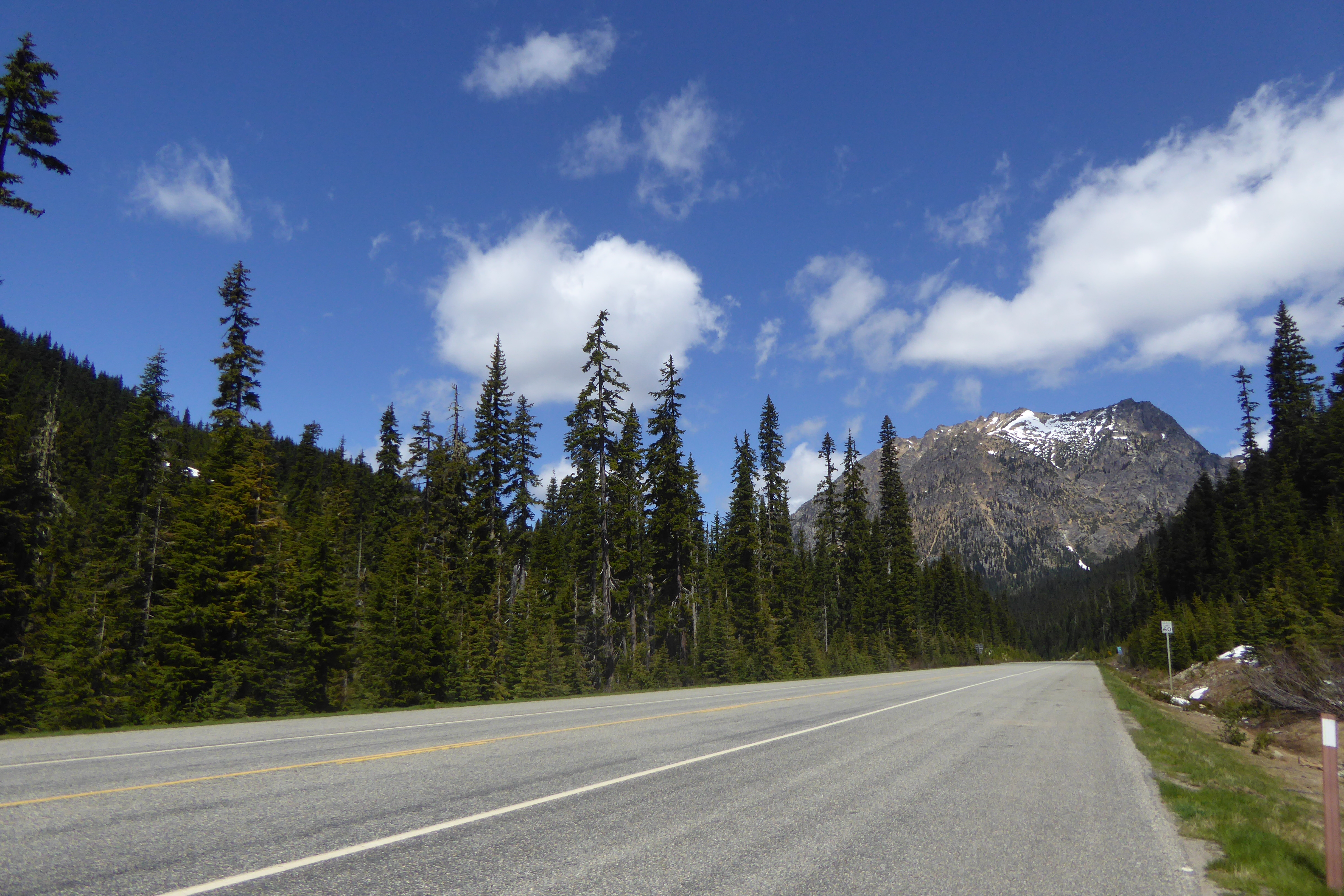
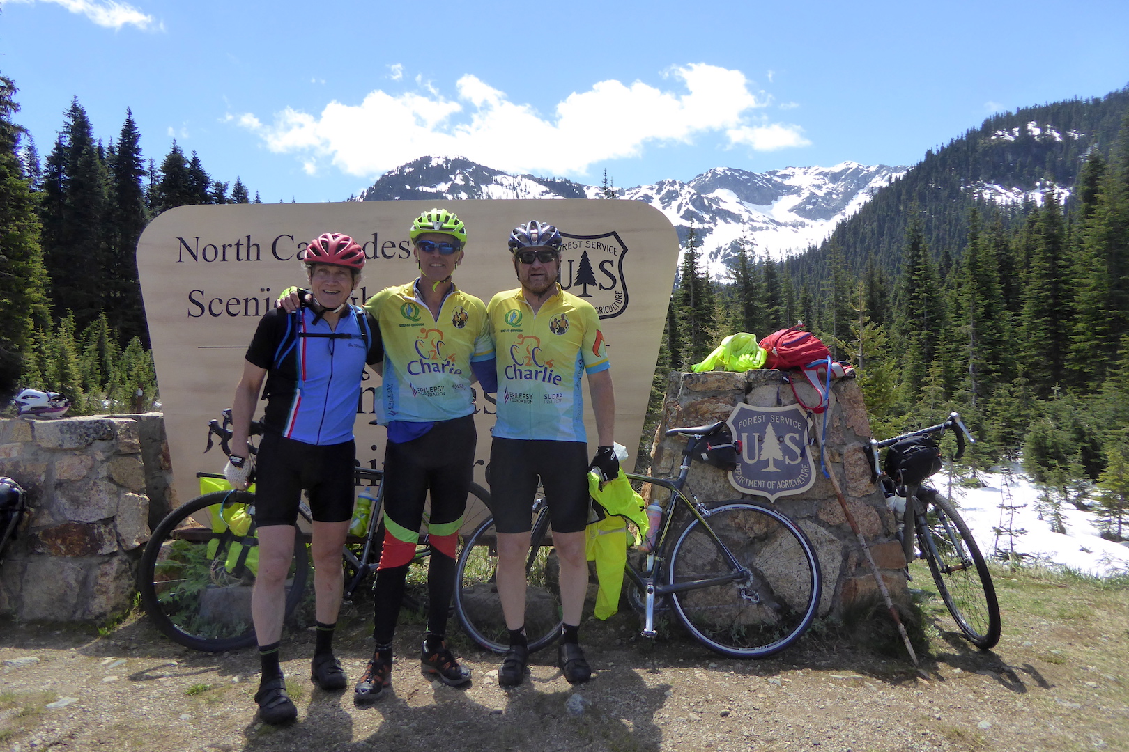
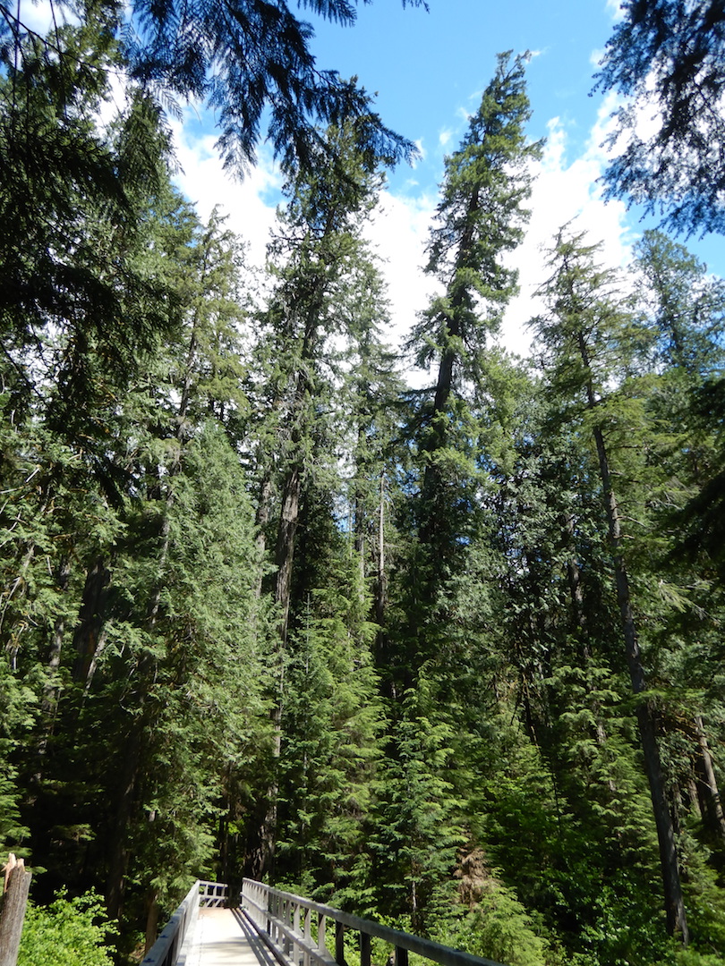
After 35 miles of cycling and over 5,000 feet of cumulative elevation gain, I ate lunch at Rainy Pass (el. 4,855 feet). Fifty-three weeks ago, I cycled over this pass as part of a larger bicycle trip around the North Cascades area. That day was chilly and wet. I encountered frosty conditions and fresh snow from the previous night.

montane forest with light snow at higher elevation

Forest at Rainy Pass on June 14, 2016. Note the light snow on the trees.

On this ride however, I needed only a light windbreaker.

view of road surrounded by coniferous trees and mountain in background

Rainy Pass on June 21, 2017.

The North Cascades Highway is also part of Adventure Cycling’s Northern Tier route. I knew I’d see touring cyclists pushing to the pass and beyond and I knew they’d be hungry so I brought candy bars to give away to those out for the long haul. When I rode across the country on my bike in 2004, there were many days where I felt like I couldn’t eat enough and many people offered food, a lawn to camp on, or even a room in their home. My free chocolate was a very small attempt to reciprocate a bit of that generosity.

A little surprisingly, almost all the touring cyclists I encountered before Rainy Pass kindly rejected my offer of empty calories. If they were creeped out by a stranger peddling candy, then they hid their concerns well. (Maybe my approach was a little off—“Hey, want some candy bars?” said the weirdo who approached you on the side of the road in the middle of nowhere.) More likely though, my offer came too early in the day when energy from breakfast still lingered. At Rainy Pass, the same cyclists gladly accepted the treats.

I spoke with cyclists from Germany, Great Britain, and a group from Massachusetts raising awareness of epilepsy.

Charlie's group at Rainy Pass_06212017

Clif Read (center) and some of his riding companions pause at Rainy Pass on their tour to raise awareness of epilepsy. Follow their journey at c2c4charlie.org/.

As unprepared as I was, carrying little more than a windbreaker and some peanuts, I felt an urge to continue my ride, joining the others heading east toward the Atlantic Ocean. I suppressed that travel bug though and let the long-distance cyclists continued on their way while I turned back west to enjoy the mostly downhill ride into the Skagit Valley.


Trail Cam

In February, I discovered wolverine tracks in the snow. After mentioning the tracks to a resource management specialist at North Cascades National Park, we decided to set up one of the park’s motion sensor trail cams hoping to capture photos of wolverines or any other animals that might wander by. The cam didn’t capture images of any wolverines, but it did reveal the presence of other large critters. (In this post, all photos from the trail cam are courtesy of North Cascades National Park Service Complex).

On March 20, I mounted the cam on a tree with a clear view of an unplowed, snow covered bridge over Stehekin River, surmising that the relative ease of crossing the bridge would funnel wildlife across it.

Trail cam mounted on Douglas-fir tree

After setting up the cam, the first photos capture me skiing away.

GIF of person skiing across bridge

Nothing appears on the cam until March 30 when a mountain lion waltzes by!

Mountain lion walking on snow. 2017-03-20, 9:52:47 AM, 33˚F

GIF of mountain lion walking across snow

I was surprised the mountain lion was in this habitat during late March. Many deer, the primary prey for Washington state’s cougars, inhabit the lower Stehekin River valley, but I had seen no tracks of those animals anywhere within five miles of the bridge. The four feet of snow in this location was still prohibitively deep for deer. Perhaps this was a male seeking females or simply one of the resident lions moving through its territory. I’m not sure, although I found a pair of lion tracks a couple of miles north along the Pacific Crest Trail three days afterward.

After swapping out the cam’s memory card on March 23…

hand and part of person's face in front of camera, snow in background

…I left the cam alone until April 3. When I returned I noticed some large, semi-fresh tracks post-holed across the bridge. Backtracking the animal’s movement, I found it walked right under the cam before crossing the bridge. Interestingly, the cam took many photos of an empty bridge the evening before I arrived. Something had nudged the cam, triggering it for 13 seconds according to the photos’ time stamps. One photo in the sequence is completely black as if something briefly covered the lens.

GIF of trail cam sequence. Cam is nudged by animal out of frame.

The culprit was revealed a few seconds later.

black bear walking on snow with nose to the ground. 2017-04-02, 7:24:44 PM, 36˚F


GIF of black bear walking across snow

Bears are extremely curious. This one found the cam and investigated it seconds before walking across the bridge. Since black bears in the northeastern corner of the North Cascades begin to emerge from hibernation in early April, it may have been fresh out of the den. On the other side of the bridge it’s tracks continued straight up the hillside disappearing into the forest.

I know these animals live here with me. I see their tracks and scat somewhat often, but I encounter the living individuals less frequently. For me, the cam provided an enjoyable, albeit brief, glimpse into their lives.

Restoring Grizzlies is not a Threat to Wilderness

Wilderness Watch, a non-profit advocacy and watchdog group for the National Wilderness Preservation System, opposes active restoration of grizzly bears in the North Cascades ecosystem. While their strict adherence to wilderness values is laudable, in this case it could lead to the extirpation of grizzlies from the ecosystem. Arbitrary wilderness values are not more important than the restoration of grizzlies.

Wilderness, as defined by the 1964 Wilderness Act, is “an area where the earth and its community of life are untrammeled by man, where man himself is a visitor who does not remain.” Importantly, the Wilderness Act states wilderness areas also preserve “wilderness character,” a set of values that link wilderness conditions with legislative intent. Federal land management agencies must manage wilderness so it maintains all aspects of wilderness character. Wilderness must remain untrammeled, natural, undeveloped, provide opportunities for solitude or primitive and unconfined recreation, and protect other features of value.

Bare mountain peak with lake below

Green view lake sits below Goode Mountain in the Stephen Mather Wilderness, North Cascades National Park.

Any ecosystem manipulation in designated wilderness will affect some of these values, especially during the effort to restore grizzlies. Specifically, the Draft Grizzly Bear Restoration Plan will temporarily trammel the land by manipulating a species’ population. Additionally, helicopters flights can impact opportunities for solitude, and tracking collars on bears will affect the wilderness’s naturalness and undeveloped characteristics. For these reasons, Wilderness Watch advocates for a natural recovery alternative, which would allow bears to return on their own and offer the greatest adherence to wilderness character and values. They state:

  • Information is lacking on the status of grizzlies on the Canadian side of the border where two moderately sized provincial parks provide some protection for the bears.
  • For dubious reasons, a natural recovery alternative was rejected for further analysis. Instead, the DEIS considers only heavy-handed management alternatives.
  • The extensive use of helicopters would continue indefinitely for monitoring bear movement and numbers. This heavy-handed management would be detrimental to Wilderness and bears alike.
  • None of the current action alternatives, involving translocating bears, are compatible with Wilderness.

However, some of these assertions are incorrect. There is a “natural recovery alternative” in the draft restoration plan. It’s the no action alternative, or Alternative A. This alternative may need further revision to achieve Wilderness Watch’s goals, but it hasn’t been rejected for further analysis or excluded. Perhaps most importantly, if Wilderness Watch’s position is adopted by the National Park Service and U.S. Fish and Wildlife Service, it will likely lead to the extirpation of grizzlies in the ecosystem, where only six bears are thought to remain (Draft Grizzly Bear Restoration Plan, p. 90).

Grizzly bears are not doing well in southwestern British Columbia. Adjacent populations to the north are only slightly more numerous. Fewer than 30 grizzlies are estimated to live within the Stein-Nahatlatch and Garibaldi-Pitt areas (interactive map of grizzly populations in British Columbia). Under current conditions, no grizzly population in Canada or the U.S. is likely to expand and occupy the North Cascades region (Draft Grizzly Bear Restoration Plan, p. 88-89).

Alt Text: Map of Grizzly Bear Population Status in British Columbia (Red=Extirpated, Yellow=Threatened, Green=Viable)

This map shows the current status of grizzly bear populations in British Columbia. Many areas of B.C. have healthy populations of grizzlies, but every population in southwest B.C. is either threatened or already extirpated. Red Circle is approximate area of North Cascades ecosystem.

Wilderness Watch is correct when they write, “None of the current action alternatives, involving translocating bears, are compatible with Wilderness.” In this case, helicopters and intensive management of translocated bears would impact the area’s wilderness character. The impacts may be unavoidable, but under certain conditions wilderness character can be manipulated for safety and management needs (i.e. invasive species removal). The NPS and USFWS would need to diligently consider ways to minimize impacts.

Anyone who is willing to share the ecosystem with bears and also wishes to preserve wilderness character should support Alternative B in the draft restoration plan, which proposes to introduce a small number of grizzly bears into the area, monitor them, then reevaluate whether more bears should be introduced. This offers the best compromise, in my opinion, between the no action (natural restoration) alternative and other options (alternatives C and D) that are much more heavy handed.

Wilderness and wilderness character is worth protecting. Groups like Wilderness Watch should continue to be a watchdog for designated wilderness. Yet, the effort to restore a healthy, self-sustaining population of grizzlies in North Cascades transcends arbitrary wilderness values. Bears need wild areas more than people.

I wish we could step back and let grizzly bears restore themselves. Nothing I’ve read indicates that’s a successful solution though. The North Cascades ecosystem was identified as one of six recovery zones for grizzlies in the Lower 48 partly because of its large, natural, and healthy wilderness areas. Bears can survive here, if we give them a push. I believe we can sacrifice a bit of our cultural need for an idealized, untrammeled wilderness to benefit grizzly bears. If we don’t act, if we allow grizzlies to disappear, then that would be one of the greatest trammels of all.

You can submit comments on the Draft Grizzly Bear Restoration Plan through April 28, 2017.

Related Posts:
Stehekin Grizzly Bear Meeting
Go Further So Bears Can Go Farther

Go Further So Bears Can Go Farther

Plans are afoot to restore grizzly bears to the North Cascades ecosystem. The draft plan includes four alternatives. Only one (Alternative A) takes no action. The others, through various strategies, all aim to restore a self sustaining population of bears in the ecosystem, an effort I support. Grizzlies should be in North Cascades, but that can’t be the end game. We need to go further to allow wildlife to go father.

The story of the grizzly bear is well documented. Like bison, grizzlies suffered immensely from westward American expansion. Once found from California to Missouri and Alaska to Mexico, this iconic species is now restricted to Alaska, western Canada, and a few isolated pockets in the Lower 48.

The grizzly bear was listed as a threatened species in the Lower 48 under the Endangered Species Act in 1975. At the time, grizzlies were known or thought to exist in only four states. Since then, its range has not expanded substantially, but the most famous grizzly population in Yellowstone National Park has grown to over 700 individuals, at or near the Yellowstone ecosystem’s carrying capacity, and the Northern Continental Divide population, centered around Glacier National Park in Montana, is also doing well with over 1000 animals.

Elsewhere in the Lower 48, grizzly bears remain rare or non-existent. The Selkirk ecosystem, in northwest Washington and adjacent British Columbia, harbors only 80 grizzly bears. The Cabinet-Yaak ecosystem in northwest Montana and northern Idaho has about 50. No grizzly bears are known from the Bitterroot ecosystem in central Idaho, nor in the San Juan Mountains of Colorado where they were rumored to exist. They are extinct in Mexico.

Grizzly bears aren’t spreading far and wide, despite a high level of protection since the 1970s. They are slow to reproduce, need isolation from people, and roam over large areas of undeveloped habitat. They maintain a foothold only where they weren’t extirpated and where humans tolerate them.

In 1982, the U.S. Fish and Wildlife Service identified the North Cascades ecosystem as a recovery zone for grizzlies in the Lower 48. The ecosystem includes over six million acres stretching from extreme southwest British Columbia to Cle Elum and the Interstate 90 corridor in Washington. The core of the ecosystem is a 2.6 million acre federal wilderness complex. The wilderness areas encompass most of North Cascades National Park, Lake Chelan National Recreation Area, and a significant portion of the Okanogan-Wenatchee and Mount Baker-Snoqualmie national forests.

Map of North Cascades area showing public land and land management agencies. Black line outlines boundary of the ecosystem.

The North Cascades Ecosystem in Washington. (From the Draft Grizzly Bear Restoration Plan, pg. 2).

A handful of grizzly bears persist in the British Columbia portion of the ecosystem, but none are known in Washington. The last verified sighting of a grizzly bear in this area of Washington was in 1996. The last time a female with cubs was seen was 1991. (A possible sighting in 2010 was likely a black bear.) According to the restoration plan, it is unlikely that the North Cascades area contains a viable grizzly bear population and grizzlies are at risk of local extinction in this ecosystem if no measures are taken to introduce more bears.

Mountain valley scene. Steep walled mountains with red-berried shrub in foreground.

Many places in the North Cascades ecosystem, like the upper Stehekin River valley, provide excellent habitat for grizzly bears.

I believe it is worthwhile to make an effort to prevent the extirpation of grizzlies in the North Cascades ecosystem, even though these bears aren’t keystones like salmon or sea otters. The bears may not create substantial changes in the area, but they will have many effects. Grizzly bears are an umbrella species. If we protect habitat for and maintain healthy populations of grizzly bears, then that large core of habitat is protected for the vast majority of other species in the area.

For grizzly bears and other large carnivores, like wolves, to regain their full potential as umbrella species, we need to do more than tolerate their existence in a few isolated areas. This is where the Draft Grizzly Bear Restoration Plan falls short. The plan aims to restore a population, not create connectivity with others. For grizzly bears to remain truly viable and self sustaining, their populations need connectivity.

The Yellowstone to Yukon Conservation Initiative is probably the most famous example of this concept. It’s an effort to protect a corridor of habitat from Yellowstone National Park north through the Rocky Mountains into the Yukon Territory. It would not only provide habitat for bears, but wolves, wolverines, elk, deer, moose, and many, many other animals and plants. It would provide animals with habitat corridors so they could migrate and shift their range as conditions dictate.

Perhaps we need to provide animals and plants on the west coast of North America with a similar corridor, one stretching from Alaska and British Columbia to Baja California. The current hodgepodge of national forests and parks along the Cascade Mountains and Sierra Nevada could provide the core. To achieve continuity between ecosystems, it would only be a (not so) simple matter of connecting those pieces together in ways to adhere habitats. (I also dream about similar conservation corridors across North America—the Appalachians, a bison commons on the high plains, and Florida among others.)

I’m not sure I will include a vision for the British Columbia to Baja corridor in any comments I might submit on the draft grizzly bear restoration plan. I already know the response: “This is outside the scope of the restoration plan.” The response is completely legit. The lead agencies for the restoration plan, the National Park Service and U.S. Fish and Wildlife Service, have no authority to create such an entity. It’ll need legislation, funding, time, and the strong support of citizens and non-government organizations to be successful.

When we have an opportunity to rewild a landscape, we should. When we have an opportunity to give a little back to wildlife, we should. But, we can do better than simply restoring grizzlies to the North Cascades. Earth’s systems don’t work in isolation. We know enough now to build resiliency into our efforts to protect wild lands and wildlife. We can provide grizzly bears with the habitat to roam into Oregon, California, and other parts of the West again. We can give the ecosystems more room to be resilient. Our goal shouldn’t be to simply have bears in a few isolated areas, but provide continuous habitat so bears can survive future changes without us. That’s how we know we’ve gone far enough.

You can submit comments on the Draft Grizzly Bear Restoration Plan through April 28, 2017.