While browsing a map of the Mount Baker-Snoqualmie National Forest, I spotted what appeared to be a little used trail in a tract of the forest south of Skagit River. I quickly assessed whether it was worthy of my short list for exploration: Is it interesting and is it within cycling distance? With an affirmative yes to both criteria, I set off with my bike, Rocinante, to Gee Point.
I pedaled about eight miles south on the usually quiet Concrete-Sauk Valley Road. Only slightly rolling, this road was a good warm up for the rest of the day, which I knew would require a lot of climbing. Upon reaching the Finney Creek Road, I began a slow ascent through a mosaic of forested land—fields of stumps in recent clear cuts, thick second and third-growth stands, and occasionally a pocket of old growth forest.

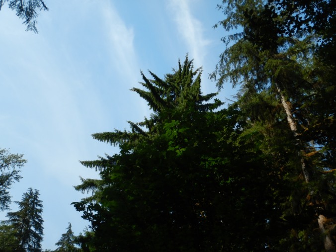
In contrast to younger forest, old-growth stands are characterized not only by large and tall living trees, but also by a complex, uneven canopy and a relatively high amount of dead standing snags and down trees. Even from a distance, the old-growth can be easy to spot once you learn to look for these signs.

Large trees with an uneven canopy reveal a stand of old-growth trees on the edge of a former clear cut.
Most of these old-growth trees were inaccessible from the road (perhaps the only reason they remain standing), but a few other giants were spared the chainsaw. Perhaps too dangerous to cut, or perched precariously on the edge of a cliff, or already dead, these trees stood as the last remnants of the forest that used to be.

A few miles up the Finney Creek Road stands a giant dead Douglas-fir tree. These trees remind me that, with the exception of fire-maintained prairies and frequently flooded areas, nearly all of the Sauk and Skagit river valleys were covered with old growth trees.
Specific trees, like Sitka spruce, along Finney Creek also indicated this was often a wet place. Sitka spruce is typically found in areas with cool summers and high rainfall.
The North Cascades, however, experience a bi-modal climate. Its cool, wet winters stand in start contrast to hot and droughty summers, and I was soon reminded of the region’s aridity even as I cycled underneath a thick canopy of needles. As the road transitioned between gravel and broken pavement, the dirt was so dry I kicked up a rooster tail of dust anytime I gained appreciable speed and each pickup truck left a cloud in their wake. (I saw about a dozen motor vehicles in this stretch of national forest. With the exception of one ATV, all were pickup trucks.)
By the time I reached FS Road 1720, I was within a few miles of Gee Point, but I still had most of the climbing ahead of me.

It’s a lot steeper than it looks.
The road, now completely dust and gravel but pleasantly lacking washboards, switch-backed through young, even-aged trees as it gained elevation. The terrain was changing as I climbed and signs of winter’s harshness began to appear. I crossed through an avalanche chute at least three times, which gave me an excuse to stop and catch my breath as I admired the power of snow to snap trees in half.

Winter and springtime avalanches are a frequent occurrence in the North Cascades area, pruning any plant too tall or any too stiff to flex under their tremendous force. In summer, the brushy chutes are prime habitat for bears and I caught a glimpse of a black bear in this one.
The bright, hot sunshine and steepness of the road slowed my speed dramatically and I accumulated a sizeable escort of biting flies, but the views kept getting better, even with a slight haze from wildfire smoke.

To reach Gee Point though, I had to hike, so I locked Rocinante to a convenient fir tree at the end of the road and started walking. About a half mile in, I entered a beautiful, uncut forest dominated by large western hemlock and Pacific silver fir. At over 4,000 feet in elevation, which is not particularly high for the Cascades and in stark contrast to the tired burned out green of lower elevations, the forest floor had a noticeably fresh appearance.


The trail soon gained a ridge line and swung to the top of Gee Point where I was rewarded with a panoramic view.


The air, so calm and comfortably warm, easily could’ve induced a nap, but then I remembered that I was running low on water and time, so I reluctantly retraced my steps to the trailhead. After taking one final break to filter drinking water from Little Gee Lake, I bombed down the mountainside.

On the rapid descent, I was glad to have wide 700x38cc tires to handle the rough surface and working brakes to check my speed. The ride home was quick, taking me half the time to ride back compared to riding there. When I reached home, my lower legs were caked in a fine powder. They felt worked too, but it was a good kind of tired.

Love the name of your bike 🙂
LikeLike
Oh, the places you will go…and take us along with you! Thank you so much for sharing. Besides the biting flies, what other wildlife did you see?
LikeLike
Great post! Love the photos. I noticed that moss was growing on one side of some of the trees. There’s an “ole” saying that moss grows on the north side of a tree. Come to find out not necessarily true according to mental floss. Thank goodness my grandfather planted garden rows south to north. 😉
🙂
LikeLike