A January Bear

It was late January, but I enjoyed nearly perfect hiking weather in Big Bend National Park. The sky was clear, the wind was calm, and the temperatures hovered in the hiking Goldilocks range (for me, that’s the low 60˚s F). I had spotted a few piles of bear scat earlier that day, but all were dry and desiccated. Then in the late afternoon, I found one particularly fresh pile of crap.

This scat was soft and pliable and hadn’t been exposed to the dry desert air for very long. (I poked it with a stick to gain a very scientific measure of its age.) Was there a bear nearby? I hoped to find out.

The previous day, I stopped in the Chisos Basin Visitor Center to purchase a book to help me search for the park’s endemic oaks. A map on the visitor center wall was marked with sticky notes identifying when and where people had spotted black bears. At least a dozen had been seen over the past two weeks. I made a mental note to watch carefully for bear sign. Maybe, just maybe, I would be lucky enough to see one for myself.

Mountain rising above pine and juniper forest

The pinyon-oak-juniper habitat near Emory Peak (center) is preferred habitat for Big Bend’s black bears.

Although I spent considerable time searching for the endemic oaks (and found at least a couple, plus some species rarely found in the U.S.), bears were never far from my mind. Backcountry campsites all had bear-resistant food storage boxes, and signs clearly informed people that bears will take your unattended pack.

metal sign. Text says, "Bear Country Do Not Leave Back Packs Unattended"

Occasionally, I’d find old piles of bear scat or a marking tree.

scratch marks on bark of tree

Black bears used this Arizona cypress (Hesperocyparis arizonica) near Boot Spring as a marking tree.

No long after I photographed the marking tree, I stumbled on the aforementioned scat. Its freshness caught my attention, but it wasn’t steaming so I couldn’t be sure if a bear was close or not. I only knew it was there earlier in the day. As I proceeded up the trail, motivated to pick up my pace and return to the campground before dark, two hikers traveling in the opposite direction told me they had just seen a bear not far from the trail. This was their first wild black bear sighting, and they spoke excitedly about their experience. I thanked them for the info and continued on, now even more alert.

The hikers said the bear was near a switchback in the trail, not far from a backcountry campsite. I slowed my pace as I approached that location, not wanting to startle the animal. A moment later, through some thick vegetation, I heard cracking branches and there it was—a black bear.

black bear ears seen through thick vegetation

My soon-to-be award winning wildlife photo of a black bear in Big Bend National Park. Move over Tom Mangelsen.

What would a bear be doing out in January? Since bears are omnivorous and eat a wide variety of food, their scat reveals a world of information about where they’ve been and what they’ve been up to. The fresh bear scat I found 10 minutes before, like the older scat on the trails, was filled with fragments of pinyon nuts and shells. Pine nuts are exceptionally nutritious, containing almost 700 calories per 100 grams. The pinyons pines in the Chisos Mountains seemed to have produced a sizable cone crop in 2016, one which helped sustain the bears into mid winter.

pile of black bear scat in grass

Pinyon pine nut shells and fragments fill this fresh pile of bear scat. I found this scat just moments before seeing an active bear.

The density of the shrubs made it difficult for me to se exactly what the actual bear was doing, but it appeared to have its nose to the ground and it wasn’t moving far. Perhaps it was still feeding on pine nuts.

pine cones on the ground

These Mexican pinyon pine (Pinus cembroides) cones still hold their fatty nuts.

Black bears in the Chisos Mountains rely heavily on habitats with pinyon, oak, juniper, and grassy talus slopes, although male bears will make more frequent use of low elevation areas. Even so, this was January 26. Shouldn’t the bear be inside a den?

Black bears in more northernly locations hibernate well before January. However, bears in Big Bend don’t typically enter their dens until late January or February, and when they do many don’t seem to fully enter hibernation. Male bears, especially, are more likely to remain active. Pregnant females in Big Bend, like other bear populations in North America, have the longest average denning period, beginning in mid to late December and ending in late April.

This winter activity isn’t unique to Big Bend’s bears. Black bears in Florida have similar winter dormancy patterns. Mild weather and the prospect of food, especially, can keep bears active for longer time spans. After all, bears are avoiding winter famine more than winter weather when they hibernate. The bear I saw probably wasn’t doing anything abnormal for a Big Bend black bear. It was just another bear doing bear things like eating and shitting in the woods.

Go Further So Bears Can Go Farther

Plans are afoot to restore grizzly bears to the North Cascades ecosystem. The draft plan includes four alternatives. Only one (Alternative A) takes no action. The others, through various strategies, all aim to restore a self sustaining population of bears in the ecosystem, an effort I support. Grizzlies should be in North Cascades, but that can’t be the end game. We need to go further to allow wildlife to go father.

The story of the grizzly bear is well documented. Like bison, grizzlies suffered immensely from westward American expansion. Once found from California to Missouri and Alaska to Mexico, this iconic species is now restricted to Alaska, western Canada, and a few isolated pockets in the Lower 48.

The grizzly bear was listed as a threatened species in the Lower 48 under the Endangered Species Act in 1975. At the time, grizzlies were known or thought to exist in only four states. Since then, its range has not expanded substantially, but the most famous grizzly population in Yellowstone National Park has grown to over 700 individuals, at or near the Yellowstone ecosystem’s carrying capacity, and the Northern Continental Divide population, centered around Glacier National Park in Montana, is also doing well with over 1000 animals.

Elsewhere in the Lower 48, grizzly bears remain rare or non-existent. The Selkirk ecosystem, in northwest Washington and adjacent British Columbia, harbors only 80 grizzly bears. The Cabinet-Yaak ecosystem in northwest Montana and northern Idaho has about 50. No grizzly bears are known from the Bitterroot ecosystem in central Idaho, nor in the San Juan Mountains of Colorado where they were rumored to exist. They are extinct in Mexico.

Grizzly bears aren’t spreading far and wide, despite a high level of protection since the 1970s. They are slow to reproduce, need isolation from people, and roam over large areas of undeveloped habitat. They maintain a foothold only where they weren’t extirpated and where humans tolerate them.

In 1982, the U.S. Fish and Wildlife Service identified the North Cascades ecosystem as a recovery zone for grizzlies in the Lower 48. The ecosystem includes over six million acres stretching from extreme southwest British Columbia to Cle Elum and the Interstate 90 corridor in Washington. The core of the ecosystem is a 2.6 million acre federal wilderness complex. The wilderness areas encompass most of North Cascades National Park, Lake Chelan National Recreation Area, and a significant portion of the Okanogan-Wenatchee and Mount Baker-Snoqualmie national forests.

Map of North Cascades area showing public land and land management agencies. Black line outlines boundary of the ecosystem.

The North Cascades Ecosystem in Washington. (From the Draft Grizzly Bear Restoration Plan, pg. 2).

A handful of grizzly bears persist in the British Columbia portion of the ecosystem, but none are known in Washington. The last verified sighting of a grizzly bear in this area of Washington was in 1996. The last time a female with cubs was seen was 1991. (A possible sighting in 2010 was likely a black bear.) According to the restoration plan, it is unlikely that the North Cascades area contains a viable grizzly bear population and grizzlies are at risk of local extinction in this ecosystem if no measures are taken to introduce more bears.

Mountain valley scene. Steep walled mountains with red-berried shrub in foreground.

Many places in the North Cascades ecosystem, like the upper Stehekin River valley, provide excellent habitat for grizzly bears.

I believe it is worthwhile to make an effort to prevent the extirpation of grizzlies in the North Cascades ecosystem, even though these bears aren’t keystones like salmon or sea otters. The bears may not create substantial changes in the area, but they will have many effects. Grizzly bears are an umbrella species. If we protect habitat for and maintain healthy populations of grizzly bears, then that large core of habitat is protected for the vast majority of other species in the area.

For grizzly bears and other large carnivores, like wolves, to regain their full potential as umbrella species, we need to do more than tolerate their existence in a few isolated areas. This is where the Draft Grizzly Bear Restoration Plan falls short. The plan aims to restore a population, not create connectivity with others. For grizzly bears to remain truly viable and self sustaining, their populations need connectivity.

The Yellowstone to Yukon Conservation Initiative is probably the most famous example of this concept. It’s an effort to protect a corridor of habitat from Yellowstone National Park north through the Rocky Mountains into the Yukon Territory. It would not only provide habitat for bears, but wolves, wolverines, elk, deer, moose, and many, many other animals and plants. It would provide animals with habitat corridors so they could migrate and shift their range as conditions dictate.

Perhaps we need to provide animals and plants on the west coast of North America with a similar corridor, one stretching from Alaska and British Columbia to Baja California. The current hodgepodge of national forests and parks along the Cascade Mountains and Sierra Nevada could provide the core. To achieve continuity between ecosystems, it would only be a (not so) simple matter of connecting those pieces together in ways to adhere habitats. (I also dream about similar conservation corridors across North America—the Appalachians, a bison commons on the high plains, and Florida among others.)

I’m not sure I will include a vision for the British Columbia to Baja corridor in any comments I might submit on the draft grizzly bear restoration plan. I already know the response: “This is outside the scope of the restoration plan.” The response is completely legit. The lead agencies for the restoration plan, the National Park Service and U.S. Fish and Wildlife Service, have no authority to create such an entity. It’ll need legislation, funding, time, and the strong support of citizens and non-government organizations to be successful.

When we have an opportunity to rewild a landscape, we should. When we have an opportunity to give a little back to wildlife, we should. But, we can do better than simply restoring grizzlies to the North Cascades. Earth’s systems don’t work in isolation. We know enough now to build resiliency into our efforts to protect wild lands and wildlife. We can provide grizzly bears with the habitat to roam into Oregon, California, and other parts of the West again. We can give the ecosystems more room to be resilient. Our goal shouldn’t be to simply have bears in a few isolated areas, but provide continuous habitat so bears can survive future changes without us. That’s how we know we’ve gone far enough.

You can submit comments on the Draft Grizzly Bear Restoration Plan through April 28, 2017.

The Other Wanderer

Most mammals aren’t keen to reveal themselves to people, which I understand. I don’t want to be around people much of the time either. Unless I’m very lucky or very observant (sometimes it’s both), I typically don’t see the more elusive animals that inhabit the North Cascades ecosystem. Winter, however, provides an opportunity to see the animals without actually seeing them.

In winter, animal tracks in snow reveal stories I could never read otherwise. Without tracks, I would be oblivious to the presence of most animals, so on every trip outside I look for them. On a recent ski journey, I found some tracks I did not expect to see.

The day was comfortable (35˚F/2˚C) and sunny. The snow was reasonable firm. I parked Large Marge at the end of plowed section of road and skied up valley. Skiing wasn’t fast, but it wasn’t a slog either. With long sleeves, I felt overdressed in bright sun, so I paused frequently to cool down and enjoy the view.

River running through snowy forest.

Pillows of snow sat on rocks in Stehekin River downstream of High Bridge in Lake Chelan National Recreation Area.

I found High Bridge, which is the boundary between the national recreation area and the national park, buried under several feet of snow.

cabin in deep snow

The NPS cabin at High Bridge was mostly buried by snow.

outhouse buried in snow

Good thing I didn’t have to use a toilet, because this outhouse at High Bridge wasn’t accessible.

Up to this point, I had seen or heard little evidence of animals. Douglas squirrels were active because I found bracts from Douglas-fir cones scattered under a couple of trees. Red-breasted nuthatches occasionally called from the tree tops (this species is one of the most common in the Stehekin Valley in the winter; at least one of the most vocal.) There was no sign of large or even medium sized mammals.

The snowy road offered a convenient path so I followed it up valley, especially since the avalanche forecast was high and I didn’t want to risk getting caught in any slide. About a mile from High Bridge, I noticed a set of faint, but fairly large tracks in the snow.

wolverine tracks in snow next to ski pole

The set of tracks I found. What animal made them?

The tracks were fairly large, although I lacked measuring tape to get accurate measurements. My first thought was “mountain lion,” but then logic started to creep in (thanks Spock). Mountain lions eat many animals, but prey probably isn’t abundant enough in the mid to upper Stehekin River valley at this time of the year to sustain a mountain lion. I saw no deer tracks, even though deer are common in the lower valley now. Other characteristics of the tracks eliminated mountain lion as the source.

  • The tracks weren’t the right size or shape.
  • Their pattern, or gait, was a 3 x 4 lope.
  • Claws marks registered with almost every track.
  • The tracks rarely broke through the snow’s surface crust. This animal, despite its size, could float on the snow.
  • Fur marks often registered around the toes.
  • Most importantly, this animal had five toes.

This was a wolverine.

wolverine track in snow next to basket on bottom of ski pole.

This fairly distinct wolverine track clearly shows the animal’s five toes. The basket on the ski pole is 7.5 x 7 cm.

The track pattern indicated it was walking in some places, but loping most of the time.

Wolverine tracks in snow.

Wolverine tracks in snow. Each set of three, starting from the bottom, represents a one lope made by the animal.

Wolverines are the largest members of the weasel family and occupy huge home ranges. The tracks were fresh, their crispness suggested they were made early in the morning or overnight. If they had been made the day before, the warm sun would’ve obscured some of their finer details.

What might it eat in this habitat? Perhaps one of the squirrels or hares out and about.

scales from Douglas-fir cone scattered on snow

A Douglas squirrel had recently torn apart a Douglas-fir cone on this pile of snow.

Snowshoe hare tracks in snow next to ski

Snowshoe hares were also moving about the forest.

At Tumwater Bridge, the wolverine continued across right next to tracks of a marten, a smaller more arboreal member of the weasel family.

wolverine tracks (bottom) next to smaller marten tracks. Tip of ski at bottom center.

Wolverine tracks (bottom) run parallel to marten tracks.

The day was waning at this point, so I turned around and left the wolverine and its tracks behind.

Last year, a large male was trapped and radio collared at Easy Pass by the U.S. Forest Service and Washington Department of Fish and Wildlife. This is almost 20 kilometers due north of the tracks I found. Could it have been the same one?

Maybe, maybe not. Wolverines occupy huge territories and are rare in this area. I was lucky to stumble upon this set of tracks before they disappeared in overnight rain. That day, I was probably the only human in the south unit of North Cascades National Park, but I certainly wasn’t the only mammal prone to wander.

Read more about on the wolverine’s status in Washington.

National Parks Aren’t Pure

National parks are often billed as places of change and integrity (even by me), where nature can take its course. Yet, they face unprecedented challenges and are managed so that nature doesn’t take its course in many cases. Some parks cull wildlife through controlled hunts or periodic roundups (Wind Cave, Badlands). Biologists occasionally control one species to benefit an endangered animal (Cape Cod). Now, the National Park Service has developed a draft plan to prevent the extirpation of wolves from Isle Royale National Park in Michigan. Plans such as this, which suggest increasing levels of intervention in ecosystem management, are the future of conservation in national parks. This is a future, and a current reality, where humans have so fundamentally altered the planet that nature doesn’t exist outside our influence. Parks aren’t pure anymore.

In the early 20th century, national parks and monuments were managed primarily for aesthetics, spectacle, and recreation. Park superintendents and rangers had preconceived notions of what parklands should look like and the experiences they should provide visitors. Caves were manipulated and became showcases to march people through sensitive areas. Predators like wolves and mountain lions were vilified and persecuted. Bears were a sideshow. Feeding them at dumps and roadsides was often encouraged. Insecticides were sprayed to control native insect outbreaks. The long-standing philosophy was: parks ought to be pretty and tidy.

As respect for wilderness and ecological integrity grew, people began to reconsider how national parks were managed. In 1963, an advisory board for the Department of Interior issued Wildlife Management in the National Parks, or the Leopold Report after the board’s chair, A. Starker Leopold. Admittedly “conceptual,” the Leopold Report fundamentally altered natural resource management in parks.

The Leopold Report catalyzed a time of real soul searching for park managers. The report asked, “How far should the National Park Service go in utilizing the tools of management to maintain wildlife populations?” It acknowledged that few parks are large enough to be self-regulating ecosystems. It went further by stating the biological communities in parks are artifacts and that management is often essential to maintain some biotic communities. The report famously recommended the National Park Service manage parklands as “vignettes of primitive America,” a philosophical shift that on the surface represents a more pure vision of what national parks should and could be—places that resemble the prevailing conditions experienced by the first Europeans.

While noble, this ideal is wrought with fallacy. The Leopold Report admitted primitive America could never be recreated fully. Just to list a few examples: passenger pigeons are extinct, American chestnuts are functionally extinct, wild bison almost became extinct, and wolves were extirpated across most of their range in the United States. It also made no accommodation for Native American use and manipulation of the land. Essentially, any recreation of “primitive America” is artificial, but something to strive for.

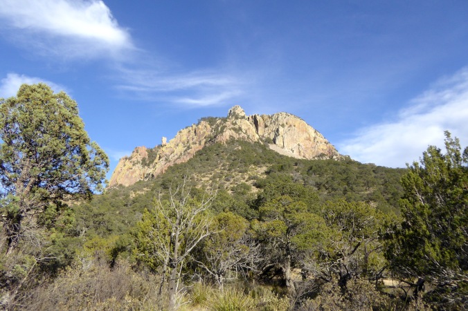
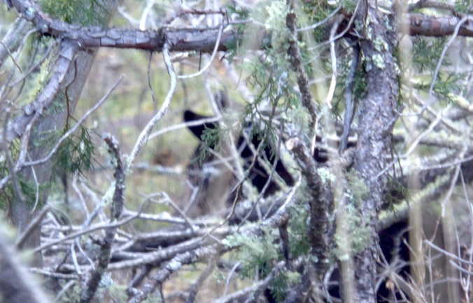
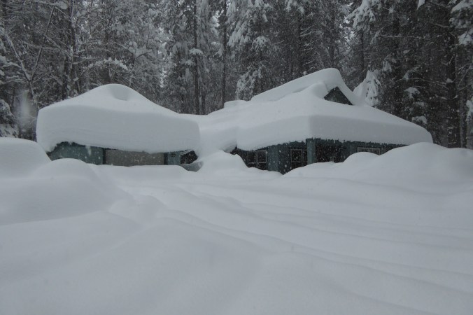
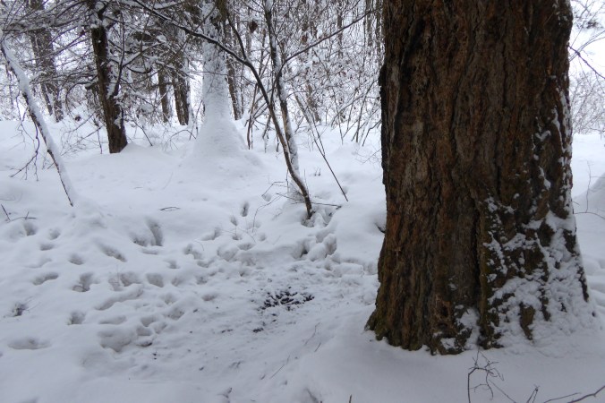
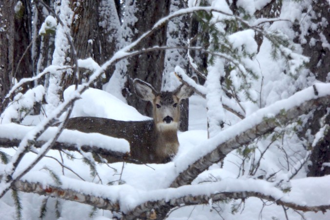
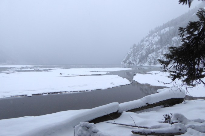
What should we do when the line blurs between maintaining a primitive landscape and acknowledging there is no longer any such thing? Isle Royale National Park is one of the most recent parks to grapple with this issue. Isle Royale is the largest island in Lake Superior, sitting about twenty miles east of Grand Portage, Minnesota, and most of it is designated federal wilderness. The upper Great Lakes region was one of the few places in the Lower 48 states where wolves maintained a foothold throughout the 20th century, but Isle Royale was wolf-free in the early 1900s. Wolves only returned to the island in the late 1940s after crossing the ice on Lake Superior.

Only two wolves were observed on the island in 2016 (the historical average, according to the draft wolf introduction plan, is 20-30). The population plummeted because disease (canine parvovirus) and a lack of connectivity with the mainland reduced genetic diversity. The animals are now extremely inbred and remain in a genetic bottleneck they probably won’t escape. Even though Isle Royale has numerous moose (the wolves’ primary prey), the wolves will likely disappear from the island without human intervention. Is it wrong to let the wolves disappear?

Yellowstone National Park’s effort to reintroduce wolves is the most famous wolf reintroduction program in history. It is also a remarkable success, from the standpoint of the wolf. The reintroduction of wolves arguably shifted the ecosystem into top-down mode where large predators like wolves exert strong influence on the behavior and abundance prey species. Yellowstone’s effort corrected a wrong—people extirpated the park’s wolves through hunting, trapping, and poisoning. Now, a strong case can be made that humans are driving Isle Royale’s wolves to extirpation, just in a less obvious way.

At first, disease and a lack of connectivity with the mainland seem like natural influences, after all Isle Royale is an isle and many diseases infect wolves. Canine parvovirus is not native to the island, however. This disease caused the wolf population to decline drastically in 1981, from 50 to 14, and the population has never fully recovered. Wolves immigrate and emigrate from the island over ice bridges on Lake Superior. A warming climate trend has drastically reduced the frequency of the ice bridges, so much so that only one formed in the first decade of the 20th century. As the climate continues to warm, ice bridges will form less and less. For those reasons, you could easily make a case that humans precipitated the decline of wolves and therefore we should intervene.

The island would become a different place without wolves. Vegetation changes would become more pronounced and happen at a faster rate. Moose browsing threatens the persistence of big-tooth aspen, red oak, and balsam poplar on the island, but vegetation changes are not tied to moose alone. Computer models indicate many dominant tree species (balsam fir, white spruce, black spruce) may disappear from the island due to a warming climate. Paper birch and quaking aspen are expected to undergo serious declines. Park managers expect that in the presence of wolves, moose herbivory would be less likely to exacerbate climate change’s influences on vegetation. Looking at the issue from the perspective of ecosystem health and biological integrity, the presence of wolves is probably necessary to prevent habitat degradation, or at least slow it. Therefore, should we intervene? The NPS thinks so, and I don’t necessarily disagree.

There is no ecological difference between humans supplementing wolves on the island and wolves immigrating naturally across an ice bridge. The only difference is mental, cultural. We’d know we did it. We’d know we manipulated the ecosystem. We know we messed with primitive America. For some people, that trammels the island’s wilderness and severely impacts its natural quality.

We need to get over any of that if we want to maintain some biological integrity in the future.

In The End of Nature, Bill McKibben argues that by burning fossil fuels, we’ve fundamentally altered Earth’s atmosphere causing global warming, and nature, as it is classically known (the physical world outside of humanity and human creations), no longer exists. Now, not even the deepest ocean trenches are free of our fingerprints. There is no place untouched by humanity. Even if we did not alter climate, humans are so numerous and so thoroughly dominate most terrestrial ecosystems that McKibben’s hypothesis would still stand. We impact the evolution of life on Earth.

Recognizing that much has changed and much has been learned since 1960s, a National Park System Advisory Board revisited the Leopold Report in 2012 and recommended the NPS manage for constant change, instead of striving for a past ideal. Isle Royale’s plan could be supportive of the old and new philosophies. Wolves are valued members of a primitive America, but under current and projected future climate conditions, Isle Royale’s wolves may indefinitely need a helping human hand to remain viable. If we value wolves on the island, then we’re probably committed to supplementing population in perpetuity. Revisiting Leopold recommends the NPS expand their management strategies to encompass a geographic scope beyond park boundaries. If parks, in order to remain ecologically viable, need greater habitat connectivity to other wild lands, then they should forcefully advocate for that. We can no longer pretend national parks are vignettes of primitive America. Wilderness areas can no longer be considered “untrammeled” and “affected primarily by forces of nature” as stated in the 1964 Wilderness Act. We have to choose what parks represent and what they protect.

I’m not opposed to any of the alternatives proposed to introduce wolves to Isle Royale. It’s probably wrong to let wolves disappear from Isle Royale because climate change limits the chances of more wolves immigrating to the island naturally, but there are a lot of threats to biodiversity and we need to choose our battles wisely. We won’t be able to intervene in every Isle Royale-like scenario.

Are we any more intelligent or sophisticated than managers, rangers, and park visitors in the 1910s and 1920s when wolves were more vilified? They could’ve left animals alone to do their own thing. They didn’t, because they didn’t want to. Because, American culture said we should do otherwise. Now, we face a lot of the same questions. What do we value most in parks? How should we protect the things we value within them?

I like to believe, sometime in the future, humans will have voluntarily reduced our footprint enough so that most plants and animals can evolve without our influence. We’re not there yet, certainly not with 7.4 billion of us living in a market economy driven largely by greater and greater levels of consumption. So, yeah, we should help Isle Royale’s wolves, but let’s not pretend national parks are pure wildlands. There is no purity in national park ecosystems anymore. Perhaps there never was.

(The NPS is accepting comments on the Isle Royale National Park Draft Environmental Impact Statement to Address the Presence of Wolves through March 15, 2017.)

wolf standing in snowy forest

Photo courtesy of Isle Royale National Park.


More Snow? Yes, More Snow.

Yesterday, I wrote about a ski trip in Stehekin Valley’s ample snow. Since I took that trip a few days ago, more snow has fallen. A lot more.

This was the scene I woke to yesterday.

Deep snow outside of home

And, snow was slowly enveloping the neighbor’s house.

deep snow covering home

This is nothing abnormal for the region, and in many way’s it is expected. In winter, the jet stream over Alaska and Canada shifts south over the Pacific Ocean. Air masses traveling across the Pacific at this time of the year are “immodestly moistened,” as Daniel Matthews describes in Cascade-Olympic Natural History, bringing heavy precipitation to Washington, Oregon and California. The Cascade Mountains and Sierra Nevada are effective moisture traps for these storms. When storms encounter the mountains, the air rises and cools causing it to precipitate its moisture. The Stehekin Valley in Lake Chelan National Recreation lies east of the Cascade Crest, so the area experiences drier weather than the wetter Skagit River valley to the west. However, the valley is not far enough east to experience the Cascades’ full rain shadow, hence the ample snowfall recently.

In my estimation, at least three feet (approximately 50-100 cm) of snow has accumulated over the past five days, much of it falling in the last 24 hours. Higher elevations certainly gained more. I was curious to know the exact snow depth near my house, which lies at a modest 1100 feet (335 meters). After the snowfall abated yesterday afternoon I got out the snow shovel prepared to dig in.

I chose to measure the snow out in a small meadow away from the influence of trees, but getting there took some effort. The first few feet of snow was very soft. The base to stand on, if you could call it that, was well under the surface.

After floundering my way into the meadow, I started digging…

snow shovel in deep snow

and digging…

snow shovel in deep snow

…and digging and digging until I reached the soil.

snow shovel in deep snow

The pit was over 65 inches (166 cm) deep!

Snow shovel in deep snow next to measuring tape. Tape is 65 inches long.

measuring tape in snow. Numbers at top of snow level read 65 inches or 166 centimeters.

Long time residents describe winters with lots of snow and occasional rain too. Rain compacts the snow, increasing its density but decreasing its depth. This winter, I’m told, is a bit of an exception with lots of snow, but without temperatures warm enough for the occasional rain storm.

Winter snowfall is essential to the well being of millions of people across the West, especially farmers who cannot depend on summer rain to sustain crops. Snowmelt in rivers quenches the thirst of residents in Los Angeles, Las Vegas, Phoenix, Salt Lake City, and many, many other places. It’s a reservoir, slowly releasing its water in spring and summer when it is needed most.

Climate models indicate changing weather patterns will come to the West as temperatures rise. The North Cascades region won’t be without snow, but changes will be felt, and in a lot of ways the region is already experiencing them. More rain will fall and less snow will collect on the mountains. At first this may seem insignificant. However, this will change the timing and duration of peak stream flows. Currently, stream discharges peak in the spring and early summer when snowmelt is heaviest. The pattern seems to be shifting toward more frequent peak flows in spring and fall. Rain on snow events can cause heavy flooding, damaging roads and homes. (Stehekin River has experienced three 100 year floods since 1995.) Warmer springs temperatures melt snow faster, affecting sensitive habitats like montane wetlands, places that harbor sensitive species like the Cascades frog. Soils dry faster without snow too, increasing the risk of wildfire.

Snow is often viewed as an annoyance or danger, delaying and restricting travel, but it is a key component of ecosystems where it occurs. Snow on mountains is a water tower, one we can’t afford to lose. (It’s also a lot of fun to play in.)

Person standing in deep snow pit. Pit is 65 inches deep.

(I’m really not that short, am I?)

Let It Snow

After three months of aimless wandering, I’m back in Stehekin and, well, there’s a lot of snow.

snow covered trees under overcast sky

Stehekin and Lake Chelan National Recreation Area lie just east of the Cascade Crest, but well within the Cascade Mountains. When moisture-laden winter storms move east from the Pacific Ocean over the Cascades, they dump prodigious amounts of snow. Stehekin averages 120 inches of snowfall each winter. In 1996, 298 inches of snow fell, almost 25 feet. Although I don’t know how much snow has fallen so far this winter, it’s not a trivial amount.

Earlier this week, I was eager to explore the snow-shrouded landscape, so I strapped some skis on to Large Marge and headed out.

No, not that Large Marge. This Large Marge, my fat tire bike.

fat tire bike with skis strapped horizontally on it

Two tools of winter exploration: Large Marge and cross-country skis.

I cycled on an icy, freshly plowed road to the Stehekin landing strip to ski the Stehekin River Trail, which parallels the Stehekin River downstream to Lake Chelan. It’s a pleasant hike in summer when the trail is easy to follow. The snow changed this familiar trail greatly. Where thick snow obscured the exact route I had to watch gaps in the vegetation carefully to stay on the trail.

deep snow and trees

Where’s the trail?

I needn’t worry about getting lost though. The trail is bordered by Stehekin River one on side and 8,000 ft. tall mountains on the other. I only had to stay in between. The trail has no significant elevation gain, but traverses some tricky spots for someone like me who sucks at skiing.

small open water channel next to steep slope

Caption: Short, steep bluffs next to the river’s side channels were difficult to negotiate on narrow skis. I often side-stepped up and down these places instead of risking a fall into open water.

The scenery was worth the effort, however.

River and snow covered trees

Stehekin River.

Animal tracking is always on my mind when there’s snow. The snow records much about an animal’s behavior as it moves through the landscape. The deep snow of the Cascade Mountains present a very difficult challenge for large and medium-sized animals, however. If you’re not a small mammal that can live under the snow or in the trees, then you either hibernate or abandon the high country and migrate to areas with less snow pack.

Partly because of lots of fresh snow and partly because most animals are either under the snow or in a different area altogether I didn’t see many animal tracks. A few Douglas squirrels were out and barked a warning when I skied under their tree, but there were few fresh signs of large animals on the upper half of the trail in the deep, soft snow.

Where the trail passed under a thick canopy of Douglas-fir and grand fir, I found the skiing easier. Tall conifers intercept a lot snow before it falls to the ground. When it does fall, it often does in large clumps that compact quickly on the ground. In these areas, deer and elk often “yard-up” to avoid getting mired in the deeper snow of open areas. Might I find deer and elk sign here?

ski tracks through forest

I encountered little fresh powder where conifer trees grew thickly. These areas are often preferred places for deer and elk to travel and rest. In open areas, my feet plowed through at least 20 centimeters of newly fallen snow, making travel more difficult.

On the river’s floodplain, under a tall Douglas-fir, I found a depression where barely an inch of snow covered the ground. Elk tracks radiated away from it, and a few pellets of elk scat lay within it. Evidently, this was a frequently used resting place for at least one elk.

depression in snow from resting elk

An elk had repeatedly used this bed to rest. For scale, the Douglas-fir trunk is larger than one meter in diameter.

Shortly afterward, my approach spooked an elk away from the fallen branch it was feeding on.

conifer twig clipped by browsing elk

Twigs nibbled by members of the deer family have ragged edges. An elk recently nipped the end of this Douglas-fir twig.

I only caught a glimpse of the elk, but it was a bull with sizable antlers. Carrying antlers into late winter seems counterintuitive and a waste of calories. Those antlers weigh a lot, and it can’t be cheap, energetically speaking, to keep them on your head. Shouldn’t this animal have shed its antlers by now?

Unlike deer and moose, who shed their antlers in early winter, elk often keep their antlers until spring. Different selection pressures may have controlled the timing of antler shedding. Antlers can be used for defense, but they are most often used to maintain dominance. This is especially important during the fall rut. For elk, antlers may be needed to help maintain dominance in the winter as well when access to food is limited. Deer and moose tend to overwinter in small groups or solo where competition with fellow moose or deer for browse may not be an issue. Elk, in contrast, overwinter in larger herds where antlers may be needed to maintain dominance; not for access to females of course, but for access to food.

That elk appeared to be alone, but as I approached the end of the trail near the lake, I skied past two deer, at least one of which was a buck, sans antlers.

mule deer looking at camera through fallen trees

The Stehekin River Trail ends at Weaver Point where the National Park Service maintains a boat-in/hike-in campground. Snow reduced visibility in the dim afternoon light, but the scene was gorgeous.

snow covered mud flats and steep mountainside

Lake Chelan seen from Weaver Point.

Seeing the land blanketed in a meter of snow gives it a very different appearance. It was almost as if I was exploring the area for the first time. In a way, I was. Winter in the Stehekin Valley is wholly different than summer.