In my last post, I left Bellingham, WA and crossed the Cascade Mountains via Amtrak’s Empire Builder. On day two of the journey to Pittsburgh, the route and landscape would prove to be even more contrasting than the previous twenty-four hours.
Overnight the train route crossed eastern Washington and Idaho. I woke around sunrise to a foggy scene along the Kootenai River. The river along this stretch harbored few rapids that I could see, but it was brimming with muddy water. Spring and early summer is the season of high runoff in the Rockies.
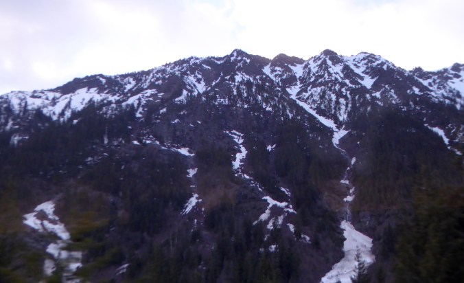
 The train soon left the Kootenai River and passed through the Salish Mountains to the Flathead River valley. After Whitefish, Montana we began a slow climb toward the continental divide. Along the middle fork of the Flathead River, between Glacier National Park to the north and the Great Bear Wilderness to the south, lies one of the most scenic stretches of rail on the route. Every bend provided new views of the snow-capped mountains bounding the narrow valley.
 While I enjoyed the mountain scenery, for me the real highlight of this section was the stark contrasts in vegetation and climate. The low valleys on the west side Glacier National Park capture enough precipitation to support the growth of species also found within the wet forests Washington’s Cascades. At West Glacier I caught glimpses of the some of the eastern-most stands of western red-cedar (Thuja plicata). This species, you could say, likes it feet wet and it won’t grow where soil moisture is too low. In this part of North America, a lack of suitable habitat squeezes the red-cedars into narrower and narrower confines, and it quickly disappeared as we traveled east.
Western red-cedars wouldn’t be the only species to vanish in the next fifty miles. On the approach to the continental divide, lodgepole pine (Pinus contorta) and Douglas-fir (Pseudotsuga menziesii) predominated. Lodgepole pine was especially abundant in areas that had experienced forest fires in the last two decades. As the train crossed the continental divide at Marias Pass (el. ~5200 feet) the forest began to disappear, partly from the elevation (treeline was only a thousand or so feet higher) and largely from increasing aridity.
Terrestrial habitats often intergrade slowly, mixing in quilted patches before one finally yields to another. At East Glacier, Montana though, the montane Rocky Mountain forest seemed to simply end where the short grass prairie began. Here is one of the most dramatic terrestrial biome shifts to be found in the United States.
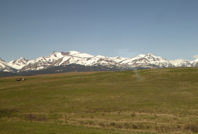 Like the Cascades, the Rocky Mountains create a strong rain shadow across northwestern Montana. Browning, MT, east of the mountains, receives only half the precipitation of West Glacier. For the next thousand miles across Montana and North Dakota prairie dominated where the land was not cultivated or otherwise appropriated by people. The only trees were either planted or grew along creek and river bottoms where their roots could tap into a shallow water table.
 Wildlife became easier to spot on the open prairie. Through Montana the railroad took us just south of the true prairie pothole region, but many of the low-lying areas adjacent to the track held water. Every little puddle seemed to harbor a few pairs of ducks and geese. I casually spotted at least ten waterfowl species during the day. Undoubtedly more used the habitat. I just failed to see them. Small prairie dog towns, frequented by red-tailed and Swainson’s hawks, occupied some of the ranching areas. I counted at least two-dozen pronghorn grazing or resting small, scattered bands.
In eastern Montana, badlands appeared in the distance and became more prominent as we approached and crossed the North Dakota state line. Parts of this area are rich with fossils and I wanted more than a little bit to poke around the hills for ancient bones.
 In North Dakota, fracking wells became a prominent sight as the sun set.
 On the morning of my third and final full day on the train I woke up somewhere in Minnesota where the prairie had long since yielded to cornfields. This was, historically, a battleground between prairie and forest. In this area, where precipitation is great enough to support tree growth, fire was the prairie’s greatest ally. Periodic burning kept the forest at bay. After American settlement, the prairie was plowed and fires suppressed. Along this ecosystem margin today, you’re more likely to see farm fields bordered by trees than a patchwork of prairie and forest.
Spring was also much less advanced in west-central Minnesota compared to the Puget Sound area where my trip began. Quaking aspen was washed with small vibrant leaves but some of the paper birches had barely broken bud.
For over a hundred miles south of Minneapolis and St. Paul, the route followed the Mississippi River where tall bluffs bordered the river valley…
 …and the floodplain forest drowned in water.
 The train crossed the Mississippi one final time at La Crosse, WI. Heading upland into central Wisconsin, jack pine (Pinus banksiana) appeared on sandy soil. This species is essentially the eastern equivalent of lodgepole pine and the two hybridize where their ranges overlap. Like it’s western sibling, jack pine is well adapted to fire, often holding serotinous cones on its branches for years before fire melts the cones’ resin and releases its seeds.

You’ll have to take my word for it: Those are jack pines in the middle ground.
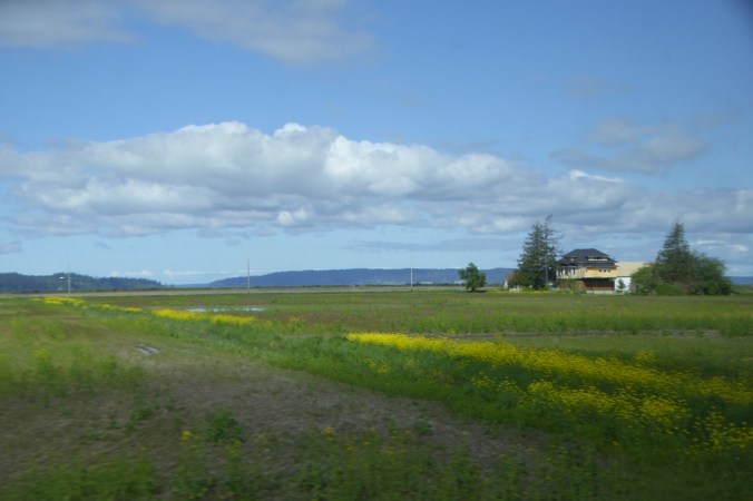
East of Madison, the landscape quickly became suburbanized then urbanized as we approached Milwaukee. We never seemed far from Lake Michigan, but I only caught a couple of glimpses of the great lake.
I transferred trains in Chicago for the final leg of the journey to Pittsburgh. Through Gary, Indiana, the land remained very urban with the exception of the forested dunes on the inland side of Indiana Dunes National Lakeshore. Night hid most of Indiana and all of Ohio. After a rough night of sleep, I arrived in Pittsburgh at 5 a.m.
There’s a lot of sitting on a railroad trip from Puget Sound in Washington to Pittsburgh and I felt very antsy, so I capped off my first day in town with a fifty-mile bike ride on the Great Allegheny Passage. The exercise and change of pace was welcome, but so was watching the landscape through the train window.


 After transferring to the
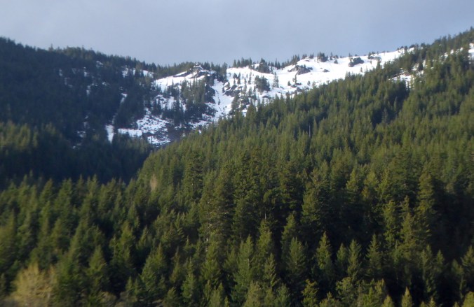
  This section of rail, besides letting me enjoy scenes of lush forest, provided a conspicuous example of habitat changes due to climate, particularly the Cascades’ rain shadow effect. When moisture-laden storms from the Pacific reach the Cascades, the rising air cools and drops a considerable amount of its moisture on the west side of the mountains. Far less remains to wet the mountains’ eastern slopes.