Lake Chelan

If you’ve never been to Stehekin, it takes some time to get to. Lying at the head of Lake Chelan, Stehekin is only accessible on foot, by boat, or plane. I’ve traveled in and out many times over Lake Chelan in the past year and each time, it gave me time to witness the climatic, topographic, and glacial changes that make this area biologically diverse.

View from ridge looking into deep valley with lake

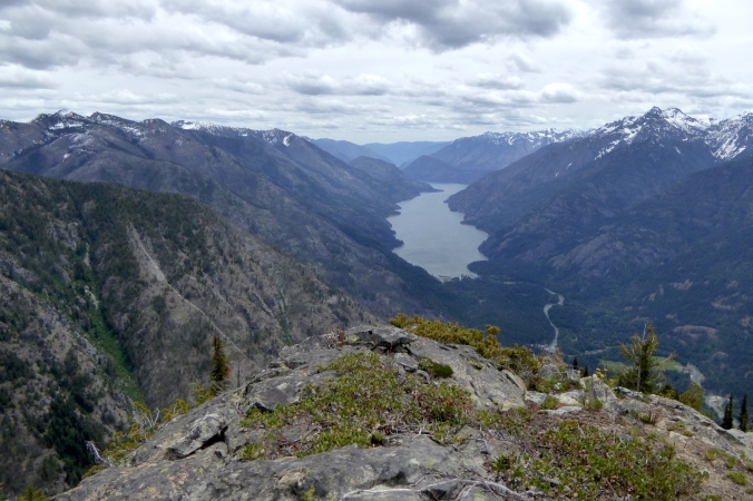
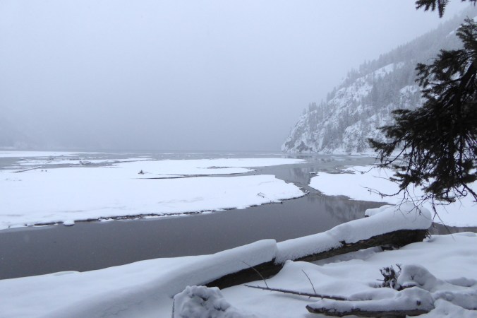
Upper Lake Chelan and the lower Stehekin River valley seen from a ridge above Rainbow Creek.

Lake Chelan is cleaved into the heart of the North Cascades and is one of the more spectacular places in the area, biologically and geologically. Most people who arrive in Stehekin in Lake Chelan National Recreation Area do so via ferry. When the ferry motors away from Fields Point Landing, about one third the distance from Chelan to Stehekin, it leaves a relatively dry habitat with sparse tree cover, but this can look lush compared to areas farther down lake. At the lake’s outlet, the town of Chelan receives only 11.4 inches (29 cm) of precipitation per year. It is a downright arid place.

Mountain slopes with few trees above lake

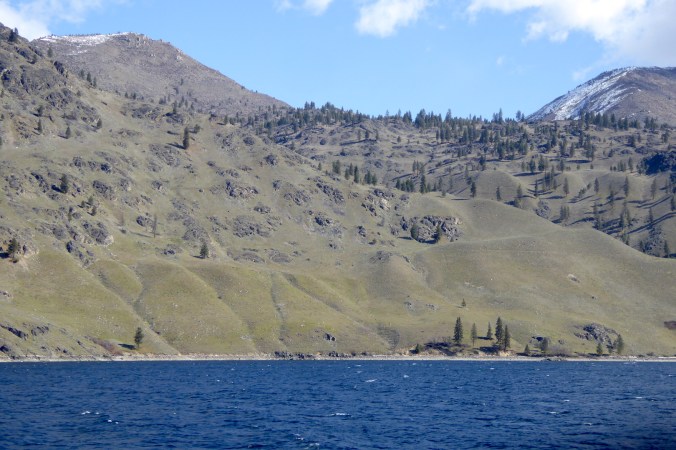
Sparse vegetation along the lower half of the lake is the result of an arid climate with hot, dry summers.

As the boat continues up lake, stands of ponderosa pine and Douglas-fir slowly thicken. At the elevation of the lake (1,100 feet, 335 meters) however, several factors continue to limit tree growth even along the lake’s upper reaches. Fires frequently burn the slopes while bare rock and sheer walls inhibit soil formation. Summer drought is common with scant rain and hot, dry temperatures that bake the lake’s western and south facing slopes. During spring, the mountainsides are flush with water from snow melt, but in late July and August the soil will become so desiccated it rises like powder under your footsteps.

Snow covered mountain with dead standing trees

In 2015, wildfires burned large areas near Lucerne, a small village on the lake.

Mountainside with dead standing trees and snow filled gullies

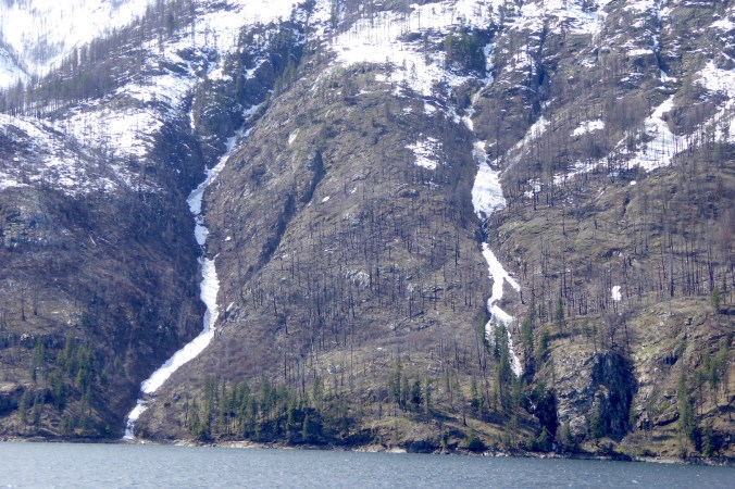
With ample snow melt, water is easy to find on the mountainsides next to the lake. In mid to late summer however, many of the gullies will become completely dry.

The North Cascades are famous for prodigious snowfall and plenty still clings to the mountains at this time of year. During the last glacial maximum, nearly the whole lake basin was filled with a glacier that carved it into a land-locked, steep-walled fjord.

In its middle reaches, Lake Chelan plunges to great depths. The mountain topography on either side of the valley restricted the glaciers outward flow, but not its forward movement. The tight topographic pinch created by the mountains enhanced downward erosion by the glacier. The lake basin, averaging only a mile wide over 50 miles, was greatly over-deepened, even reaching below sea level. At its deepest point the lake is almost 1500 feet (456 meters) deep. (More info about Lake Chelan’s underwater topography.)

Diagram of lake basin. Y axis is depth in feet and and X axis is length in miles

The upper basin of Lake Chelan is its deepest and most voluminous. Near mile 16 on the horizontal axis lies a submerged glacial moraine.

Section of bathymetric map of Lake Chelan. Contour Lines in 100 foot intervals. Greatest depth 1486 feet.

The steep mountain topography continues underneath the lake.

Steep mountain above lake

Sheer cliffs plunge steeply into Lake Chelan above the deepest areas of the lake. Below the boat on which I stand, the water is over 1,000 feet deep.

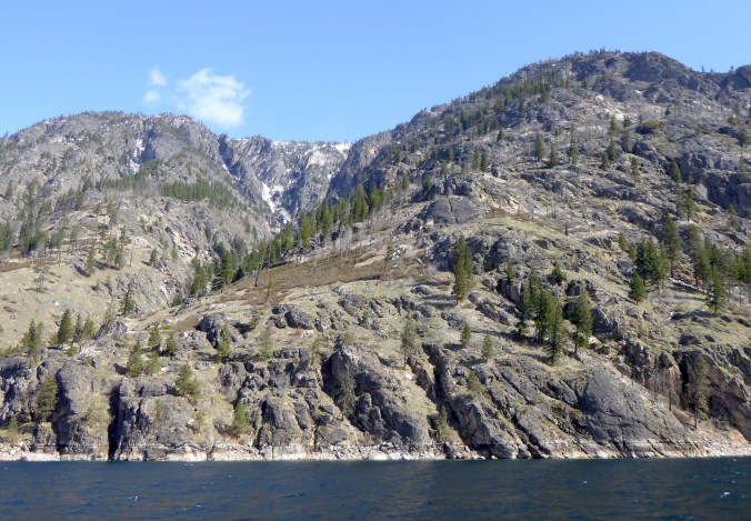
The volume of the former glaciers is apparent by looking at the shape of the mountains. Where glaciers overran the mountains, the ridges and peaks are smoothed over and somewhat rounded. Mountains that were tall enough to escape complete glaciation remain craggy and jagged. Measured perpendicularly from the deepest area on the lake to the crest of nearby mountains, vertical relief can reach 9,000 feet (2,744 m) and glaciers filled most of the space in between.

Snow covered mountain peak and ridgeline

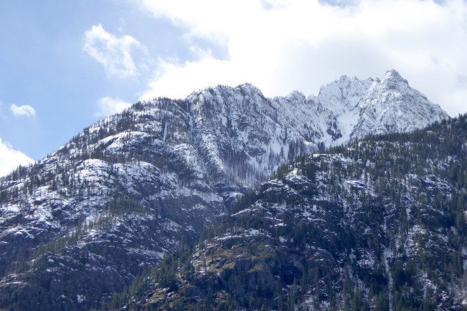
Knife-edged ridges and peaks were not completely glaciated. Glacier ice eroded lower ridges, smoothing them over.

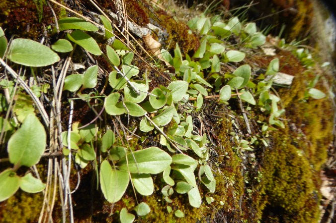
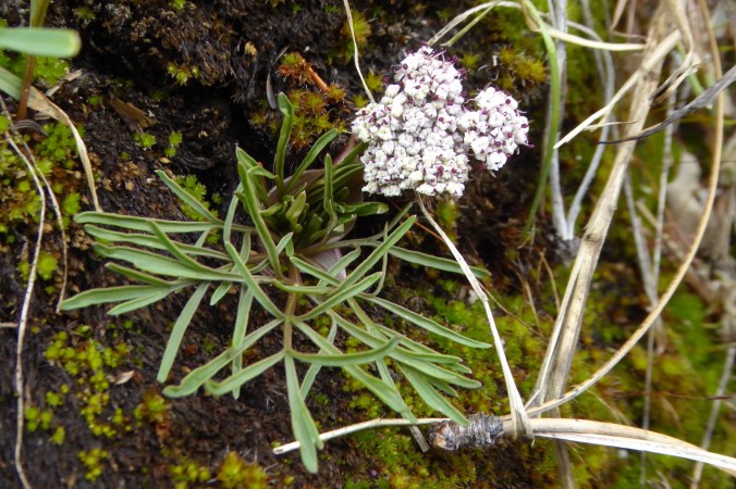
Looking at a map of Washington before I arrived here, I didn’t fully understand or appreciate the area’s diversity or its glacial story. Here, arid adapted species like sagebrush can live on hot, dry rocky outcrops just a short distance away from a cool, moist ravine with western red cedar and thimbleberry. Glaciers left their mark up and down the lake, accentuating topography even further. Lake Chelan is Washington’s inland fjord surrounded by, perhaps, the most diverse habitats in the whole North Cascades ecosystem.

First Flowers

Spring has officially arrived in the northern hemisphere, and southwestern facing slopes in the North Cascades, especially near Lake Chelan, are thawing quickly. This is where I seek the first herbaceous and mossy greenery of the year.

leaves and moss on rock

Green leaves and vibrant moss are a welcome sight after a snowy winter.

At the lakeshore, approximately 1100 feet (335 meters) in elevation, deep snow and relatively mild winter temperatures (daily lows for December through February average around 25˚F/-4˚C) prevent soil from freezing significantly. During late winter and early spring, sunlight directly strikes the southwestern facing slopes along the lake. Bare rock and tree trunk create heat islands that further warm the soil and melt remaining snow. The first wildflowers of the season bloom here, taking advantage of conditions that higher elevations will not experience for months. Two species are just setting blossoms now.

wildflower with umbel of yellow flowers and pinnate leaves, among other small vegetation

Wyeth biscuitroot (Lomatium ambiguum) near Stehekin Landing.

wildflower with umbel of white blossoms and pinnate leaves

Geyer’s biscuitroot (Lomatium geyeri) near Stehekin Landing.

Biscuitroot (Lomatium sp.), also called desert-parsley, is a large and widespread genus of plants in western North America. The species I found are not exclusively restricted to the rocky areas near the lake, but these individual plants have found an ideal early season microhabitat. The slopes where these plants grow are very warm, although it may not seem that way when they are dripping with snowmelt.

bright green moss, dripping with water, on side of rock

Anyplace it is exposed near upper Lake Chelan, moss is saturated with snow melt.

By the end of June, perhaps even before, these plants will be parched by low humidity and scorched by high daytime temperatures. The soil, instead of wet and clumpy, will become dust. Flowering plants in this location do their business quickly—blooming and setting seed before the soil completely desiccates and ground temperatures become too hot. They get ahead now, because conditions allow them to. Up valley and higher on the mountainsides, under the snow, other members of their respective species are waiting for their own moments in the sun. It’s only a matter of time.

Let It Snow

After three months of aimless wandering, I’m back in Stehekin and, well, there’s a lot of snow.

snow covered trees under overcast sky

Stehekin and Lake Chelan National Recreation Area lie just east of the Cascade Crest, but well within the Cascade Mountains. When moisture-laden winter storms move east from the Pacific Ocean over the Cascades, they dump prodigious amounts of snow. Stehekin averages 120 inches of snowfall each winter. In 1996, 298 inches of snow fell, almost 25 feet. Although I don’t know how much snow has fallen so far this winter, it’s not a trivial amount.

Earlier this week, I was eager to explore the snow-shrouded landscape, so I strapped some skis on to Large Marge and headed out.

No, not that Large Marge. This Large Marge, my fat tire bike.

fat tire bike with skis strapped horizontally on it

Two tools of winter exploration: Large Marge and cross-country skis.

I cycled on an icy, freshly plowed road to the Stehekin landing strip to ski the Stehekin River Trail, which parallels the Stehekin River downstream to Lake Chelan. It’s a pleasant hike in summer when the trail is easy to follow. The snow changed this familiar trail greatly. Where thick snow obscured the exact route I had to watch gaps in the vegetation carefully to stay on the trail.

deep snow and trees

Where’s the trail?

I needn’t worry about getting lost though. The trail is bordered by Stehekin River one on side and 8,000 ft. tall mountains on the other. I only had to stay in between. The trail has no significant elevation gain, but traverses some tricky spots for someone like me who sucks at skiing.

small open water channel next to steep slope

Caption: Short, steep bluffs next to the river’s side channels were difficult to negotiate on narrow skis. I often side-stepped up and down these places instead of risking a fall into open water.

The scenery was worth the effort, however.

River and snow covered trees

Stehekin River.

Animal tracking is always on my mind when there’s snow. The snow records much about an animal’s behavior as it moves through the landscape. The deep snow of the Cascade Mountains present a very difficult challenge for large and medium-sized animals, however. If you’re not a small mammal that can live under the snow or in the trees, then you either hibernate or abandon the high country and migrate to areas with less snow pack.

Partly because of lots of fresh snow and partly because most animals are either under the snow or in a different area altogether I didn’t see many animal tracks. A few Douglas squirrels were out and barked a warning when I skied under their tree, but there were few fresh signs of large animals on the upper half of the trail in the deep, soft snow.

Where the trail passed under a thick canopy of Douglas-fir and grand fir, I found the skiing easier. Tall conifers intercept a lot snow before it falls to the ground. When it does fall, it often does in large clumps that compact quickly on the ground. In these areas, deer and elk often “yard-up” to avoid getting mired in the deeper snow of open areas. Might I find deer and elk sign here?

ski tracks through forest

I encountered little fresh powder where conifer trees grew thickly. These areas are often preferred places for deer and elk to travel and rest. In open areas, my feet plowed through at least 20 centimeters of newly fallen snow, making travel more difficult.

On the river’s floodplain, under a tall Douglas-fir, I found a depression where barely an inch of snow covered the ground. Elk tracks radiated away from it, and a few pellets of elk scat lay within it. Evidently, this was a frequently used resting place for at least one elk.

depression in snow from resting elk

An elk had repeatedly used this bed to rest. For scale, the Douglas-fir trunk is larger than one meter in diameter.

Shortly afterward, my approach spooked an elk away from the fallen branch it was feeding on.

conifer twig clipped by browsing elk

Twigs nibbled by members of the deer family have ragged edges. An elk recently nipped the end of this Douglas-fir twig.

I only caught a glimpse of the elk, but it was a bull with sizable antlers. Carrying antlers into late winter seems counterintuitive and a waste of calories. Those antlers weigh a lot, and it can’t be cheap, energetically speaking, to keep them on your head. Shouldn’t this animal have shed its antlers by now?

Unlike deer and moose, who shed their antlers in early winter, elk often keep their antlers until spring. Different selection pressures may have controlled the timing of antler shedding. Antlers can be used for defense, but they are most often used to maintain dominance. This is especially important during the fall rut. For elk, antlers may be needed to help maintain dominance in the winter as well when access to food is limited. Deer and moose tend to overwinter in small groups or solo where competition with fellow moose or deer for browse may not be an issue. Elk, in contrast, overwinter in larger herds where antlers may be needed to maintain dominance; not for access to females of course, but for access to food.

That elk appeared to be alone, but as I approached the end of the trail near the lake, I skied past two deer, at least one of which was a buck, sans antlers.

mule deer looking at camera through fallen trees

The Stehekin River Trail ends at Weaver Point where the National Park Service maintains a boat-in/hike-in campground. Snow reduced visibility in the dim afternoon light, but the scene was gorgeous.

snow covered mud flats and steep mountainside

Lake Chelan seen from Weaver Point.

Seeing the land blanketed in a meter of snow gives it a very different appearance. It was almost as if I was exploring the area for the first time. In a way, I was. Winter in the Stehekin Valley is wholly different than summer.