Thirteen Mountain Months

Truly knowing a place might be a capacity only of the omniscient or for earthly beings, perhaps, something gained through multi-generational experience. Lacking omniscience, living in an area far from where I was raised, and having lived in my home only for a few years, I’m forced to make do as best I can. I’ll never know a place in its totality, but I’ve come to realize that I can get closer if I experience it in every season, which is how I found myself trekking to the top of Mount Chase, Maine during every month of the year. 

December 11, 2022 
The first trip in the journey and the most treacherous. Snow has yet to establish itself for the winter and ice covers many sections of trail. The summit is frosty. The hike down is much slower than the hike up.

A trail ascends through a thick forest. The trees are generally less than 6 inches in diameter and grow closely together. The trail is covered in ice like a steep stream that has frozen. About 30-40 feet of the trail is visible before it disappears at center.
Ice covers the Mount Chase Trail on Dec. 11, 2022.

View of forested landscape. Lightly frosted spruce and fir fill the foreground. A lake is visible at center in the lower elevation forest. A ridge of mountains forms the horizon at left center.
Looking west from the Mount Chase summit toward Upper Shin Pond, Sugarloaf Mountain, and Traveler Mountain.

January 8, 2023
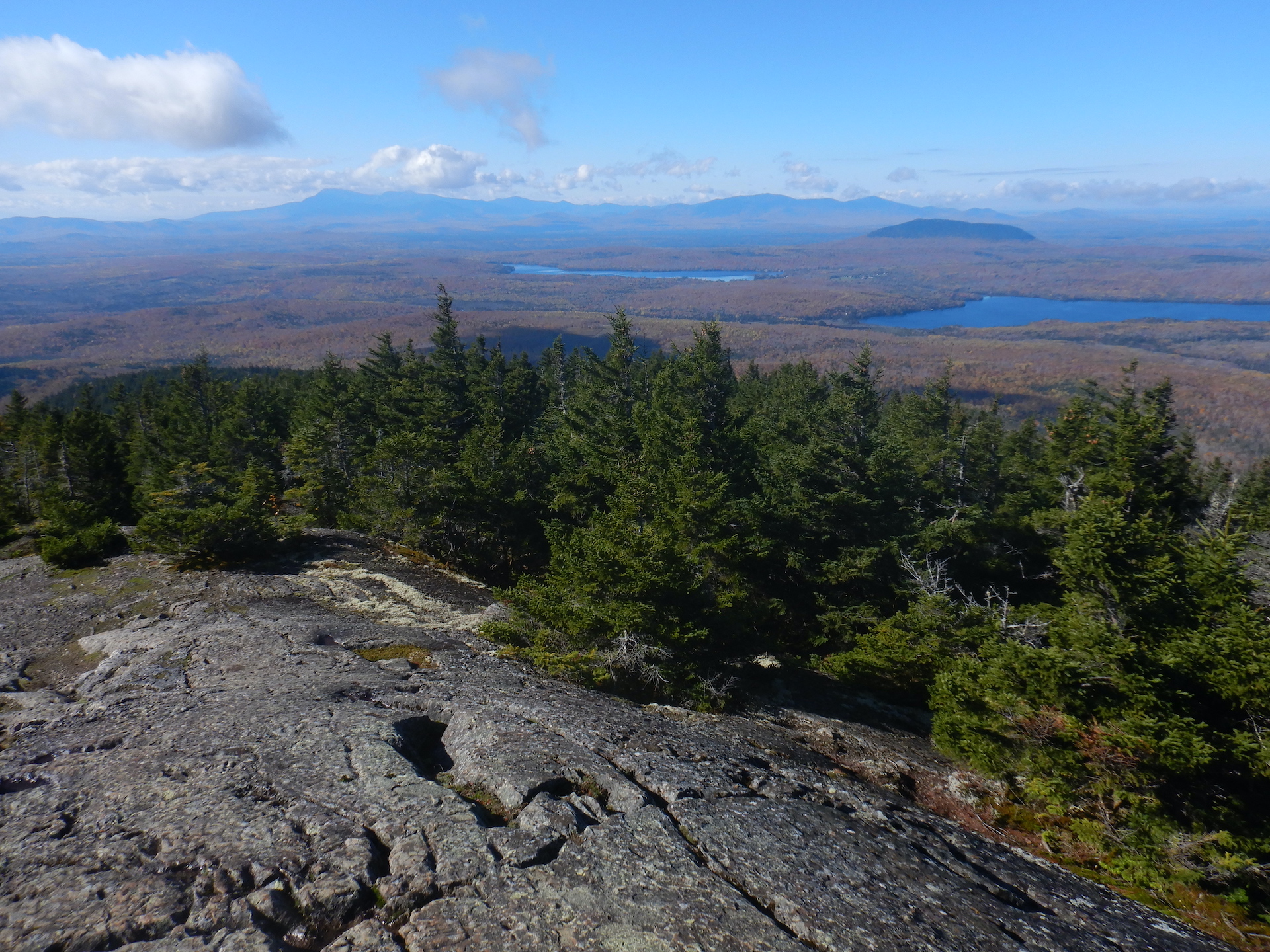
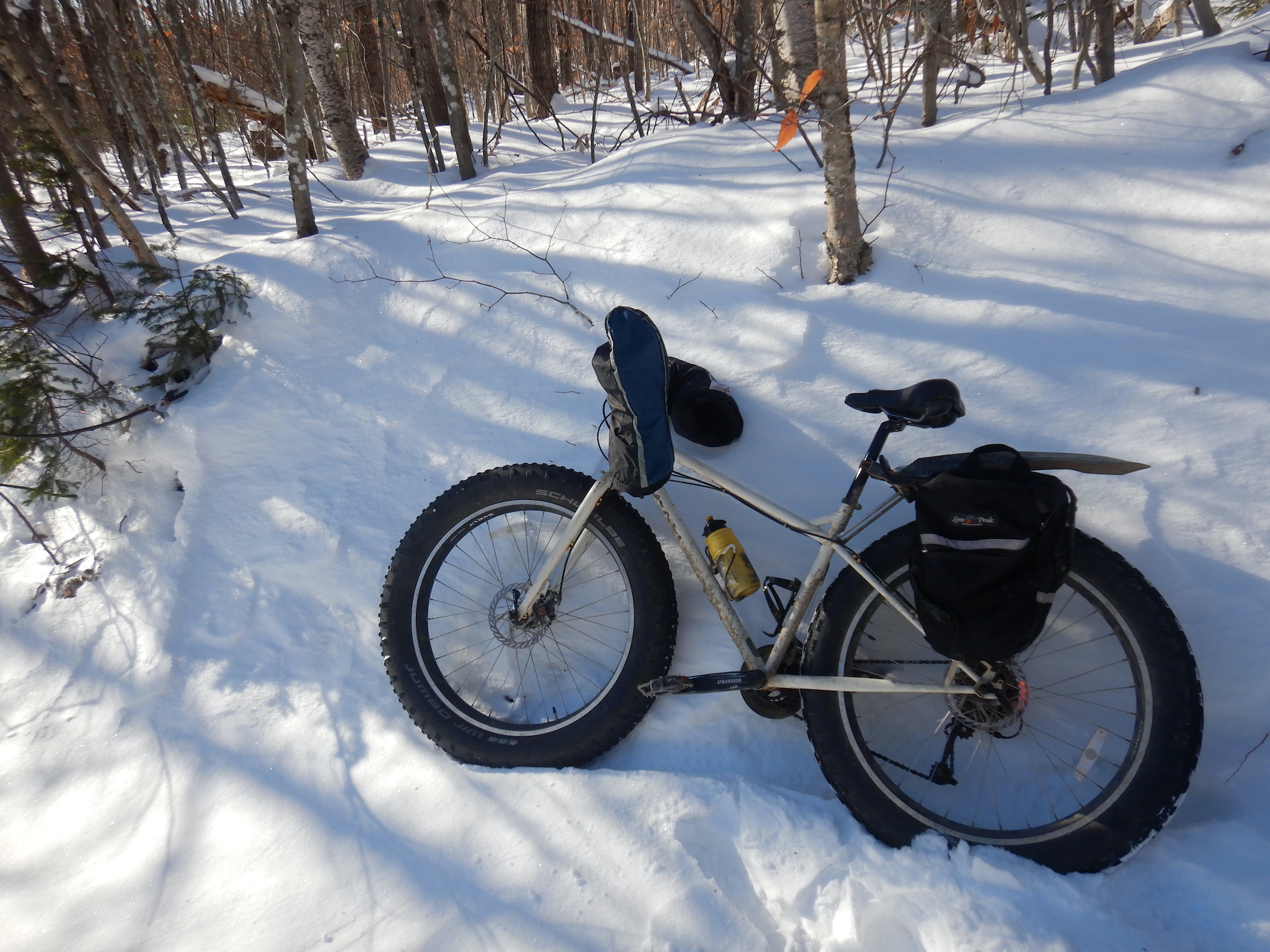
With snow now covering the ice, the trip is far easier than last month and the snow is not yet thick enough that I have to ski to the trailhead. My trusty fat tire bike, Large Marge, gets me there. At the summit, visibility is exceptional and perhaps only limited on this day by the curvature of the Earth. On the way down, I hear a raspy-sounding chickadee. A boreal? Yes. I see it fluttering from branch to branch in the spruce-fir forest maybe 200 – 300 feet in elevation below the summit.

View from a mountain of a forested landscape. A ridge of large mountains form the horizon, although they appear small in the photo. Snow covered trees form the foreground just above windswept rock. Frozen ponds and forest sit in between the
The view to the west-southwest from the Mount Chase summit on Jan. 8, 2023. The mountains of Baxter State Park including Katahdin form the horizon.

A boreal chickadee perches in a frost covered dead spruce tree. The bird is at left center. It has a brown cap with is diagnostic of boreal chickadees.
A boreal chickadee perches in a dead spruce.

February 12
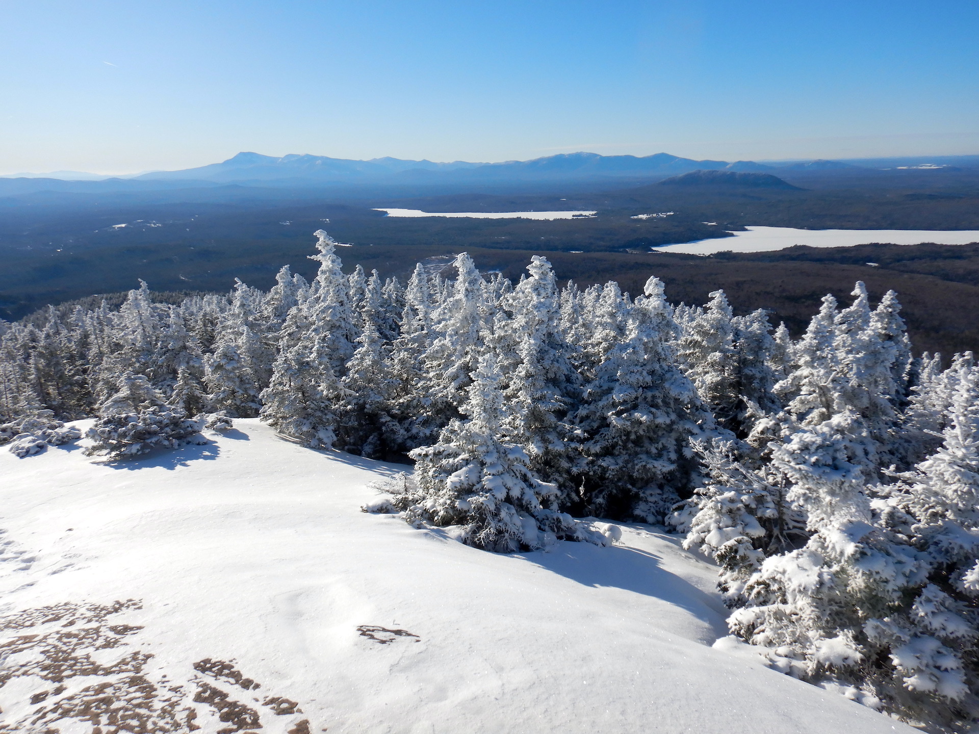
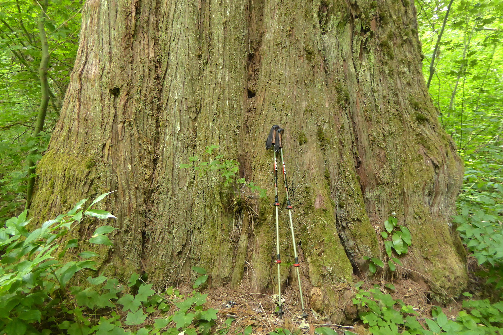
Peak winter. Minus 60˚ F wind chills during the week prior and low air temps approaching -30˚ F at home. I know arctic peoples cope with those temperatures routinely, but I’m too poorly prepared to survive those conditions. Thankfully, this day is warmer, so much so that snow fleas are active on the snow surface. I ski as far as I can up the trail. Eventually, I abandon my skis and walk the rest of the way when the trail steepness beyond my comfort level. The trail is also too narrow to ski down safely and I don’t own the the right style of skis or the skills to do that anyway. On the way up, though, I miss their floatation. The snow pack on the upper mountain must be at least 36 inches. I post-hole to my waist on two occasions.
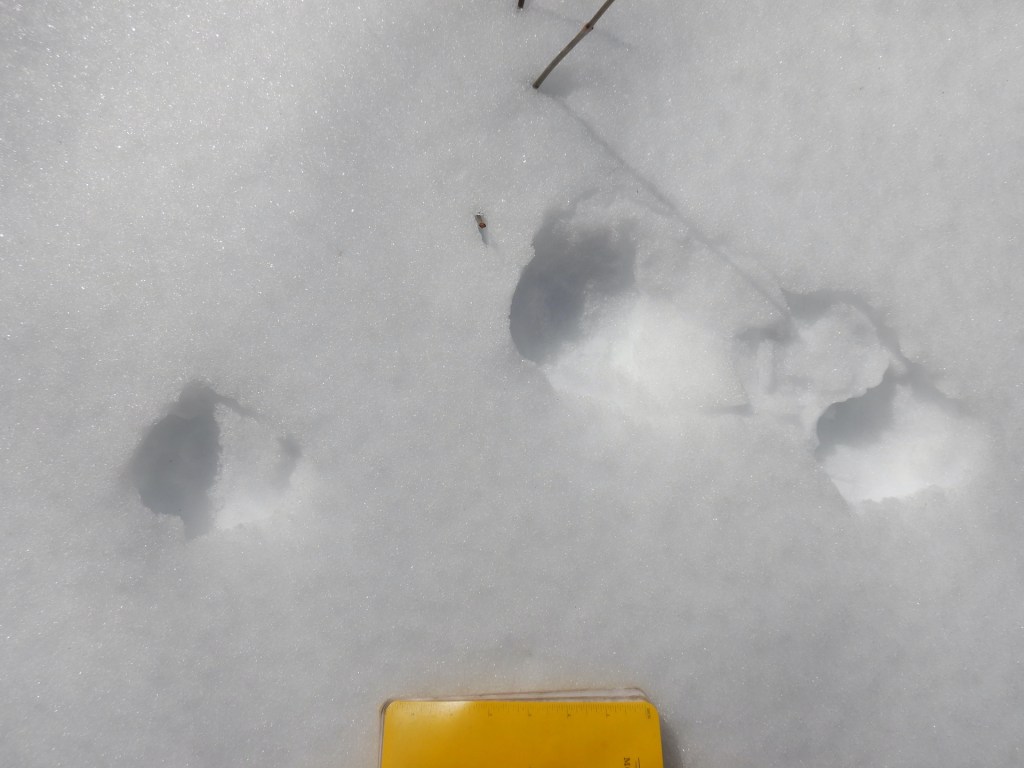
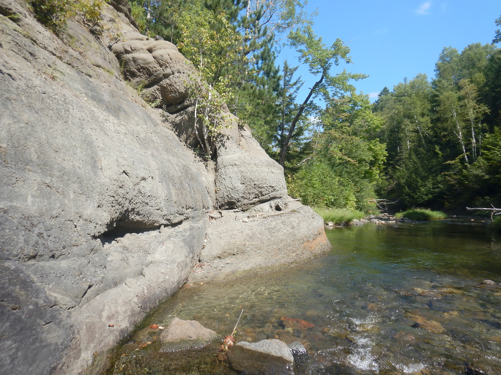
View of mountain from a low elevation. The mountain is covered in trees that transition from deciduous to coniferous from low to high. The foreground is snow covered.
The destination: Mount Chase on Feb. 12, 2023.

View from a mountain of a forested landscape. Only a sliver of the lowlands are visible. Snow and trees fill the fore and middle ground. The trees are snow covered, especially on their left side.
The view looking south from the Mount Chase summit on Feb. 12, 2023.

March 11
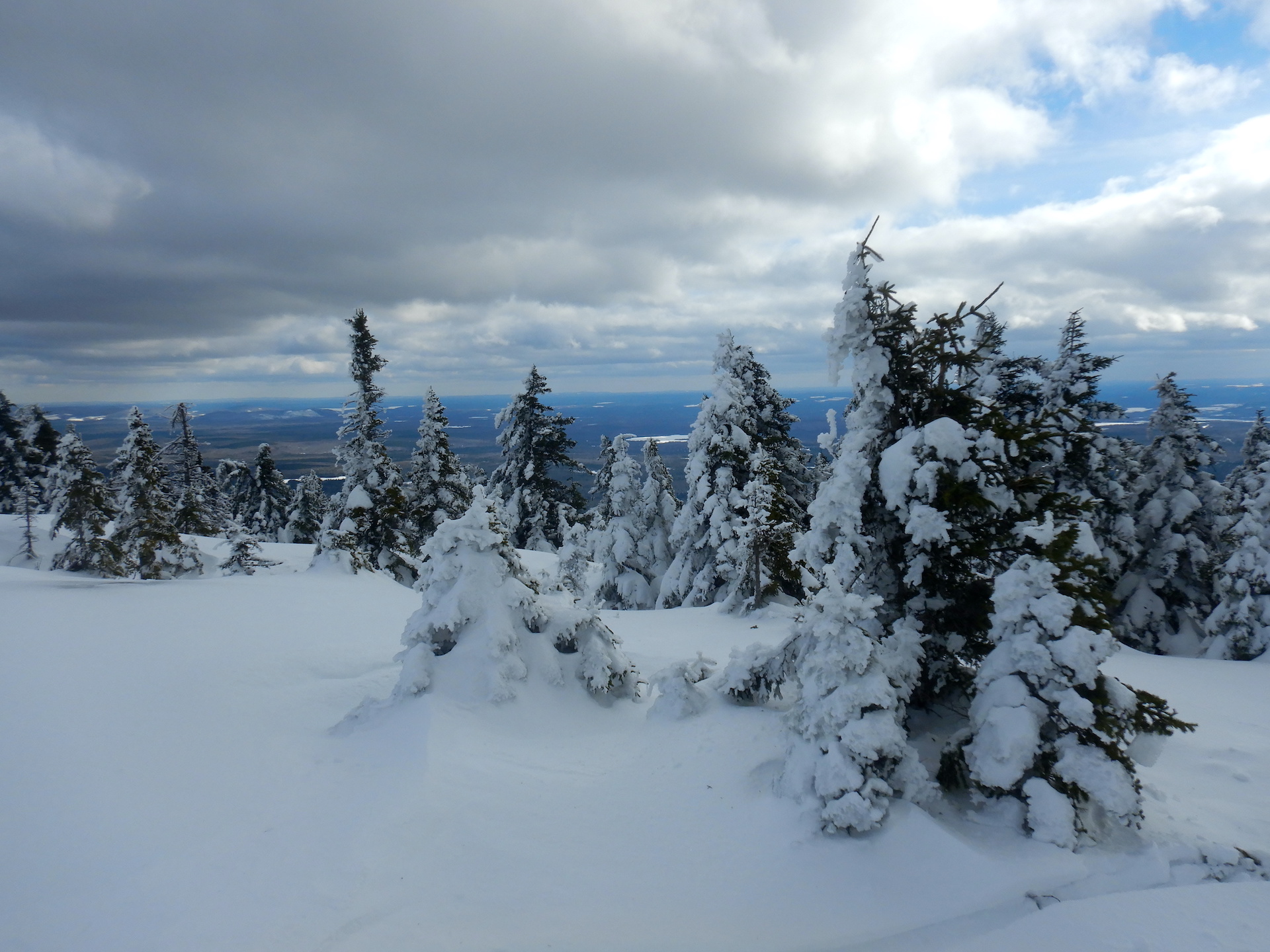
The snow seems deeper than February, but maybe this will be the last deep snow trip of the year? Along an alternative route I like to take to the main trail, I find a set of lynx prints in the snow. Farther up the mountain I ditch my skis again at a point above the abandoned fire warden’s cabin where the slope gets too steep. A few snowmobiles have made the trip, though, and I continue with relative ease in their trackways.
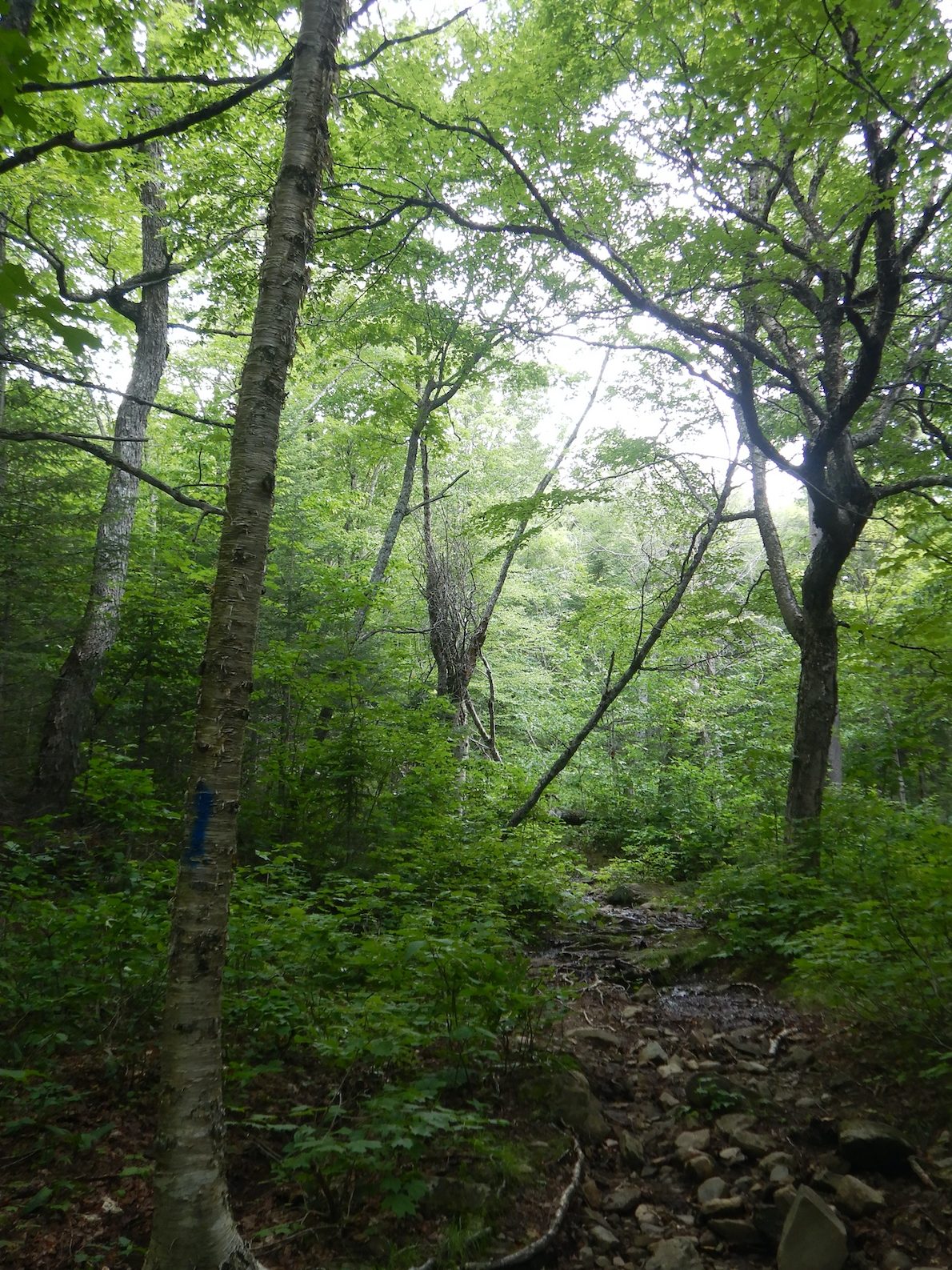
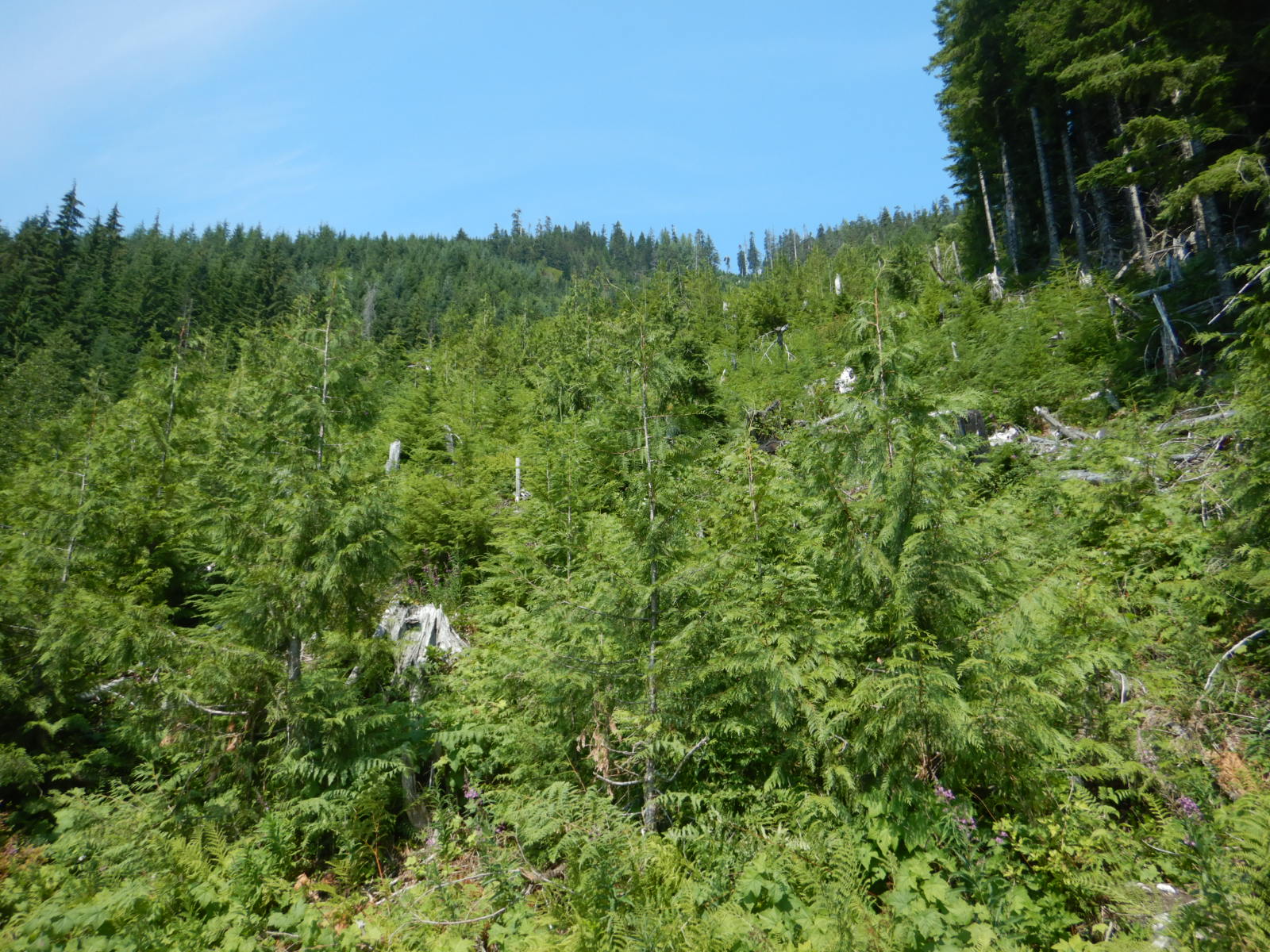
A single lynx track. Photo is taken from directly above it. The notebook at bottom is about 7 inches long.
A single lynx track. The feline was traveling from right to left.
The 3x4 gait of a lynx in snow. Photo is taken from directly above tracks looking down. The tracks are several inches in width and length.
Although these lynx tracks aren’t well defined, the size and shape are distinctive. I find one set of these tracks per winter on average. Lynx are rare in Maine and have large territories.
Portrait view of forest. Spruce and fir trees fill the scene with spruce growing the tallest. A narrow trail is visible at bottom center.
The coniferous forest on the upper slopes of Mount Chase.

April 22
A difficult trip to the top and back (the hardest of them all, in hindsight). Mud season has fully enveloped the region. The dirt roads that approach the trailhead are slop. Large Marge gets me to the trailhead but not without extra effort from my legs. The trail remains almost wholly snow-covered above the abandoned fire warden’s cabin and the remaining snow is soft. Still, I’m thankful winter’s dormancy is broken. Near the trailhead, I hear wood frogs looking for love in a nearby a vernal pool. The calls of juncos, robins, and sapsuckers—birds that do not overwinter here—fill the deciduous forest nearby.
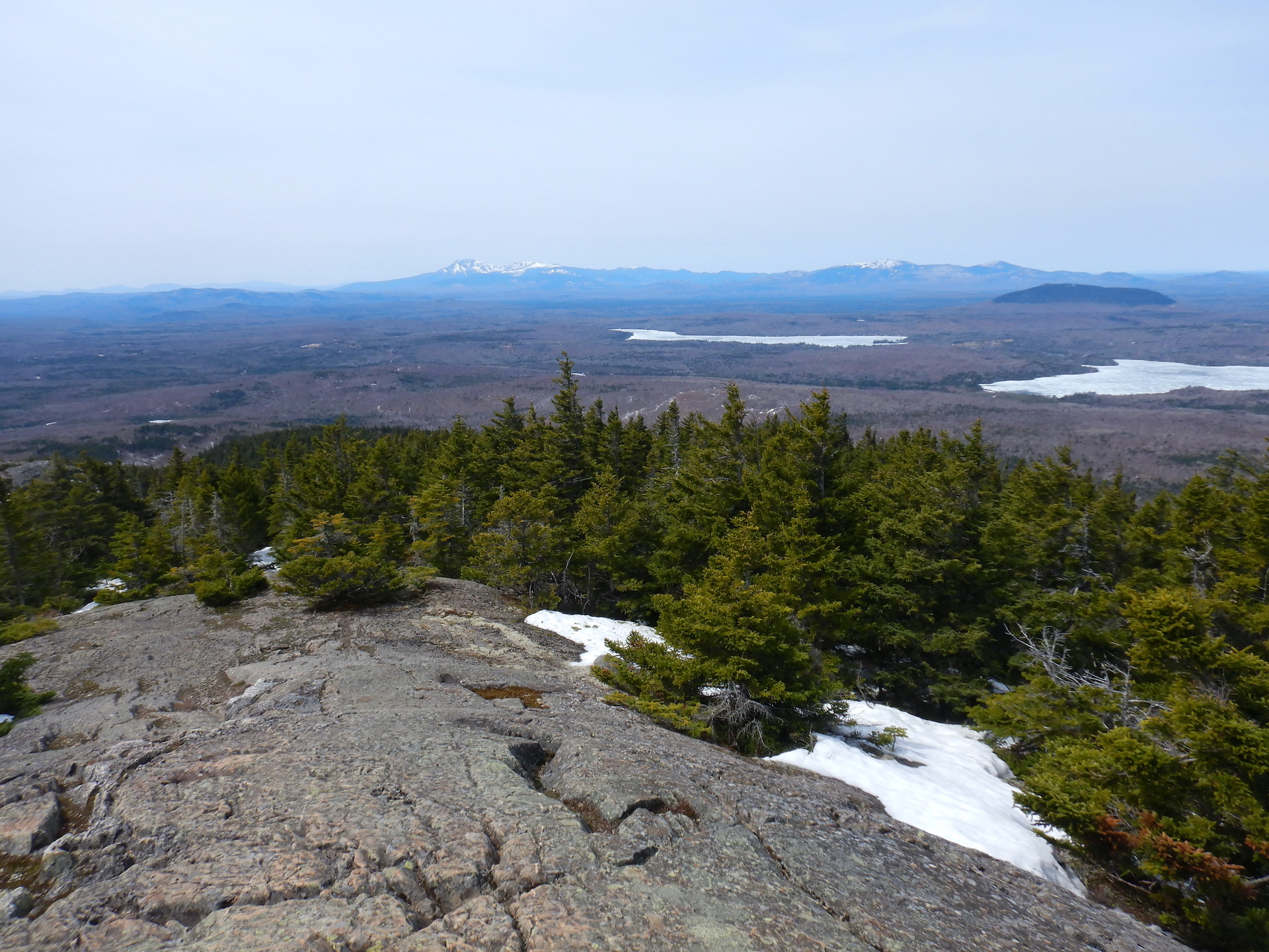
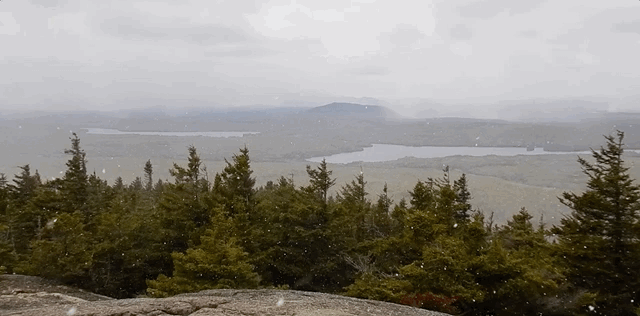
Two trails intersect at lower right. Both have water flowing on them. A sign at left points to the center of the photo. The sign is mounted on a post has a homemade look. It says "trail." An arrow points to the right toward the trail. Both "trail" and the arrow are outlined in permanent marker.
The official Mount Chase trailhead.

A derelict cabin in a forest. Wet, late season snow covered the bare area in front of the cabin. A mixed forest surround the cabin. The windows and door of the cabin is missing and the brick red lead paint is peeling from the outside.
The abandoned fire warden’s cabin on Mount Chase.
View from a mountain of a forested landscape. A ridge of large snow capped mountains form the horizon, although they appear small in the photo. Snow covered trees form the foreground just above windswept rock. Frozen ponds and forest fill the middle ground.
Looking west-southwest toward Katahdin and Baxter State Park from the Mount Chase summit on April 22, 2023.

May 17
I thought I’d be done with snow on the mountain by now. I was wrong. It falls on the way up and on the summit. Some small patches linger in the shadiest areas among the spruce and fir. Bud break might be advancing fast at lower elevations, but the plant phenology seems at least a week delayed on the mountain’s mid elevations and maybe two weeks behind in the summit area.
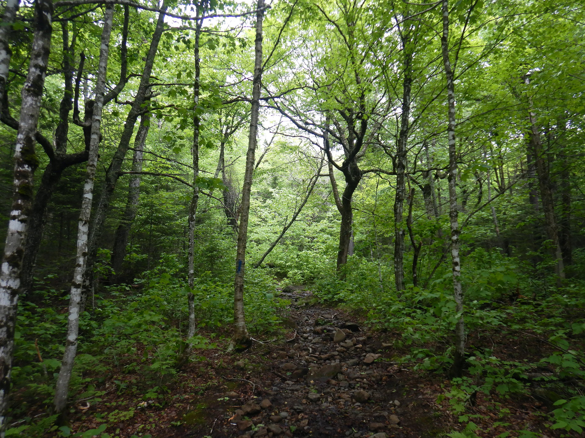
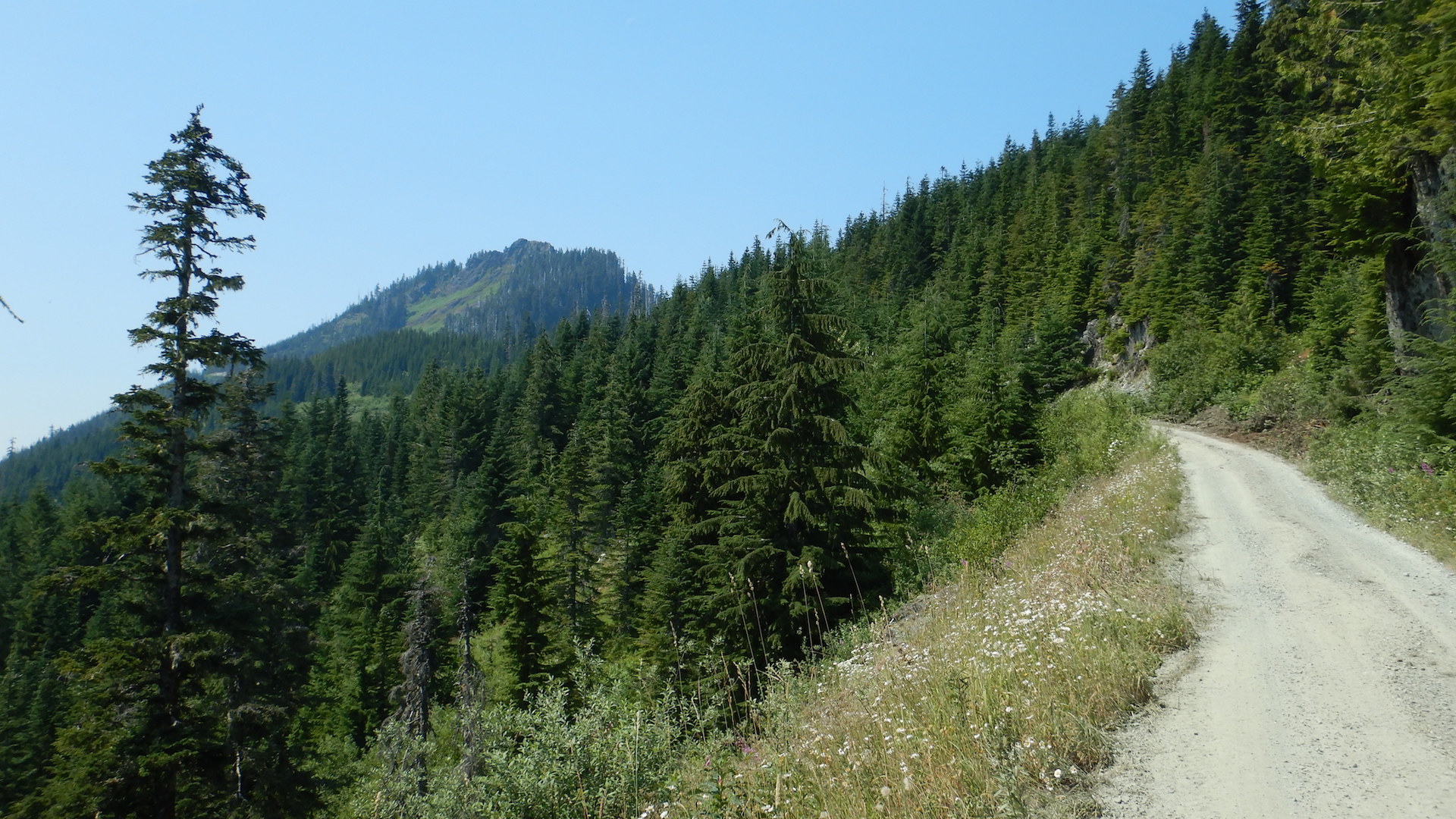
GIF of landscape view from a mountain top. Stunted spruce and fir fill the foreground. Forested lowlands fill the middle ground to the cloud obscured horizon. Snow flakes fall in the air.

Close up photo of flower in deciduous forest. The flower petals face the camera. The three petals are maroon.
Trillium erectum on the lower slopes of Mount Chase.

June 19 
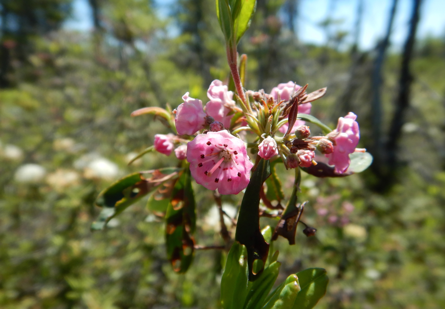
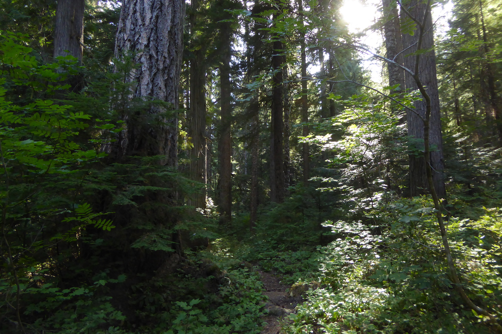
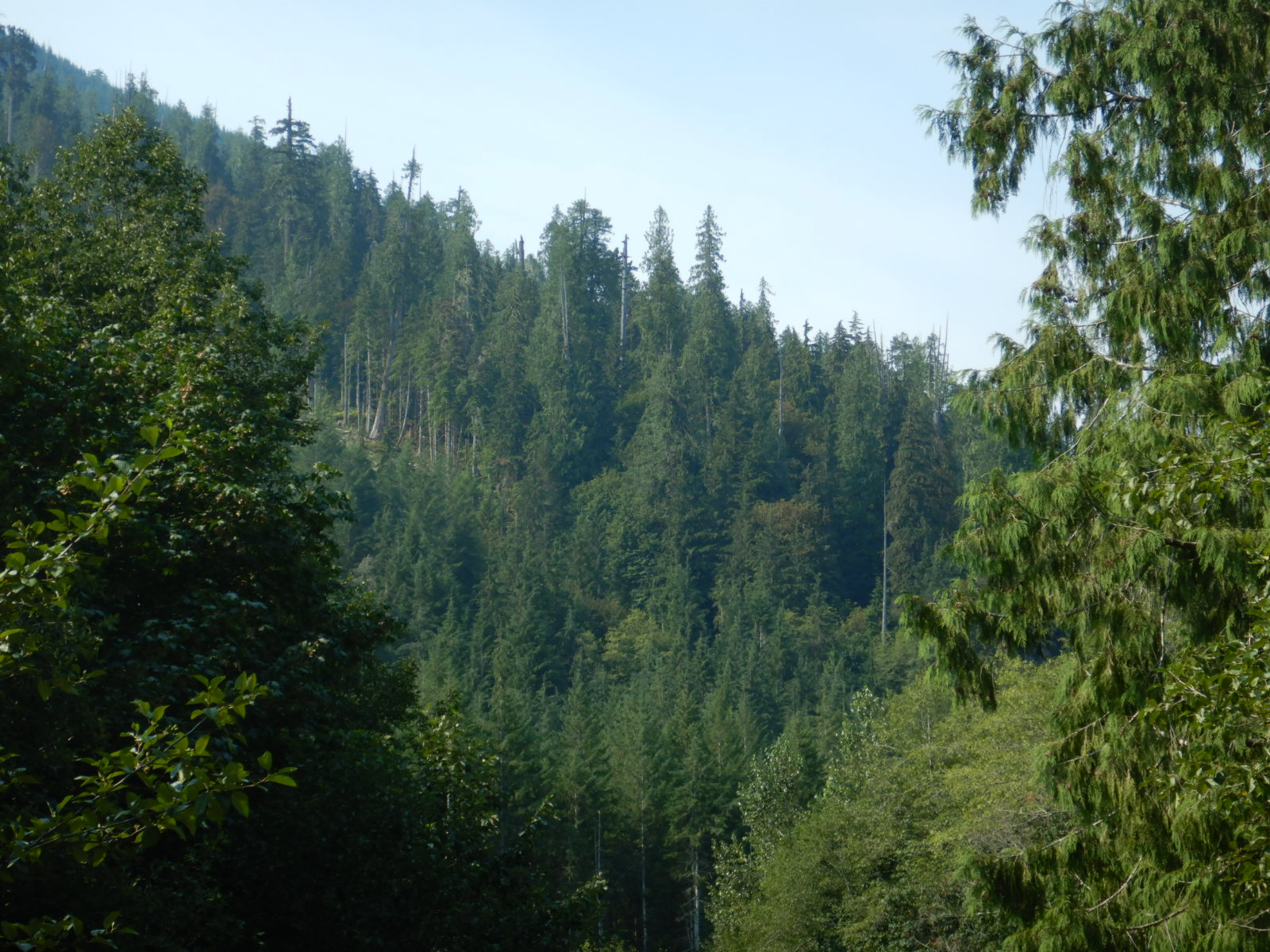
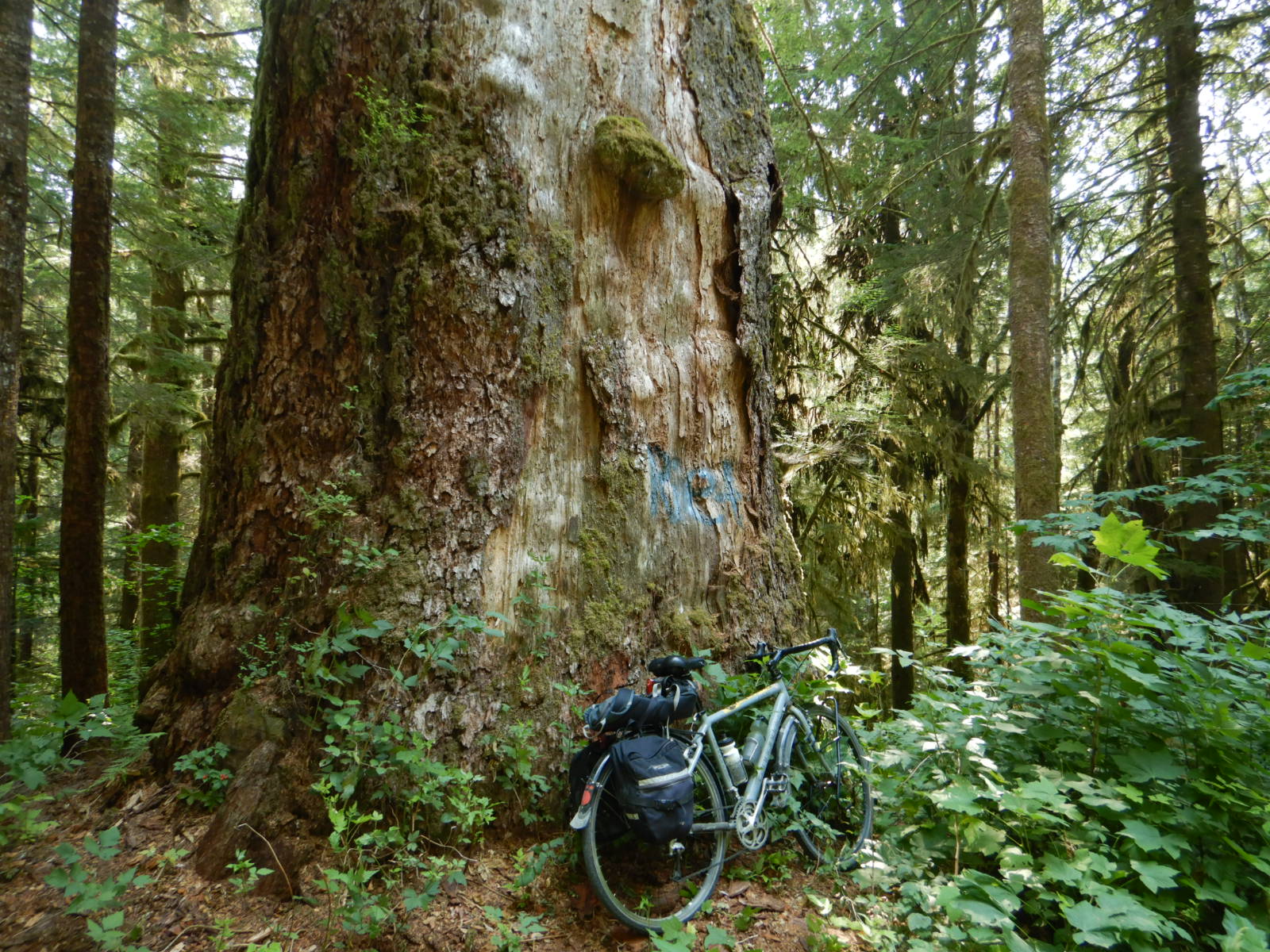
A busy day on the trail with a whopping three cars at the trailhead! Large Marge, as usual, doesn’t have any other bicycles to keep her company. The forest has come to life. I note more than 20 plant species blooming. Biting insects are surprisingly few in contrast to home where the abundance of mosquitoes and black flies force me to don long sleeves, long pants, and a headnet almost anytime I intend to spend more than a few minutes outside. In the spruce-fir forest, I enjoy listening to the songs of blackpoll warbler. Sadly, they are categorized as a threatened species in the state.
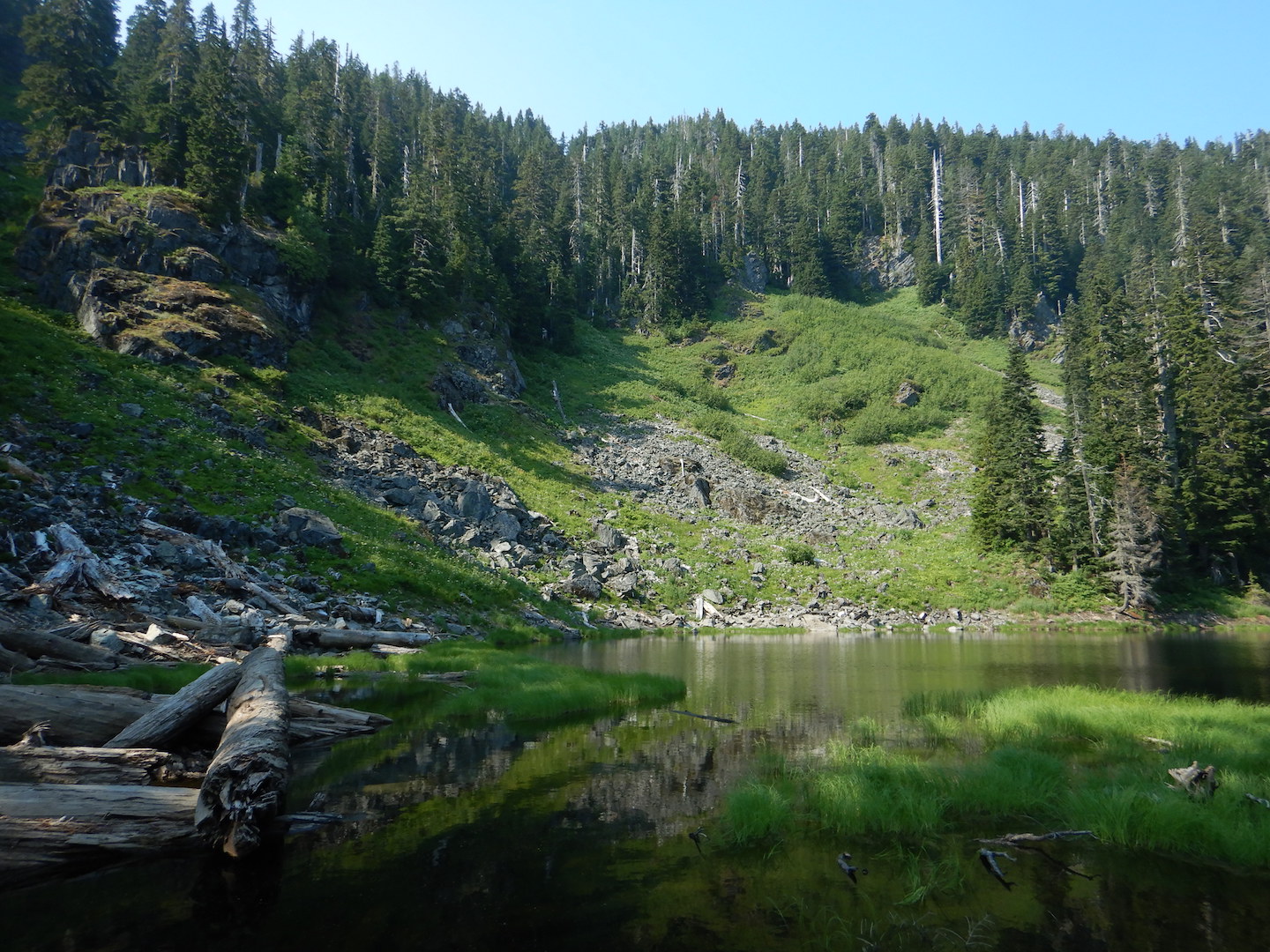
A rocky trail disappears into a green forest. Trees with bright green leaves obscure the sky. The understory is also thick with green plants.
Late spring on the Mount Chase Trail.

This is the song of a blackpoll warbler recorded in the spruce-fir forest of Mount Chase. The song is a rapid series of high-pitched notes near the beginning of the track. The audio also captures part of the songs of Swainson’s thrush and winter wren.

July 21
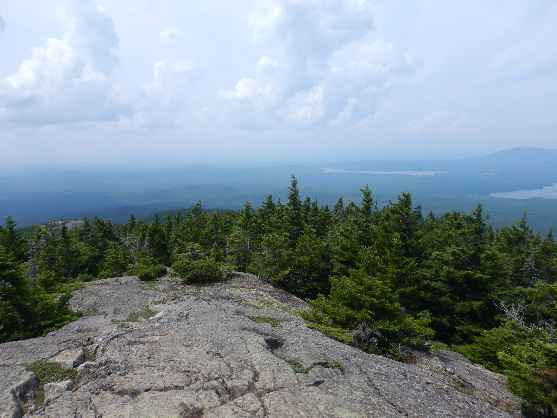
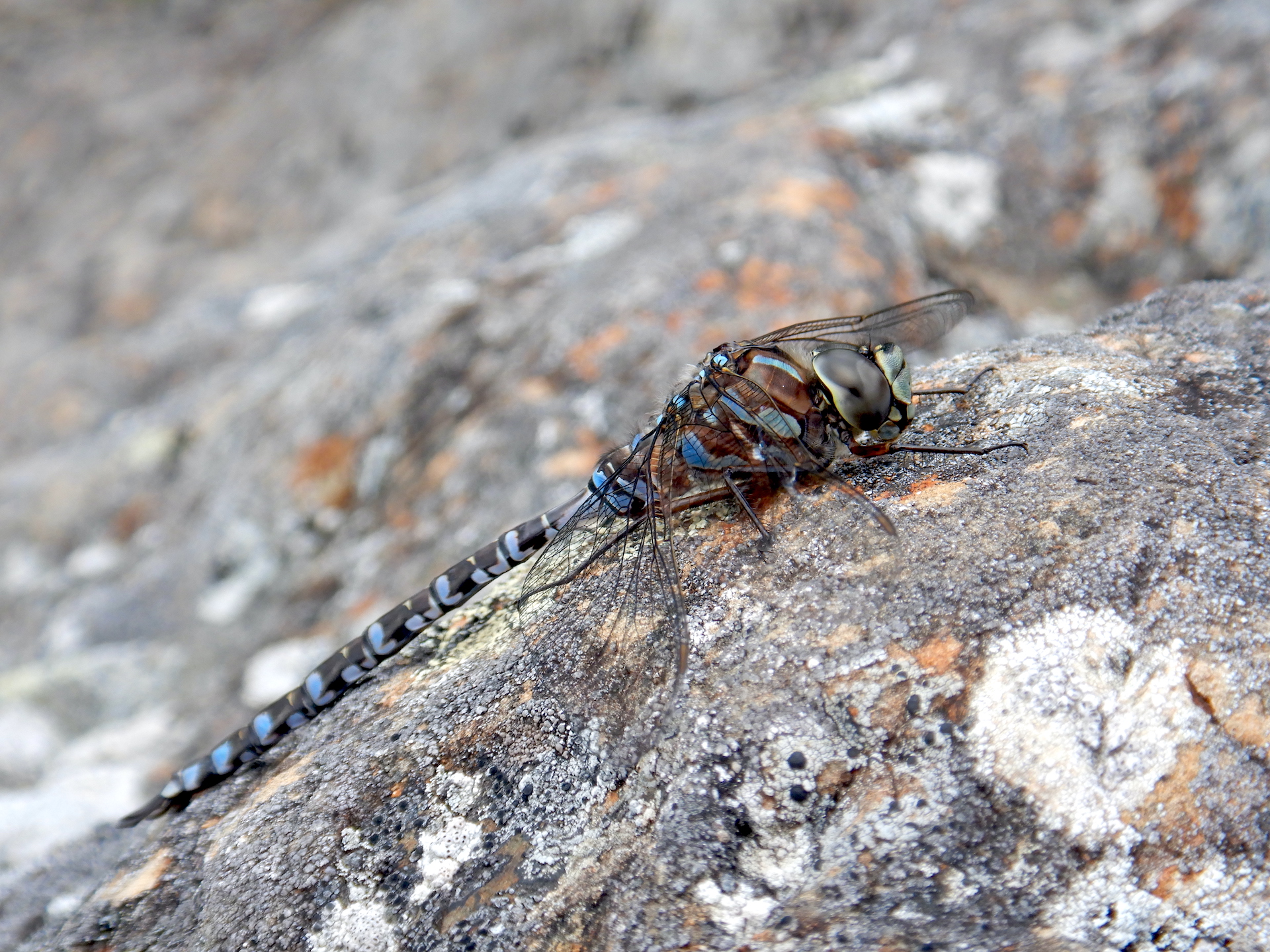
The air feels and looks heavy due to high humidity and hazy, smoke-filled skies. This isn’t the first day of the summer with these conditions, and the past two summers had days like this too. Is the presence of smoke becoming the new normal for summertime Maine? I concentrate on observing the trees, which are in “peak green,” a phase in summer when the foliage has reached its max yet still retains some of the freshness of spring. Fledgling birds are the latest addition to the animal community. Golden-crowned kinglets and red-eyed vireos feed noisy babies. On the summit, hundreds of dragonflies zip between the stunted trees.

Portrait view of rocky trail through a green forest. The trail starts at lower right and disappears at center.Trees with bright green leaves obscure the sky. The understory is also thick with green plants.
Peak green on Mount Chase trail. July 21, 2023.

View of forested landscape from mountain summit. Bare rock covers the ground at bottom while spruce and fir trees slope off the mountain. The lowlands and horizon are obscured by haze in the air.
Looking west-southwest through smoky haze toward Katahdin and Baxter State Park from the Mount Chase summit on July 21, 2023.

Close up view of a dragonfly. The insect rests on rock speckled with small crusty lichens. It has a blue-spotted abdomen and holds its wings flat parallel with the rock.
A darner dragonfly of genus Aeshna rests on at the summit of Mount Chase. If you know what species it is, please identify it on iNaturalist.

August 20 
A quiet hike now that songbird nesting season is done. Only white-crowned sparrows sing in the summit area. The summer foliage has reached “tired green.” The work of photosynthesis as well as insect attacks have rendered the previously vibrant leaves a darker, less vibrant hue. I experienced a stressful week. Yet, I’m fortunate to have an escape for some brief solace.
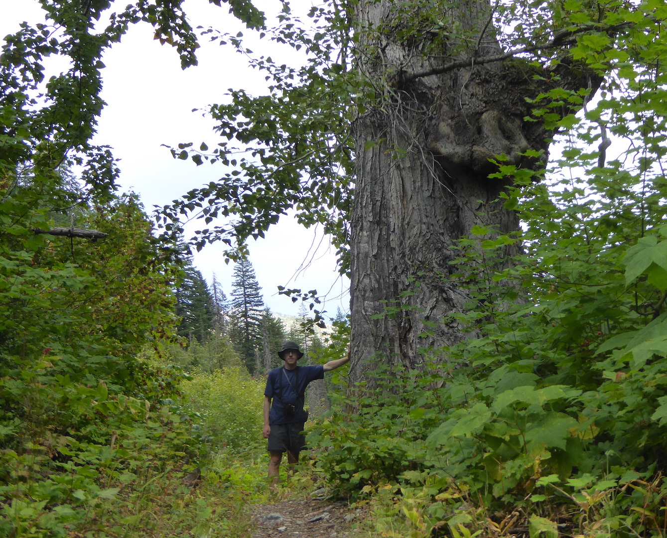
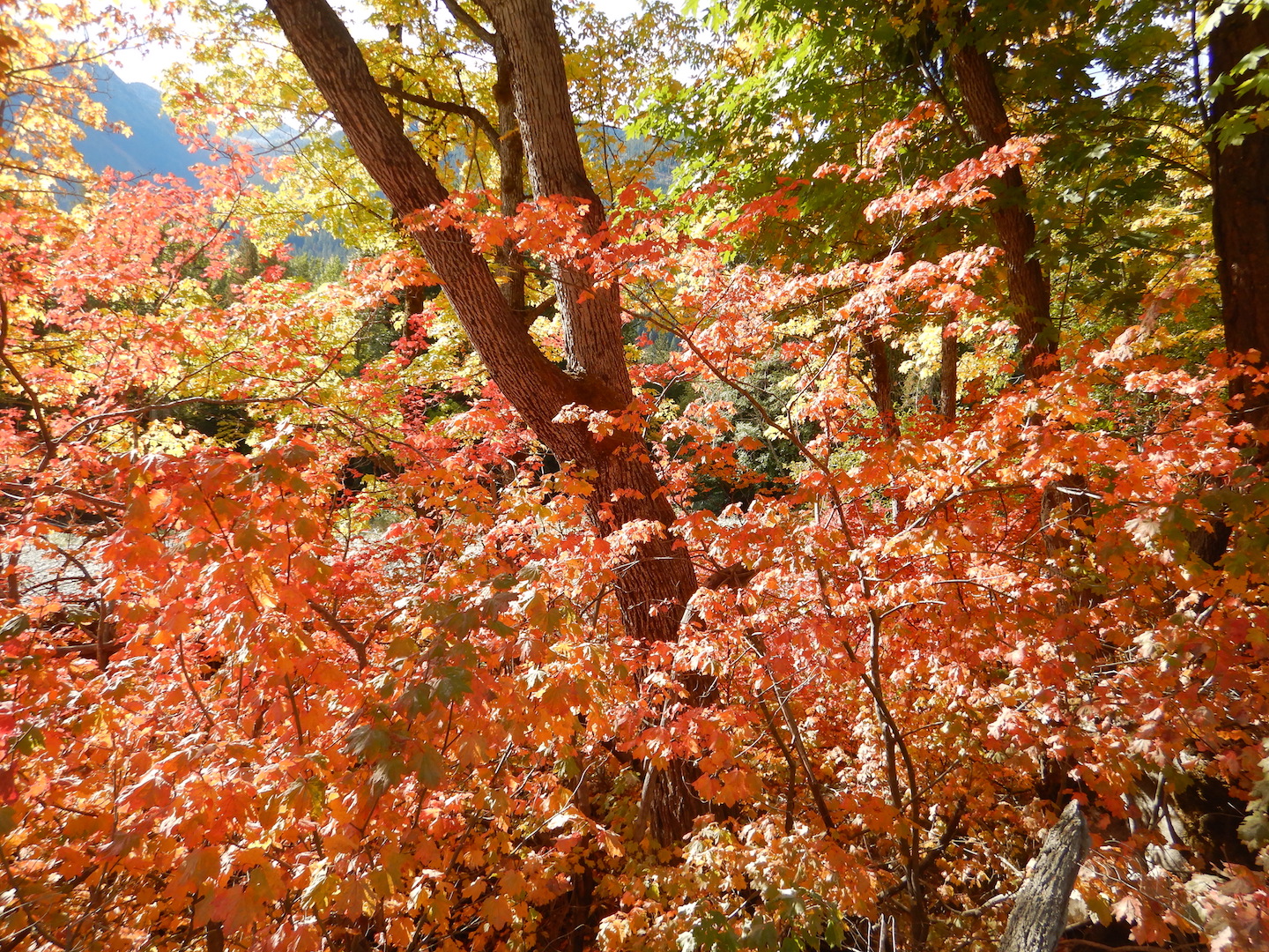
View of forest that is a mix of young and old spruce and fir trees. Dead standing trees are among them. A large trunk is at left.
A section of old growth forest on upper Mount Chase.

View of forested landscape from mountain summit. Bare rock covers the ground at bottom while spruce and fir trees cover the near slopes. The skies are mostly cloudy. Forest fills the lowlands. A pond and mountains can be seen near the horizon at center left.
Looking west-southwest toward Katahdin and Baxter State Park from the Mount Chase summit on August 20, 2023.

September 24 
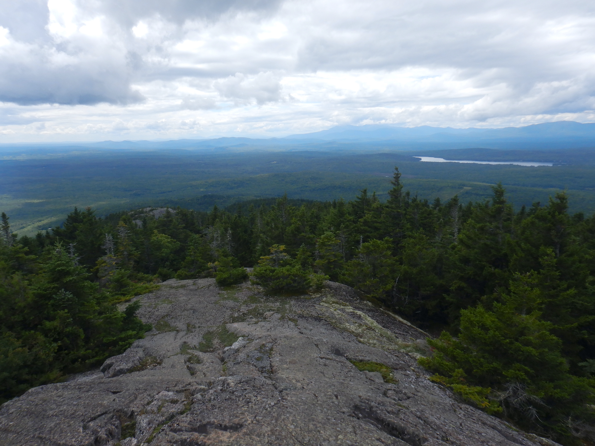
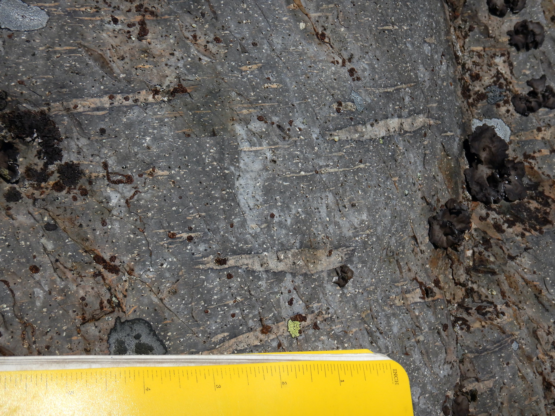
I discover (for myself) the remnants of a long abandoned cabin maybe 20 yards off the trail. It’s collapsed to its foundation. Still, I’m surprised by its presence. I walked by it many times previously without seeing it. The forest tends to make things disappear. Hazy conditions have returned to the area. A thick band of wildfire smoke clouds the north horizon and the mountains of Baxter State Park are mostly obscured. A few red-tailed hawks ride the thermals on the mountainside on their migration south. A raven family doesn’t tolerate their presence. They move to chase one of the soaring hawks. We’re approaching peak fall colors, although the colors are quite muted compared to normal.
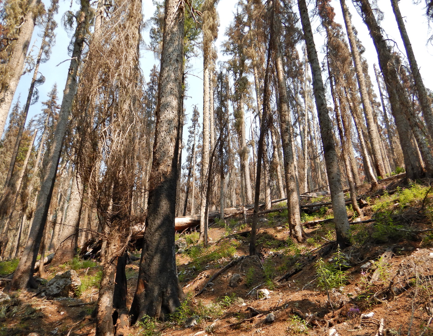
A collapsed cabin rests in the forest. Vegetation has yet to grow over the structure but the wood at the base in the foreground is rotted and moss covered. The rest of the structure forms a pyramid shape.
The forest and weather will soon consume this collapsed cabin.

The Mount Chase Trail on Sept. 24, 2023.

View of forested landscape from mountain summit. Bare rock covers the ground at bottom while spruce and fir trees cover the slopes. A pond is visible at center left. Haze obscures the horizon. The low elevation forest is speckled with yellow foliage.
Looking west-northwest from the Mount Chase summit on Sept. 24, 2023.

October 18
The forest trends brown. A solid layer of newly fallen leaves cloaks the forest floor. I somehow sleepwalk most of the way to the summit, a habit I’ve been trying to break for years with greater mindfulness. I find myself stopping to focus on my breath and immediate surroundings. Something distracted me, probably precipitated by a media culture that profits from distraction and rage-inducing social networks. It is possible to walk through a forest and not see it at all.

Landscape view of rocky trail through a forest. The trail starts at bottom center and disappears at left of center. The canopy is mostly bare of leaves. The leaves that remain are mostly yellow. A larger tree bisects the image from top to bottom.
The Mount Chase Trail on October 18, 2023.

View of forested landscape from mountain summit. Bare rock covers the ground at bottom while spruce and fir trees cover the upper slopes. The lowland forest is mostly brown and bare of leaves. Tall mountains form the horizon although they look small due to the perspective. A pond is visible in the forest at center right.
Looking west-southwest toward Katahdin and Baxter State Park from the Mount Chase summit on October 18, 2023.

November 16
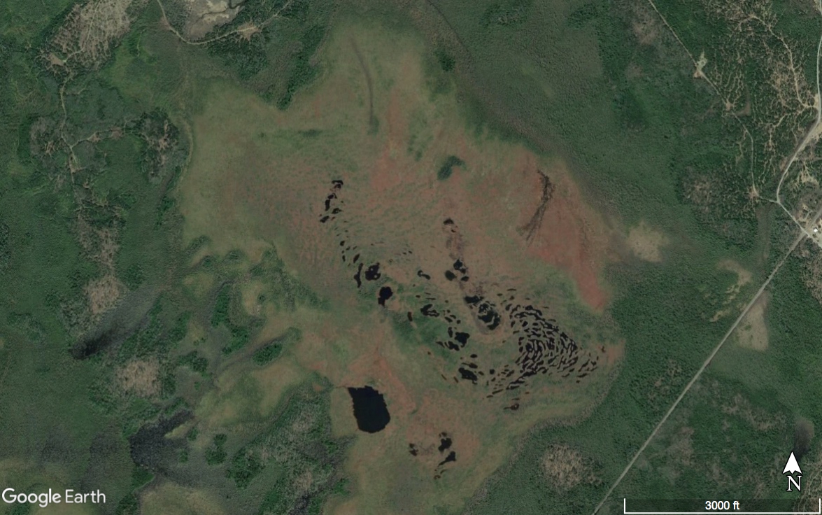
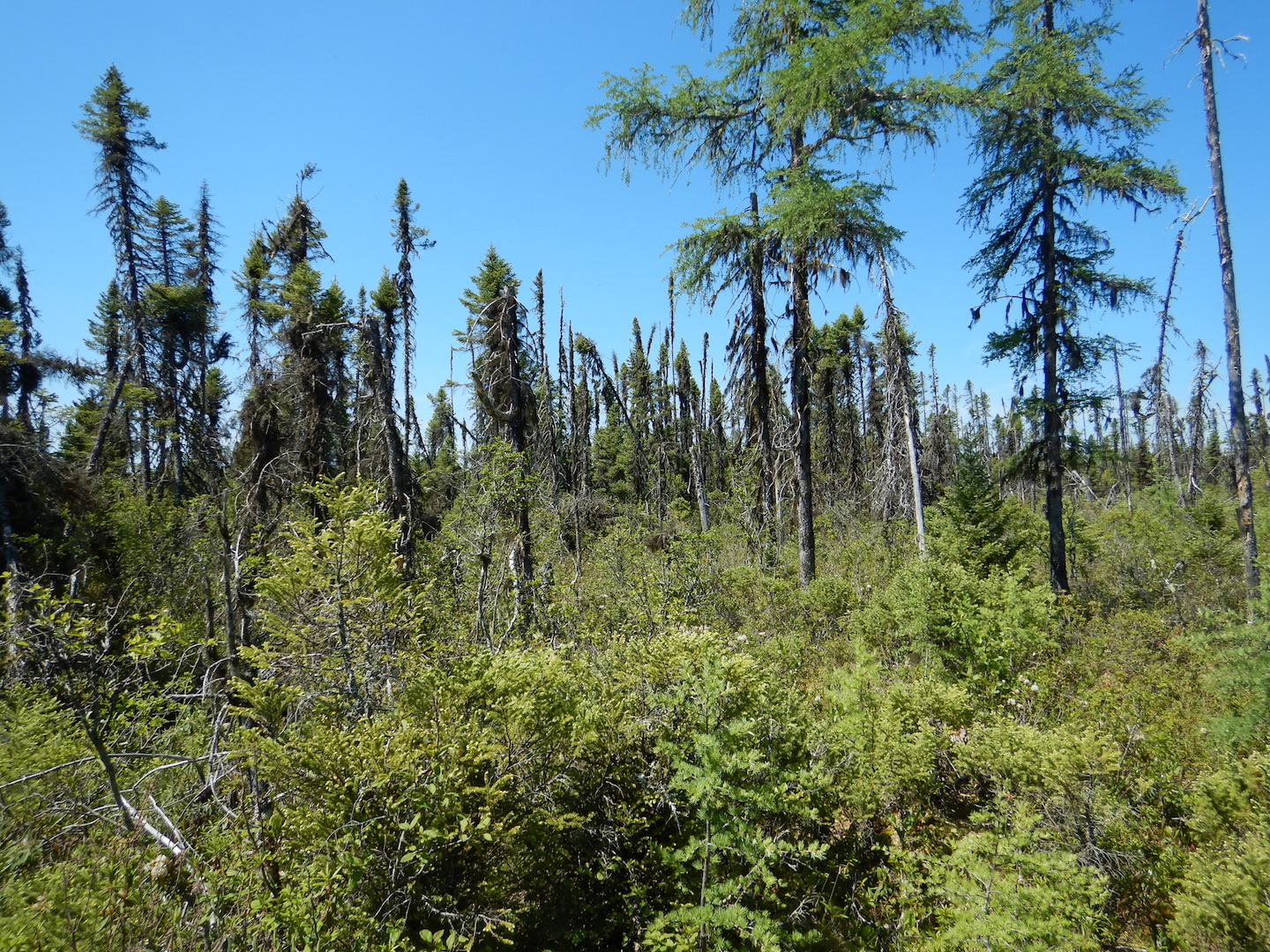
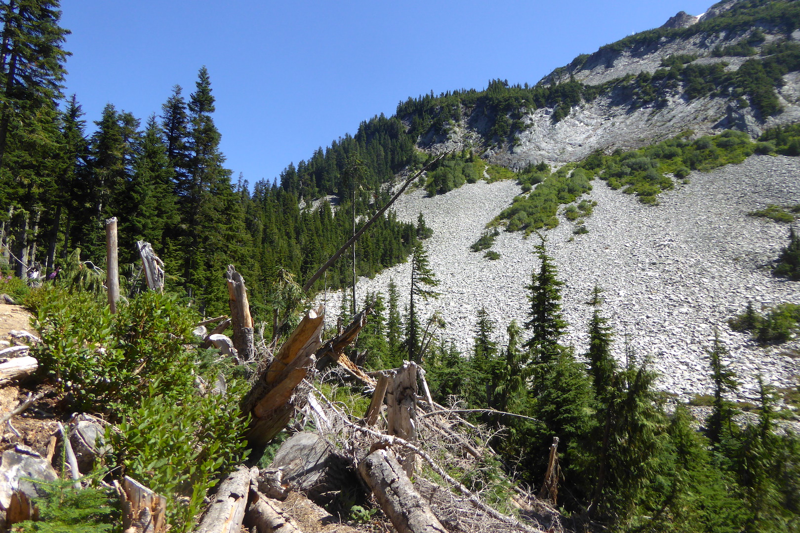
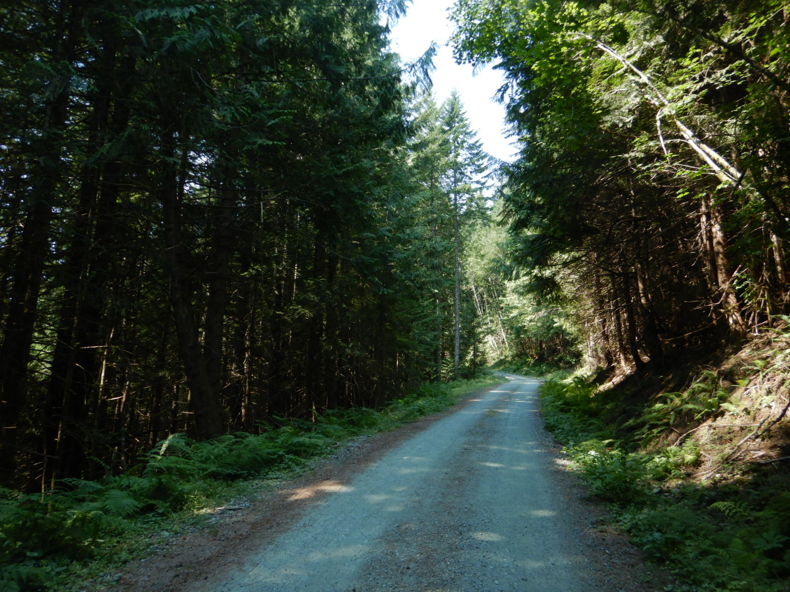
I begin at an alternative trailhead that I’ve used a few times this year. The route isn’t maintained. It’s nothing more than a decades-old skidder trail, but it is a quicker and more secluded course than the main trailhead. The year has been wetter than average, so water has consistently flowed over parts of the trail. Mid fall brought a prolonged stretch of dry weather though, and the trail is drier than it has been over the entire year. Winter will soon be here. The canopy is bare. Patchy snow sits in the shady areas of the mountain’s spruce-fir forest.
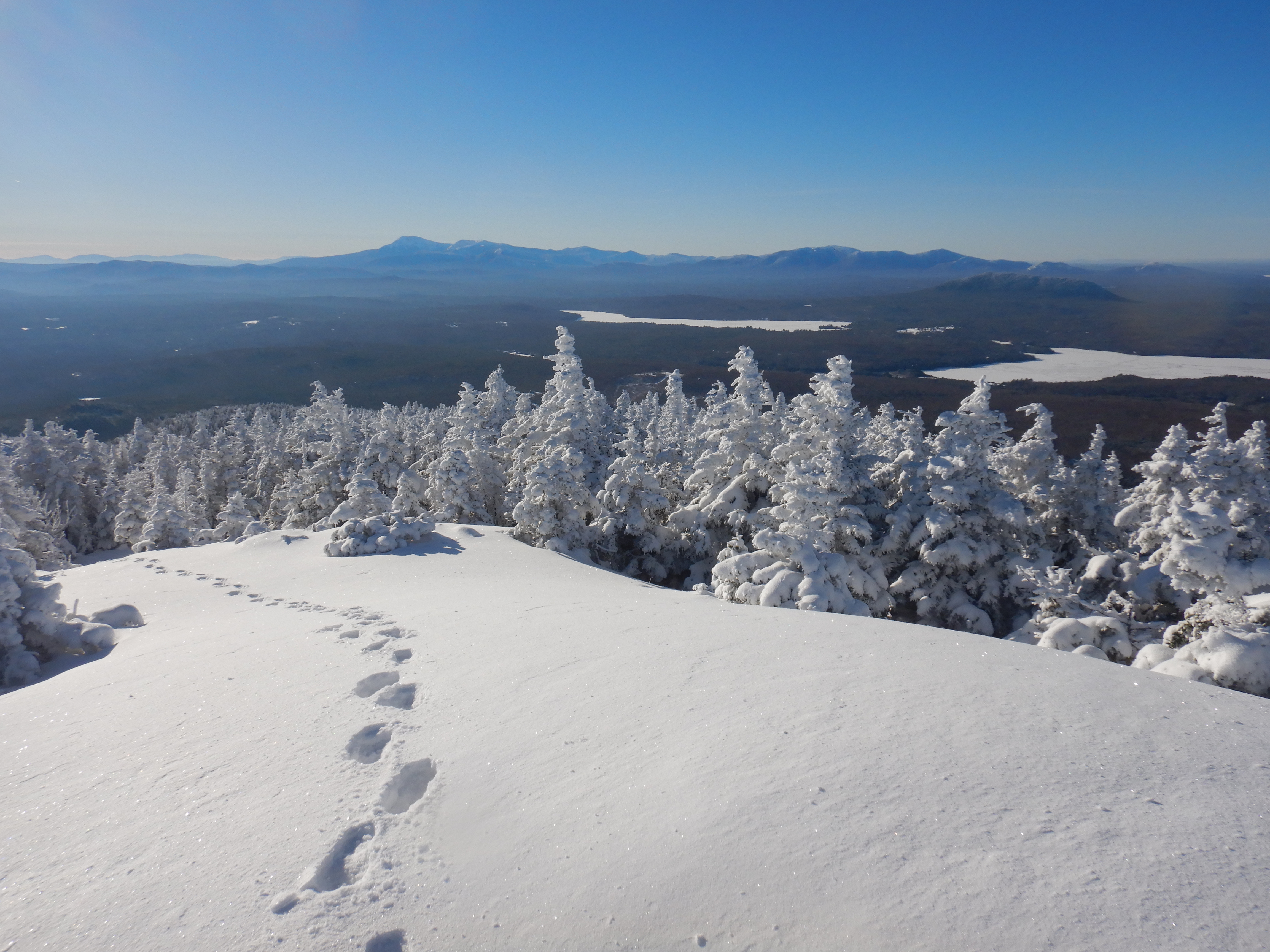
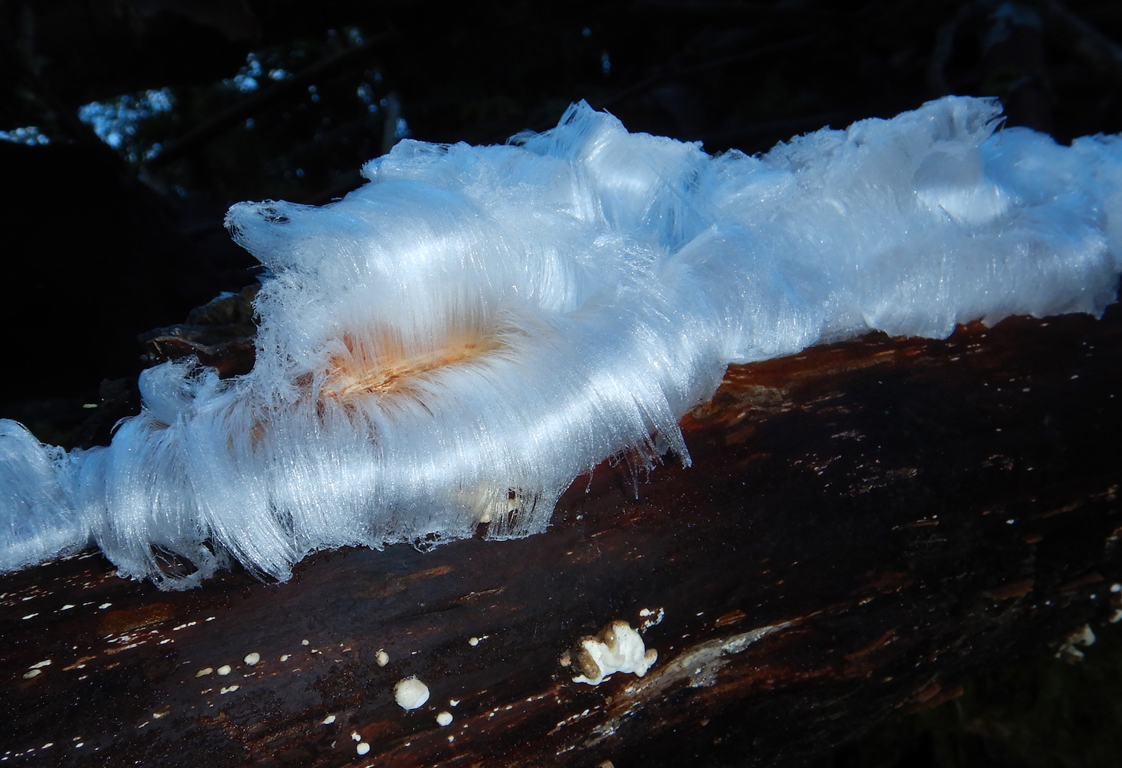
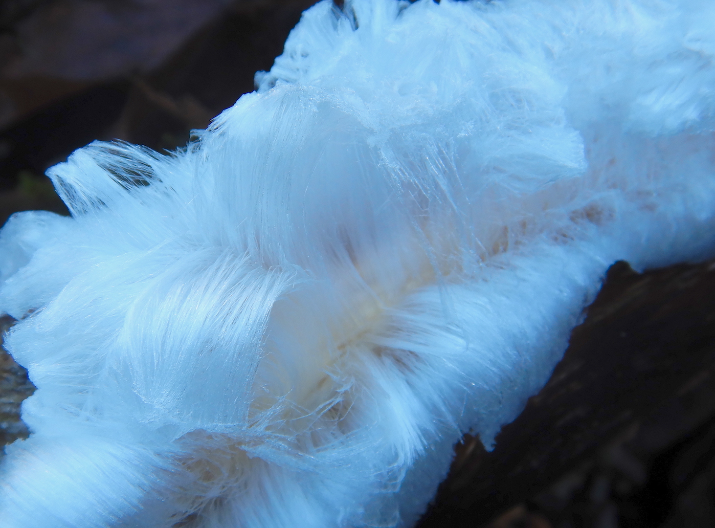
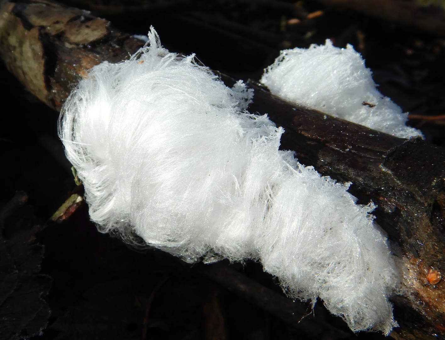
View of forest that is a mix of young and old spruce and fir trees. Dead standing trees are among them. A large trunk is at left. Tiny patches of snow sit on fallen tree trunks.
The old growth forest on upper Mount Chase on November 16, 2023.

View of forested landscape from mountain summit. Bare rock with some patchy snow covers the ground at bottom while spruce and fir trees cover the upper slopes. The lowland forest is bare of leaves. Tall mountains form the horizon although they look small due to the perspective. A pond is visible in the forest at center right.
Looking west-southwest toward Katahdin and Baxter State Park from the Mount Chase summit on November 16, 2023.

December 8, 2023
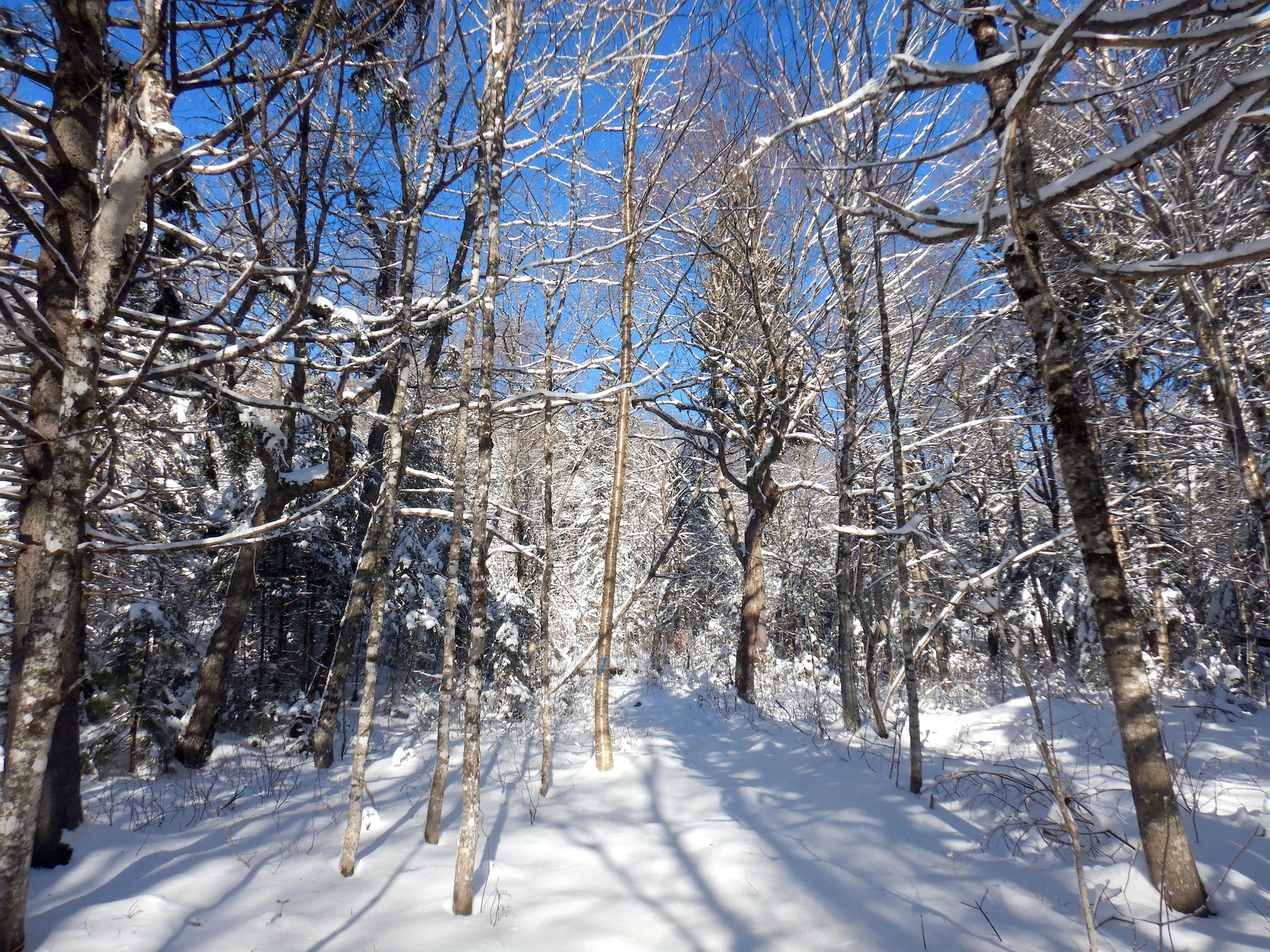
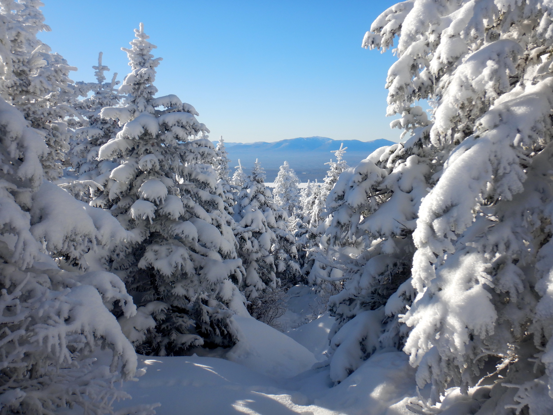
Winter is a time of dormancy for many life forms, although it brings vibrancy in other ways. None of the previous trips were as beautiful or as quiet. Several inches of snow coat the ground at low elevations and about 12 inches linger higher on the mountain. No human footprints are discernible on the trail. Snow and hoarfrost cover the conifers like cake icing. The landscape appears clean in a way that I don’t find in spring, summer, and fall.

A fat tire bicycle rests against a snow covered bank. Trees fill the background at top. The bike has a rear pannier and bar mitts.
Large Marge

view of snowy forest. The trees are mostly deciduous and bare of leaves. Snow covered the ground.
The Mount Chase Trail on December 8, 2023.
The final approach to the Mount Chase summit on December 8, 2023.

View of snowy conifer trees looking toward mountains on a far horizon. The trees are pyramidal in shape and their branches are covered in thick snow. The ground is fully snow covered. A blue sky fills the upper half of the photo.
Looking down the Mount Chase Trail near the summit on December 8, 2023.

View of forested landscape from mountain summit. Snow covers ground at bottom. A single set of human footprints cross them toward the perspective of the camera. Snow-covered spruce and fir trees cover the near slopes. Ice covered ponds and forest fill the lowlands. A line of mountains forms the horizon.
Looking west-southwest toward Katahdin and Baxter State Park from the Mount Chase summit on December 8, 2023.

Time spent in the forest is never wasted and every moment offers the potential to discover new perspectives. I’m no closer to profound insights after thirteen trips to the summit of Mount Chase, although I’ve walked away with a greater appreciation for the mountain’s rhythms. The experience is both the same and vastly different every time. 

Time and Change Along the South Branch

There’s a walk I’ve been eager to follow since reading about it in A Guide to the Geology of Baxter State Park and Katahdin. So on a warm day in early September, I found myself meandering downstream along the South Branch of Trout Brook. 

I was fortunate to be there at that time of year. Water levels were low, which made for easy walking. Water temperatures were cool, which allowed my wet feet to buffer the heat of the day. Importantly, biting insects were few, which permitted me to enjoy the scenery without taking extraordinary measures to protect exposed skin.

A hike down the South Branch is intriguing because stream erosion exposes a series of rock formations that reveal a 400 million year-old story. In it we find the violence of long extinct volcanoes as well as the marvel of the first plants to colonize land on Earth. It is a story of immense time and change.

A calm portion of a stream surrounded by deciduous trees. The stream flows from lower left to center before disappearing around a bend.
South Branch Trout Brook in Baxter State Park.

Maine in the early Devonian Period, about 400 million years ago, would be wholly unrecognizable. The landmasses that would become Maine were located south of the equator. Extensive volcanism scalded the Katahdin region. Terrestrial vertebrates weren’t yet a thing. Dinosaurs were still about 150 million years into the future. Perhaps the oceans would be the only similarity we could recognize.

To explore this age of Earth’s past, I began at South Branch Falls which was empty of people when I arrived in mid-morning. It is an appealing swim spot with shoots and pools carved into Traveler Rhyolite, a rock formation created by ash fall and pyroclastic flows that may have filled a volcanic caldera about 407 million years ago.

A stream flows through a narrow chute carved into bedrock. The stream flows from center to bottom right. Deciduous trees and some white pines overtop the stream and trees.
South Branch Falls. The rock is composed of a type of rhyolite known as welded tuff.
Close up photo of rock. The rock is gray and includes light gray inclusions of flattened pumice. The scale at bottom measures about 6 inches.
An example of welded tuff from Peak of the Ridges to the south of the South Branch. While this photo was taken a few miles from South Branch Falls, the rocks formed in the same manner. Ash and pumice from volcanic eruptions were heated and compressed, which deformed and stretched clasts of pumice within it. Instead of loose ash and pumice, it was welded together by heat and pressure.

In contrast, nearby Katahdin, Maine’s tallest peak, in the southern portion of Baxter State Park is composed of granites. 

View of boulder field and alpine vegetation (mostly small sedges tucked between the rocks) looking toward a taller mountain peak in the background.
Mount Katahdin as seen from the North Peaks Trail in Baxter State Park.

Despite their differences in appearance and texture, rhyolite and granite are chemical equivalents. Both are formed from silica-rich magma. The difference is a product of time and location. Rhyolite is a volcanic rock formed from viscous lava. Because of its high viscosity it tends to erupt explosively—think Plinian type eruptions such as Krakatoa in 1883. Granite, though, forms underground when silica-rich magma is given the opportunity to crystalize over millions of years. According to the aforementioned Guide to the Geology of Baxter State Park and Katahdin, mineralogical analysis confirms the relatedness of the Katahdin Granite and the Traveler Rhyolite. They both date to about the same age too, although the rhyolite must be younger since it rests on top of the granite and there’s no evidence that the granite intruded into the rhyolite. Katahdin’s granite, therefore, is the solidified core of a magma chamber that fed the eruptions resulting in the Traveler Rhyolite.

The nearest modern analog to the Traveler Rhyolite that I have seen is the pyroclastic flows of the Valley of Ten Thousand Smokes in Katmai National Park, but that was result of a single, 60-hour eruption. While Traveler Rhyolite is not a widespread rock formation currently it may have once covered a much more extensive area. It is also voluminous where it remains, perhaps accumulating to a total depth of 10,000 feet (3,000 meters) from the successive accumulations of an unknown number of eruptions. The enormity of the eruptions that created the Traveler Rhyolite is difficult to imagine. The serenity of a quiet morning at South Branch Falls fails to capture the violence of the events that created the bedrock here.

Stream flowing over a small waterfall then through a wider pool. Water flows from center at the waterfall to lower right. Bedrock surrounds the lower portion of the stream, while forest frames it from above.
South Branch Falls.

I left the falls to walk downstream before anyone arrived to wonder why I was putting my face so close to the bedrock (I’m not much of a conversationalist when out in public) but not before stopping slightly downstream to watch fish…

GIF of small fish in a stream. Most of the fish are a few centimeters long and have a dark stripe from head to tail on their side.

…and to identify a species of willow I had not seen before.

Close up photo of willow leaves. The leaves are arranged alternately on the stem and taper to a long, sharp point.
Summer foliage of shining willow, Salix lucida.

Much of the rock in Maine has been subject to deformation by plate tectonics and mountain building processes. Occurring between the Late Silurian and Devonian, the Acadian Orogeny saw the convergence of crustal terranes (essentially fragments of crustal plates with different geologic histories) as well as the creation of volcanic arcs and the folding metamorphism that accompanies tectonic collisions. Part of modern Maine and Atlantic Canada belongs to Avalonia, a crustal terrane that is also found in Europe from Ireland to Poland. Still more bedrock was formed under the Iapetus Ocean, an ancestral Atlantic that closed in the Paleozoic. Imagine the mess of geology which would be created by the collision of Sumatra, New Guinea, and Borneo into mainland southeast Asia by future tectonic movement. Something like that happened in the area we now call the Northeast U.S. and Atlantic Canada about 400 million years ago. The geology, as you can infer, gets complicated quickly. 

So owing to the forces formerly at work here, it is uncommon to find unaltered sedimentary rocks in this neighborhood. They are usually tilted, folded, and baked. Yet, only few hundred meters downstream of the South Branch falls the bedrock changed and we’re provided with a rare example to the contrary.

The Gifford Conglomerate is a section of the larger Trout Valley Formation, a collection of younger, Devonian-aged sedimentary rocks overtopping the Traveler Rhyolite. This is reportedly one of the few places in Maine where sedimentary rocks formed post Acadian Orogeny and haven’t been extensively altered even though they did experience some metamorphic change. With its rusty cliffs and shallow grottos, this section of stream was also particularly beautiful. 

Stream flows past a wall of rock. The rock is rusty in color and composed of cobbles that are cemented together. A series of grottos are enclosed in the rock at stream level. The water flows from bottom left to
This wall of cobbles are eroded pieces of Traveler Rhyolite in a deposit known as the Gifford Conglomerate. It was emplaced during the waning epochs of the Acadian Orogeny. It’s also not found anywhere else, which suggests this spot could have once been an alluvial fan at the base of a canyon or valley on the side of a volcano.

As I continued downstream, the conglomerate disappeared under rocks with a finer consistency. As these sediments accumulated the plants growing among them seized a revolutionary opportunity.

Steam flowing past a wall of gray rock. The rock wall is at left. The stream flows from lower right to center right.
An exposure of the Trout Valley Formation along the South Branch. Younger portions of the Trout Valley Formation do not include cobbles of rhyolite like the Gifford Conglomerate. In fact, the rock is composed of progressively finer sediments the higher one looks in the formation. Sandstones, shales, siltstones are common.

The Trout Valley Formation contains some of Earth’s oldest terrestrial plant fossils. At first, finding the fossils was a challenge. I wasn’t sure exactly where to look, but once I developed an eye for them then they popped into view.

A rock containing a branched fossil stem of a plant. The rock with the fossil is wet and sits on a rusty colored dry rock. The scale at bottom measures about 10

Forests of the late Devonian included tree-sized plants, but that was still several million years into the future. The plants found in the Trout Valley Formation had only just begun the colonization of dry land and they remained small in stature. One Psilophyton species reached a foot or two (a few decimeters) in height. Another Psilophyton had dainty 3 millimeter-wide stems. Kaulangiophyton akantha (don’t ask me how to pronounce that) had almost centimeter-wide stems with irregularly spaced spines. Pertica quadrifaria is the tallest known plant of its time. It grew to be about 10 feet (~3 meters) tall with stems about 0.6 inches (1.5 cm) in diameter. They were perhaps fragile as well. Their fossils are often highly fragmented.

An in situ rock with a plant fossil. The rock is dark gray. The fossil is branched and rusty in color. The scale at left measures about 10 centimeters.

Sidenote: I hesitated to include any mention of fossils because certain people are dicks and steal them. But I chose to include them anyway because they are frequently mentioned in the published book I used to guide me. The state park also has a publication noting some fossil locations online. Athough collecting is prohibited in Baxter State Park, there is still a risk someone will read this and steal fossils. Please don’t be that guy. Leave the fossils where they are for others to enjoy and study.

So here are 400 million year-old plant fossils comprising few to several species found in finely grained sediments. What might this tell us about the habitat they lived in? The authors of one of the first papers to formally describe the fossils, published in 1977, stated, “The number of plants found at a single site is very small, usually only one species, occasionally two or three at most. There seems to be a valid comparison with present-day marshland vegetation along the New England coast where the number of species is relatively small over much of the area with scattered peripheral patches of other species that occupy smaller niches in the landscape.” When I read that I immediately thought, “Hmm…sounds like a salt marsh.”

Salt marsh grass with dry, browning stems are bordered by channels of mud on left and right. A line of trees
A salt marsh near Charleston, South Carolina.

Salt marshes are harsh environments for plants. For most species, it is an uninhabitable space. Vegetation must be able to survive flooding by tides, oxygen-poor soils, and high salinity. But for the plants that possess the physiological adaptations to cope with the challenges, the salt marsh becomes a richly productive environment. 

On the east coast of the United States, salt marshes exist in the wetland transition zone between the sea and land. Salt marsh or smooth cordgrass (Spartina alterniflora) dominates the low marsh, the area flooded by tides each day. It grows in sand, clays, and mud. It can tolerate salinities that are double that of sea water by excluding salts from entering its roots, sequestering of sodium in its tissues, and secreting excess salt through its leaves. It counters a lack of oxygen in the soil with stems and roots connected through air pockets. No other plant in its native range copes as well with the salt, flooding, and disturbances that cordgrass experiences.

While smooth cordgrass dominates the low marsh, salt meadow hay (Spartina patens) outcompetes it in places above the average high tide line. Salicornia, a tasty edible, finds space in salt pans where conditions can be too harsh for even the Spartina grasses. When I learned to recognize the dominant plants of salt marshes while working at Assateague Island, I could use that information to note at a glance the approximate average high tide and the driest, saltiest places in the marshes. In east coast salt marshes, the few thriving species grow in habitats that differ in salinity and tide exposure. 

A grassy meadow in front of a mud flat. Trees form the horizon at center.
A meadow of Spartina grasses in Pembroke, Maine. The cow-licked grasses are Spartina patens (i.e. salt meadow hay) that live in the high marsh. Just to the left of the S. patens is a border of S. alterniflora (i.e. smooth cordgrass) that marks the low marsh.

Might the first plants that took to the land in the Devonian have created habitats that resembled salt marshes? I do not possess the ability, imagination, or knowledge to adequately envision those environments. But that won’t stop me from trying. There were no grasses or flowering plants or even seed-bearing plants in the Devonian so the scene was different. Even so, perhaps a series of extensive mudflats and braided streams flowed into the sea on the edge of an eroding volcano. Maybe some of the now fossilized species were best adapted for habitats closer to fresh water. Others could have preferred spaces inundated by tides. Disturbance and competition may have partitioned them into habitats perfect for some and harsh for others.

Rock containing plant fossils. The fossils are roughly parallel in the rock and trend horizontally in the photo. The rock with the fossils rests on other rocks. The scale at bottom is about 9 centimeters.

After continuing downstream where most of the Trout Valley Formation became hidden under a veneer of glacial till and not far from the South Branch’s confluence with the main stem of Trout Brook, I paused to admire a large sugar maple. 

A large sugar maple stands at center of the photo. It is surrounded by other smaller statured trees in a dense forest.
A beauty of a sugar maple along the lower reaches of the South Branch.

Perhaps 75 feet tall, its broad crown of leaves included the first hints of fall color. The tree was a fine representative of its species. A world without sugar maples would be a poor one, I think, and the humble fossils I examined upstream represent a beachhead for land plants to eventually become beings as magnificent as maples. In the Devonian, terrestrial plants began to stabilize landscapes from erosion, create soils rich in nutrients, and provide food for arthropods and vertebrates. It might’ve been the first time in Earth’s history when an organism with my oxygen needs could have breathed the air and survived.

Each fossil I found was a plant that grew for months or years. It died during a specific point in time at specific place. In contrast to the collective millions of years preserved in the rocks and the hundreds of millions of years of evolution represented by the maple tree and me, each fossil represents single moments of life and death. They are, paradoxically, the past and the present and the future. 

Although this is an ancient story, I’m not sure “ancient” is an appropriate adjective for it. In my mind, the word implies a connection to human antiquity, while this story of change is a chapter of Deep Time. It is part of the arc of Earth history before humanity’s evolved ability to conceive of it. We can, though, draw a metaphoric line between the volcanoes that once blanketed the area under thousands of feet of ash to the plants which grew in tidal marshes to the forests that now bath my lunges in oxygen. I might live in a different world, but my existence remains rooted in the events preserved in these rocks.

A Most Impressive Bog

Some people who know me well poke fun at my penchant for exploring mucky places. At one national park where I worked as a ranger, it took a few years of turnover among the seasonal staff before their friendly prodding about a short lecture I once gave on the differences between bogs, fens, and muskegs died away.

I suppose my fascination with wetlands began on camping trips when I was young (probably no older than eight or nine years). In those good ol’ days of the 1980s my cousins, me, and any temporary campground friends we found spent hours alone exploring a “swamp.” It was little more than a shallow, cattail-filled ditch at the end of one of the state park campground’s cul-de-sacs, but armed with dip nets, fishing nets, and plastic buckets, we pulled more than a few frogs, tadpoles, and crayfish out of it, and sometimes a leech or two off of us.

Although I couldn’t articulate it at the time, I now understand that I was drawn to that place because it seemed so alive. I’ve never outgrown the urge to slog into habitats where I feel like other life forms envelope my whole being. A trial-and-error bushwhack is a small burden to pay so that I can experience that feeling again, which is how I found myself shoving through tangles of spruce and larch last June.

In a broad lowland a few miles south of Patten, Maine lives a most impressive bog. The difficulties I experienced getting into the bog were far surpassed by the beauty one experiences in a rarely trammeled landscape. Crystal Bog is the most spectacular bog I’ve ever seen.

Photo of peat bog with pond at center left, yellow-colored sphagnum moss at center, and red-colored sphagnum at right. Horizon is lined by sparse conifer trees.
Google Earth image of Crystal Bog area. Scale at lower right marks 3000 feet.

Getting into Crystal Bog (also known as the Thousand-Acre Bog) is not an easy task—a fact I discovered when I first explored it in 2020. No trails enter the bog proper, and the adjacent ATV trails only skirt the extensive swampy thickets that surround it. Choosing the wrong route is easy in such habitat, especially on overcast days when clouds obscure the sun and any hint of which direction might be north or south.

I don’t carry a GPS device or a smart phone, so I navigate via compass when vegetation is too thick and landmarks too obscure to provide orientation. During my attempt to access Crystal Bog in 2020 I rode my bicycle a little too far on the ATV trail that cups the north side of the wetland, started south at the wrong place, didn’t utilize my compass often enough, and bushwhacked much farther than expected or necessary. With those lessons learned, however, I felt better prepared to avoid the thickest muskeg and swampiest areas to reach the open bog more easily.

I locked Rocinante to a sturdy tree once I located a good starting point…

photo of bicycle leaning against a tree in dense vegetation

…and set off through the trees.

thick forest with ferns, shrubs, and tall trees filling the entire frame

Crystal Bog is part of a large wetland complex. On every side of it, streams meander through forested swamps and sedge-filled fens. The sphagnum peat lands at the center of this complex was my destination, though.

After 20 minutes of travel (a remarkably short time span compared to the two hours of bushwhacking I needed the previous year), the forest began to transition into a more open woodland. Sphagnum moss and low-growing ericaceous shrubs became common and spindly black spruce and eastern larch were the only trees.

open forest with tall conifers and thick, low shrubs in understory

Shortly after, I reached the open expanses of the bog proper.

bog with widely scattered small trees

As I moved from swamp to muskeg to sphagnum bog, I moved progressively into harsher habitats, at least from a botanical perspective.

Bogs are a type of peat-land that generally get water from aerial precipitation rather than flowing surface or ground water. Sphagnum thrives here. The tannins and acids released by sphagnum lower soil pH to levels inhospitable for most plants. While a bog’s edges might be richer in minerals and productivity due to ground or surface water flow, the sphagnum-dominated areas in and around its center offer very different conditions. The pH at Orono Bog near Bangor, for example, progresses from 6.6 (a pH you find in milk) at the forested edge to 3.8 (a pH approaching that of grapefruit juice) at its sphagnum-dominated center. Since the pH scale is logarithmic, rather than linear, this difference represents almost a 1,000-fold change in acidity.

close up view of deep red sphagnum moss

Sphagnum moss

As more sphagnum grows on the surface, it buries and compacts previous generations to form peat. Decomposition is also hindered by the low oxygen conditions found in the bog’s supersaturated soils. But, sphagnum is really good at growing on top of itself. In this manner, sphagnum begets sphagnum. Under the right climatic conditions, sphagnum bogs can sustain themselves for thousands of years and peat accumulations can grow many meters thick. Peat also preserves a botanical record of the plants that lived in the bog and the pollen that settled on it, a paleontological record on present and extinct animals that died within them, and even an archeological record of the people who utilized these places.

On top of this wealth of partial decay exists a living veneer. Minute gradations in topography and drainage create micro-habitats for the plants that are adapted to the bog’s stressful conditions. The higher above the bog’s water table, the more oxygen can diffuse into the soil and the more O2 is available for plant roots that need oxygen. Relatively few plant species survive in bogs compared to nearby forests. Yet those that do are often abundant.

Larch and black spruce in bogs receive ample sunlight, have access to plenty of water, and experience little competition from other tall plants, but the peat enveloping their root systems offers little to sustain their growth. Small-statured trees in a bog may be many decades old, while growing little more than the height of an average adult person. At the Orono Bog, some 7-foot tall spruce trees were found to be about 100 years old. (FWIW a tree, I think, cares not for its appearance, only its ability to reproduce.)

island of small-statured black spruce surrounded by dwarf bog plants

These small-statured black spruce (Picea mariana) may be many decades old.

Ericaecous shrubs such as Labrador tea, bog rosemary, and laurels survive in bogs only where their shallow roots remain perched above the flooded peats and sphagnum. Yet, although bogs are classified as wetlands, summertime drought can cause drastic lowering of the water table. The thick, leathery leaves of these plants might help them retain moisture under those conditions.

flowers of Labrador tea. Flowers are white and clustered at the top of the stem.

Labrador tea (Rhododendron groenlandicum)

flowers of sheep laurel. Pink flowers are clustered at a node in the stem.

Sheep laurel (Kalmia angustifolia)

Orchids tap mycorrhizal fungi to overcome the lack of nutrients, a trick utilized by the ericaceous plants as well.

flower of grass pink. Flower is pink and bilateral in symmetry. The lower lobes are bright pink.

Grass pink (Calopogon tuberosus)

Other bog plants evolved means to capture nutrients from animals. Bladderworts capture prey in small sacs attached to their thread-like underwater leaves. When a tiny zooplankton contacts sensitive hairs on the outside of the bladder, it triggers the bladder to inflate. The sudden action sucks in water and the hapless prey. The plant then absorbs its nutrients.

bladderwort flower. Single yellow flower at top of thin stem.

Bladderwort (Utricularia sp.)

Sundews ensnare small insects using sticky secretions on the ends of glandular hairs on their leaves. An insect alights on the leaf and becomes stuck. The hairs and the leaf margins then slowly fold over and envelope the insect. The leaf hairs also release an anesthetic to stupefy the prey as well as enzymes to dissolve its soft tissues.

Round-leaved sundew (Drosera rotundifolia). An unlucky insect is trapped on the leaf in the right photo.

Pitcher plants use specialized leaves to create a basin of water. Insects that fall into the basin, aided by downward pointing hairs on the inside of the leaf’s rim and numbing secretions, are slowly decomposed by bacteria and possibly plant enzymes that live in the water. Specialized cells at the bottom of the pitcher absorb the insects nitrogen and other nutrients.

Pitcher plant (Sarracenia purpurea)

I paused often as I wandered through the bog to marvel at the tenacity and beauty of the life around me. I also marveled at the lack of a human presence. The ability to experience a landscape that wasn’t overtly altered by people was a special treat, even in one of the least populated U.S. states.

Maine is lushly vegetated. Forest covers a greater percentage of its land than any other state. That forest, though, is heavily manipulated by people—by a timber industry that often harvests trees before they reach age 50, by a warming climate, by tens of thousands of miles of roads, and by invasive species. But human-caused changes are not limited to the land. Off the coast, the Gulf of Maine is one of the fastest warming bodies of water in the world. There is virtually no Atlantic cod fishery because cod haven’t recovered from the devastation of overfishing in the 20th century. Ditto for Atlantic salmon, which hang on by a thread. Places where evidence of humanity’s heavy hand is absent or at least minimized are difficult to find even in parks such as Acadia, Baxter, and Katahdin Woods and Waters.

Bogs are often overlooked at best or viewed as wastelands to be “reclaimed” for agriculture or mined for peat at worst, but they rank among the worlds most important habitats, especially when we consider their ability to capture and sequester atmospheric carbon. Like old-growth forests, peat is a non-renewable resource since we humans lack the patience and self-restraint to harvest it at sustainable levels (please buy peat-free soil products for this reason).

While the area surrounding Crystal Bog is full of roads, early successional timberland, potato fields, homes, and small towns, this bog remains remarkably unmarred. It is one of the few places in modern day Maine that would be recognizable to a Wabanaki traveler from the 15th century. In the middle of Crystal Bog, it’s easy to let your mind drift to a place where the world is well. This is an illusion, I realize, but one we all must escape into every once in a while.

bog landscape. Small pond sits at upper right. Yellow and red sphagnum moss are at center and left.

A (Sometimes) Overlooked Significance

Recently, I stumbled upon this question.

Honestly, it’s something that I think about regularly when I’m planning a trip to a national park. While people frequently visit parks and other protected areas to experience unique and special landscapes, sometimes we fail to see their forests for the trees, or even see their forests at all.

I think this is particularly true of North Cascades National Park and the adjacent recreation areas, Lake Chelan and Ross Lake. The region is most famous for its rugged mountain topography, which I must admit is quite pretty, but visiting here solely to see mountains risks missing some of the best, uncut forests left in the Pacific Northwest. I’m not implying that a visit to a park without admiring trees is somehow less worthy than my slow forest strolls. Far from it; national parks mean different things to different people. But, I find myself drawn to trees, no matter where I go, even among some of the Lower 48’s craggiest mountains.

view of forested valley with tall craggy mountains on horizon

The North Cascades are defined by their ruggedness, and the area’s vertical relief is impressively steep. Ridges and mountain peaks frequently rise above 7,000 feet while deep valleys incise the landscape to near sea level in some places. The Skagit River at Newhalem, for example, flows at 500 feet in elevation while several peaks ascend over 5,000 feet within a few miles. In Stehekin, Lake Chelan sits at a modest 1,100 feet above sea level, but within two and half horizontal miles of the lakeshore, Castle Rock reaches above 8,100 feet.

view of snowy mountains rising above lake

Castle Rock rises 7,000 feet above Lake Chelan.

The rugged topography slowed the march of industrial logging into the mountains, so by the time the North Cascades National Park Service Complex was established in the 1960s and 1970s, much of the forest within the newly protected area had never been logged. In the park today, nearly every low elevation valley holds wonderful examples of wild, unmanaged forests.

Some of the most spectacular and significant trees are found along Big Beaver Creek, which flows southeast into Ross Lake. A section of trail about five miles from Ross Lake passes through a grove of thousand year-old western redcedar.  Preservation of these trees was the catalyst that stopped the expansion of Ross Dam.

bole of large tree with two hiking poles leaning against it

Some western redcedar in the Big Beaver valley are over three meters in diameter at chest height.

hiking trail lined by large redcedar trees

Big Beaver Trail

Along their entire length, both the Big Beaver and Little Beaver valleys harbor incredible forests. The same goes for the Chilliwack River valley and Brush Creek area, so if you hike from Hannegan Pass to Ross Lake, you’re in for a spectacular forest hike.

trail winding through dense forest with large trees

Little Beaver Trail

person standing next to trunk of large Douglas-fir

Yours truly and a large Douglas-fir at Graybeal Camp in the Brush Creek valley.

Those places are remote, however, requiring most of a day’s hike just to get near them and several days of backpacking to traverse the valleys. Many other old-growth forests are more accessible. The Stetattle Creek Trail, which starts in the Seattle City Light company town Diablo, ends in a classic example of a climax forest on the west side of the Cascades. This trail is often overlooked and rarely busy. What it lacks in mountain vistas it makes up for in trees.

view of old growth forest with large coniferous trees

Forest near the end of Stetattle Creek Trail

Hiking south from the Colonial Creek Campground, an easy four-mile round trip along Thunder Creek brings you through stately Douglas-fir and western redcedar. People often march through this section, barely stopping to look, as they have their sights set on up-valley destinations, but if you go plan some extra time to stop and admire these trees.

tall trees with foot bridge at bottom

The forest along Thunder Creek

Disturbance—whether brought by fire, avalanche, landslides, or people—is a hallmark of this ecosystem as well. Many large trees stand as witnesses to past and current change.

person standing in front of large tree

Englemann spruce, McAlester Lake Trail

person standing next to large tree with smaller trees nearby

Western white pine, Old Wagon Road Trail

person standing next to large deciduous tree

Black cottonwood, Upper Stehekin Valley Trail

Those that didn’t survive allow us to explore how the ecosystem may cope with future disturbance. I find myself pausing frequently in burned areas and avalanche tracks to admire how quickly the landscape can change.

lightly burned forest with standing dead trees and some minor green vegetation on ground

A recently burned forest along the Park Creek Trail

broken trees in foreground with forests and mountain in background

Avalanches can sometimes devastate otherwise healthy stands of trees. This example comes from the upper Brush Creek valley.

Often overlooked and visited far less than the Highway 20 corridor, the Stehekin valley is the most diverse place in the park complex, both in terms of cultural and natural history. In Stehekin, you can find everything from a historic orchard to plants adapted to desert-like climates growing alongside old-growth groves.

trail through forest with bright yellow fall colors

Stehekin River Trail

red maple leaves in forest

Vine maple splashes the Stehekin valley with color each fall.

Trees persist and even thrive despite the forces constantly working against them. They create vertical habitat, greatly increasing the landscape’s capacity to support life. They tell tales survival and struggle, longevity and adaptability. They are living witnesses to history and catalysts for conservation. North Cascades provides a rare opportunity to explore unmanaged, old forests—habitats that are becoming increasingly rare. And, if you can’t get here, just go to your local park or maybe even your back yard where, I bet, there’s a tree worthy of your attention.

Hair Ice is Doped for Beauty

Late one frosty morning, I paused my walk to admire ice crystals that had grown from a small branch lying on the ground. Delicate and lacy to the extreme, the ice had a silky and well-kempt appearance. The formation was gorgeous.

silky ice, parted neatly in curls, growing out of dead wood

This was my first glimpse of hair ice, a phenomenon that originates in a surprising way.

If you live in a temperate climate that experiences hard frosts, you might be familiar needle ice. Even though it forms on frosty nights, this type of ice isn’t frost because it doesn’t condense out of the atmosphere. According Dr. James Carter of Illinois State University, it forms instead from in water in soil through ice segregation, a process when “above freezing and below freezing temperatures are juxtaposed. At the Earth’s surface this is most common in fall at night as the air cools to below freezing while the land surface stays relatively warm.” As ice forms on the soil surface, liquid water is pulled up from below through capillary action and freezes to the existing ice. This forces the ice to grow away from the freezing surface. The process stops when the temperature becomes cold enough to freeze everything up, the temperature rises above the freezing point of water and everything melts, or the soil surface becomes too dry.

Hair ice however, forms under even more specific, and perhaps unusual, circumstances. Like needle ice in soil, hair ice needs air temperatures just below freezing and a water saturated substrate. Unlike needle ice though, hair ice forms only on wood, specifically the dead and bark-free wood of broadleaf trees. Why only on dead wood?

silky looking ice growing out of dead woodsilky looking ice growing out of dead woodSee more photos of hair ice on iNaturalist

In 2015, researchers from Germany and Switzerland published a very interesting (and highly readable for a scientific paper) study titled, “Evidence for the Biological Shaping of Hair Ice.” Through repeated observations and laboratory experiments, they confirmed that the biological action of a winter-active fungus, Exidiopsis effuse, is required to enable the growth of hair ice.

Looking at the cross section of a small branch, wood rays radiate from the center of a branch like spokes on a bicycle wheel. From these rays, hair ice threads emerge and grow perpendicularly from the wood surface. The thickness of individual hair ice stalks corresponds to the diameter of the wood ray channels. Perhaps for the first time in my life, I could visualize the true scale of these cellular channels.

But this doesn’t explain how the ice maintains its shape. Threads of hair ice are extremely thin, sometimes .02 millimeters in diameter or smaller. Yet, they can grow to be 20 centimeters long (that’s 1,000 times longer than it’s thickness!) and maintain their shape for days. Normally, ice this fine couldn’t retain its shape for so long. It would recrystallize into larger crystals quickly at temperatures near freezing.

While the chemical process that preserves its fine and delicate structure is not fully understood, it seems that the ice, according to the 2015 study’s authors, is “doped” into maintaining its shape by fungi. Samples of melted hair ice contain lignin, tannins, and other compounds. Lignin cannot be digested by animals, only by fungus and some bacteria. It’s presence in the water, therefore indicates fungal activity. (We can thank fungi that forested habitats aren’t buried in dead trees.) The lignin and tannins might act as a crystallization surface for the ice and the fungi might help to initially shape the ice as it forms at the surface of the wood rays.

When researchers applied fungicide or hot water (90-95˚C) the hair ice wood for several minutes, hair ice formation was suppressed for many days. Instead of hair ice, an simple ice crust formed on the wood. This indicates that hair ice formation is somehow catalyzed by fungal activity and that high temperatures inhibit the activity of Exidiopsis effusa.

Since I first observed it, air temperatures have been too warm in my neck of the woods for hair ice to reappear. Given its ephemeral nature and remarkable delicacy, I’ll be sure to search for it once the temperature drops again. If I find it, I’ll surely be astonished by ice that was—in a sense—doped by a magic mushroom.

Francis Beilder Forest

Tucked away in a section of Four Holes Swamp, a tributary of the Edisto River in South Carolina, lies a pocket of remarkable forest. Currently owned and managed by the National Audubon Society, Francis Beilder Forest protects the largest virgin bald cypress and tupelo swamp remaining in North America.

silhouette of large bald cypress tree surrounded by other treesBald cypress (Taxodium distichum) is a deciduous member of the cypress family (Cupressaceae), which includes juniper, white-cedar, arborvitae, incense-cedar, Sequoia, and redwood. Like hickory trees, however, bald cypress shed their pinnate leaves each fall and grow new leaves in the spring. This characteristic inspired their common name since the trees are “bald” for at least part of the year. The species is long-lived and its wood is rot resistant. Recently, cypress logs dating back 25,000 to 50,000 years have been uncovered from sand quarries along the Pee–Dee River.

Visiting the Beilder forest is easy, requiring only the ability to traverse a level, 1.75 mile-long boardwalk. Walking into the forest, I could immediately see this was a special place.

black water swamp in winter with reflections of trees in water
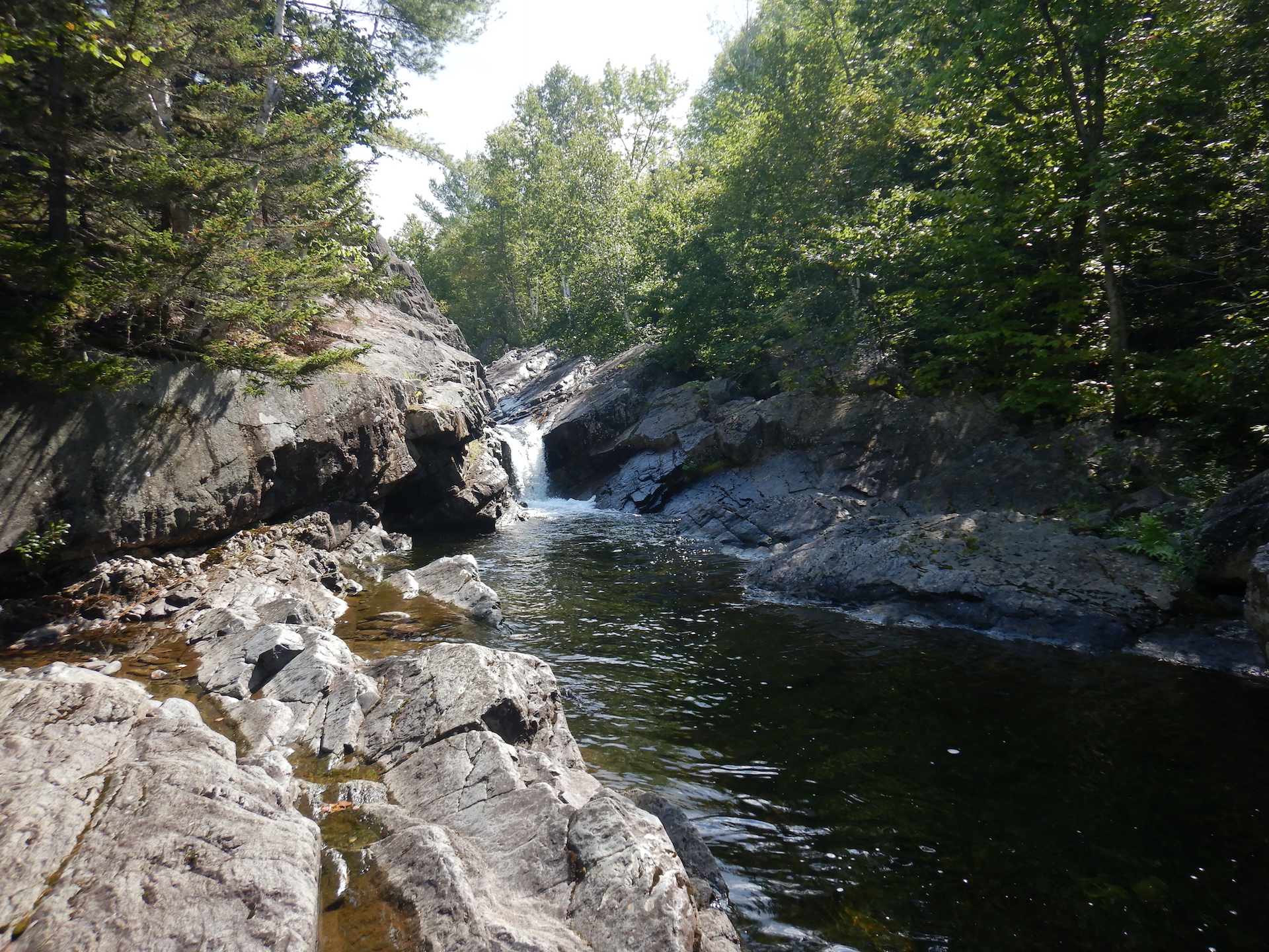
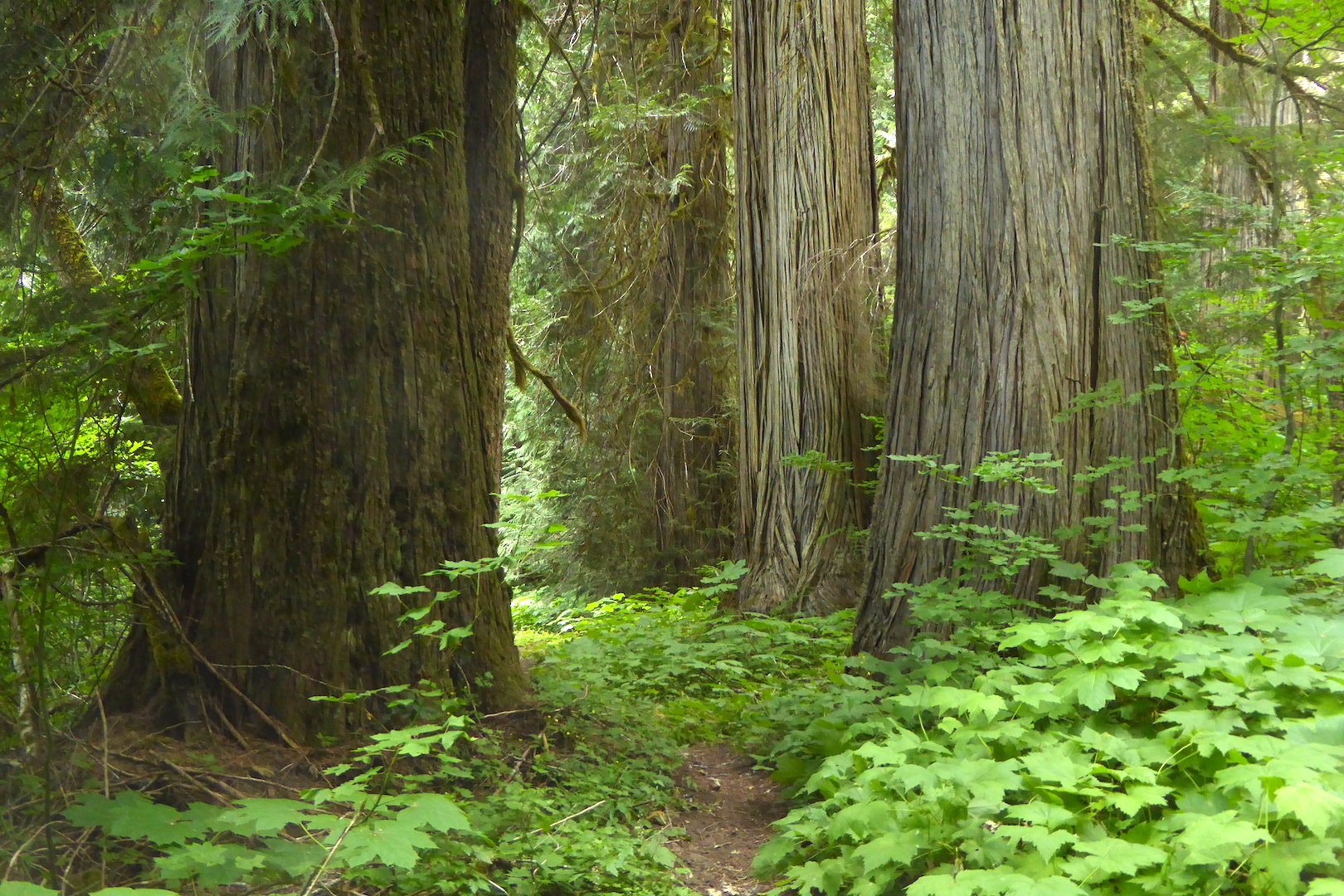
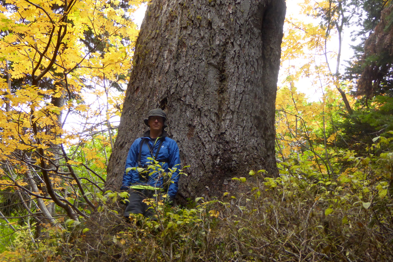
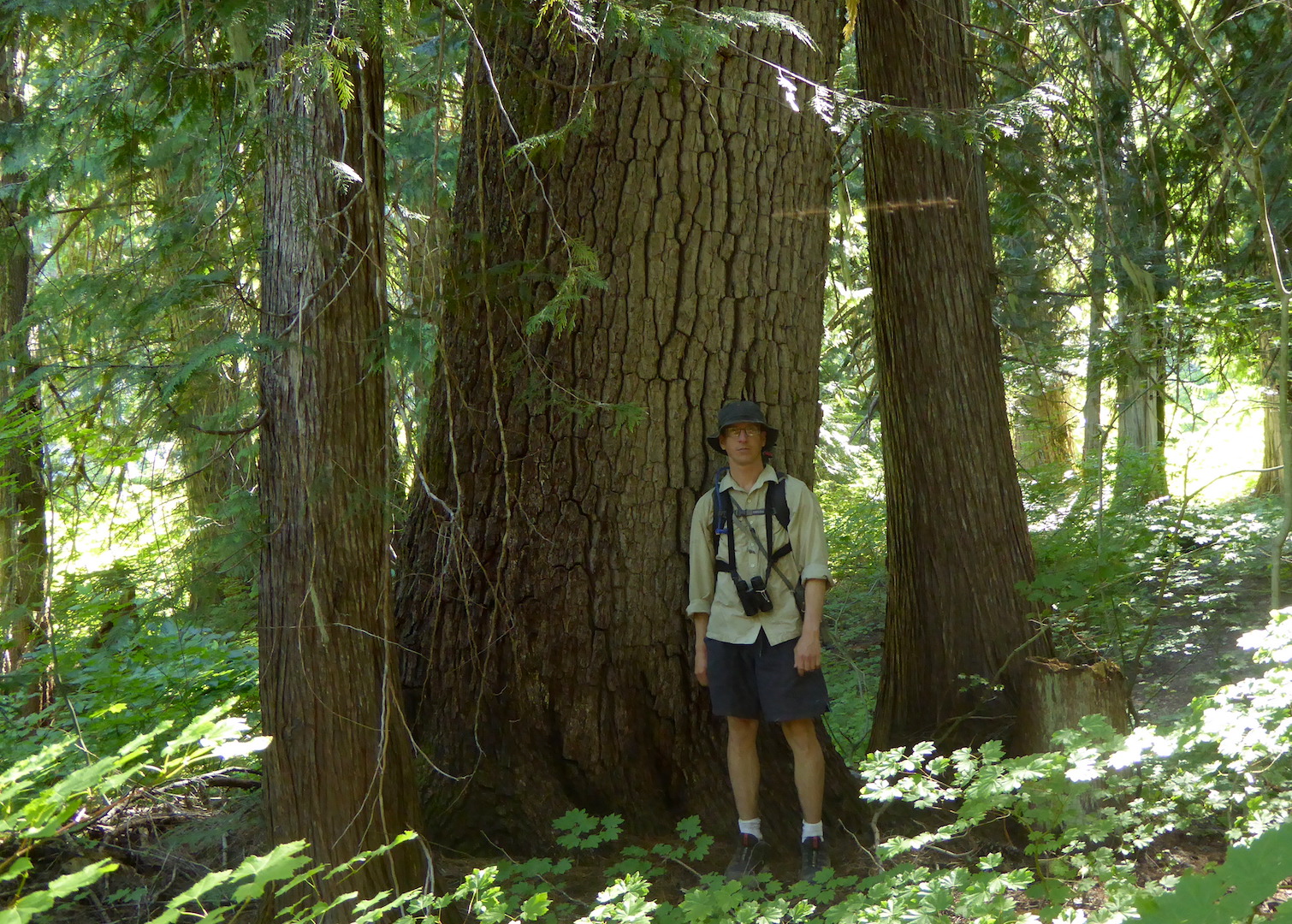
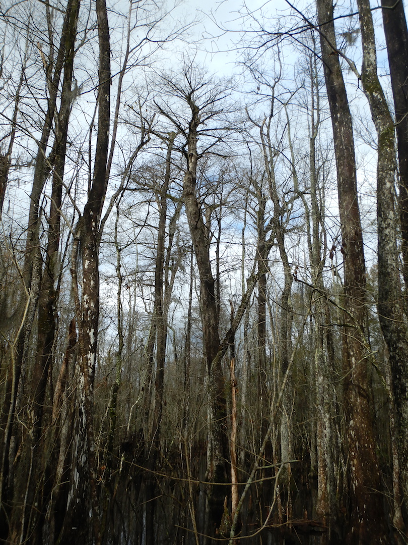
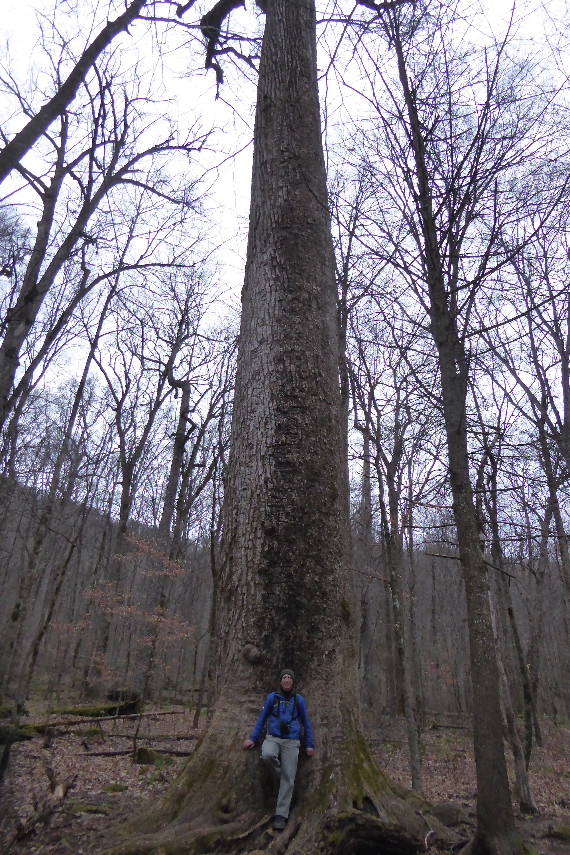
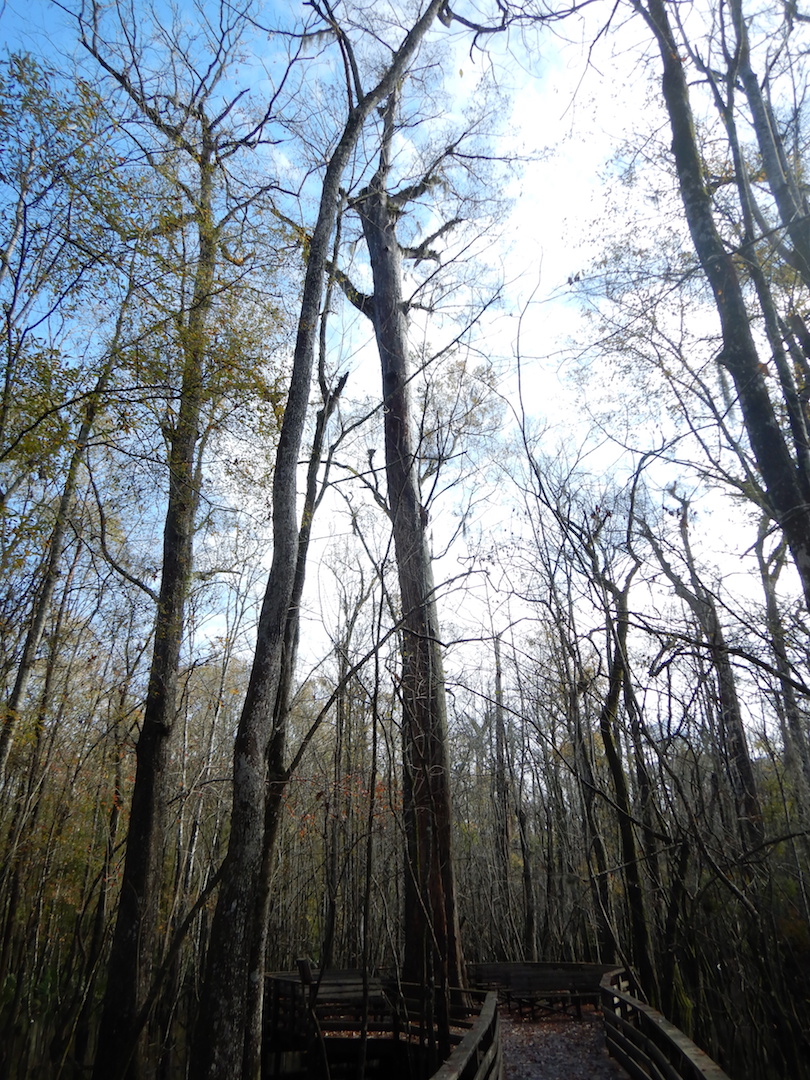
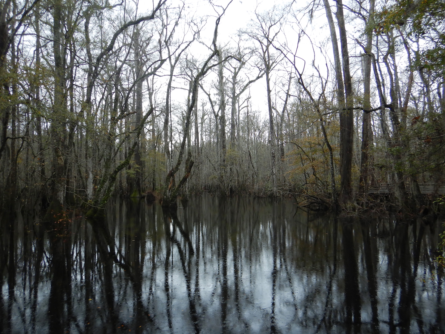
Bald cypress swamps experience seasonal flooding, and when I visited in mid December the forest was covered in a blanket of tea-colored water stained brown by tannins. The day was relatively warm and temperatures reached above 60˚ F. A few turtles and snakes took the opportunity to climb out of the water and sun themselves on fallen logs. My attention, however, was consistently drawn to the canopy and the craggy tops of centuries- and millennium-old bald cypress trees.

silhouette of large bald cypress tree
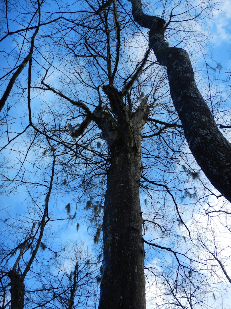
Bald cypress is one of the longest-lived trees in North America and the longest-lived tree in the eastern U.S. The oldest known tree at Beilder is nearly 1,600 years old. Along the boardwalk, you can find a 1,000-year giant, which outwardly looks healthy enough to stand another thousand years. (I asked the Audubon staff if I could see the 1,600 year-old tree and to my delight it could be found along the boardwalk. But, I won’t disclose its exact location since the staff would like to avoid making it a target for vandals.)

silhouette of large bald cypress tree

A thousand year-old giant in Francis Beilder Forest. This tree grows adjacent to the boardwalk and is identified by a sign.

At Beilder, many trees are massively trunked, resembling the silhouette of giant sequoia. Above their basal swell, they barely seem to taper until their branches splay outward in the canopy.

silhouette of large bald cypress tree; tree is surrounded by a boardwalk
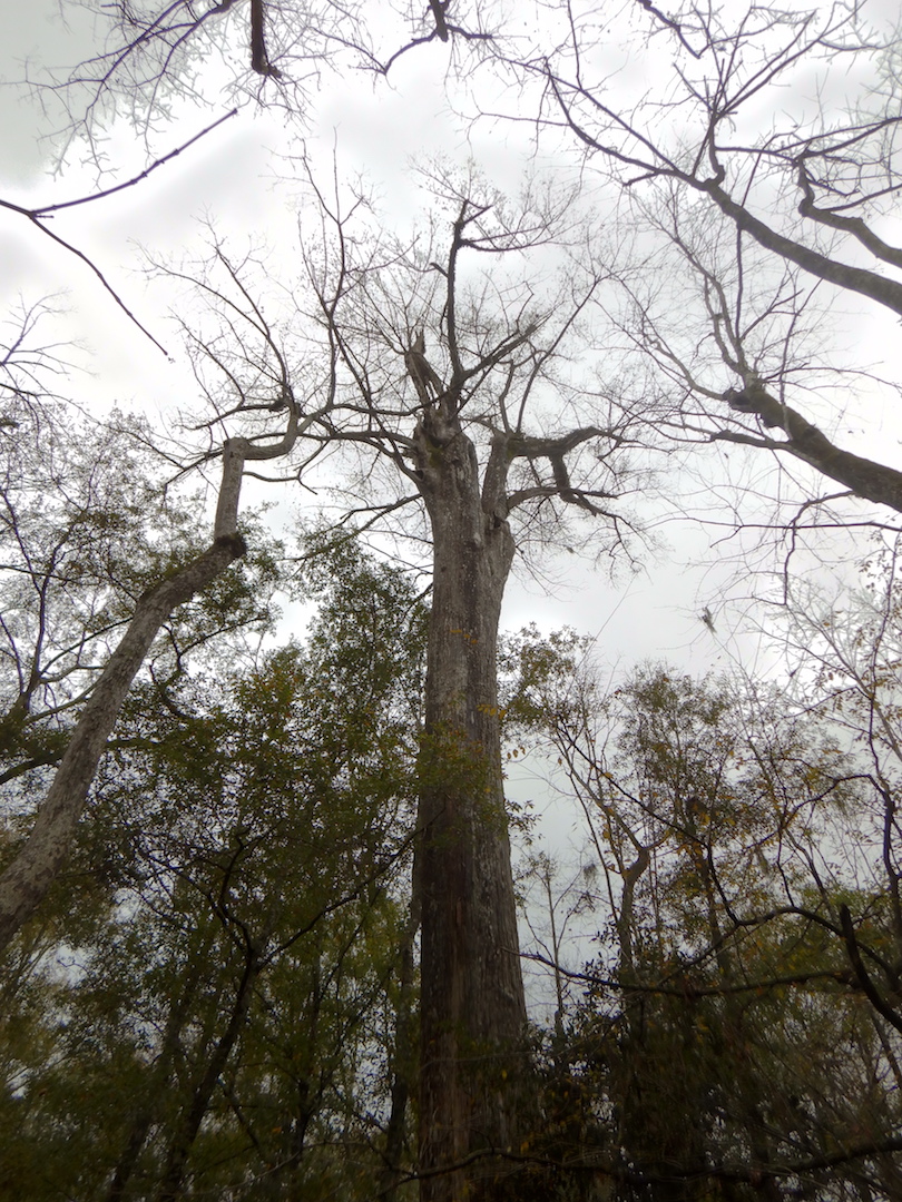
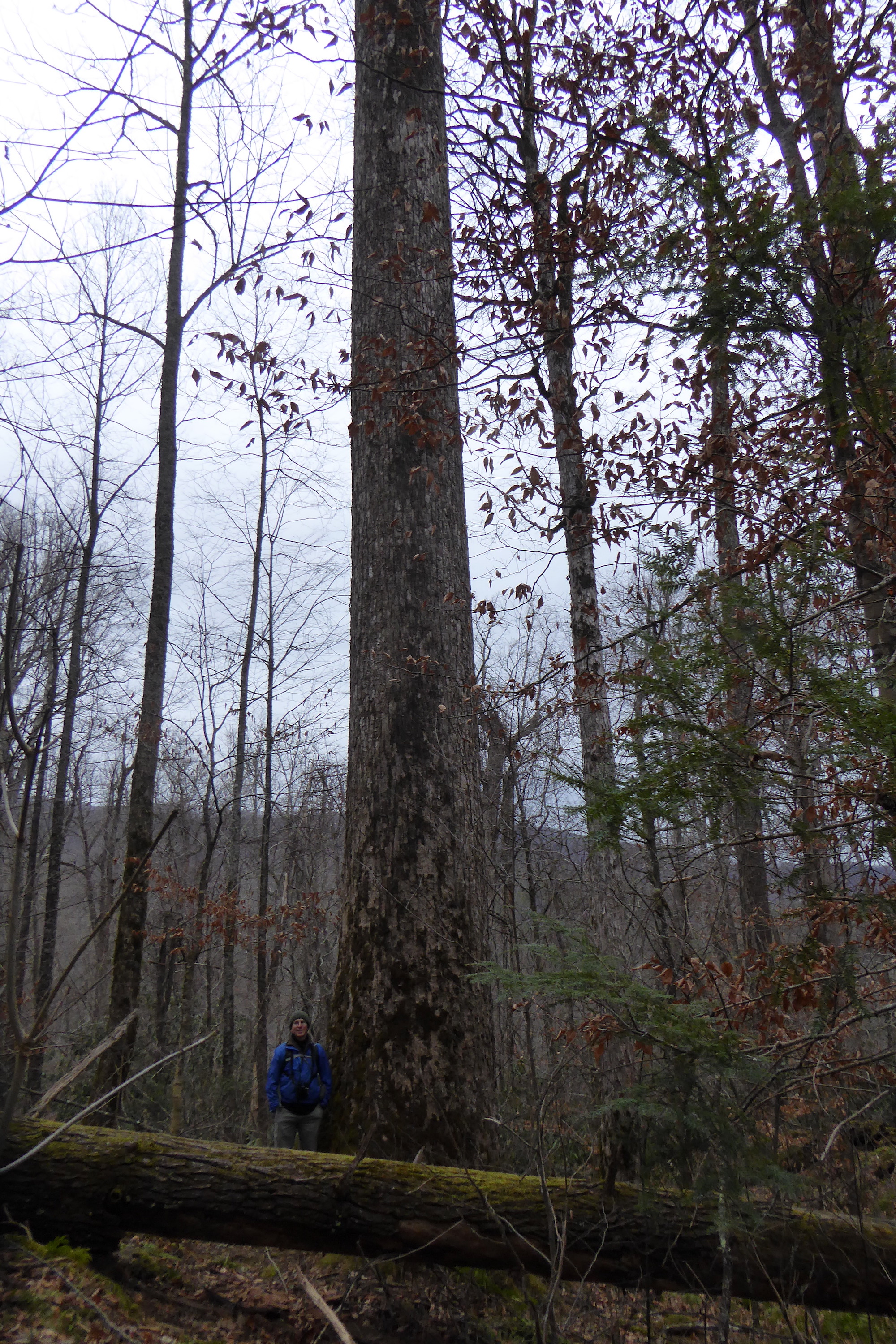
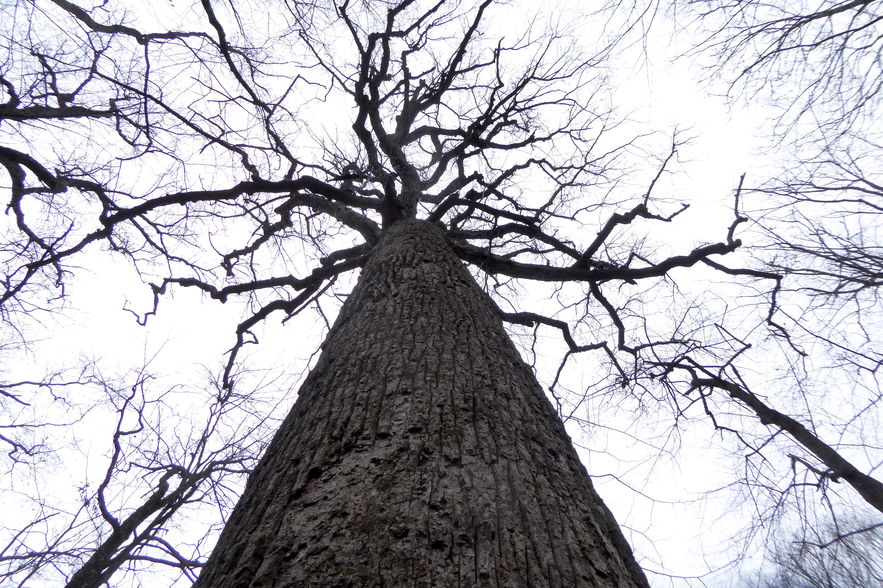
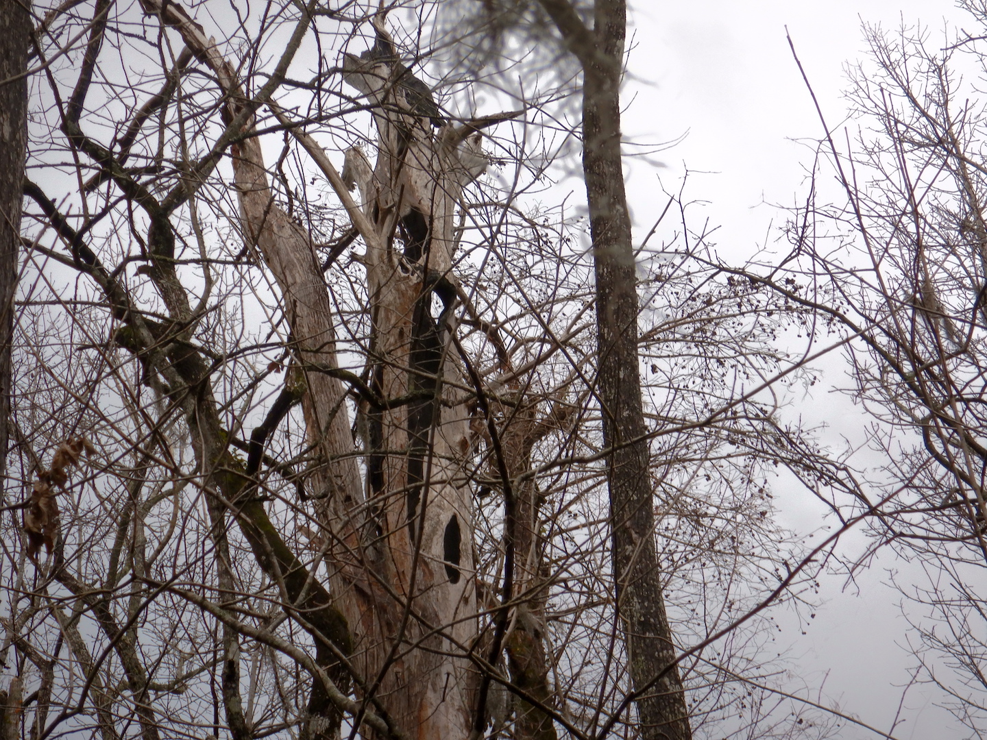
When you live to be over 1,000 years old you’re bound to acquire a scar or two. Reaching over 100 feet high, each bald cypress carries a legacy of the battles with insects, fire, and severe weather like thunderstorms, tornados, and hurricanes.

crown of large bald cypress with broken branch

Some time ago, a large branch broke off of this tree, perhaps allowing carpenter ants an easy means of entry. Larger holes in the same branch are the work of large woodpeckers like pileated woodpeckers. One hundred and fifty years ago, ivory-billed woodpeckers would’ve inhabited this place too. Could some of these woodpecker holes be from this extinct bird?

top of trunk of hollow bald cypress tree

The charcoaled interior of this large bald cypress preserves a moment in time when it was struck by lightning and burned.

Collectively and individually, these trees tell a fascinating story, if we are willing to listen. Maybe the most poignant of those, from my perspective, is loss.

I marveled at the trees at Francis Beidler, but I marveled at a fragment. Their longevity and physical proportions might only be remarkable because we’ve eradicated nearly all other bald cypress of the same size and age. Francis Beidler Forest is one of the few places where old-growth bald cypress trees still exist. According to one estimate, over 42 million acres of bald cypress forests once covered the southeastern United States, an area nearly the size of Missouri. Now, only 10,000 acres remain, equivalent to .02% of the original bald cypress forest! The rest was logged for lumber, furniture, and shingles with no forethought for future generations who may find great value (monetary or otherwise) in healthy ecosystems or for the species who depended on this habitat.

Through uncontrolled hunting and the loss of old-growth forests like bald cypress swamps, we drove the Carolina parakeet and ivory-billed woodpecker to extinction. Knowing what we consumed in the past, understanding that we continue to cause extinctions and change the climate today, can we ethically expand our footprint on Earth? How much extinction does it take before we say enough is enough?

The trees at Beilder felt the pounding of the ivory-bill and heard the calls of parakeets. Perhaps they were even enveloped by passenger pigeons, a species once so abundant in North America that their flocks extended for miles and blackened the skies. The air in this forest used to ring with the echoes of these birds. When we lose forests, we lose much more than trees.


Gee Point

While browsing a map of the Mount Baker-Snoqualmie National Forest, I spotted what appeared to be a little used trail in a tract of the forest south of Skagit River. I quickly assessed whether it was worthy of my short list for exploration: Is it interesting and is it within cycling distance? With an affirmative yes to both criteria, I set off with my bike, Rocinante, to Gee Point.

I pedaled about eight miles south on the usually quiet Concrete-Sauk Valley Road. Only slightly rolling, this road was a good warm up for the rest of the day, which I knew would require a lot of climbing. Upon reaching the Finney Creek Road, I began a slow ascent through a mosaic of forested land—fields of stumps in recent clear cuts, thick second and third-growth stands, and occasionally a pocket of old growth forest.

view of forest area with maturing trees and recently clear cut areas

In contrast to younger forest, old-growth stands are characterized not only by large and tall living trees, but also by a complex, uneven canopy and a relatively high amount of dead standing snags and down trees. Even from a distance, the old-growth can be easy to spot once you learn to look for these signs.

view of forest with tall trees on horizon

Large trees with an uneven canopy reveal a stand of old-growth trees on the edge of a former clear cut.

Most of these old-growth trees were inaccessible from the road (perhaps the only reason they remain standing), but a few other giants were spared the chainsaw. Perhaps too dangerous to cut, or perched precariously on the edge of a cliff, or already dead, these trees stood as the last remnants of the forest that used to be.

bicycle leaning against bole of large dead tree

A few miles up the Finney Creek Road stands a giant dead Douglas-fir tree. These trees remind me that, with the exception of fire-maintained prairies and frequently flooded areas, nearly all of the Sauk and Skagit river valleys were covered with old growth trees.

Specific trees, like Sitka spruce, along Finney Creek also indicated this was often a wet place. Sitka spruce is typically found in areas with cool summers and high rainfall.

silhouette of Sitka spruce

The North Cascades, however, experience a bi-modal climate. Its cool, wet winters stand in start contrast to hot and droughty summers, and I was soon reminded of the region’s aridity even as I cycled underneath a thick canopy of needles. As the road transitioned between gravel and broken pavement, the dirt was so dry I kicked up a rooster tail of dust anytime I gained appreciable speed and each pickup truck left a cloud in their wake. (I saw about a dozen motor vehicles in this stretch of national forest. With the exception of one ATV, all were pickup trucks.)

By the time I reached FS Road 1720, I was within a few miles of Gee Point, but I still had most of the climbing ahead of me.

view of dirt road lined with thick forest

It’s a lot steeper than it looks.

The road, now completely dust and gravel but pleasantly lacking washboards, switch-backed through young, even-aged trees as it gained elevation. The terrain was changing as I climbed and signs of winter’s harshness began to appear. I crossed through an avalanche chute at least three times, which gave me an excuse to stop and catch my breath as I admired the power of snow to snap trees in half.

view of short trees caused by avalanche

Winter and springtime avalanches are a frequent occurrence in the North Cascades area, pruning any plant too tall or any too stiff to flex under their tremendous force. In summer, the brushy chutes are prime habitat for bears and I caught a glimpse of a black bear in this one.

The bright, hot sunshine and steepness of the road slowed my speed dramatically and I accumulated a sizeable escort of biting flies, but the views kept getting better, even with a slight haze from wildfire smoke.

dirt road leading toward mountain peak

To reach Gee Point though, I had to hike, so I locked Rocinante to a convenient fir tree at the end of the road and started walking. About a half mile in, I entered a beautiful, uncut forest dominated by large western hemlock and Pacific silver fir. At over 4,000 feet in elevation, which is not particularly high for the Cascades and in stark contrast to the tired burned out green of lower elevations, the forest floor had a noticeably fresh appearance.

The trail soon gained a ridge line and swung to the top of Gee Point where I was rewarded with a panoramic view.


The air, so calm and comfortably warm, easily could’ve induced a nap, but then I remembered that I was running low on water and time, so I reluctantly retraced my steps to the trailhead. After taking one final break to filter drinking water from Little Gee Lake, I bombed down the mountainside.

view of alpine lake and basin

On the rapid descent, I was glad to have wide 700x38cc tires to handle the rough surface and working brakes to check my speed. The ride home was quick, taking me half the time to ride back compared to riding there. When I reached home, my lower legs were caked in a fine powder. They felt worked too, but it was a good kind of tired.

Cross Country By Rail Continued

In my last post, I left Bellingham, WA and crossed the Cascade Mountains via Amtrak’s Empire Builder. On day two of the journey to Pittsburgh, the route and landscape would prove to be even more contrasting than the previous twenty-four hours.

Overnight the train route crossed eastern Washington and Idaho. I woke around sunrise to a foggy scene along the Kootenai River. The river along this stretch harbored few rapids that I could see, but it was brimming with muddy water. Spring and early summer is the season of high runoff in the Rockies.

river flowing through foggy valley
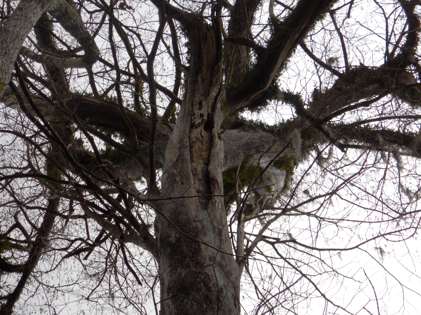
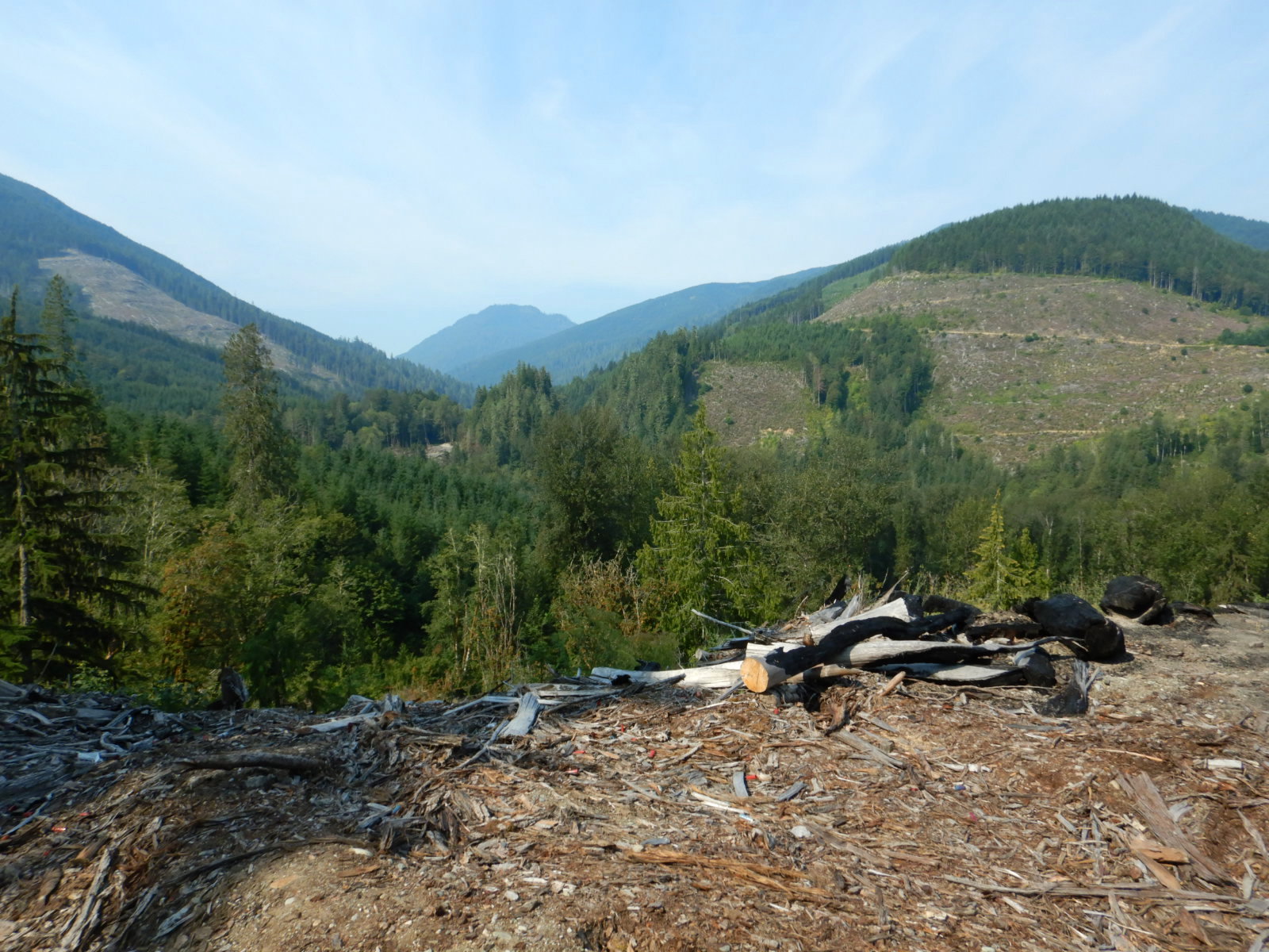
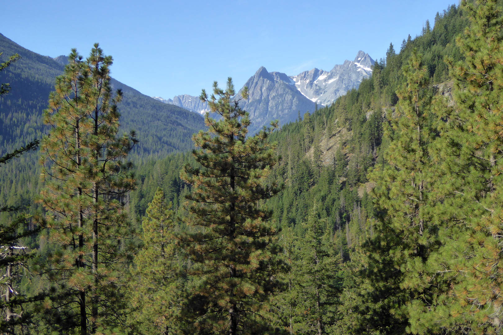
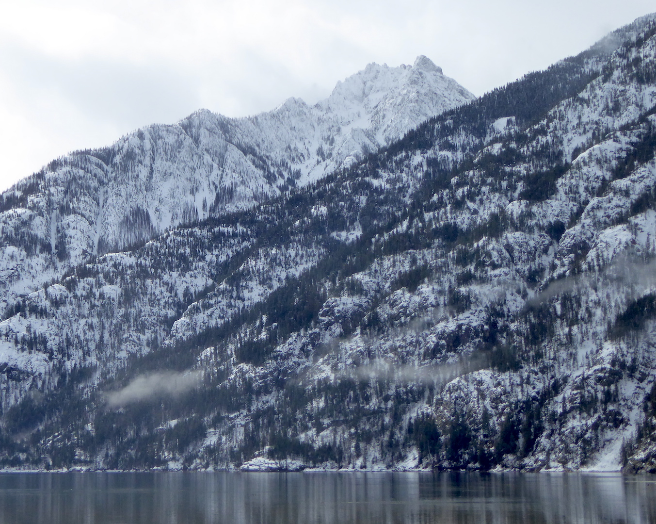
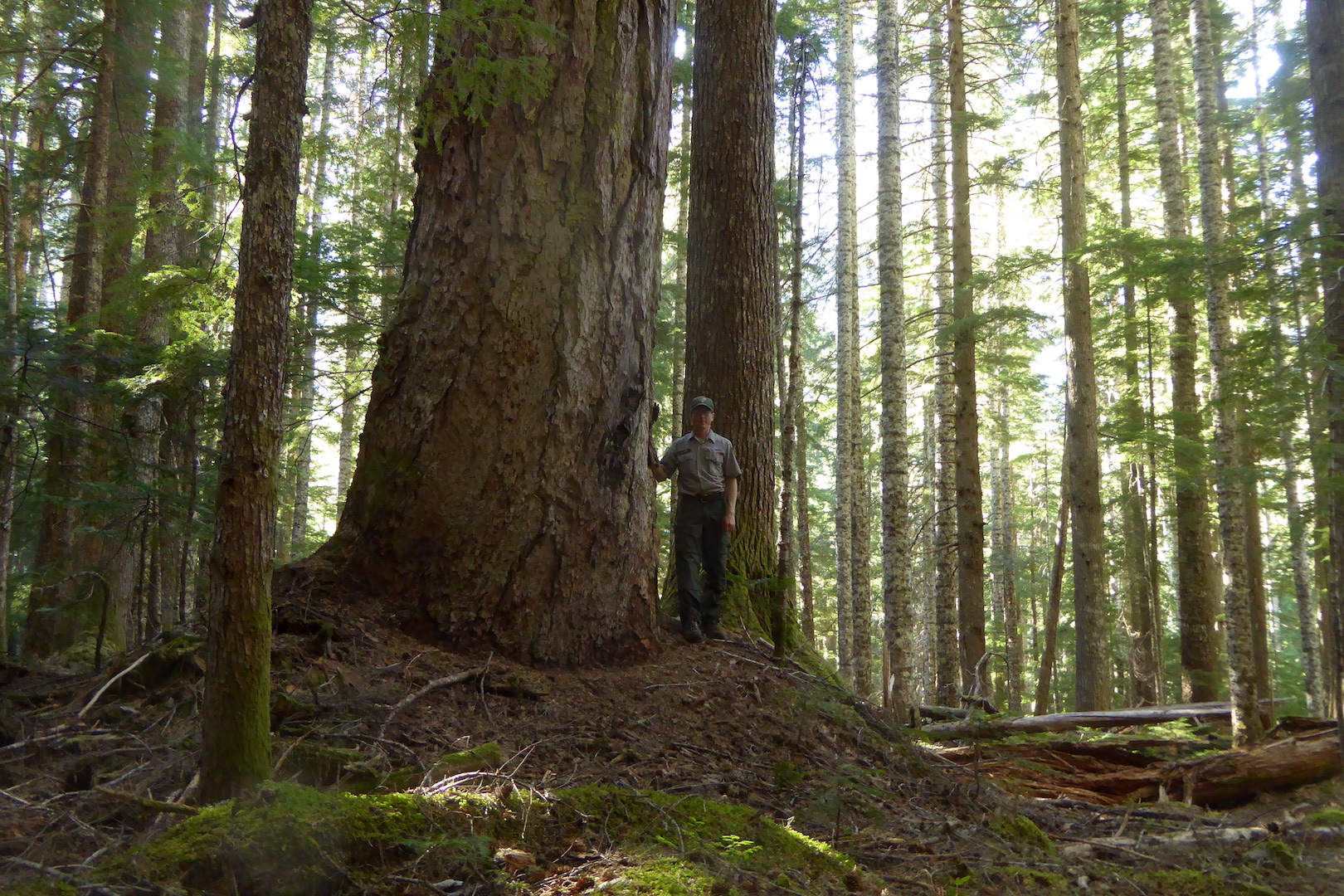
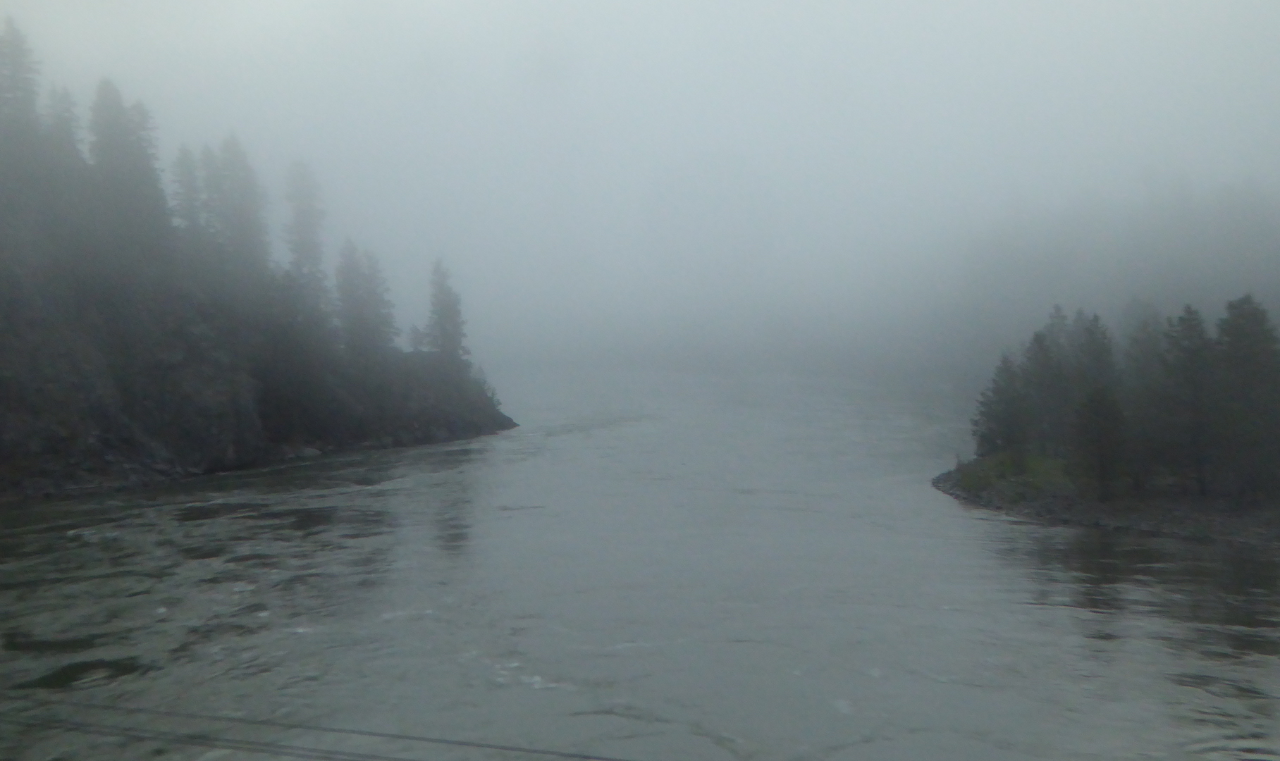
The train soon left the Kootenai River and passed through the Salish Mountains to the Flathead River valley. After Whitefish, Montana we began a slow climb toward the continental divide. Along the middle fork of the Flathead River, between Glacier National Park to the north and the Great Bear Wilderness to the south, lies one of the most scenic stretches of rail on the route. Every bend provided new views of the snow-capped mountains bounding the narrow valley.

view of forested mountains
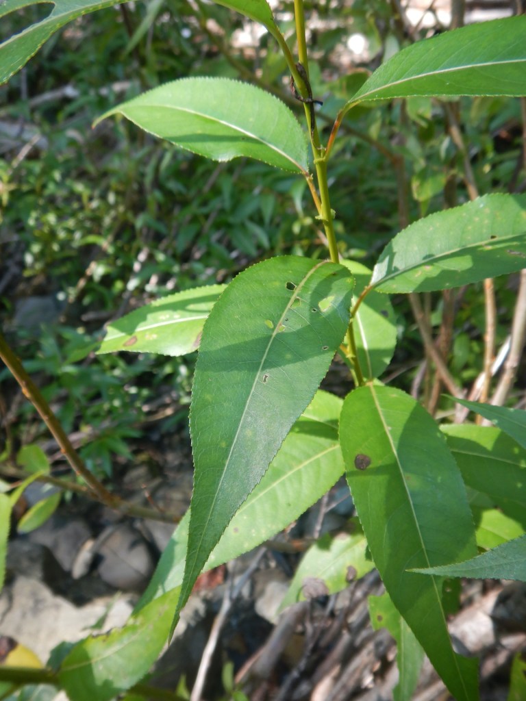
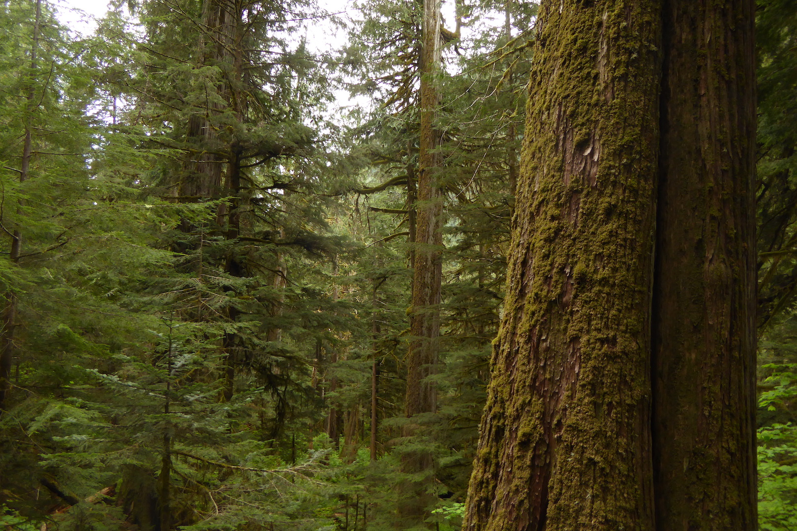
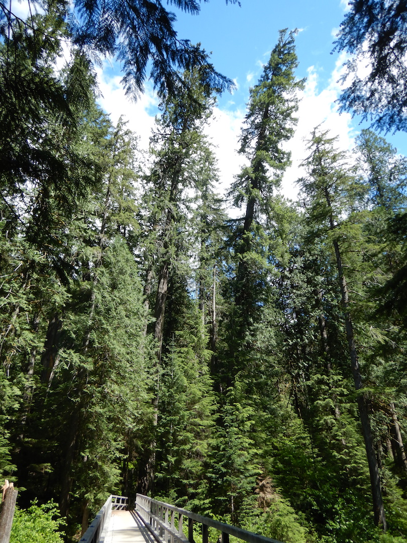
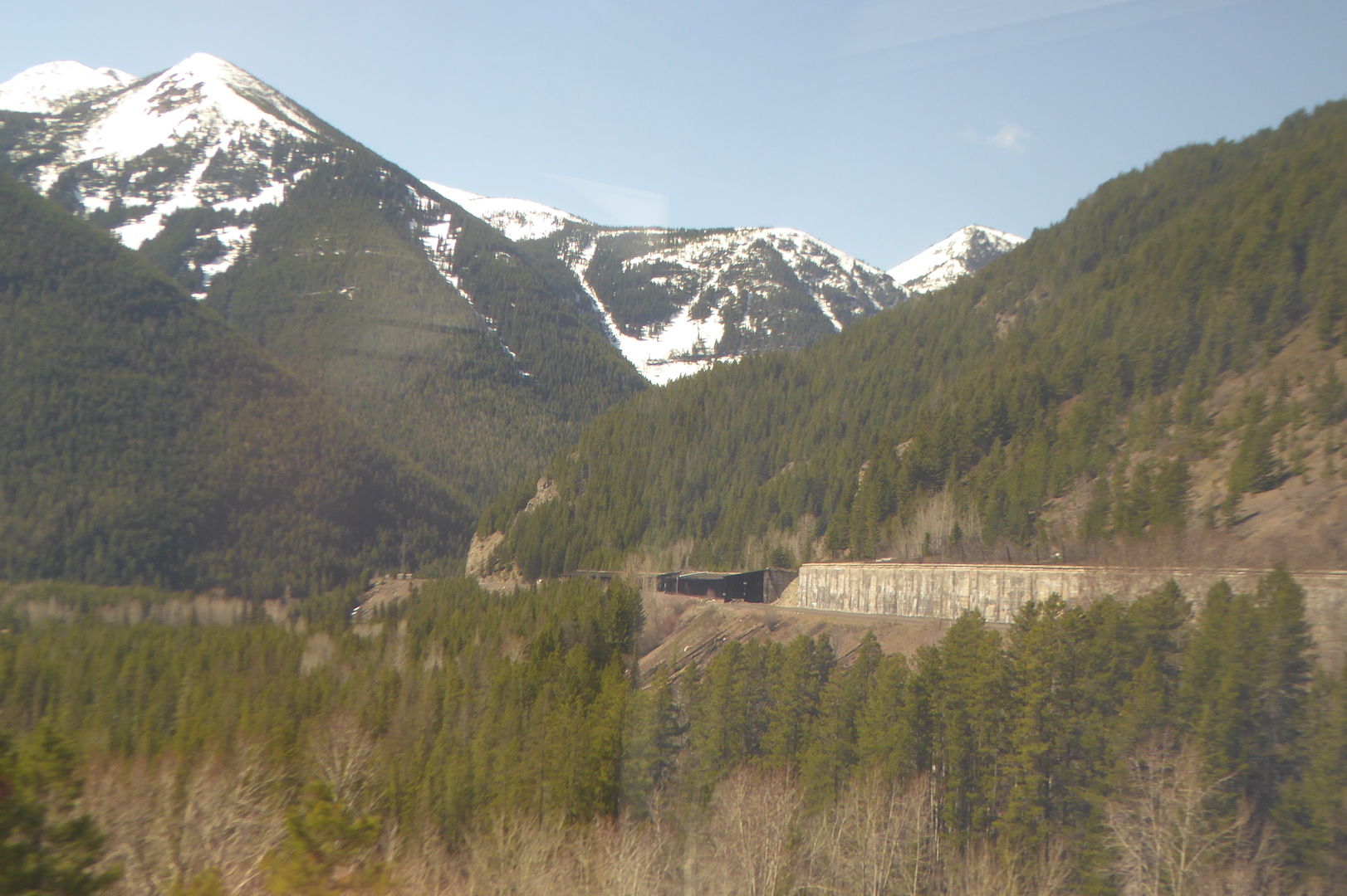
While I enjoyed the mountain scenery, for me the real highlight of this section was the stark contrasts in vegetation and climate. The low valleys on the west side Glacier National Park capture enough precipitation to support the growth of species also found within the wet forests Washington’s Cascades. At West Glacier I caught glimpses of the some of the eastern-most stands of western red-cedar (Thuja plicata). This species, you could say, likes it feet wet and it won’t grow where soil moisture is too low. In this part of North America, a lack of suitable habitat squeezes the red-cedars into narrower and narrower confines, and it quickly disappeared as we traveled east.

Western red-cedars wouldn’t be the only species to vanish in the next fifty miles. On the approach to the continental divide, lodgepole pine (Pinus contorta) and Douglas-fir (Pseudotsuga menziesii) predominated. Lodgepole pine was especially abundant in areas that had experienced forest fires in the last two decades. As the train crossed the continental divide at Marias Pass (el. ~5200 feet) the forest began to disappear, partly from the elevation (treeline was only a thousand or so feet higher) and largely from increasing aridity.

Terrestrial habitats often intergrade slowly, mixing in quilted patches before one finally yields to another. At East Glacier, Montana though, the montane Rocky Mountain forest seemed to simply end where the short grass prairie began. Here is one of the most dramatic terrestrial biome shifts to be found in the United States.

rolling prairie with snow-capped mountains in background
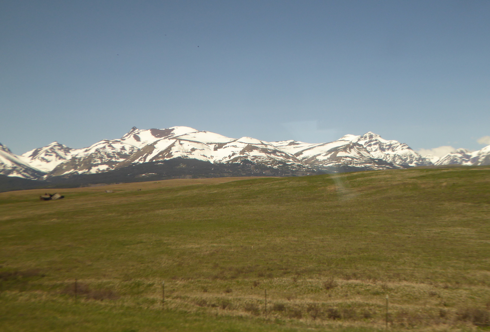
Like the Cascades, the Rocky Mountains create a strong rain shadow across northwestern Montana. Browning, MT, east of the mountains, receives only half the precipitation of West Glacier. For the next thousand miles across Montana and North Dakota prairie dominated where the land was not cultivated or otherwise appropriated by people. The only trees were either planted or grew along creek and river bottoms where their roots could tap into a shallow water table.

prairie and wheat fields across north central Montana
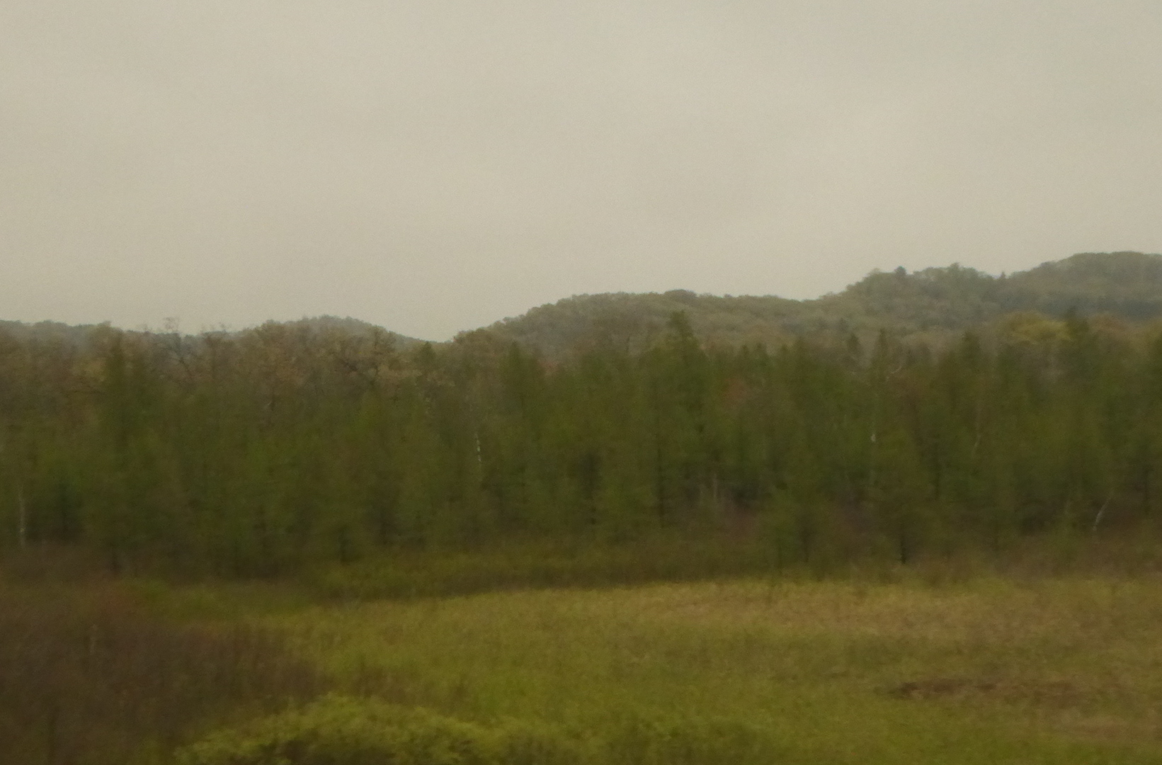
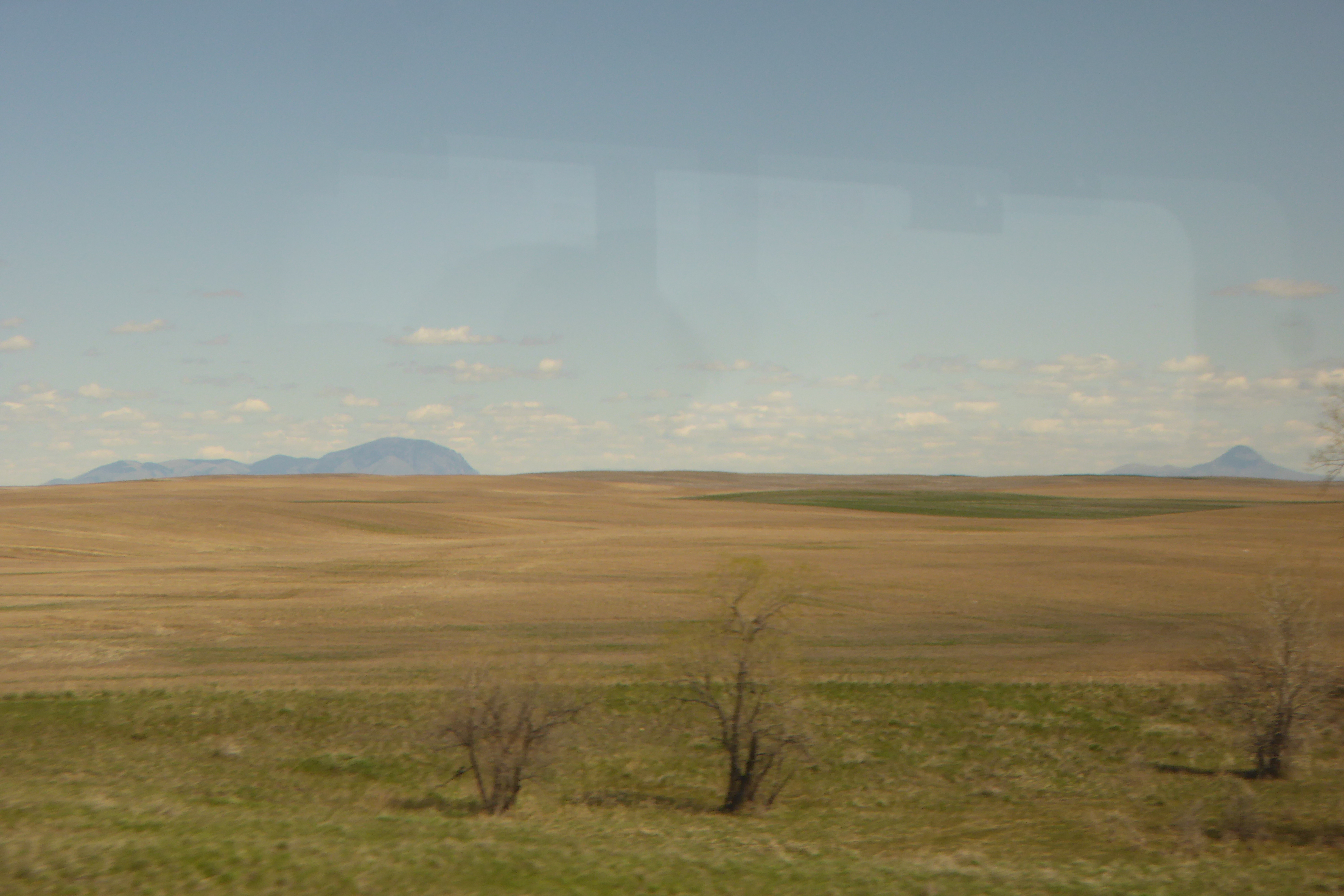
Wildlife became easier to spot on the open prairie. Through Montana the railroad took us just south of the true prairie pothole region, but many of the low-lying areas adjacent to the track held water. Every little puddle seemed to harbor a few pairs of ducks and geese. I casually spotted at least ten waterfowl species during the day. Undoubtedly more used the habitat. I just failed to see them. Small prairie dog towns, frequented by red-tailed and Swainson’s hawks, occupied some of the ranching areas. I counted at least two-dozen pronghorn grazing or resting small, scattered bands.

In eastern Montana, badlands appeared in the distance and became more prominent as we approached and crossed the North Dakota state line. Parts of this area are rich with fossils and I wanted more than a little bit to poke around the hills for ancient bones.

badland bluff
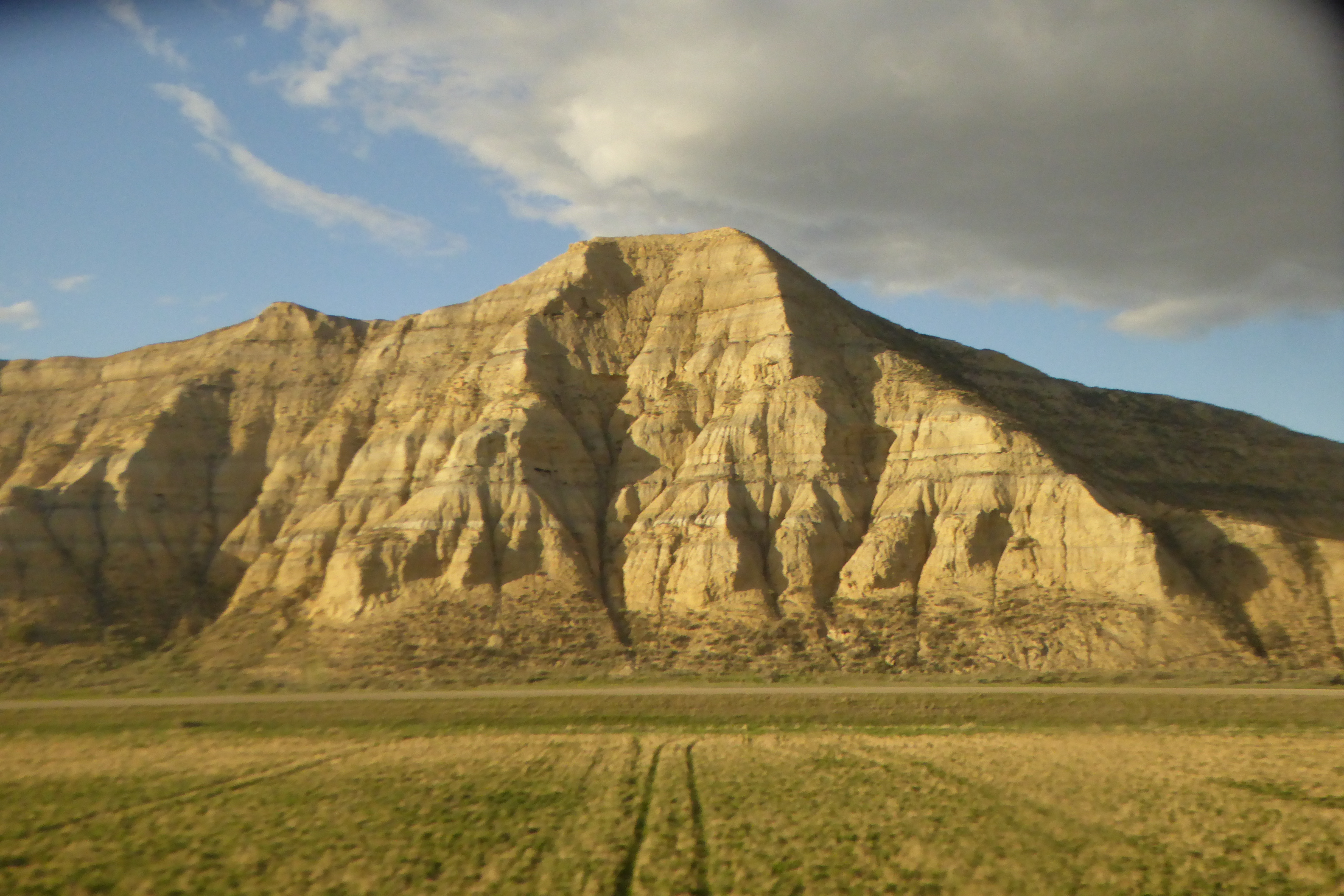
In North Dakota, fracking wells became a prominent sight as the sun set.

oil wells silhouetted by the setting sun
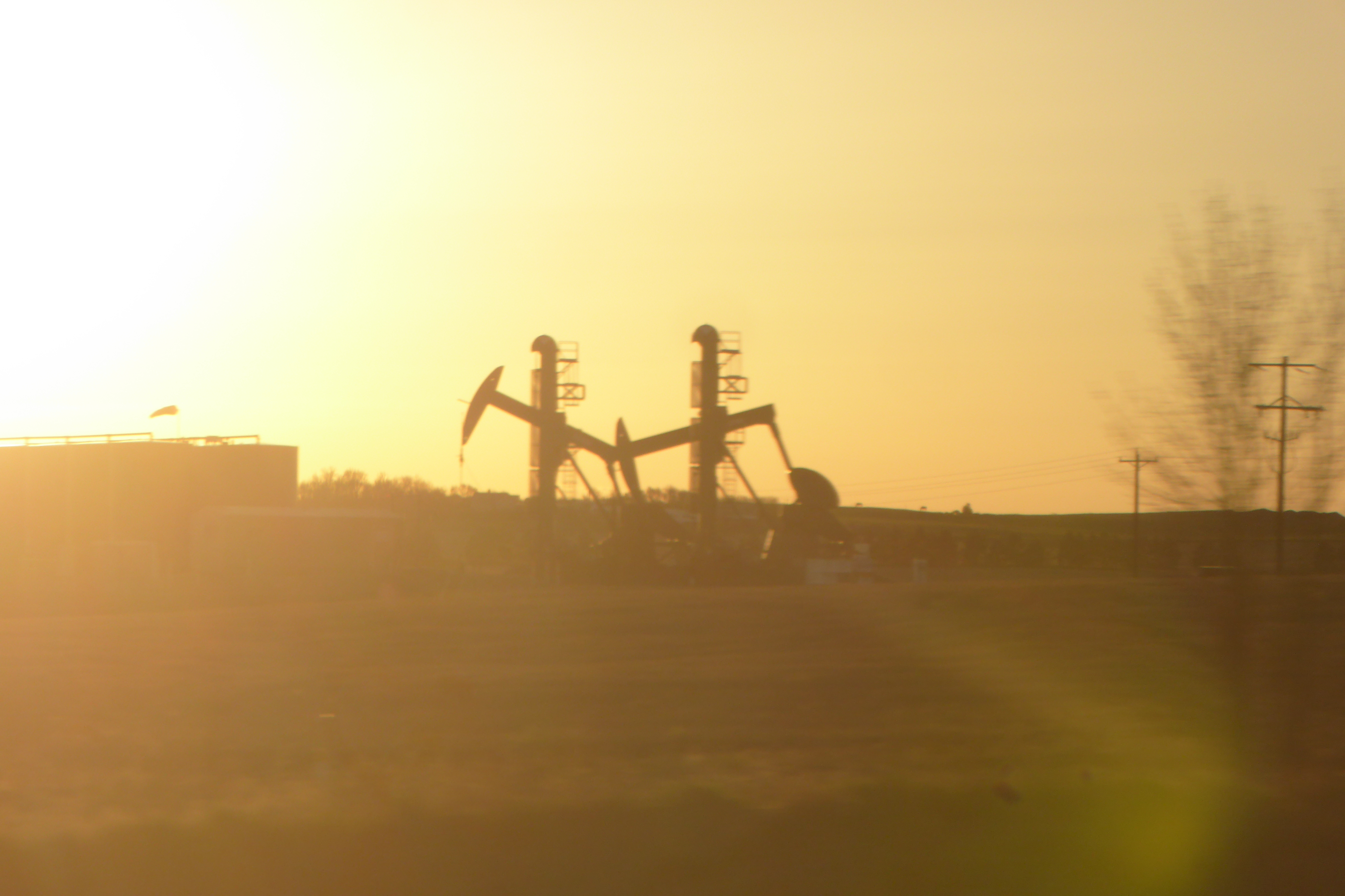
On the morning of my third and final full day on the train I woke up somewhere in Minnesota where the prairie had long since yielded to cornfields. This was, historically, a battleground between prairie and forest. In this area, where precipitation is great enough to support tree growth, fire was the prairie’s greatest ally. Periodic burning kept the forest at bay. After American settlement, the prairie was plowed and fires suppressed. Along this ecosystem margin today, you’re more likely to see farm fields bordered by trees than a patchwork of prairie and forest.

Spring was also much less advanced in west-central Minnesota compared to the Puget Sound area where my trip began. Quaking aspen was washed with small vibrant leaves but some of the paper birches had barely broken bud.

For over a hundred miles south of Minneapolis and St. Paul, the route followed the Mississippi River where tall bluffs bordered the river valley…

wide river with tall bluffs in background
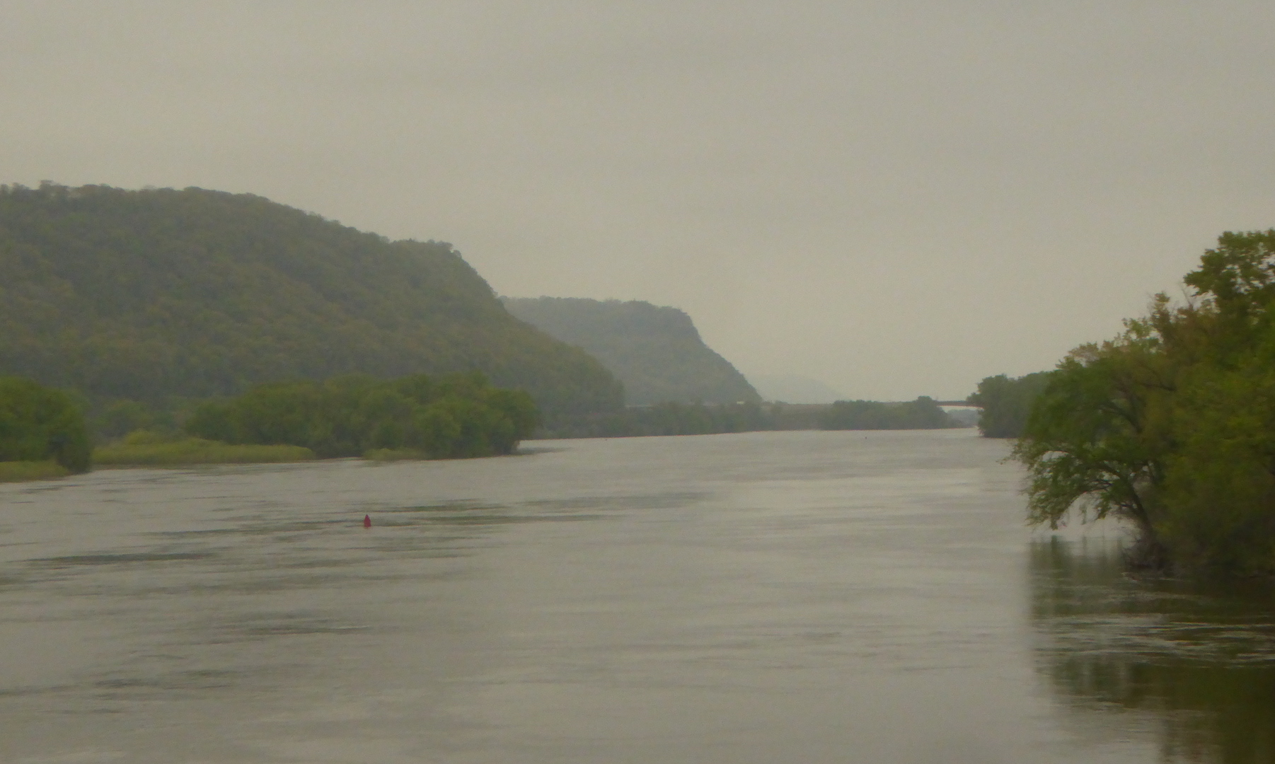
…and the floodplain forest drowned in water.

flooded marsh bordered by forest
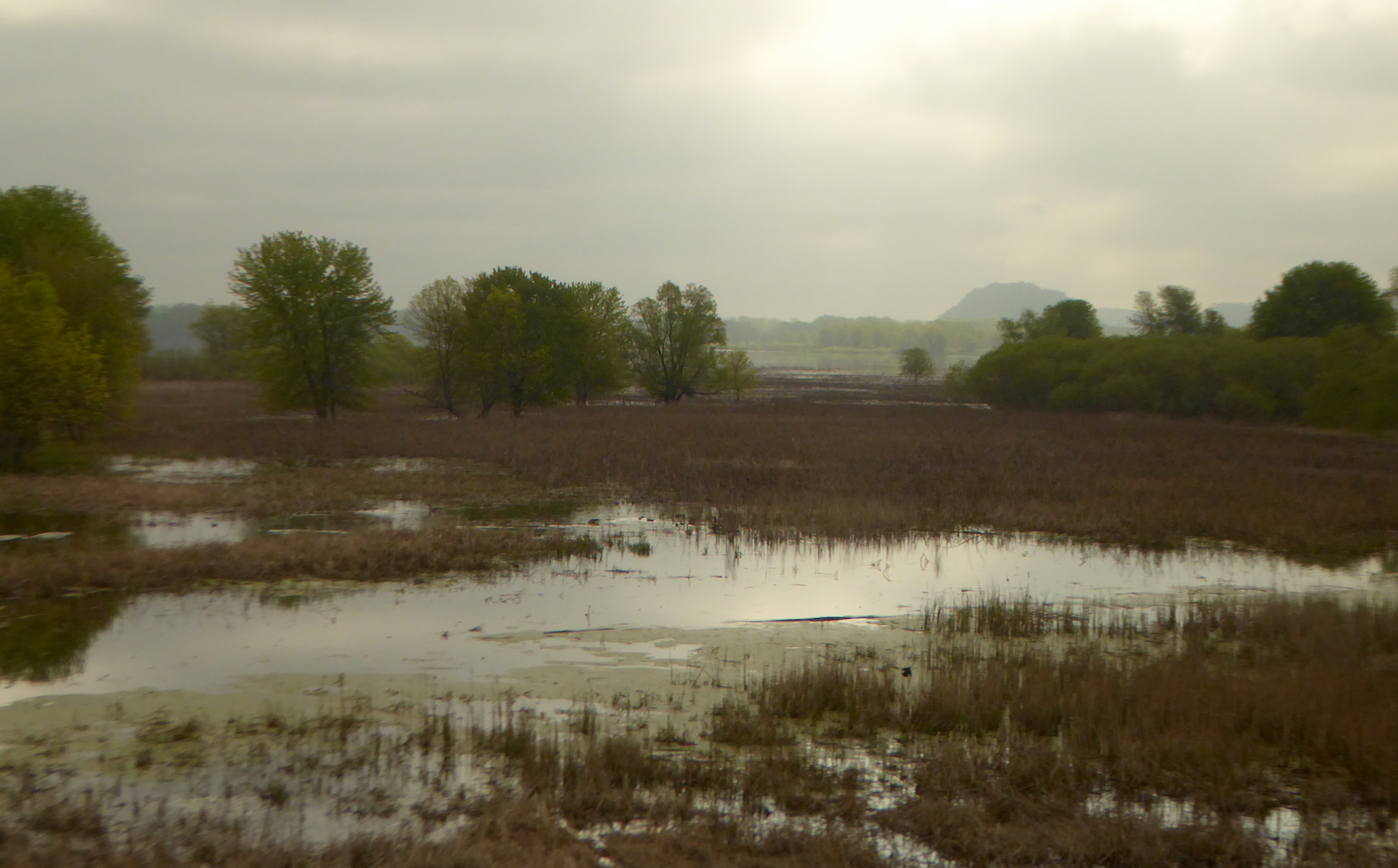
The train crossed the Mississippi one final time at La Crosse, WI. Heading upland into central Wisconsin, jack pine (Pinus banksiana) appeared on sandy soil. This species is essentially the eastern equivalent of lodgepole pine and the two hybridize where their ranges overlap. Like it’s western sibling, jack pine is well adapted to fire, often holding serotinous cones on its branches for years before fire melts the cones’ resin and releases its seeds.

forest and rolling hills

You’ll have to take my word for it: Those are jack pines in the middle ground.

East of Madison, the landscape quickly became suburbanized then urbanized as we approached Milwaukee. We never seemed far from Lake Michigan, but I only caught a couple of glimpses of the great lake.

I transferred trains in Chicago for the final leg of the journey to Pittsburgh. Through Gary, Indiana, the land remained very urban with the exception of the forested dunes on the inland side of Indiana Dunes National Lakeshore. Night hid most of Indiana and all of Ohio. After a rough night of sleep, I arrived in Pittsburgh at 5 a.m.

There’s a lot of sitting on a railroad trip from Puget Sound in Washington to Pittsburgh and I felt very antsy, so I capped off my first day in town with a fifty-mile bike ride on the Great Allegheny Passage. The exercise and change of pace was welcome, but so was watching the landscape through the train window.

Joyce Kilmer Memorial Forest

Old growth forests in the eastern U.S were formidable barriers to colonization, places to be subdued and civilized, to fuel industrialization, not preserved. Today, we view old growth forests differently. They give refuge to rare species, support diverse ecological communities, and often provide the conditions necessary for trees to attain their maximum size and age. While visiting Joyce Kilmer Memorial Forest in the Nantahala National Forest, I thought about why these forests remain so important despite the some negative changes they’ve recently undergone.

Prior to European colonization, forests in the eastern U.S. formed a mosaic of complex habitats, owing to natural disturbance regimes and the influences of American Indian nations. An unbroken old growth canopy stretching for the Atlantic Ocean to the Mississippi River is mythical and never existed. Lightning-caused fires, human-caused fires, tornadoes, ice storms, hurricanes, and insects imparted constant change. Some forests were likely disturbed every few decades at minimum, while others grew undisturbed for hundreds of years.

Joyce Kilmer Memorial Forest is one of those places that grew relatively undisturbed. It is a pocket of old growth tucked away in the rugged mountains of western North Carolina. While many impressive trees grow here, the most impressive and largest trees are Liriodendron tulipifera, the tulip tree. Also known as tulip-poplar or yellow-poplar, tulip trees grow fast and tall (the tallest individual tree in the eastern U.S. is currently a tulip tree) and are easy to identify in summer because of their distinctively-shaped leaves.

No live leaves hung from the tulip trees on the overcast, early January day when I visited, but this allowed me to contemplate the trees’ full scale. The tulip trees at Joyce Kilmer are the largest of the species that I’ve ever seen. Many exceed 15 feet in circumference at chest height, approach 150 feet tall, and are several hundred years old.

person standing at base of large tree

I was impressed by complex crowns of the largest trees. Most trees in the eastern U.S. today don’t attain such large, complex crowns. They simply aren’t allowed to grow long enough. Many of the crowns were scarred and broken by centuries of battles with wind, ice, and other forces that try to break the tree down.

crown of large tulip tree

Since tulip poplars are intolerant of shade, the largest tulip trees at Joyce Kilmer likely sprouted and began to dominate the canopy after a major disturbance, like a fire or tornado, swept through the area several hundred years ago. The now towering tulip trees effectively shade the understory, suppressing the germination and growth of their offspring. Instead of young tulip trees, the understory of the forest was filled with more shade tolerant species like sugar maple and American beech. In a couple of hundred years future visitors may see giant sugar maples growing over the decaying remnants of tulip poplars.

Despite the beauty and stateliness of the trees at Joyce Kilmer, this isn’t forest primeval. No such thing exists in the eastern U.S. Evidence of significant, human-caused changes are easy to find here. Until recently, Joyce Kilmer Memorial Forest contained many large eastern hemlock trees. Now, however, almost every hemlock tree in the grove has been killed by hemlock woolly adelgid, a non-native, invasive insect that basically sucks starch out of the hemlock. I found only a handful of live hemlocks in the grove, and none were particularly large.

dead hemlock trees

These hemlocks were killed by hemlock woolly adelgid.

Disturbed, young forests are easy to find. Joyce Kilmer Memorial Forest is different. It represents the forests which used to exist and provides examples of the threats forests face today. The tulip trees at Joyce Kilmer are massive, dwarfing almost everything there, especially me. I walked under the trees in wonder even though this place is very changed. I can’t pretend this is the same forest with the same species composition as it was even a hundred years ago. Among other changes, the hemlocks are dead or dying, American chestnuts are functionally extinct, and passenger pigeons no longer darken the skies. Still, I don’t want to demean this place as less special because it’s not what it once was. On the contrary, it is more special because forests like this are so rare.

person standing at base of large tree